
To cycle the South Downs National Park is to cycle through one of the UK’s treasures. Its quintessentially English countryside rolls on for mile after protected mile, via picture postcard villages and verdant green hills.
While it may never compete with the Alps or the Pyrenees for cycling kudos, if you’re based in the UK, cycling the South Downs should definitely be on your radar. We were therefore delighted when local Winchester cyclist, Andy Penn, kindly offered to write this fantastic guide to road cycling the South Downs. In it he shares some of the best cycling routes in the South Downs, Hampshire and West Sussex as well as his tips for the best climbs and coffee shops.
We hope this guide helps you enjoy this stunning part of the world. Let us know how you find it in the comments below!
1. Give us an overview of what cycling the South Downs is all about
Winchester, in Hampshire, is the ancient capital of England, and it’s a great base for cycling.
Winchester is on the doorstep of several Areas of Natural Beauty including the New Forest, Cranbourne Chase, North Wessex Downs and the closest of all, the South Downs National Park. It’s also an easy trip to the Isle of Wight for a day ride around the island.
The South Downs National Park, despite being in the south of England, has plenty of quiet roads and relatively unexplored areas. The Park stretches from Winchester in the west to Eastbourne in the east. It takes in Hampshire, West and East Sussex.
The main towns are Winchester, Petersfield, Midhurst, Petworth and Eastbourne.
The terrain is a mixture of gentle rolling lanes with some aggressive and sharp climbs that can appear around any corner. You can expect beautiful english country vistas during any ride in the South Downs.
2. What’s the most famous climb in the South Downs? What’s it like?
There are many climbs in the area, no alpine length climbs, however it is easy to accumulate a few thousand feet of climbing on many of the short and nasty climbs that populate many of the quiet and hidden lanes all over the South Downs.
Well-known local climbs include:
Butser Hill (RideWithGPX route here)
Old Winchester Hill – Route 1 (RideWithGPX route here)
Old Winchester Hill – Route 2 (RideWithGPX route here)
The climb out of South Harting (RideWithGPX route here)
Beacon Hill (RideWithGPX route here)
3. What’s your favourite climb in the South Downs – and why?
There are too many to pin it down to just one, but Old Winchester Hill is still a favourite.
This climb starts from the A32, but within seconds you are away from any traffic and climbing upwards, with beautiful scenery all the way up.
There are a few chances on the climb to catch your breath and spin a bit easier, take these as they will be needed in the last section of the climb.
The view from the top, where the two routes merge (see Old Winchester Hill Route 1 and 2 above), is worth the climb and is one I never tire of.
The length of both the climbs is just short of two miles and, although the gradient never quite breaks 10%, it’s a tough climb. Be wary of cyclists descending at speed.

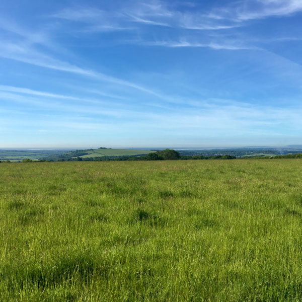
Early morning at the top of Old Winchester Hill
4. What are the best South Downs cycle routes that not many people know about?
The GPX routes and descriptions below are some of my favourite rides in the South Downs. They include a great mixture of terrain and some incredible countryside.
All the routes start from the King Alfred Statue in Winchester.
Note: Andy has kindly written fabulously detailed descriptions of the routes, to help you choose the best ride for you and know what to expect. These, and the GPX routes, are at the bottom of this article – you can jump to the relevant section by clicking here.
Also, it’s worth saying that the South Downs is probably best known in cycling circles for the South Downs Way cycle route. This is the 100 mile, mainly off-road route through the Park. As you’ll appreciate, this being Epic Road Rides, we don’t cover this route in this guide. Instead we cover the amazing road riding on offer in the region!
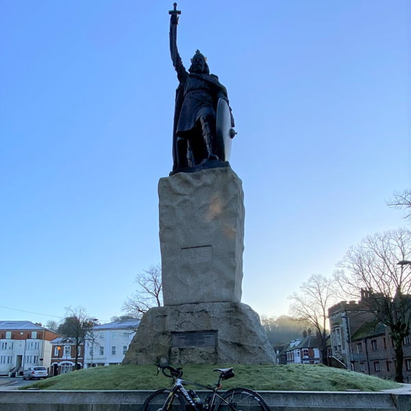
Kind Alfred statute in Winchester
5. What are your best tips for people cycling in the South Downs for the first time?
Make sure you plan a route or follow one of the routes below. It’s easy to get lost in some of the small lanes and many have no road signs.
Watch out for farm machinery, you probably won’t see much, but if you do, you’ll find that in the narrow lanes some of it takes up the entire road!
Be cautious around the A272 and A32. Although these are single carriageway roads, there can be fast moving traffic on them, especially motorbikes.
After heavy rain, some of the smaller lanes can flood quite easily; be wary of large puddles and potholes.
Ensure you have spare inner tubes and a pump. This is flint country and punctures are not unheard of. Also hedges get trimmed, leaving sharp pieces of branches laying across the roads.
Take strong lights as a lot of the lanes are very dark after sunset.
If you’re planning a coffee stop, check their website or call them in advance, as café hours can vary.
Look around you as you go, the views are unbeatable!
6. Are there any really good coffee/bar/café stops while cycling in the South Downs?
There are plenty of good stops in the larger towns such as Winchester, Alresford, Petersfield etc.
Here are my favourite stops on the routes that are described below.
Sustainability Centre (Route 1, Route 3, Route 5)

An unusual stop a couple of miles on from the top of Old Winchester Hill. The café is called the Beech Café and is around the back of the Sustainability Centre building. The coffee is excellent and the food is vegetarian and vegan based. On a nice day it can be busy as it also attracts walkers on the South Downs. Check the website for opening hours which can vary.
Hungry Guest (Route 4)

This popular café is based right in the centre of Petworth and as a result can be very busy. Excellent locally sourced choice of food and drink. Take a lock as areas to park bikes are limited. Check their website here.
Cuppacheeno (Route 1, Route 5)

A small cosy local café in the picturesque village of West Meon located behind the village shop. Friendly service, great choice of hot and cold food and good coffee. Plenty of room to park bikes on provided racks. Track pump and inner tubes available. Check their details here.
Handlebar Café (Route 1, Route 5)

Newly opened café on the cycle and footpath that follows the Itchen navigation out of Winchester. The café offers a good selection of food and coffee but can get busy at times as it also caters for a lot of walkers. A ‘Bike Booth’ is also next to the cafe which will offers puncture repairs and quick tune ups etc. Check their website here.
QE2 Country Park Café (Route 2)

Newly refurbished and expanded in the heart of the QE2 Country park, this is a council run café with a good selection of food and drinks. Secure bike parking is available in good view of the café windows.
Old Forge Tea Rooms Hambledon (Route 1)

Family run and very friendly, excellent service and excellent choice of food and drink based in the pretty village of Hambledon. Track pump and inner tubes available. Check their website here.
The Tea Barn at Durleighmarsh Farm (Route 3)

Big selection of food and drink and safe bike parking.
Rake Garden Centre (Route 4)
Standard garden centre fare. You can take your bike into the centre and leave it by the café.
7. Is there anything that visitors shouldn’t miss?
The stunning views at every turn and peace and quiet. This is also a walker’s paradise with the famous South Downs Way running through the park from end to end. There are many pretty villages with cosy old English pubs and plenty of history.
8. What can non-cycling partners do in the South Downs?
As mentioned above, the South Downs is walker’s territory and there are some fantastic walks to be had.
There is also plenty of history and shopping in bigger towns.
For young children, Marwell Wildlife is a great day out and Paultons Park is not too far away.
Winchester
A splendid cathedral and many other attractions. It’s also less than an hour from London by train.
Petersfield
The ancient market town of Petersfield was formerly an important coaching centre on the London to Portsmouth Route. There is also a direct train line to London from here.
Petworth
The market town of Petworth a centre for arts and culture is set in the heart of the South Downs National Park and is surrounded by the walls of Petworth House and Park.
Marwell Zoo
Paultons Park (Peppa Pig World)
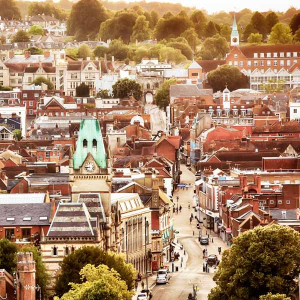
Winchester from high up
9. What’s the best town/city to stay in?
I’ve got a particular soft spot for Winchester, and of course all the rides below start from Winchester, but any of the towns above would make good places to stay to explore the South Downs.
10. When’s the best time to visit?
There is no best time to visit!
Being England, the weather can vary enormously. You could get a beautiful ride on a winter’s morning with clear skies and frost glistening and showing the landscape to its best. Equally in summer you could suffer a heavy downpour or a gloriously hot and sunny day…
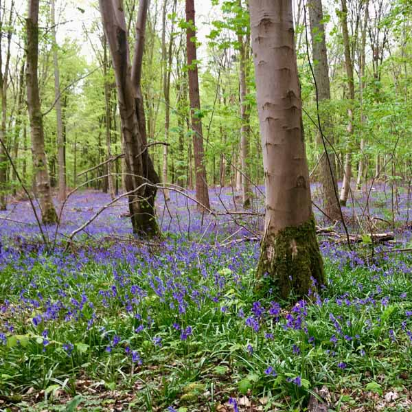
There should be plenty of bluebells around if you visit in April and May
My route suggestions
Route 1 – Hambledon Loop
Overview:
A great loop with plenty of rolling hills and stunning views.
Detail:
The route leaves Winchester via the Itchen river path to the left of the Bishop on the Bridge pub. You will pass by some famous Winchester landmarks including Wolvesey Castle and Winchester College. At about 1.5 miles is the Handlebar Café if you need caffeine to get you going.
At the end of the river path you head under the M3 motorway towards the village of Twyford. Once in Twyford the roads will become quieter as you take to the lanes. At the six-mile mark you climb up Whites Hill. A seemingly innocent looking lane that gets a lot steeper towards the top, expect gradients between 10-14%. Be very wary of any cars on this lane as its very narrow at points. The next 13 miles or so are on rolling lanes with some gentle climbs and descents.
At the pretty village of West Meon, the route takes you past the local village shop and behind that is the Cuppacheno café. You can decide whether you want to stop here or at the Beech café in the Sustainability Centre at the top of the next climb. The climb out of West Meon at around 20 miles is a good one with some great views. The last section of the climb from Coombe to the ridge where it joins the Droxford Road is the sting in the tail. Less than a mile from the top here is The Sustainability Centre and café.
The route takes on a nice descent that ends up at a crossroads by the Bat and Ball pub opposite the Broadhalfpenny Down cricket ground, the original home of the Hambledon Club founded around the 1760s.

Hambledon Cricket club opposite the Bat & Ball Pub
From here, there is a loop around the village of Clanfield before following several pretty lanes (watch out for mud and pot holes). Just before 36 miles you will descend into the village of Hambledon and here you will find the excellent Old Forge Tea Rooms.
The route now takes you up and down a couple of nice climbs including Speltham Hill before returning through the village of Hambledon and going around the imposing Church of St Peter and St Paul. You can omit these if your legs are tiring.

Church of St Peter and St Paul
Leaving the church behind you, you will climb out of Hambledon and into open farmland once more. You pass through the villages of Soberton and Waltham Chase where there is a bike shop on the main crossroads for any emergencies. From Waltham Chase the route takes you down more rolling lanes before joining the B2177 road at the village of Lower Upham. Just on your right at this junction are the highly recommended bike fit specialists Vankru Cycling. You will now follow the B2177 for just over a mile before turning right towards the Marwell Activity Centre.
Back on the lanes again you will climb up to the Village of Owslebury and the Ship Inn (you will recognise this as it was at the top of the Whites Hill climb at mile 6). The route now heads back to Twyford and back into the city of Winchester. There are plenty of options here to regain the calories you have just burnt off.
Route 2 – QE2 Loop
Overview:
A 52 mile loop from the city of Winchester to the Queen Elizabeth Country Park in the south of the South Downs.
Detail:
The route leaves Winchester from the King Alfred statue and on your left you will pass the Winchester City Mill before climbing out of the city on Magdelen Hill. You will arrive at a roundabout and take the 3rd exit for the A272 towards Petersfield. Once on the A272 you will climb up and around Cheesefoot Head home to the Boomtown Festival each summer. There is a long descent and at about 5.1 miles there is a right turn towards Warnford and Preshaw.
You are now on quieter roads that eventually lead to the top of Beacon Hill. There are some great views from the top here, and on this ride you are descending the climb of Beacon Hill. It’s a fast descent on a narrow lane and watch out for horse riders and other cyclists. At around 11.5 miles at the bottom of Beacon Hill is the village of Exton. Here you cross over the A32 road: be careful of fast-moving traffic and in particular motorbikes. You pass through the village of Meonstoke and head onto quiet country lanes. At around 13.5 miles there is a challenging climb to the top of Stock’s Lane.

The beacon on top of Beacon Hill
The route passes through some picturesque countryside and the village of Chidden and then leads down and around the town of Clanfield. At around 22 miles the route follows the cycle path alongside the A3 dual carriageway before it loops underneath it and you arrive at the Queen Elizabeth Country Park. There is plenty of secure bike storage in front of the café.
After refuelling you will leave the Park via a wooden ramp to the right of the exit barriers for the car park. This ramp takes you up to a new bike path that follows alongside the A3 towards Petersfield. The bike path ends at a roundabout where you cross the road and go left towards Weston, Ramsdean and East Meon. You immediately pass under the A3 where you take the first right and then the first left towards Ramsdean and East Meon.

You pass through the village of Ramsdean and Langrish before taking a left onto the A272 where you will climb for half a mile before taking a right at the top of the climb, caution is required on this junction. Back onto quiet lanes again which lead through the village of Froxfield Green. After crossing the A32 you will next pass through the village of West Tisted and then skirt around the village of Ropley before descending down to the A31.
Once over the A31 you climb up the hill towards Gundleton and Bighton. Halfway up you will cross a railway bridge which passes over the famous Watercress Line. You may be lucky enough to spot some old steam trains.
Once you have passed Gundelton, continue to follow Bighton Lane until you reach the junction with the B3046 at 42.3 miles. If you are in need of further refreshments you could take a left here and follow the B3046 for just under half a mile to the town of Alresford where there are plenty of choices available.
From the B3046 junction, the route takes you right and then immediately left towards Abbotstone. You follow the lanes for about 3.5 miles before joining the B3047 by St Marys Church at Itchen Stoke. Following the B3047 you will pass by the villages of Itchen Abbas, Martyr Worthy and Abbotts Worthy before the road ends at the junction with the A33. Take care crossing the A33 before heading through the village of Kings Worthy. You follow Worthy Lane back into Winchester and around the one-way system before ending back at the statue of King Alfred.
Route 3 – Rogate Loop
Overview:
A 60 mile loop from the city of Winchester across the Meon Valley to Rogate near Petersfield.
Detail:
Similar to route 2, you will leave Winchester from the King Alfred statue and on your left you will pass the Winchester City Mill before climbing out of the city on Magdelen Hill. You will arrive at a roundabout and take the 3rd exit for the A272 towards Petersfield. Once on the A272 you will climb up and around Cheesefoot Head before a long descent and at about 5.1 miles there is a right turn towards Warnford and Preshaw.

A272 heading into the Meon Valley
At around 7.3 miles you turn left and take a beautiful descent eventually ending in the village of Kilmeston.
After 5 rolling miles, you arrive in the village of West Meon. From here you take one of the classic climbs up Old Winchester Hill. From the moment you turn the second corner on Station Road you’ll hit a nasty ramp signifying the start of the climb. The rest of the climb is nowhere near as violent but you’ll be steadily climbing for 2 to 3 miles.
Old Wichester Hill
You continue to climb up before the road levels and then dips a little before rising again slowly to the Sustainability Centre on the right where you may wish to stop for refreshments. After leaving the Sustainability Centre there’s a fast descent before turning right into Oxenbourne Lane. From here for the next 4 miles, the road gradually descends until you pass under the A3 and reach the pretty village of Buriton. You will pass by the pond and St Marys Church. At 26 miles you will turn right onto the B2146 road and follow this for about half a mile before turning left and following the lanes to the A272. You will cross directly over the A272 and take a no-through road to Durleighmarsh Farm shop and Tea Barn.
Make sure you refuel well here as the second half of the route is tough! On leaving the farm shop you will turn left onto the A272 and then take the first left. Be careful on the next mile of the route as this is a sandy area and sand can quite often be found on the road. You will next take a left onto North Street and a gradual climb will take you to a left turn where you will pass through a forest at Combe Hill. From here you will cross the London Road at Hill Brow and descend down into the town of Liss. In the centre of Liss you will cross over the Portsmouth to London main line. On leaving Liss you will pass over the top of the A3 before turning left at approximately 35.5 miles.
It’s at this point in the ride that things get tougher as you will enter a series of ups and downs equivalent to a rollercoaster. This is great riding country but that may not be top of your mind as you will need to get out of the saddle to make your way up several of the climbs. There are great views if you can take them in. The rollercoaster will eventually come to a stop as you get to the Church of St Peter ad Vincula at Colemore. From here you will roll down under an old bridge to the A32.

Church at Colemore
As with Route 2, once over the A31 you will climb up the hill towards Gundleton and Bighton. Halfway up you will cross a railway bridge which passes over the famous Watercress Line. You may be lucky enough to spot some old steam trains. Once you have past Gundelton, continue to follow Bighton Lane until you reach the junction with the B3046 at 50.8 miles. If you are in need of further refreshments you could take a left here and follow the B3046 for just under half a mile to the town of Alresford where there are plenty of choices available.
The route heads around the back of Alresford before dropping down to the tiny village of Ovington. From Ovington you will continue onto to Avington and pass through Avington Park with spectacular views of the stately home and lake. You will probably also pass several long horned highland cattle wondering through the grounds. The next village is Easton and here the route heads up the hill and away from the village for the last few miles towards Winchester. You will pass over and under the M3/A34 roundabout following a series of bike paths and from here it’s aroll down Easton Lane and Water Lane before the ride finishes close to the statue of King Alfred.
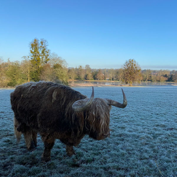
Highland cattle at Avington Park
Route 4 – Top Gear Ride
Overview:
The big one, 108 miles across the South Downs National Park to the edge of the old Top Gear airfield at Dunsfold. Stops for refreshment are at Rake and Petworth. It’s a long day in the saddle but you won’t be disappointed.
Detail:
Similar to route 2 and 3, you will leave Winchester from the King Alfred statue and on your left you will pass the Winchester City Mill before climbing out of the city on Magdelen Hill. You will arrive at a roundabout and take the 3rd exit for the A272 towards Petersfield. Once on the A272 you will climb up and around Cheesefoot Head before a long descent and at about 5.1 miles there is a right turn towards Warnford and Preshaw. Also, in common with Route 3 at around 7.3 miles you will turn left and take a nice descent eventually ending in the village of Kilmeston.
The next 5 and a half miles are on quiet lanes until you reach a crossroads with the A272. Take caution crossing here. The route then climbs from the A272 before you reach a junction with the A32. Caution is also needed on this awkward junction. You will cross over the A32 and climb again to the village of Privett where you will pass by the Victorian Holy Trinity Church. The route continues along picturesque quiet lanes until around 17.8 miles you will take a left fork and climb for around a mile until you pass the White Horse pub at Priors Dean.
You will pass through the village of Hawkley and pass over the top of the A3 before dropping into the town of Liss. In the middle of Liss you will take a right onto Rake Road and follow this for a couple of miles before emerging onto the London Road where you will go left for a small distance before arriving at the garden centre at Rake for the first refreshment stop. Fuel well here as there is plenty more riding to be done here and the next scheduled stop is at Petworth which is just under 40 miles from here.
On leaving the garden centre you will retrace your steps before taking a left and heading back to the lanes. At just over 29 miles there’s a great view of Cook’s Pond on the right and you can get a better view if you just go a little way down Cooks Pond Lane on your right.

Cooks Pond
From Fernhurst you head back onto quiet rolling roads and pass through small villages and hamlets for the next 12 or so miles. At 46.3 miles you will reach the village of Dunsfold and here you will take a right turn onto Alfold Road. This is the road that skirts around the edge of Dunsfold Aerodrome which was used by BBC’s Top Gear programme as a test track. Unfortunately, you won’t get much of a view of the track as the area is fairly heavily wooded. At 48.7 miles you will take a right turn and head south away from the airfield.
The next part of the route takes you through the villages of Alfold and Loxwood and at around 60.5 miles you will join the main A283 road and climb up into the market town of Petworth where you will also spot the famous Petworth House and Park. Petworth is the main lunch stop on this ride and with over 60 miles in your legs you have earnt it. The planned lunch stop is The Hungry Guest although there are a few choices in this tourist hotspot.

Petworth
Make sure you eat well here and refill your water bottles as there are plenty more ups and downs to come in the last 50 or so miles.
From the centre of Petworth, the route takes you out on the main A286 road for a couple of miles until you take a right turn back onto quiet wooded lanes again. You will pass through many pretty villages, Heyshot, Cocking, Didling to name a few and you will experience the true beauty of the national park as you head west back towards your start point.

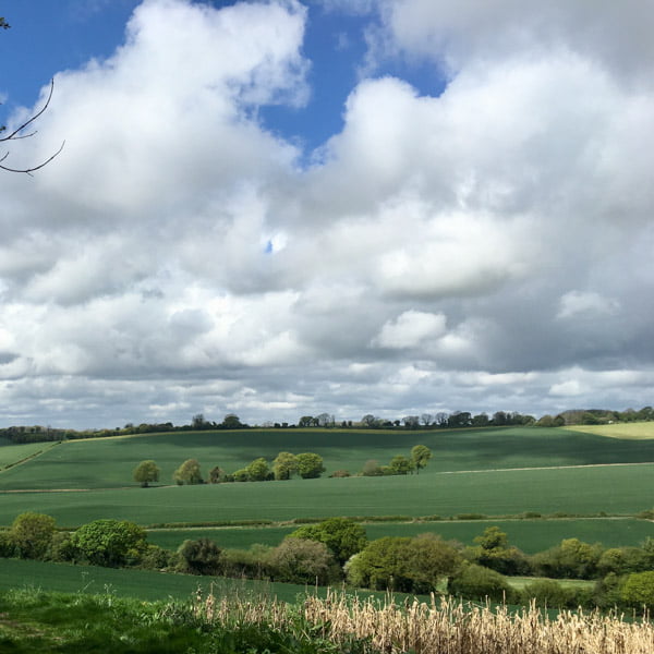
South Downs National Park in all its glory
At around 78 miles you will reach the village of South Harting and then take the main road up and out of the village towards Petersfield. If you need supplies you can carry straight on into the town of Petersfield. At around 81 miles you will take a left turn and head towards Buriton. Make sure you select an easy gear before turning left as the gradient kicks up quickly. You will pass through Buriton with its village pond before heading across a roundabout and under the A3. Here you will take an immediate right and then left as you head into the Meon Valley. At around 87 miles you will reach the pretty village of East Meon. From here the route climbs up and towards the top gets steeper as it rises towards Old Winchester Hill. If you are riding this route in the summer you can expect a sea of yellow all around you.

At the top of the lane you will continue to climb a little more before enjoying a fast descent down Old Winchester Hill. Be wary of cars and cyclists climbing the hill. The descent ends at the junction of the sometimes busy A32 road. You will take a left and then a right up Wheely Down Road where you will need your climbing legs once more. There’s more descents and a few more sharp climbs before you head up to the village of Owslebury. From here you will make your way through quiet lanes before reaching the village of Twyford.
Only a few more miles as you head out of Twyford before passing under the M3 and heading back to your start point in Winchester where you can reload on calories and caffeine and rest your very tired legs.
Route 5 – Meon Valley Hills
Overview:
A 63 mile loop from the city of Winchester across the Meon Valley taking in many of the areas signature climbs. Suggested stops at Cuppacheno and the Sustainability Centre.
Detail:
You will leave Winchester from the King Alfred statue and head out of the city along Chesil Street before turning right down Wharf Hill and picking up the river path. At about 1 mile you will pass the Handlebar Café if you need caffeine to get you going. As with Route 1, at around 5.5 miles you will ascend up Whites Hill. A seemingly innocent looking lane that gets a lot steeper towards the top, expect gradients between 10-14%. Be very wary of any cars on this lane as its very narrow at points. You will leave the village of Owslebury at around 7 miles for just less than 2 miles climb up to a crossroads. There are great views at the top here at any time of year.
For the next 5 miles you will climb and descend and follow some of the South Downs Way before you end up in the village of Warnford. In Warnford you will turn left onto the A32 before taking a right opposite the George and Falcon pub onto Hayden Lane. Take care on this junction. Haden Lane is the start point for one of the routes up Old Winchester Hill. Within seconds you are away from any traffic and climbing from the start, enjoy the beautiful scenery that you will experience all the way up. There are a few chances on the climb to catch your breath and spin a bit easier, take these as they will be needed in the last section of the climb. The view from the top is worth the climb. The length of both the climb is just short of 2 miles and although the gradient never quite breaks 10% it’s a tough climb. Be wary of cyclists descending at speed.

View from the top of Winchester Hill
The climbing continues although it is less intense until you reach the Sustainability Centre at around 19 miles. You may want to get refreshments here. Leaving the Sustainability Centre there is a great descent. The road will flatten out and at 20.8 miles you will take a right into Oxenbourne Lane. A little way down you will turn right into Harvesting Lane, this is the lane that climbs Butser Hill. You will pass a farmhouse ‘Upper Parsonage Farm’, from here the climb gets nasty.
At the top on a clear day, you are rewarded with views down to Portsmouth and the sea in the distance.
Views from the top of Butser Hill
You will now descend down into the village of Clanfield. You will climb back out of Clanfield and pass The Bat and Ball pub as you take a climb of nearly 2 miles up to the top again near to the Sustainability Centre. You will make the same descent you made earlier buit this time instead of taking a right towards Butser Hill you will continue on to the village of East Meon and the West Meon where you may want to call in at Cuppacheeno for refreshments. You will now take a gentle climb out of West Meon before descending down Lippen Lane to the A32 at Warnford.
You will follow the A32 for a little over a mile before taking a right turn onto Church Lane and into the village of Exton. It is here that you will pick up The White Way as you climb to the top of Beacon Hill. This is a steady climb that will certainly warm you up and you get the opportunity for some great views as you climb.
From the top there’s a great descent down to the B3035 where you will go right and then right again towards Morestead and Winchester. You will follow this road for approximately 2 miles before turning left onto smaller lanes again. At just over 47 miles you will take a left fork and head up Baybridge Lane. This is another steady climb passing through a dark wooded section before rewarding you with more great views at the top. You will descend and then take a hidden left turn at approximately 48.3 miles by a small cottage into Lower Baybridge Lane. This will eventually take you to Whaddon Lane and then Thompsons Lane.
Thompsons Lane passes the Marwell Wildlife Zoo and then joins the main road. You will pass two pubs and at the second The Fishers Pond you will turn right into Hensting Lane. As you pass large houses you will catch glimpses of the large pond on your right. The best view of the pond is from The Fishers Pond Pub. The route follows Hensting Lane before eventually heading up Jackmans Hill towards Morestead. At around 55 miles you will take a left onto Morestead Road. Take care at this junction. You will now climb for around a mile before reaching the top and the descending back down towards Winchester. As you reach Garnier Road at around 58 miles you will pass the Handlebar Café where you can restock on coffee and cake. From here the route takes you back to the King Alfred statue where you began.
An East Meon view
What next?!
Huge thanks to Andy for putting together these notes on cycling the South Downs, and in particular for the very helpful route guides and GPX downloads.
We hope this guide leaves you feeling inspired to explore the UK’s South Downs National Park by bike.
Have you done any of the routes? Let us know how you found them below!
Want ideas for where else to ride in the UK? Check out our UK page, with guides on Yorkshire, Peak District, Isle of Wight and the Surrey Hills, as well as our tips for the best UK sportives and series of cycling cafe recommendations for the home counties.
Please support Epic Road Rides
A huge amount of time and effort goes into the article you’ve just read, all with the aim of helping you!
If you found what you’ve read useful, I’d really appreciate it if you dropped something in the tip jar here.
It’s a way you can say thank you and help us carry on creating top quality content with no annoying ads and no pay wall.
Looking for an organised cycling trip?
If you want someone to help you plan and book your cycling holiday, fill out this form. We aren’t a tour operator/agent but we work with lots of people who are and will do our best to put you in touch with someone that can help (within 24 hours where possible)!First Published: 17 March 2020
The contents of this website are provided for general information purposes only. It is not intended to amount to advice and you should not rely on it. You should carry out your own due diligence and risk assessments and take professional advice. Views expressed by interviewees or other users of this website do not necessarily represent our views. We make no representations, warranties or guarantees, whether express or implied, that the content on our website is accurate, complete or up to date. If you use any information or content on this website, download from, or otherwise obtain content or services through our website, it is entirely at your own discretion and risk. Epic Road Rides Ltd disclaims all liability and responsibility arising from any reliance placed on the information and content on this website. Find out more here.
Comments