Cycling from Land’s End to John O’Groats (also known as LEJOG) is one of the most iconic routes you can enjoy in the UK, or even across Europe.
With such a long route to tackle, there are a lot of variants, so it’s always interesting to hear firsthand accounts from experienced riders!
In this article, you enjoy the perspective of Norbert Dürauer, a seasoned cyclist who bikepacked the LEJOG route in June 2025 over 12 days.
With a lifelong passion for road cycling, Norbert’s career has taken him all over the world. Now working in the tourism industry and holding a cycling coaching qualification, Norbert approaches each ride with his expert eye, and he was more than happy to share his experiences of his once-in-a-lifetime Land’s End to John O’Groats ride.
Read on to find useful tips to help you plan your own long distance cycling journey across the UK.
Like the idea of tackling the Land’s End to John O’Groats cycle route, but would prefer more support, including a support van, bike maintenance and experienced guides? Don’t miss this in-depth guide.

Norbert Dürauer comes from Waidhofen an der Ybbs in Lower Austria, a small city surrounded by perfect terrain for road cycling. His passion for the sport began in childhood and quickly developed into a competitive career. As a junior and U23 rider, he represented Austria at the Road World Championships in Hamilton (2003) and Salzburg (2006). Alongside his university studies, he raced for several years on the Continental level, taking part in prestigious events such as the Tour of Austria and multiple 1.1 one-day classics.
His sporting journey extended beyond cycling into triathlon, where he claimed a national championship title. Highlights include competing in the elite category at two European Cross Triathlon Championships and the World Winter Triathlon Championships.
Despite these achievements, road cycling has always remained his greatest passion. For Norbert, the sport is not only about competition but also about freedom, health, and discovery. Travelling by bike has allowed him to explore diverse countries and landscapes, enriching his appreciation of cultures, scenery, and local cuisine. With a cycling coaching degree and a professional background in tourism, he brings a unique perspective to assessing destinations for their cycling suitability.
Norbert values the sense of community within the cycling world. Having experienced both triumphs and setbacks on the bike, he is always eager to share his knowledge while learning from others’ stories. For him, cycling is more than sport; it is a way of life, a means of connecting with people, and a gateway to experiencing the world.
Part 1: An overview of the Land’s End to John O’Groats Bike Ride

My route took me through large parts of England and Scotland, along with a short stretch of around five kilometres through Wales.
The route I took avoids big cities and uses roads with low traffic as much as possible. It’s perhaps one of the shortest LEJOG routes that meet these criteria since there is mainly just one direction: north!
In total, my route took 1,530 kilometres with around 17,600 metres of elevation gain.
GPX DownloadTerms of use reminder
Terrain
Be aware! The beginning is tough as South West England, particularly Cornwall, is anything but flat.
There are plenty of short but rather steep climbs, which made it quite tricky to find a good rhythm and save energy for everything that was still ahead of me.
The good thing is that there are so many things to see. You have to navigate, too, so your focus is completely in the here and now. This lets you “forget” about the terrain, but you will also get a reminder of that in your legs later in the evening, anyway!
Later in the route, the terrain changes to longer climbs with less gradient, something I really liked a lot.
Navigation
Be aware! Aside from the iconic signposts at the beginning and end of the route, there are no official LEJOG signposts to help you navigate along the way.
I fully plotted my route in advance. It is quite a lot of work to plan the route, and there are many questions and puzzle pieces to figure out until you upload your final route to your watch! Some common things I had to think about for navigating included:
- How long did I want to cycle each day?
- How are the roads and traffic?
- Which sights should be included?
- Where to stay?
Since I was also born in the “pre-digitalisation era”, I not only use devices to help me, but I also study good old roadmaps and leaflets. Just like during my racing years, I collect as much information about the route as possible. I always feel happier about that when you i’m on the road.
However, today’s technologies and all those sport/cycling watches make it almost impossible to get lost, and navigation is quite easy with those tools. Some missed corners or sharp turns you see too late, but that’s it, and what probably would have been a lot of extra miles in earlier days are only some seconds until you turn around to be on the right path, again.
Top tip! The more industrialised the area you cycle through is, the more you must be careful when navigating.
Don’t forget to raise your head and notice the scenery! In the north of Scotland, you hardly need any navigation since there is only one road, so you can relax a little and enjoy taking in the beautiful surroundings.

Roads
If you are used to Austrian, German, or Swiss road infrastructure, you will find that British road surfaces are not of that good quality and the tarmac is very rough.
Be aware! Potholes occur quite regularly and can be crash hazards, so take care when cycling.
The smaller roads are often better, apart from some gravel or grass trails that farmers left behind. I used 40 millimetre tyres, and that was a good choice as the trip is not about speed or being aerodynamic.
Is there anything to be aware of when choosing the best roads?
‘M’ motorways are off-limits. ‘A’ roads are major roads between bigger cities that can have heavy traffic if there’s no motorway next to it. Depending on the situation, it’s sometimes better to ride a few kilometres on ‘B’ roads, which are smaller and often rather quiet.
I rode a lot on very narrow side roads where two cars can hardly pass each other. They are great for cycling, but sometimes it is tricky to navigate when sharp turns appear very quickly. Sometimes the route follows really small paths that you think cannot be the right way. Be cool and trust your device.
In Scotland or the further north you get, navigation is much easier as there are not many other options than the only existing road.
Cycling culture
During my whole time cycling in the UK, I experienced friendliness, support and respect, especially on the road. I encountered no dangerous situations, and car drivers would patiently wait for enough time and space to pass. That was a big surprise to me!
But I found the same treatment when off the bike, in my accommodation, the supermarkets or just somewhere on the road, you’ll get plenty of support, including help storing your bike safely.
Locals seemed curious about my cycling journey. You also tell the same story every day and answer the same questions, only slightly adapted: where are you from? Where are you going? Why? Are you serious? Where did you ride today? Where will you ride tomorrow? How does your butt feel?
Part 2: Why cycle Land’s End to John O’Groats
An unrivalled sense of achievement
There are so many highlights to the route, but the overall highlight was completing it. Both start and finish give you emotions beyond simple goosebumps: those two signposts, those two oceans … I mean: how cool is that?!
And in between, every mile is clearly about the beauty of cycling and what it means to be free.
It has provided me a genuine lifetime memory, and a mix of feelings ranging from pure joy, to relief, gratitude and somehow disbelief. It feels like a complete privilege to have achieved this route!
The varied landscapes
The first half of the tour was characterised by a lot of agriculture. But I was very often surprised when I was riding through beautiful sections such as Cheddar Gorge, the Wye Valley and all those lovely little villages and market towns, including Truro, Okehampton, Chepstow, Leominster or Middlewich, to name a few.
The second part was clearly dominated by the outstanding nature and spectacular views. From the Lake District on the scenery became much hillier and more isolated.
Once in the Scottish Highlands, you ride all day with your mouth wide open, especially through the Cairngorms National Park. Yes, admittedly, sometimes because of the profile there! But most of the time due to the fantastic surroundings. There is nowhere else like this, and it provided one of my best days I’ve ever had on the bike!
The last stage, which took me to the North Sea coast and its breathtaking views, was also phenomenal.
British culture
I also loved all the encounters, chats and talks that I was able to have during my time in the UK. British culture is contagious; the various dialects across the British mainland are so interesting to listen to, and, of course, British humour is a highlight in itself.
I also have to mention my all-time highlight: a certain native that is everywhere, all of the time, no matter the weather. I love them all: British sheep, you are the best!
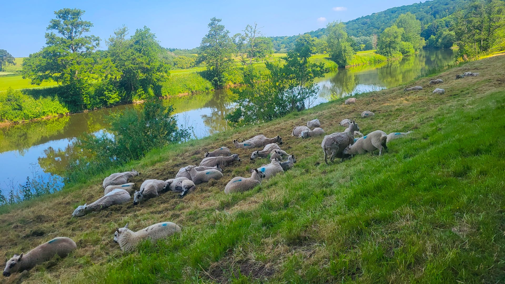
A flock of sheep enjoys life beside the River Wye (photo credit: Norbert Dürauer)
Part 3: My Land’s End to John O’Groats cycling itinerary
Day 0 (Prologue): Land’s End to Penzance
GPX DownloadTerms of use reminder
Key statistics
16 kilometres
170 metres of elevation gain
Summary
This was just a short warm-up on the day after arrival. A chance to spin the legs, check the equipment and get ready. The route to Penzance is very up-and-down.
Points of interest
- There is a big “START” sign on the road
- The whole complex of Land’s End is an experience with some interesting things to see
Where I stayed in Penzance
Lombard House Hotel – hosted by a friendly older couple, although they don’t provide breakfast.
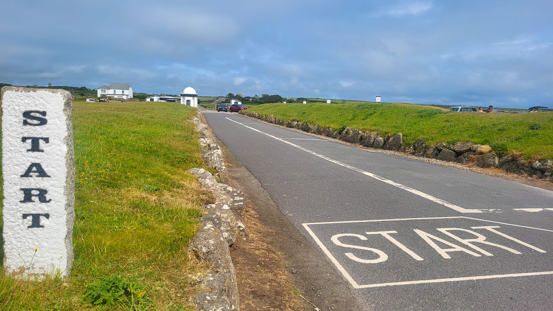
Route start point (photo credit: Norbert Dürauer)
Day 1: Penzance to Launceston
GPX DownloadTerms of use reminder
Key statistics
127 kilometres
2,100 metres of elevation gain
Summary
Not a single metre flat on small roads all day. You sometimes don’t see a lot of the area because you’re riding between high hedges. Take it easy on those steep, short hills, they add up during the day! You often think you’re at the top, only to find it goes on.
Points of interest
- Mount St. Michael, right after the start, is a famous sight
- Riding through Cornwall National Landscape Park, including some sheep on the road, is a great section towards the end.
Where I stayed in Launceston
Castle View B&B – this property is very quiet and has a beautiful garden and a very friendly owner.
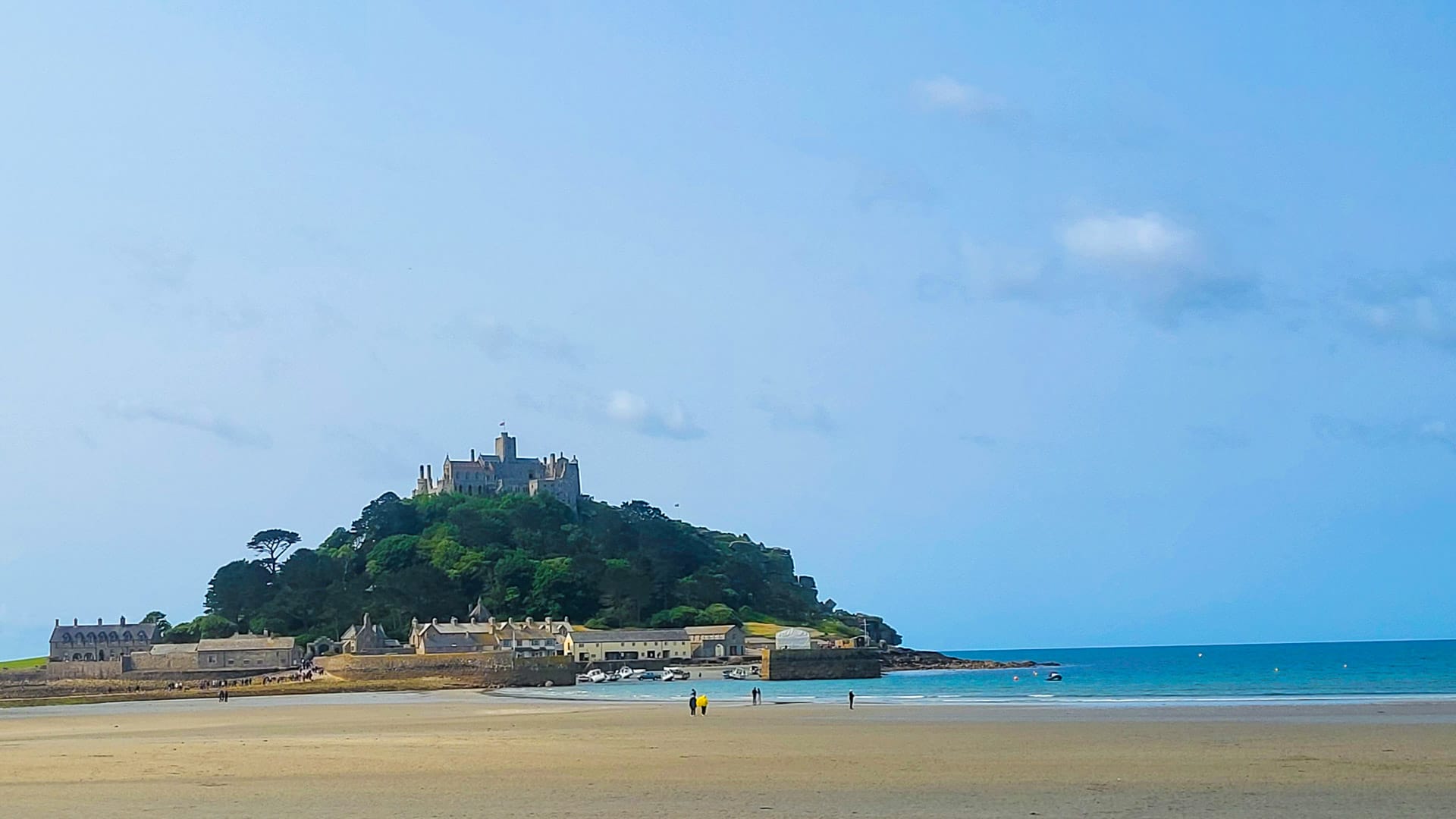
St Michael’s Mount (photo credit: Norbert Dürauer)
Day 2: Launceston to Bridgwater
GPX DownloadTerms of use reminder
Key statistics
135 kilometres
2,000 metres of elevation gain
Summary
Basically a repeat of day one, though you leave Cornwall and ride through Somerset. Most of the day is spent again on small roads between hedges and from one farm to the other. You often think this must be a dead-end street, but somehow you cross and enter a bigger road, again. Like the day before, there’s plenty of climbing and descending.
Points of interest
- The market towns of Tiverton, Bampton and Wiveliscombe are very pleasant
- Quantock Hills National Landscape. There’s a steep climb, but a beautiful forest near Bridgwater.
Where I stayed in Bridgwater
The Tudor Hotel – a great location near the town centre, with helpful staff and cosy rooms.
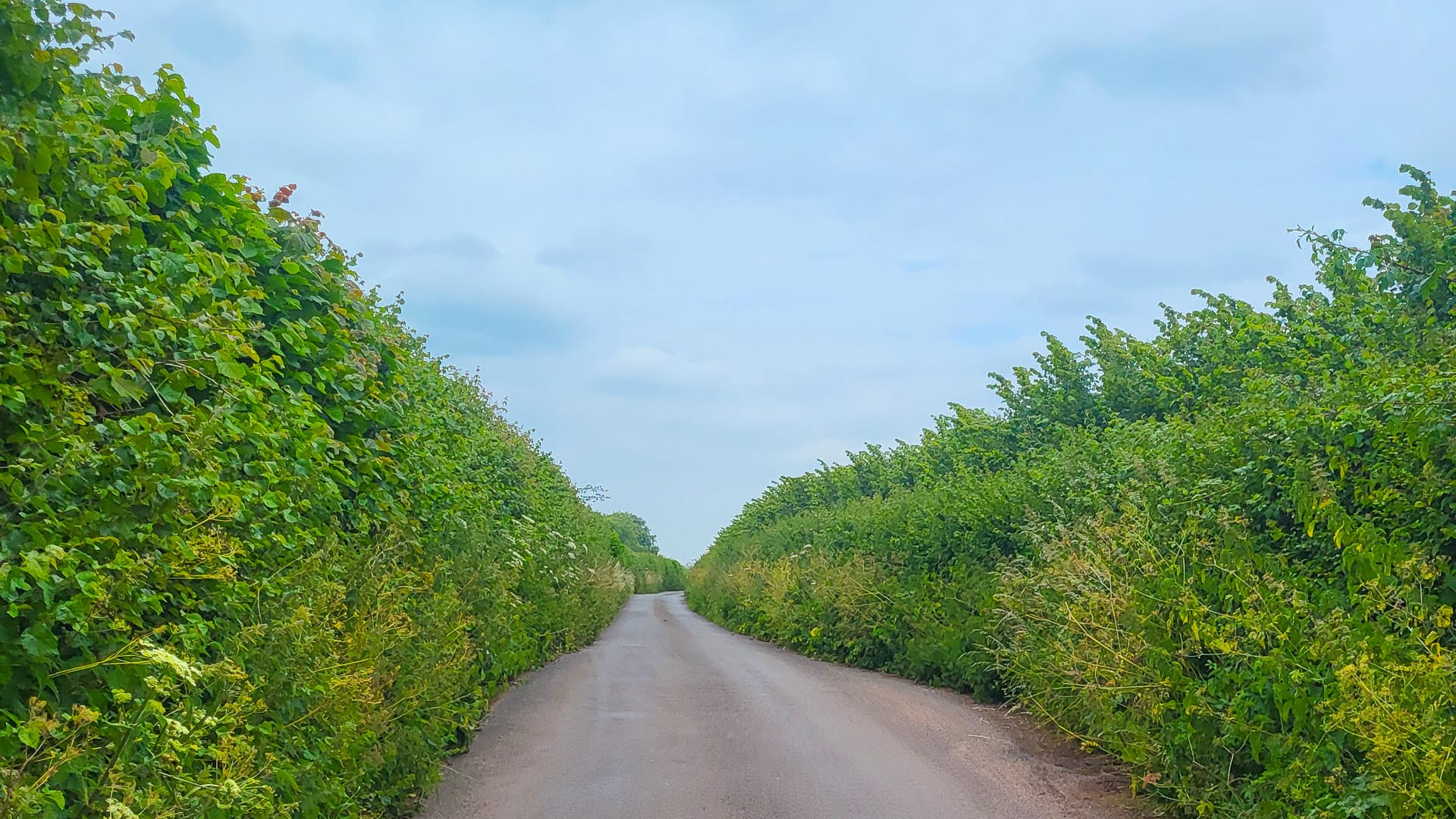
Not much to see on these small backyard roads (photo credit: Norbert Dürauer)
Day 3: Bridgwater to Coleford
GPX DownloadTerms of use reminder
Key statistics
144 kilometres
1,800 metres of elevation gain
Summary
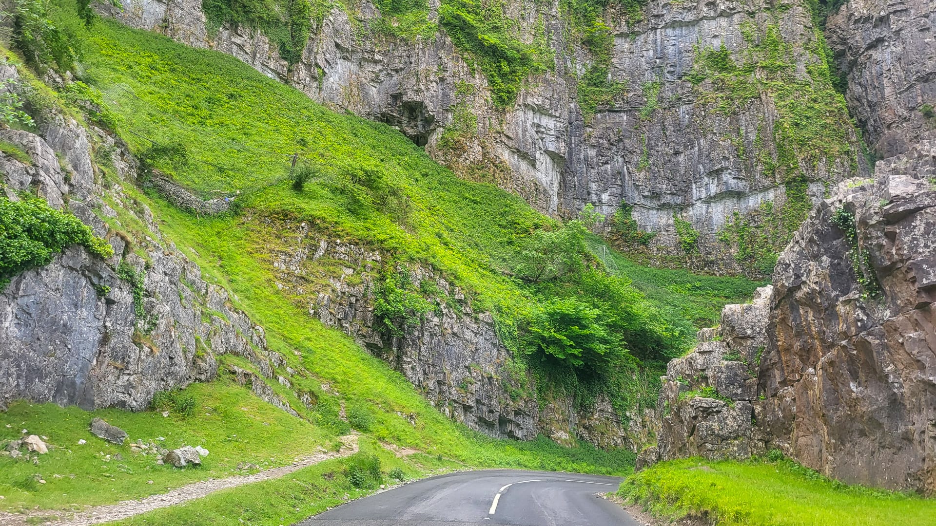
The up and down continues! But beautiful Cheddar Gorge, the City of Bath (a UNESCO World Heritage Site) and the small dip into Wales after crossing the big Severn Bridge split this long and demanding day into great pieces. Since it’s day three of hardly any flat sections, you get the feeling that Coleford is a little mountain village, though it’s only about 200 metres above sea level.
Points of interest
- The dramatic rocks of Cheddar Gorge are stunning to cycle through.
- Coleford has a lovely location in the Forest of Dean, with a very nice market square.
Where I stayed in Coleford
The Bells Hotel – a golf club hotel next to the Forest of Dean, it was nice, but the walls are thin.
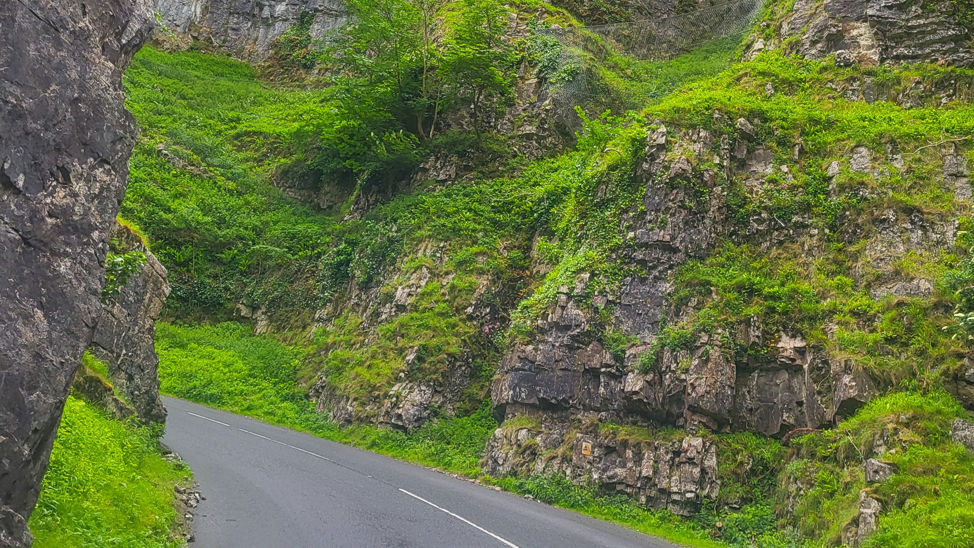
Cheddar Gorge’s striking rock formations are really impressive to cycle through (photo credit: Norbert Dürauer)
Day 4: Coleford to Wellington/Telford
GPX DownloadTerms of use reminder
Key statistics
130 kilometres
1,420 metres of elevation gain
Summary
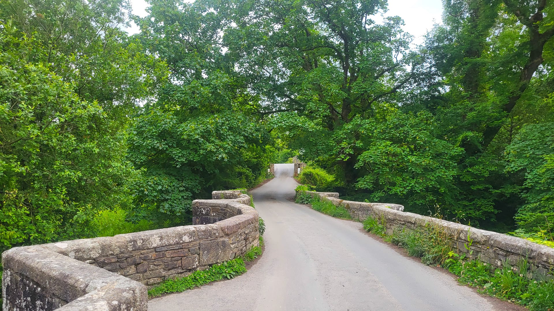
Riding next to the River Wye through the valley for the first 35 kilometres is excellent – there is no traffic, lots of sheep and smooth terrain. It’s definitely a hidden gem!
Once you leave the river, the scenery goes back to hedges, farms, small roads and also horse racetracks. Leominster and Ludlow are the only bigger towns you pass. You’re quickly back amongst small hills, and the pain in your legs after four days of riding with this elevation profile is beginning to set in!
Points of interest
- The Wye Valley also caught me by surprise; I didn’t know it was that beautiful.
- Ludlow Racecourse – the road goes directly through the big oval track on grass. For an Austrian, this is impressive!
Where I stayed in Wellington
The Old Orleton Inn – a beautiful building with great food, including breakfast served in the room and good dinner options.
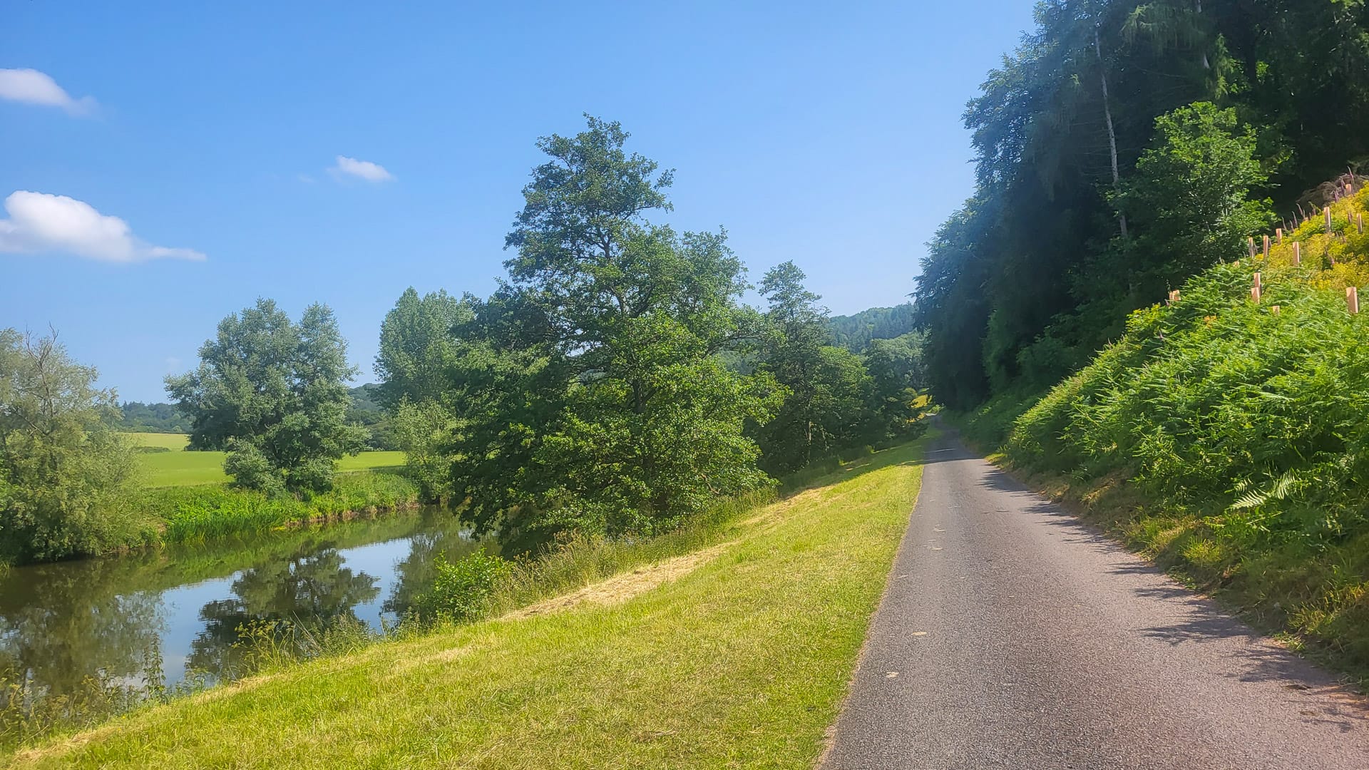
Beautiful cycling path next to the River Wye (photo credit: Norbert Dürauer)
Day 5: Wellington/Telford to Wigan
GPX DownloadTerms of use reminder
Key statistics
139 kilometres
700 metres of elevation gain
Summary
The route is starting to flatten out, but you feel every quarter-percentage of gradient in your legs now! There are also some long, straight roads to manage today.
You might assume that traffic will increase as you’re between Liverpool and Manchester, but you’re still riding on small side roads, passing farms and watching the planes approaching Manchester Airport.
That said, you can feel a shift in the landscapes; this is a very urban part of England, compared with the south.
Points of interest
- The town of Middlewich has historical buildings, modern amenities and a beautiful canal system.
- Knutsford aeroplane spotting on their approach to Manchester Airport.
Where I stayed in Wigan
This felt very new and modern, with friendly staff and a big breakfast served.
Day 6: Wigan to Penrith
GPX DownloadTerms of use reminder
Key statistics
155 kilometres
1,650 metres of elevation gain
Summary
Goodbye industry, hello nature!
Slowly, but steadily, after Preston, the route gets greener and greener. Once you’re near Kendal, the scenery is completely different to what you have seen before!
Now that you’re in the Lake District, you have reached the halfway point of your LEJOG cycle challenge. Although you’re cycling on an A road, there’s not much traffic since most of the vehicles drive on the motorway. A long descent to the scenic town of Penrith concludes the longest stage of the route.
Points of interest
- Shap Fell is a beautiful climb. It’s very rhythmic and has great views.
- The town of Kendal has a great castle and is the entrance to the Lake District National Park
Where I stayed in Penrith
Located on the outskirts of Penrith, in a very quiet area. Extremely friendly and communicative owner, usage of all facilities.
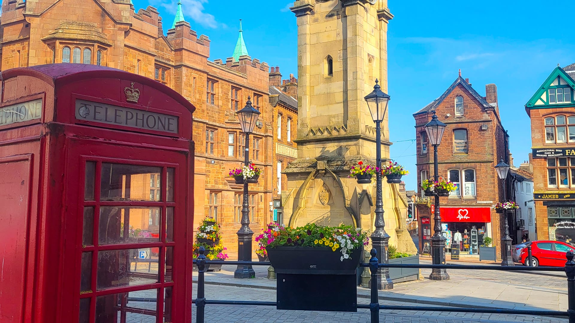
Very British – the market square in Penrith (photo credit: Norbert Dürauer)
Day 7 (Rest Day): Penrith to Carlisle
GPX DownloadTerms of use reminder
Key statistics
29 kilometres
250 metres of elevation gain
Summary
Designed as a rest day, this is just a little more than an hour of spinning the legs, almost flat and with not much to see between those two towns.
Points of interest
- In Carlisle, the capital of Cumbria, you have lots of culture, cafes and bookstores to spend time off the bike.
Where I stayed in Carlisle
Abbey Court Guest House – the rooms are small, but the attention to detail is excellent, and breakfast is both big and tasty.
Day 8: Carlisle to Livingston
GPX DownloadTerms of use reminder
Key statistics
153 kilometres
1,440 metres of elevation gain
Summary
Leaving England, it’s off to Scotland! On almost completely traffic-free roads next to the M6, you ride through the lowlands and cycle over another long and steady climb to the valley of the River Tweed. Small villages, grass mountains and big farms guide you to the outskirts of Edinburgh. You have to listen carefully now when people are speaking to you. The Scottish accent can be hard to understand for non-native English speakers!
Points of interest
- Moffat is Europe’s first Dark Sky Town and has adopted special street lighting to keep light pollution to a minimum in order to preserve the wonders of the night sky.
- Tweedsmuir Wilderness Resort is home to a lovely river and beautiful nature. Scotland’s lowlands are really picturesque.
Where I stayed in Livingston
Chain Runner (Marston’s Inns) – next to a Sainsbury’s, which is useful, this inn has spacious rooms and helpful staff.
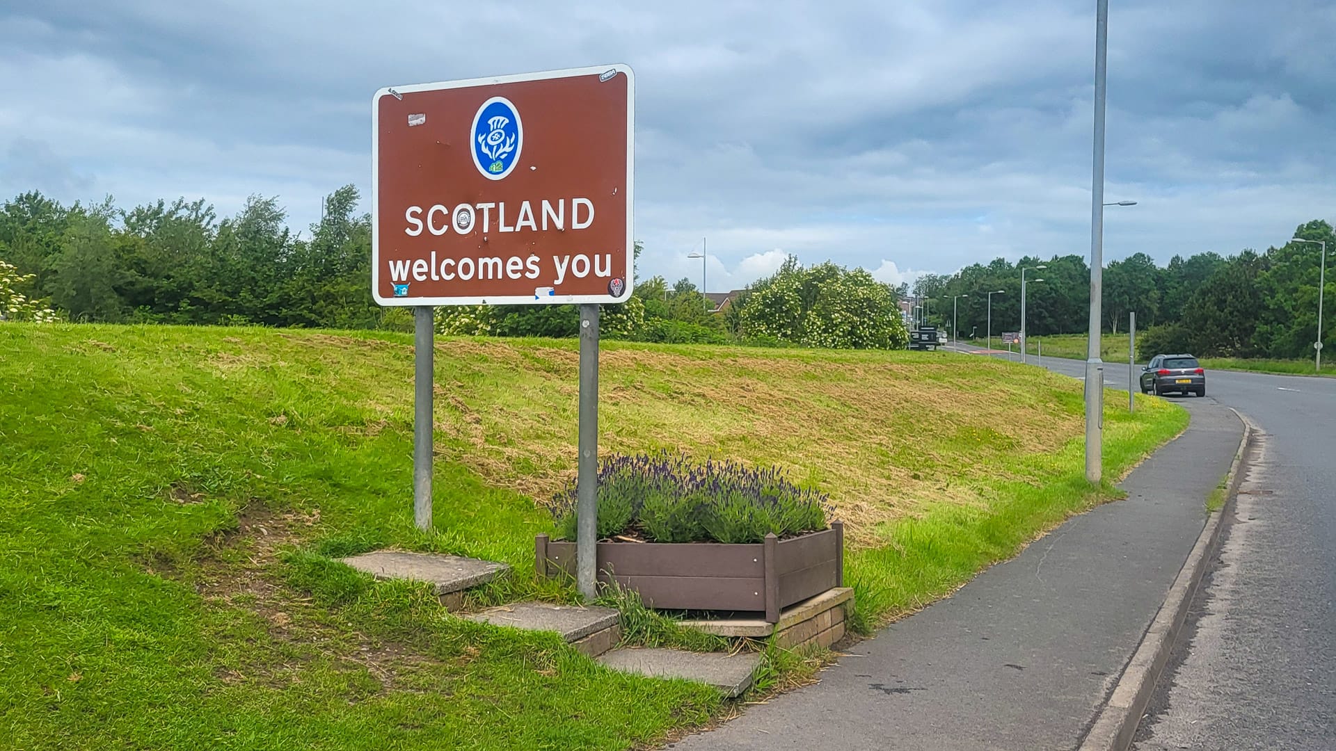
Welcome to Scotland (photo credit: Norbert Dürauer)
Day 9: Livingston to Alyth
GPX DownloadTerms of use reminder
Key statistics
118 kilometres
1,250 metres of elevation gain
Summary
The shortest stage features crossing over the famous Forth Bridge to the Highlands. Nice rolling hills on quiet roads through smaller and bigger towns, such as Perth, are perfect to take a deep breath before the upcoming days. The small village of Alyth, where today ends, is on the edge of the Cairngorms National Park, and you get a good idea of what to expect on the next stage.
Points of interest
- South Queensferry is a charming little village, and the famous Forth Bridge
- City of Perth: No, not in Australia! A very old town on the River Tay. This is the last big city for a long time.
Where I stayed in Alyth
Tigh Na Leigh – a 5-star guest house with stunning furnishings and an extraordinary garden. Comfortable rooms and a quiet location – perfect.
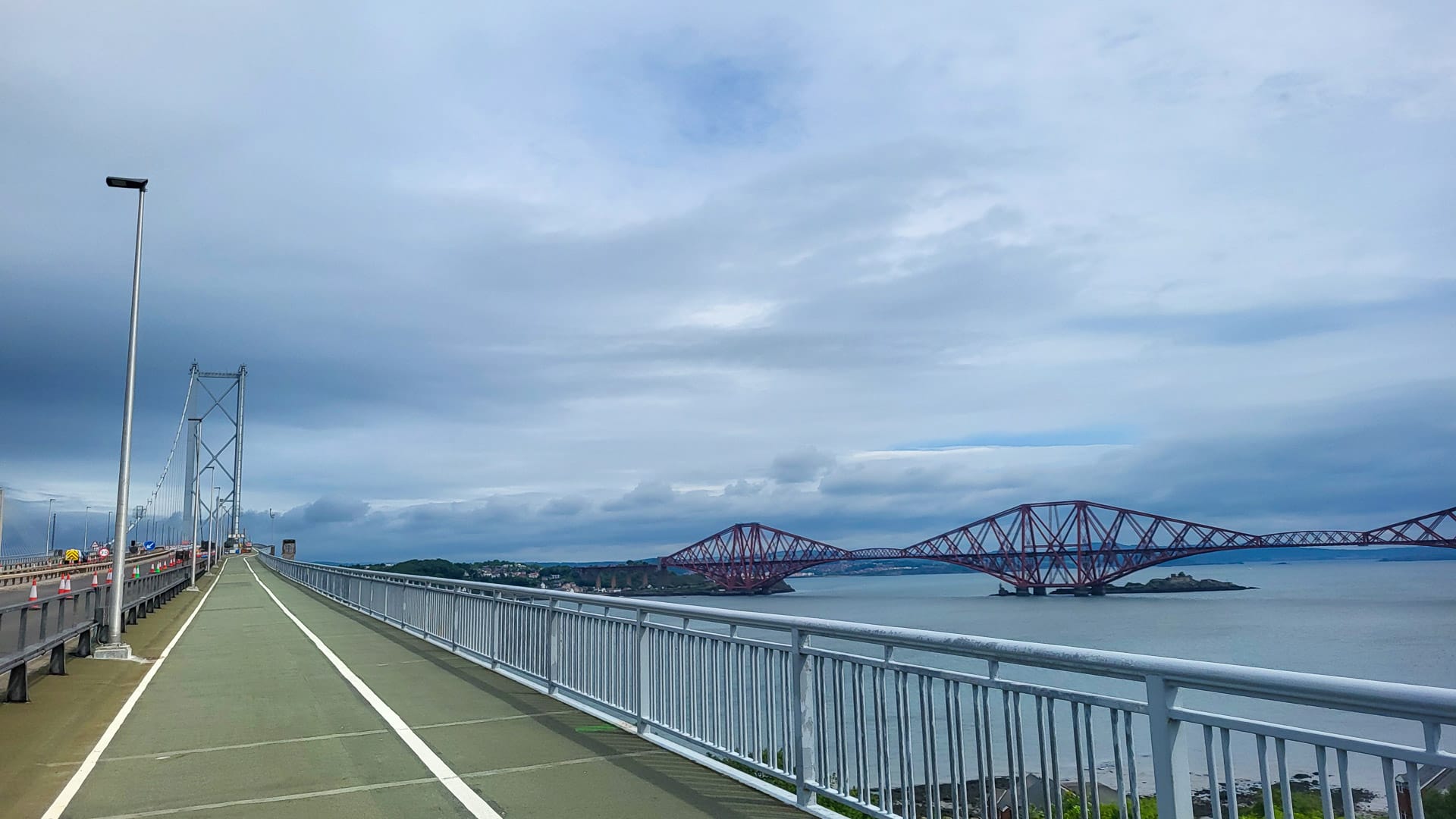
Forth Bridge on a distance (photo credit: Norbert Dürauer)
Day 10: Alyth to Grantown-on-Spey
GPX DownloadTerms of use reminder
Key statistics
128 kilometres
2,150 metres of elevation gain
Summary
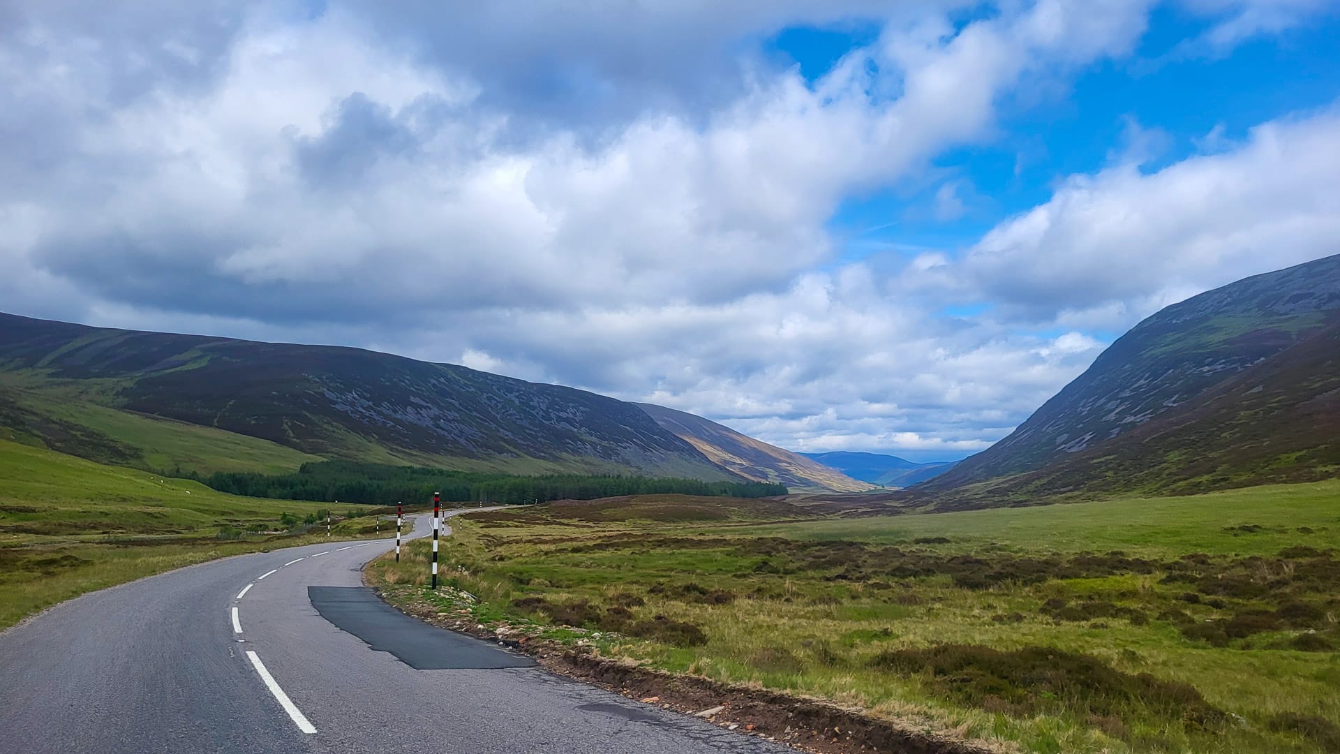
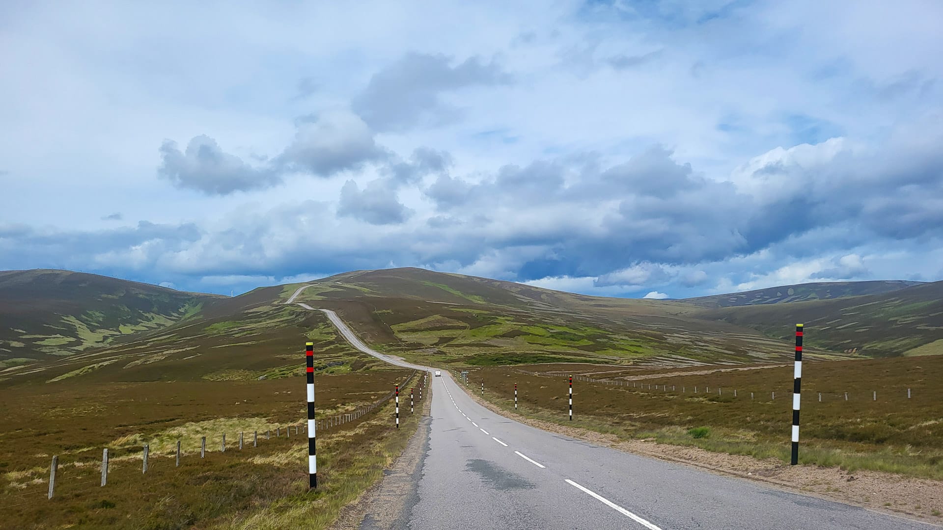
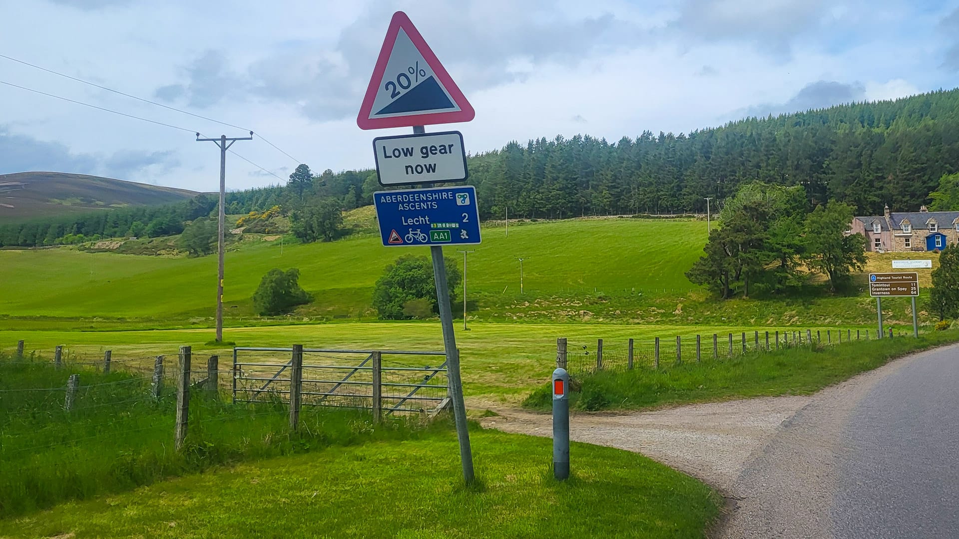
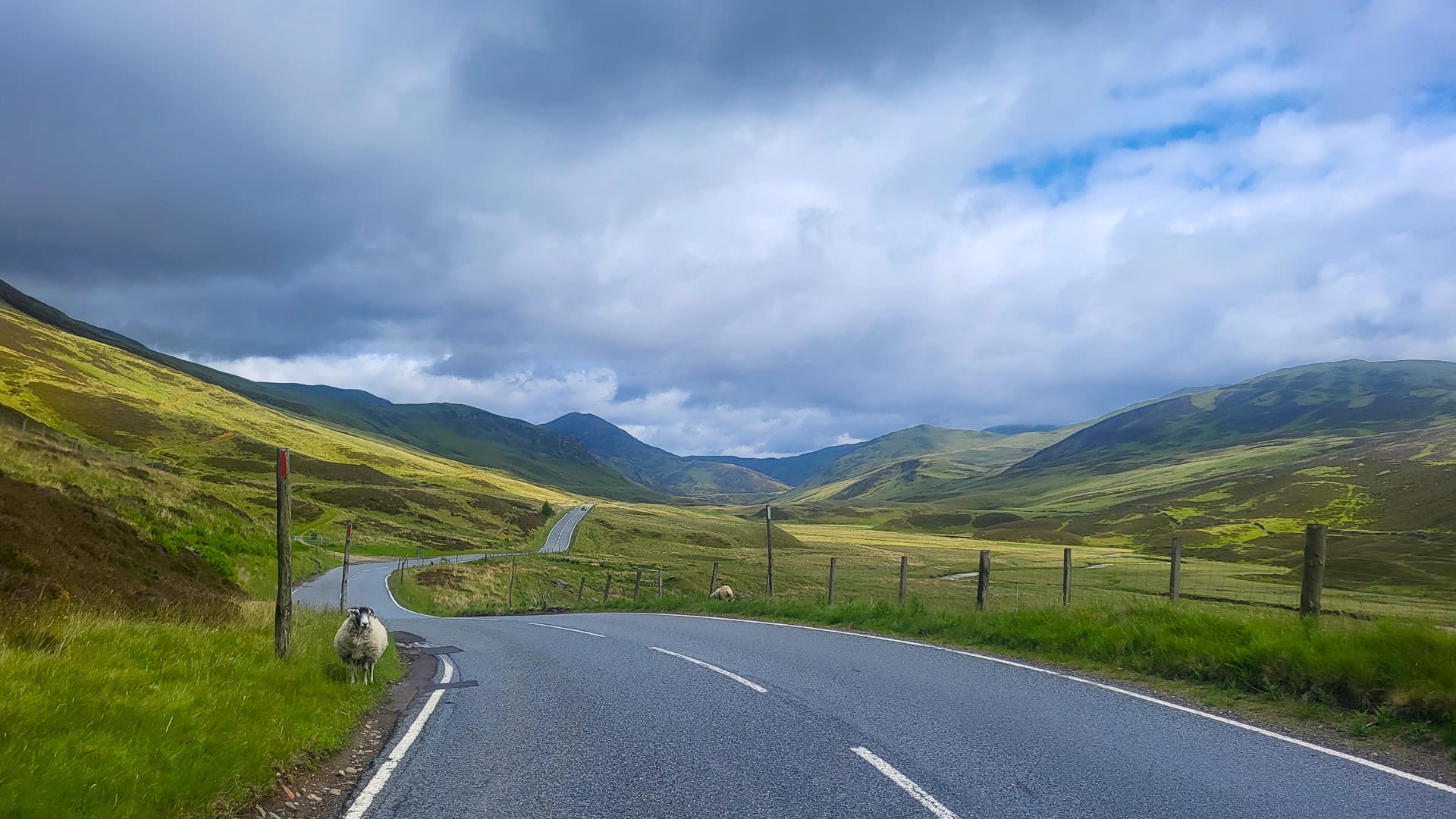
This is the best stage, both because of the scenery and the stage profile.
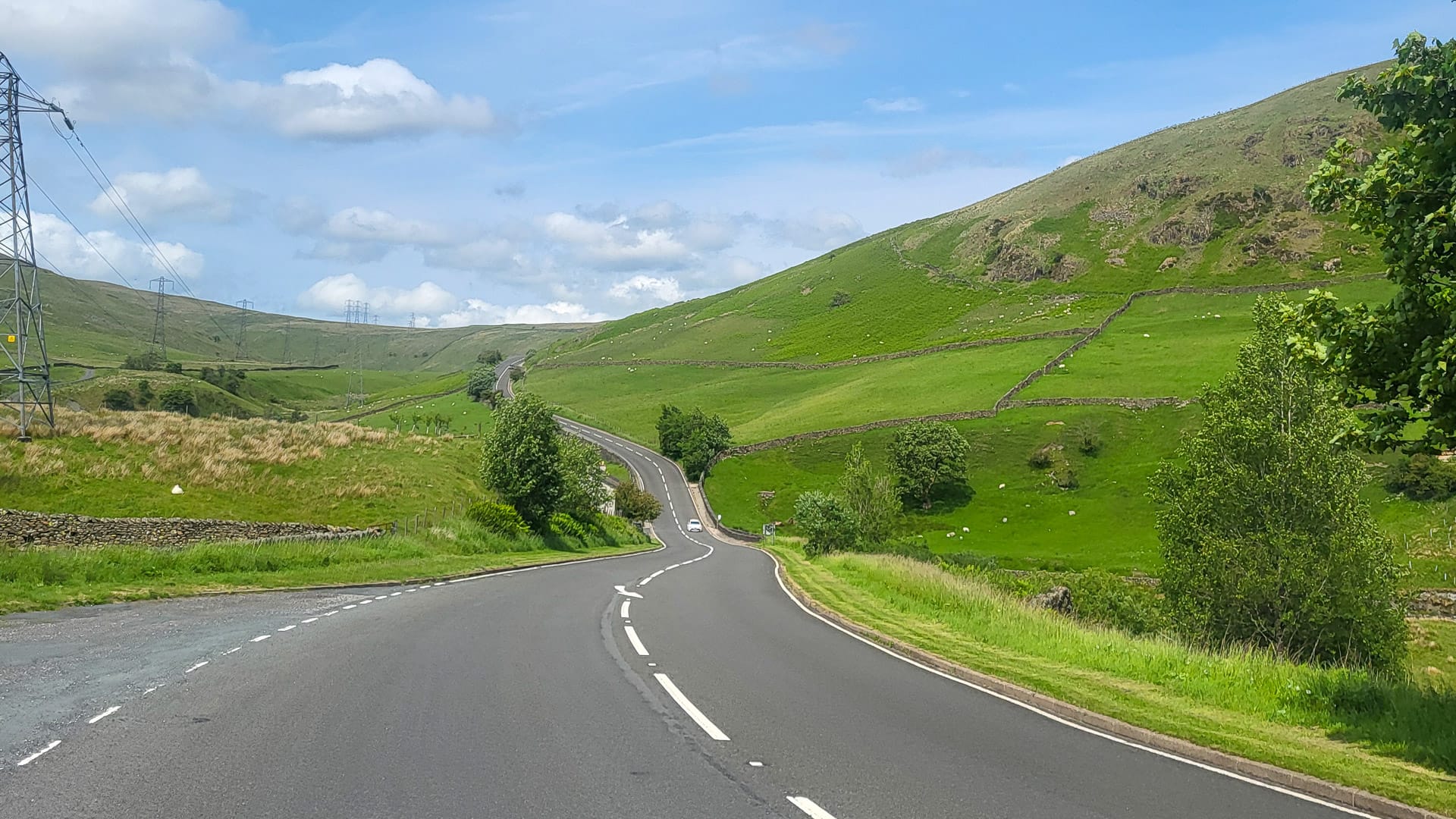
Right after the start, you dive deep into the Cairngorms National Park and the breathtaking highlands. It’s just you, the road and nothing else but pure nature surrounding you when you climb over Glenshee Pass and Ski Resort.
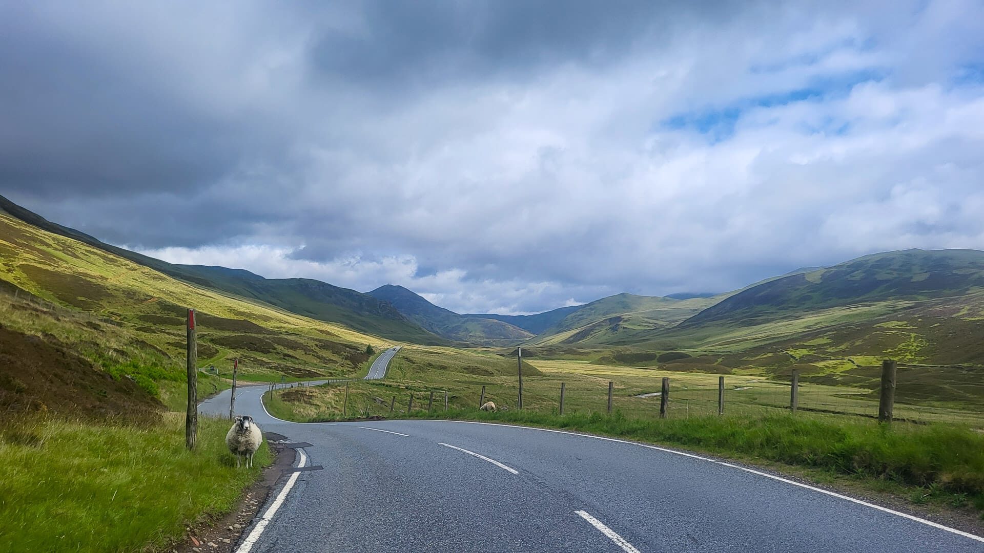
You ride past the village of Braemer, inhaling the outstanding beauty of nature. Though you conquer more than 2,000 metres of climbing today on long, steady climbs and gradients up to 20%, time and kilometres pass by so quickly because you cannot stop marvelling at the views! The sheep next to and even on the road make it even more authentic. The lovely old town of Grantown-on-Spey is the cherry on the cake. Fantastic!
Points of interest
- The peaceful surroundings of the Cairngorms as you ride along quiet roads are magnificent.
- Braemer Castle: A 17th-century castle, somehow in the middle of nowhere on the scenic “snow road”.
Where I stayed in Grantown-on-Spey
Craiglynne Hotel – a historic hotel that kept things nice and simple. Clearly popular with bus groups.
Weaving through the dramatic scenery of the Cairngorms (photo credit: Norbert Dürauer)
Day 11: Grantown-on-Spey to Dornoch
GPX DownloadTerms of use reminder
Key statistics
129 kilometres
1,330 metres of elevation gain
Summary
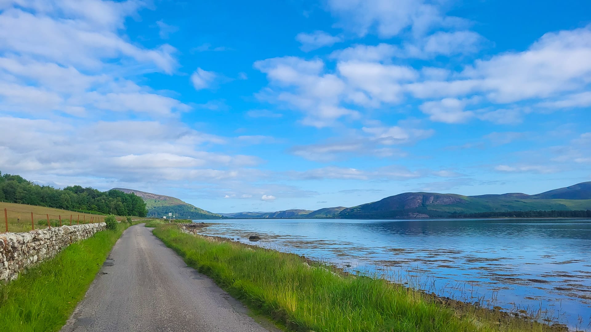
The first half of the penultimate stage, today, is a ride on beautiful small roads through the foothills of the Cairngorms.
There’s a bit of a contrast, riding through the city of Inverness. But soon after, you find yourself again on side roads with nice ups and downs, only interrupted by three bigger bridges over various firths
Points of interest
- You’ll see the first road sign of John O’Groats. Palpitations!
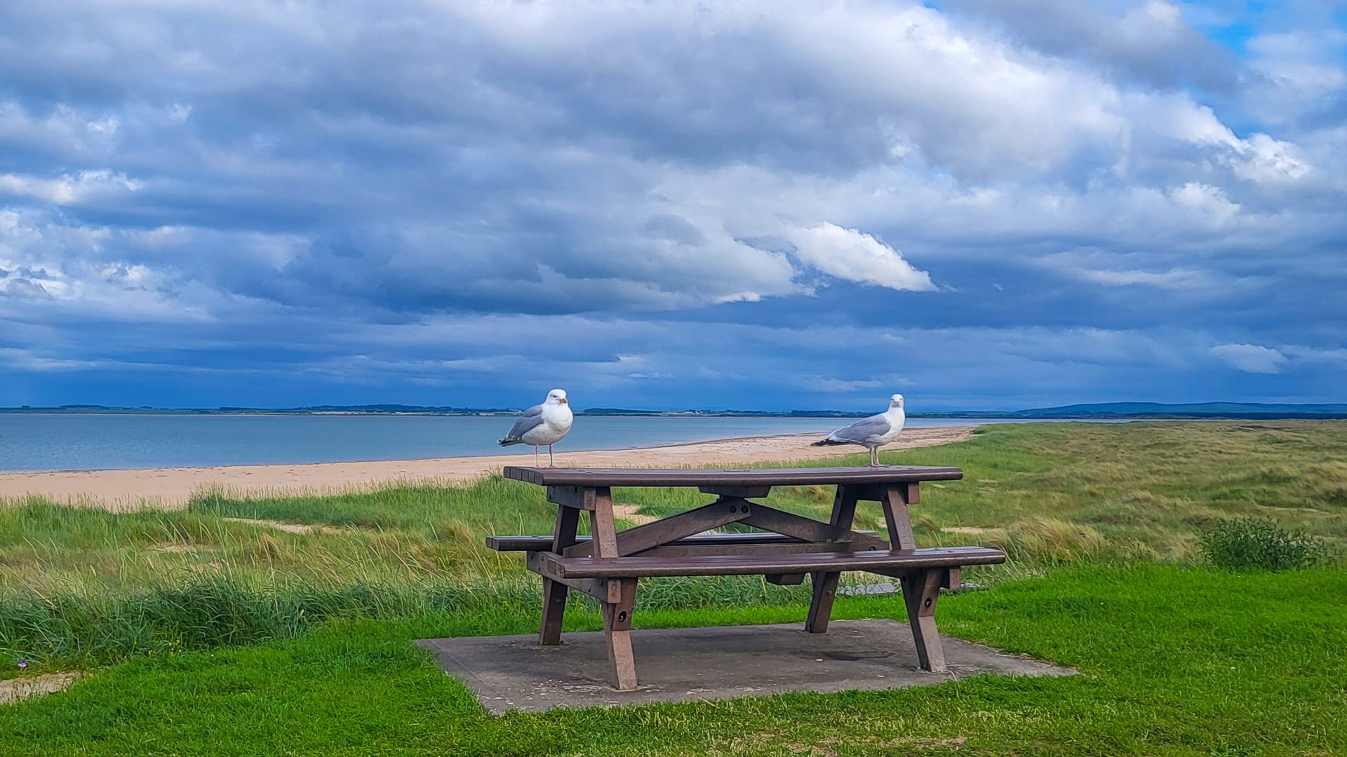
- Dornoch Beach, next to the little village where the day ends, has beautiful sandy beaches, colourful seawater and fresh air. Wow!
Where I stayed in Dornoch
UHI Campus – able to use the on-site facilities, but no towels or toilet roll were provided. Expensive for what it was.
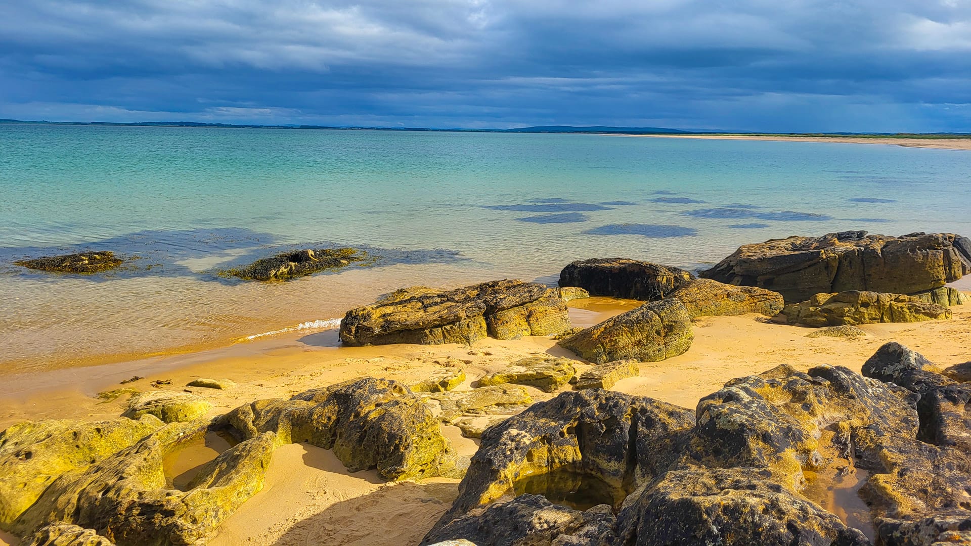
Beautiful colours on the sandy beach near Dornoch (photo credit: Norbert Dürauer)
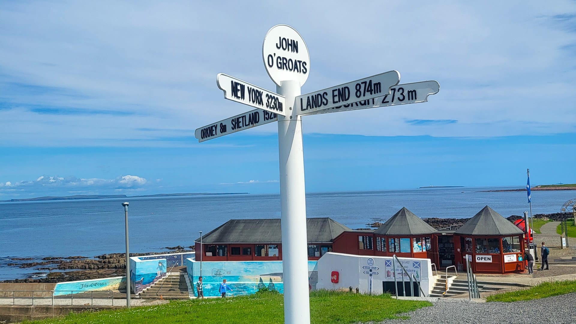
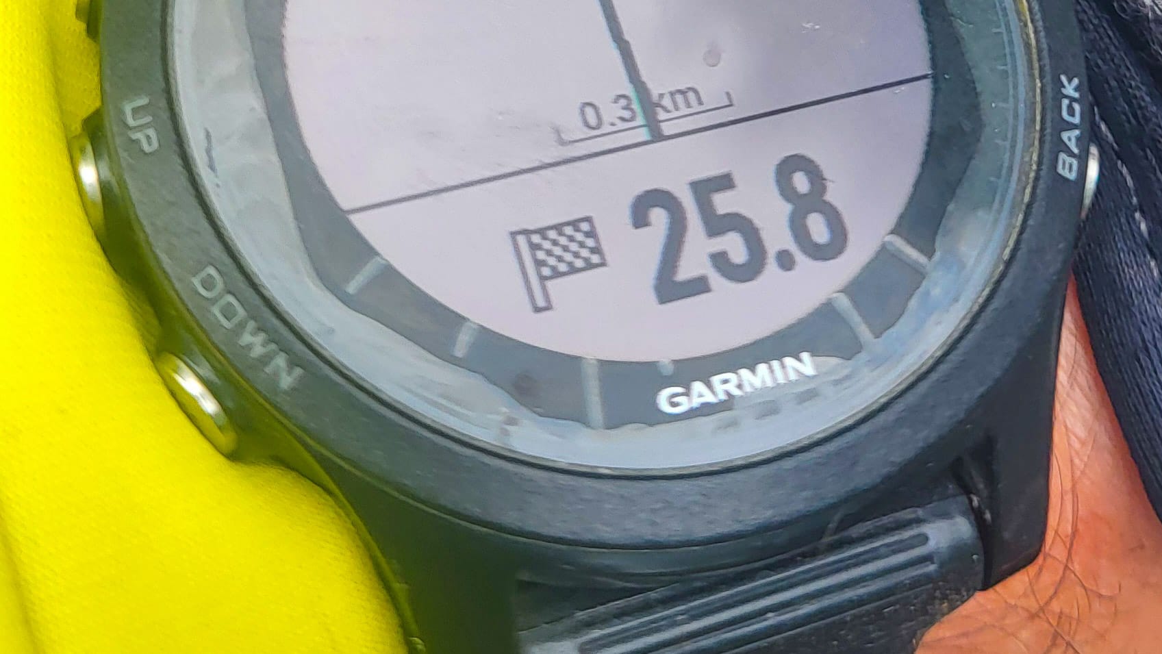
Day 12: Dornoch to John O’Groats
GPX DownloadTerms of use reminder
Key statistics
128 kilometres
1,340 metres elevation gain
Summary
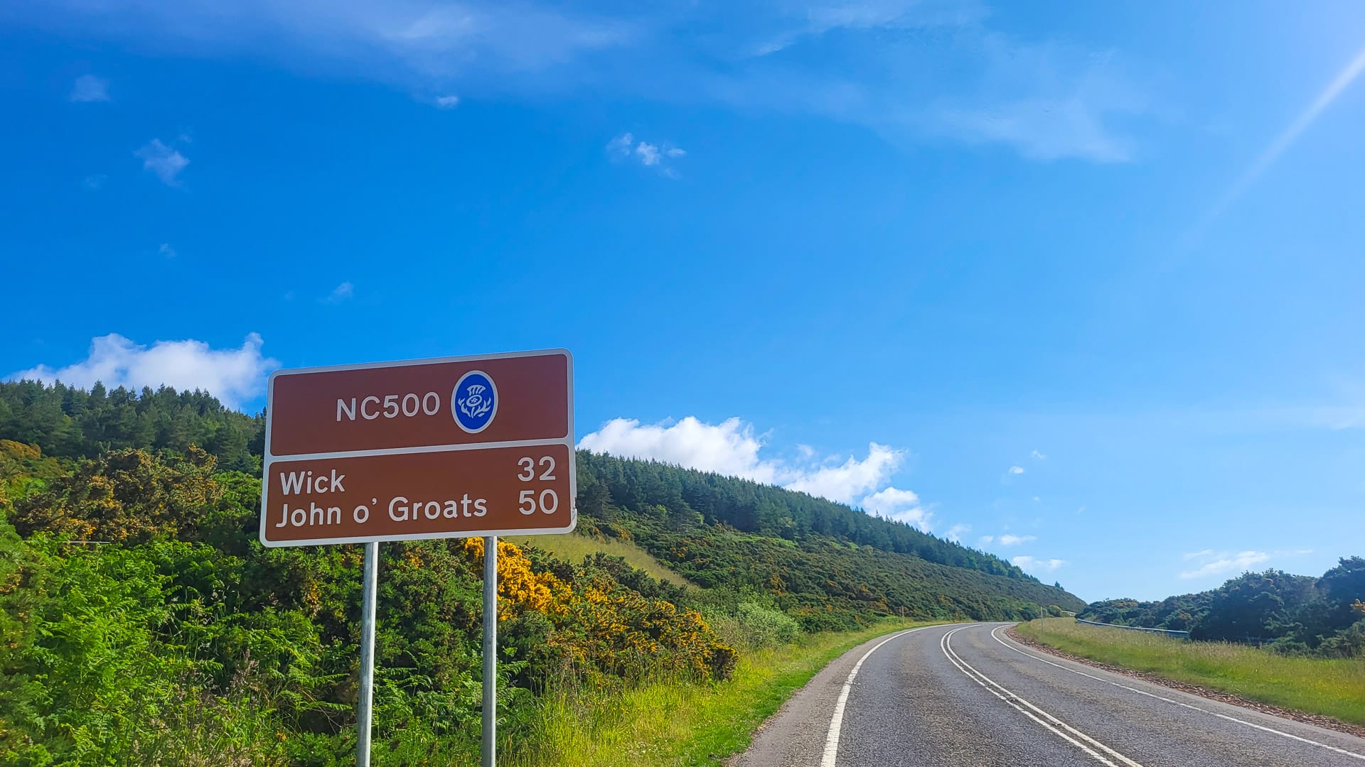
The final stage of your epic LEJOG adventure has arrived, just 130 kilometres to glory! This last chapter, next to the North Sea, is absolutely glorious.
A couple of times, the road rises up to 200 metres above the sea, and those are points of view behind the handlebars you will never forget. You start to reflect on the whole ride, and all of a sudden, you roll over a small hill and see the small settlement around John O’Groats. There it is: the other signpost, the finish!
Points of interest
- This section of the NC500 has some fantastic views over the ocean.
- The moment you crest the last hill and see the finish is phenomenal.
Where I stayed in Thurso
St Clair Hotel – clean rooms, friendly staff and a good breakfast – just what you need after completing the ride.
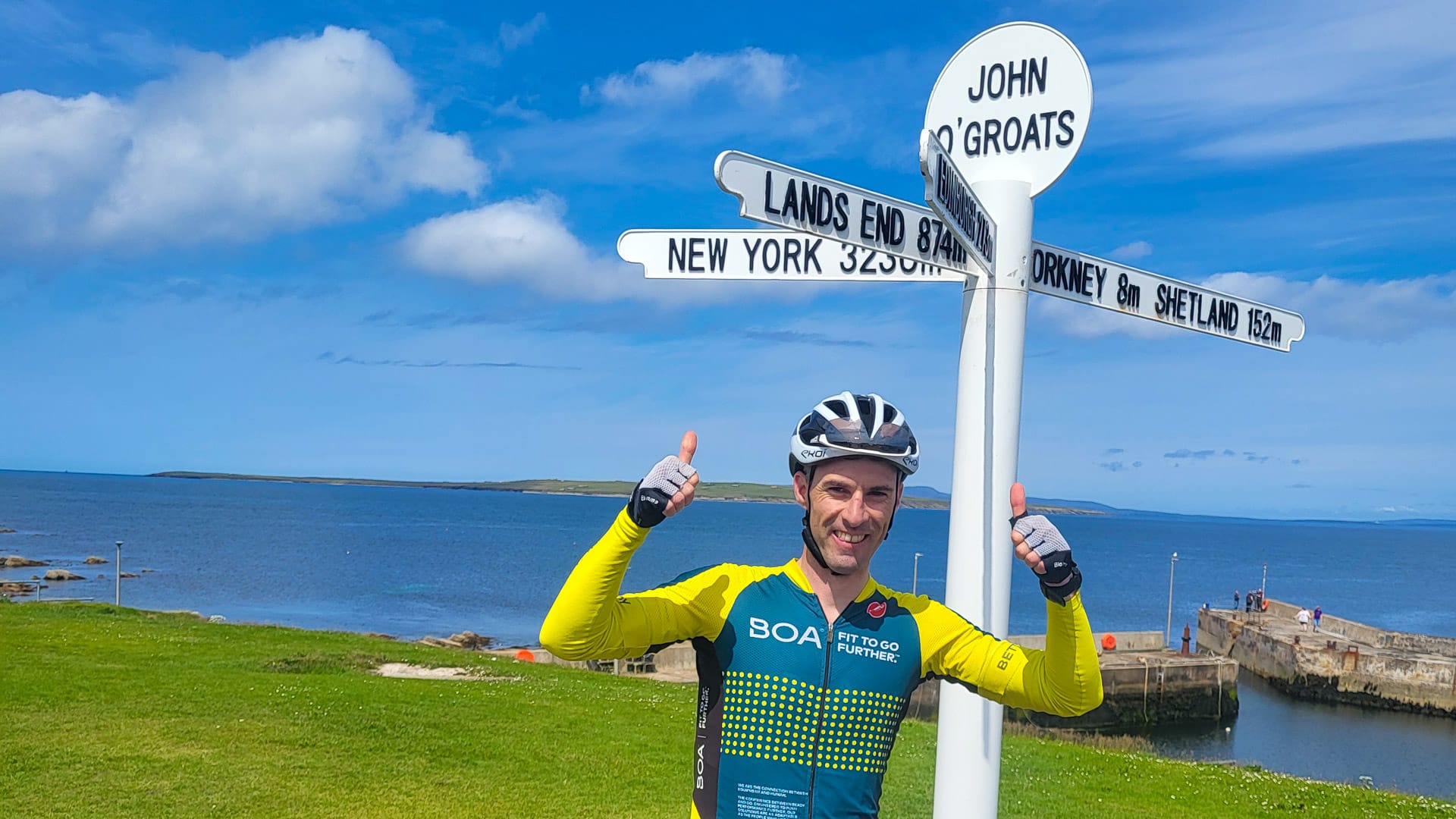
Nothing to add at the finish line in John o’ Groats (photo credit: Norbert Dürauer)
Part 4: What you need to know before cycling from Land’s End to John O’Groats
Planning your LEJOG bikepacking route
When is the best time to cycle LEJOG?
I rode in mid-June, and I would say it’s the best time to do it. It’s still before the major holiday season, so it’s quieter, but you’ve got long sunny days, a better chance of good weather, and it’s easier and cheaper to get a B&B for one night. Plus, the annoying midges aren’t out.
I can imagine that it’s similar in autumn, which would be a very colourful experience, although days would be shorter and you’d have a greater chance of rain.
What was the weather like?
I never thought I would stay dry like I did for two weeks in the UK.
I was almost 1,000 kilometres into the ride before I needed to put on my rain jacket for the first time. I know I was extremely lucky, and even when it did rain, it wasn’t when I was on the bike!
What’s the best advice you would give for cycling from Land’s End to John O’Groats?
Don’t underestimate the time it takes to prepare everything. Planning, training, and finally booking everything requires a lot of homework, and it can sometimes feel like two steps forward, one step back.
There are plenty of books, social media groups and other sources of information about LEJOG, cycling in the UK or travelling across Britain. I’d suggest not reading too many of them. It’s good to have some hints and tips, but some resources will also have too many ‘ifs’ and ‘buts’. Explore the route on your own terms and you’ll enjoy it more!
Don’t forget to enjoy it! It’s a rare once-in-a-lifetime project, and it’s a huge privilege to do it. It doesn’t have to be a competition, so try not to compare your LEJOG to others! Everyone is different and special.
Finally, whenever things get tough, remember to enjoy your time and keep moving onwards.
Looking for more useful information about how to prepare for long distance cycling? Don’t miss this in-depth guide.
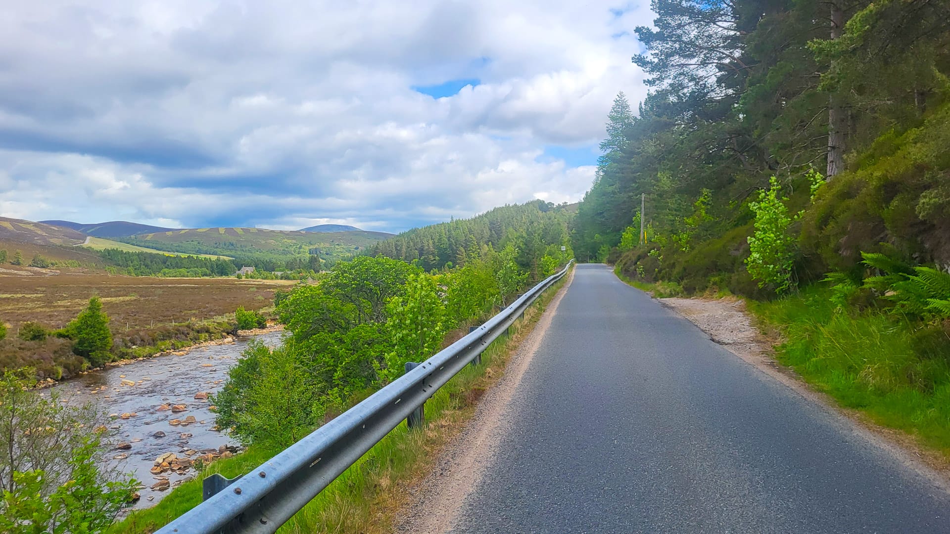
Remote moorland hills on the LEJOG route (photo credit: Norbert Dürauer)
How much time do you need to cycle Land’s End to John O’Groats?
As there is no specific route or timetable, this is completely up to you!
Depending on your fitness, holidays, budget and also interests, or things you want to see or do, the time could stretch from an ambitious week to a month, or even more.
Did you hire a bike?
No, I rode LEJOG on my own bike, a Lapierre Crosshill CF 5.0. It’s a gravel bike, which I find more convenient for bikepacking trips. I used Schwalbe G-one Speed tyres of 40 millimetres, which was a good decision since the road surfaces in the UK are not always that good.
Steep ascent in the Cairngorms National Park (photo credit: Norbert Dürauer)
How did you manage your luggage transfer?
I packed everything into a cardboard bike box that I disposed of in Penzance after arrival. I used a small bag as hand luggage too, which I sent by post from Penzance to a bike shop in Thurso, which I picked up at the end of the trip.
How did you transport your bike?
My bike was in the above-mentioned cardboard bike box for the flight and train to Penzance. In Thurso, conveniently, the local bike shop (The Bike Shop Thurso) provided me with a new bicycle box for my return journey. They were also extremely helpful in making sure that my bike was safely packed, and I really appreciated their support and friendliness!
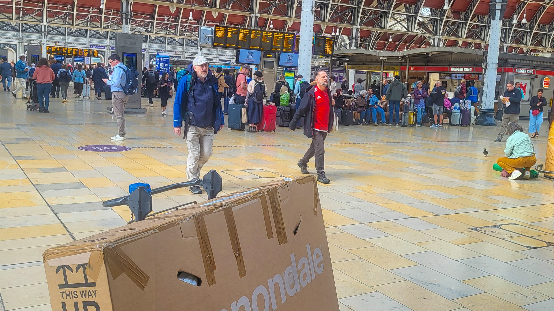
Paddington goes cycling (photo credit: Norbert Dürauer)
Where did you fly in and out of?
For the journey, I took the morning flight from Vienna to London Heathrow, followed by a short transfer to Paddington Station by Elizabeth Line. From London Paddington, I took a direct train to Penzance that took approximately five hours. So, it was a long day of travelling, but even the part from London Heathrow to London Paddington went smoothly.
The return trip started in Thurso with a long (but scenic) transfer by ScotRail via Inverness to Edinburgh Waverley. However, the part from Thurso to Inverness was on a bus due to a rail replacement service. That said, there was no problem with my bike already in a box.
From Edinburgh, I flew via Amsterdam back home to Austria.
Tips for LEJOG bikepacking adventures
How fit do you need to be to ride this route?
With daily elevation gains of 1,500 kilometres or more – depending on the route – and the fact you’re cycling day after day, some training and endurance are needed.
I’d suggest building in some specific “LEJOG-training” in the six months before taking on this route, for example:
- I did some 1:1 test rides at home with all the equipment I eventually took with me, even my toothbrush and my passport.
- Try to ride in almost every terrain before you set off! Such as during heat and sunshine, and when it’s cold and raining.
- Go on a few longer rides on consecutive days, for example, 3- or 4-day blocks.
- You do not need to get over-exhausted by HIIT, but some intervals on climbs or with low cadence on the flat are good to get in proper shape.
- Since you are in the saddle for many hours, it is important to do some alternative sport or exercise to balance things out. For example, swimming, stretching (yoga) or blackroll.
- Also, test the quantity and quality of your nutrition before, during and after a ride. Do not take something with you that you or your stomach does not know. Check what is available in the UK and test these products, as you have to buy your food day by day.
Of course, that depends on your level. You should be aware of your capabilities and needs, also in terms of nutrition and recovery. You’ll learn this when riding regularly, and based on this, you should plan your stages.
Be aware! Another big issue you should pay attention to is that bikepacking is different to ‘normal’ cycling. Riding with bags on your bike needs some training. You pedal more when sitting in the saddle – a thing your muscles have to get used to! The whole system is heavier, which affects steering and braking. Consequently, you are slower than usual, meaning 100 kilometres takes you longer and requires more effort.
Like always, the more you’re prepared, the more you’ll enjoy the ride!
Looking for more useful training tips for long distance cycling routes like LEJOG? Don’t miss this in-depth article.
How much did the trip cost?
That depends entirely on the way you want to do it – from sleeping in a tent via glamping, to nice B&Bs (the way I did it), to luxury hotels – the costs can vary a lot.
I chose to have a good shower each day, a warm bed and a large breakfast, and the prices for accommodations that meet these criteria ranged from £60 to £100 per night. As is often the case, the most expensive element is getting to the start line, and then getting home afterwards.
The good thing about bikepacking is that you can’t buy any souvenirs or other unnecessary items unless you carry them.
So it’s quite easy to plan in advance what your financial outlay will be. But remember, this is a once-in-a-lifetime project and – within reasonable limits – worth every penny!
Did you use any official support?
Apart from psychological support from many people, including the friendly and caring B&B owners and a really good setup from my bike store at home, I didn’t get any support for my Land’s End to John O’Groats cycle ride. But I won’t ever forget the support of The Bike Shop in Thurso to get my bike packed again for the return trip. That was awesome.
I’ve heard about various companies that offer fully supported LEJOG packages that include: transfers, luggage transport, support vehicle, massage, feeding, high-quality accommodation, etc.
It’s up to everyone how they would like to take on the Land’s End to John O’Groats cycle route. Of course, cycling in a group can be motivating and supportive, but sometimes the terrain doesn’t allow much working together.
However, having someone with you is always better for safety, and if there’s a mechanical issue, you probably get things fixed faster. No matter if alone, with a friend or in a big group – it’s an adventure for anyone.
Our interview with Pedal Britain is worth a read if you’re interested in a supported LEJOG cycling holiday.
Is there much provision for cyclists on the journey?
Cyclists are welcome almost everywhere, but you don’t get any discounts just because of the route you’re doing. It’s usually easy enough to find any support you might need.
Upon completion, I have now become a member of the “Land’s End to John O’Groats Association”, but while you get some nice small gifts, it’s more of a fun image thing. Find out more here.
Quiet country lane (photo credit: Norbert Dürauer)
What kit did you take with you?
I decided to use my gravel bike as it is more convenient for bikepacking. I rode on 40 millimetre tyres, which were a good choice, since the roads are sometimes not the best in the UK.
I had no puncture, but, of course, was prepared for that and carried three tubes and a new electronic (battery) pump along with a small multitool with me. I am absolutely no mechanic – so glad I didn’t need any of these things.
On my bike, I had bags from Ortlieb. This included a seat pack, a handlebar pack, as well as a big and small frame pack.
Looking for more packing tips? Don’t miss this useful guide.
How did you manage with the local food and drink?
Top tip! Food was my number one priority. I even started eating more than usual about a week before the start to make sure I was fully fuelled. I tried to never be hungry or run into any deficits, especially during the first couple of days.
A solid breakfast, with lots of porridge and eggs of any kind, was standard. Fruits (I ate about 50 bananas in total, that’s why I thought the whisky ‘Monkey Shoulder’ was the most suitable one to order in the pub on the last evening in Edinburgh ), bars and some Belgian waffles were always in my pocket. Right after finishing each stage, I always refilled with cacao, fruit salad, vegetables or noodles, the obligatory ”meal deal”.
I never sweated or got cold, but you have to be careful to take on enough fluids, too, of course. Electrolytes during the stage, water and plenty of tea before and after.
In the evening, I went to restaurants and tried to eat a lot of good, healthy, but affordable food. I tried to enjoy some variety, but Italian ingredients were somehow part of every dinner.
One day I was lucky as there was a “happy hour” between 5pm and 6pm in a restaurant, which included buy-one-get-one-free on main courses. I will never forget the face of the waitress when she realised that there would be no second person joining me. After providing a short explanation of my situation, she smiled.
On my way back to the hotel, I often went to the supermarket again! This would usually be to buy a nice dessert, a snack for the room and to buy the food for the next stage.

First & Last Refreshment House in England (photo credit: Norbert Dürauer)
Was it always easy to find food and water?
Planning is half the battle, and once you know what and when you need to drink and eat, you can check in advance where on your route refreshments are available. Though my route very often went off the beaten track, I was never that far away from civilisation that I had no access to food or water.
The only exception was maybe the Scottish Highlands, where it can take a bit longer between two villages – but once you know, you’ll be fine.
Any tips for cafés and shops on the route?
Costa Coffee is a safe bet and available from start to finish, but all those lovely villages and towns offer a lot of nice cafés on their main square or a bit hidden in the narrow streets.
No matter if it’s Sainsbury’s, Co-Op, Morrisons or Tesco, they are open nearly all day and you will find what you need for a fair price. I only stopped once at a small grocery store in a very small village, which was almost empty of everything.
Do you need a car?
You don’t need a car. The UK’s public transport system is well-established and effective. Also, I found that travelling with a bike was no problem at all, though make sure to reserve your bike space on trains in advance.
What’s next?
A huge thank you to Norbert for sharing this detailed account of his Land’s End to John O’Groats cycle route.
Have you conquered this epic journey across Great Britain before? We’d love to hear from you in the comments below!
Looking for more inspiration? Don’t miss:
- We have another guide to riding LEJOG, which focuses more on a supported trip.
- See where LEJOG features on our list of the ultimate cycling challenges.
- This route is featured in our best coast-to-coast bike rides article. Discover more inspiring C2C challenges!
- Planning on cycling LEJOG as part of a fundraising adventure? Check out this guide to charity cycling challenges.
- Discover more long-distance cycle routes in the UK and Ireland.
- Or go global with our suggestions for the world’s best long-distance cycling routes.
Please support Epic Road Rides
A huge amount of time and effort goes into the article you’ve just read, all with the aim of helping you!
If you found what you’ve read useful, I’d really appreciate it if you dropped something in the tip jar here.
It’s a way you can say thank you and help us carry on creating top quality content with no annoying ads and no pay wall.
Looking for an organised cycling trip?
If you want someone to help you plan and book your cycling holiday, fill out this form. We aren’t a tour operator/agent but we work with lots of people who are and will do our best to put you in touch with someone that can help (within 24 hours where possible)!Norbert Dürauer comes from Waidhofen an der Ybbs in Lower Austria, a small city surrounded by perfect terrain for road cycling. His passion for the sport began in childhood and quickly developed into a competitive career. As a junior and U23 rider, he represented Austria at the Road World Championships in Hamilton (2003) and Salzburg (2006). Alongside his university studies, he raced for several years on the Continental level, taking part in prestigious events such as the Tour of Austria and multiple 1.1 one-day classics.
His sporting journey extended beyond cycling into triathlon, where he claimed a national championship title. Highlights include competing in the elite category at two European Cross Triathlon Championships and the World Winter Triathlon Championships.
Despite these achievements, road cycling has always remained his greatest passion. For Norbert, the sport is not only about competition but also about freedom, health, and discovery. Travelling by bike has allowed him to explore diverse countries and landscapes, enriching his appreciation of cultures, scenery, and local cuisine. With a cycling coaching degree and a professional background in tourism, he brings a unique perspective to assessing destinations for their cycling suitability.
Norbert values the sense of community within the cycling world. Having experienced both triumphs and setbacks on the bike, he is always eager to share his knowledge while learning from others’ stories. For him, cycling is more than sport; it is a way of life, a means of connecting with people, and a gateway to experiencing the world.
First Published: 27 August 2025
This article includes details of products and/or services that we have used ourselves or which we would consider using. Some are paid features or include affiliate links or referral codes which we may earn commission from. As an Amazon Associate we earn from qualifying purchases. Please read our disclosure policy for further information.
The contents of this website are provided for general information purposes only. It is not intended to amount to advice and you should not rely on it. You should carry out your own due diligence and risk assessments and take professional advice. Views expressed by interviewees or other users of this website do not necessarily represent our views. We make no representations, warranties or guarantees, whether express or implied, that the content on our website is accurate, complete or up to date. If you use any information or content on this website, download from, or otherwise obtain content or services through our website, it is entirely at your own discretion and risk. Epic Road Rides Ltd disclaims all liability and responsibility arising from any reliance placed on the information and content on this website. Find out more here.
Comments