
The Col du Tourmalet, in France’s Pyrenees mountains, is a must-do climb for cyclists.
It’s one of the big three mountains of the Tour de France (Ventoux and Alpe d’Huez being the other two) and at 2,115m, it’s the highest road pass in the Pyrenees. The 2018 Tour de France will be the 86th time it’s been featured. It’s a bucket list ride for any serious cyclist.
This route gives you the opportunity to experience France’s Tourmalet on a loop ride you won’t easily forget. You start with an easy 11km warm up on the greenway to Lourdes, followed by 70km of rolling French countryside. You hit the famous Col d’Aspin at Arreau and then it’s on to the Col du Tourmalet via Sainte Marie de Campan and La Mongie.
The route includes half of the infamous “Circle of Death” (more on this below) and the first 144 km of Stage 19 of the 2018 Tour de France. If you want to ride the whole mammoth 200km TdF stage in one day, simply tack on our fantastic Aubisque ride.
For other ways you can tailor (and shorten!) this ride, check out our tips below.
Want to cycle the Tourmalet as part of a cycling holiday in the Pyrenees? Take a look at the Trans Pyrenees route.

Clare Dewey is a cyclist with a passion for travel. She set up epicroadrides.com in 2018 to help make it easy for cyclists to explore the world by bike. Today her mission is still inspiring cyclists to discover new places on two wheels - and doing what she can to make sure they have the best possible time while they're there. Clare has visited 50+ destinations around the world, many of them by bike.
Want to connect with Clare? Find her over on LinkedIn.
Highlights
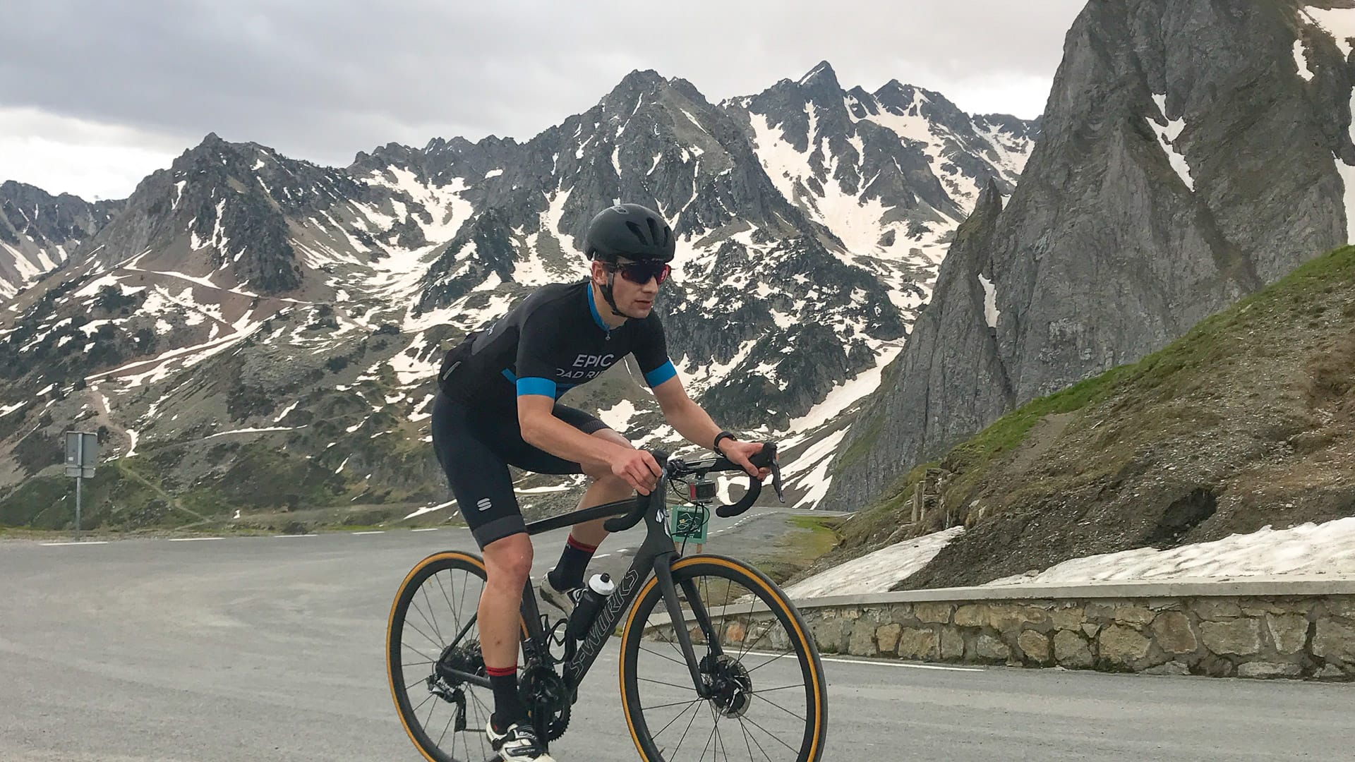
The riding above La Mongie on the Col du Tourmalet is out of this world. It’s a gruelling 8% all the way to the top and the scenery is bleak and barren with jagged grey rock faces. In June there were still pockets of snow and icy run-off from the glaciers. The scenery combined with the weight of Tour history, makes this a very special, atmospheric climb to ride.
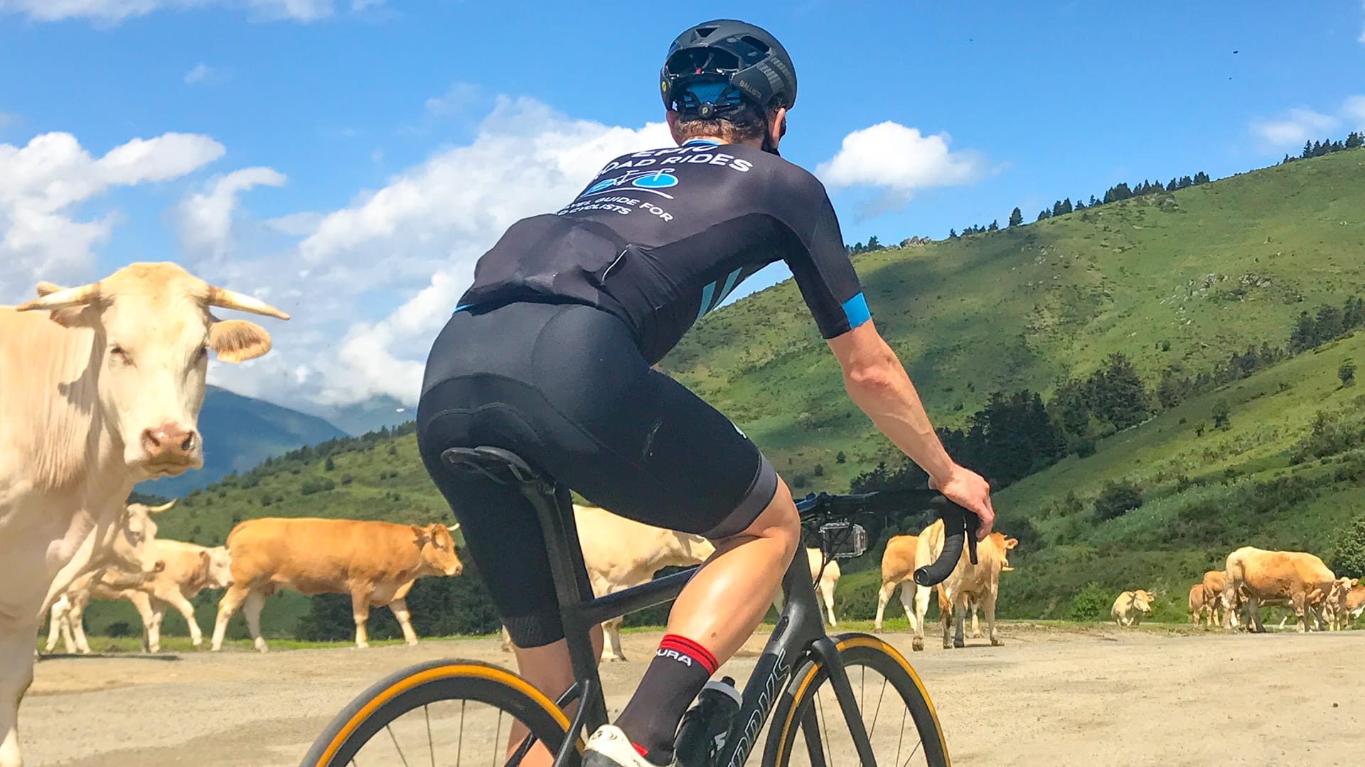
We also loved the Col d’Aspin and can see why it’s sometimes called the Queen of the Pyrenees. It’s a narrow road that’s well-engineered so it’s rarely overly steep: 12km at 6.5%. It’s surrounded by pastures and slow-moving cream-coloured cows. If you get lucky with the sunshine, we bet it’ll become one of your favourite climbs too!
Route notes
1. Argelès-Gazost to Arreau: 0-80 km
You pick up the Via Verte/Greenway in Argelès-Gazost and follow it for around 11km to Lourdes. We found it in good repair, suitable for road bikes. It’s separate from the road and winds in and out of the river, through fields, surrounded by hills. Enjoy the flat – it’s pretty much all you’ll see all day!
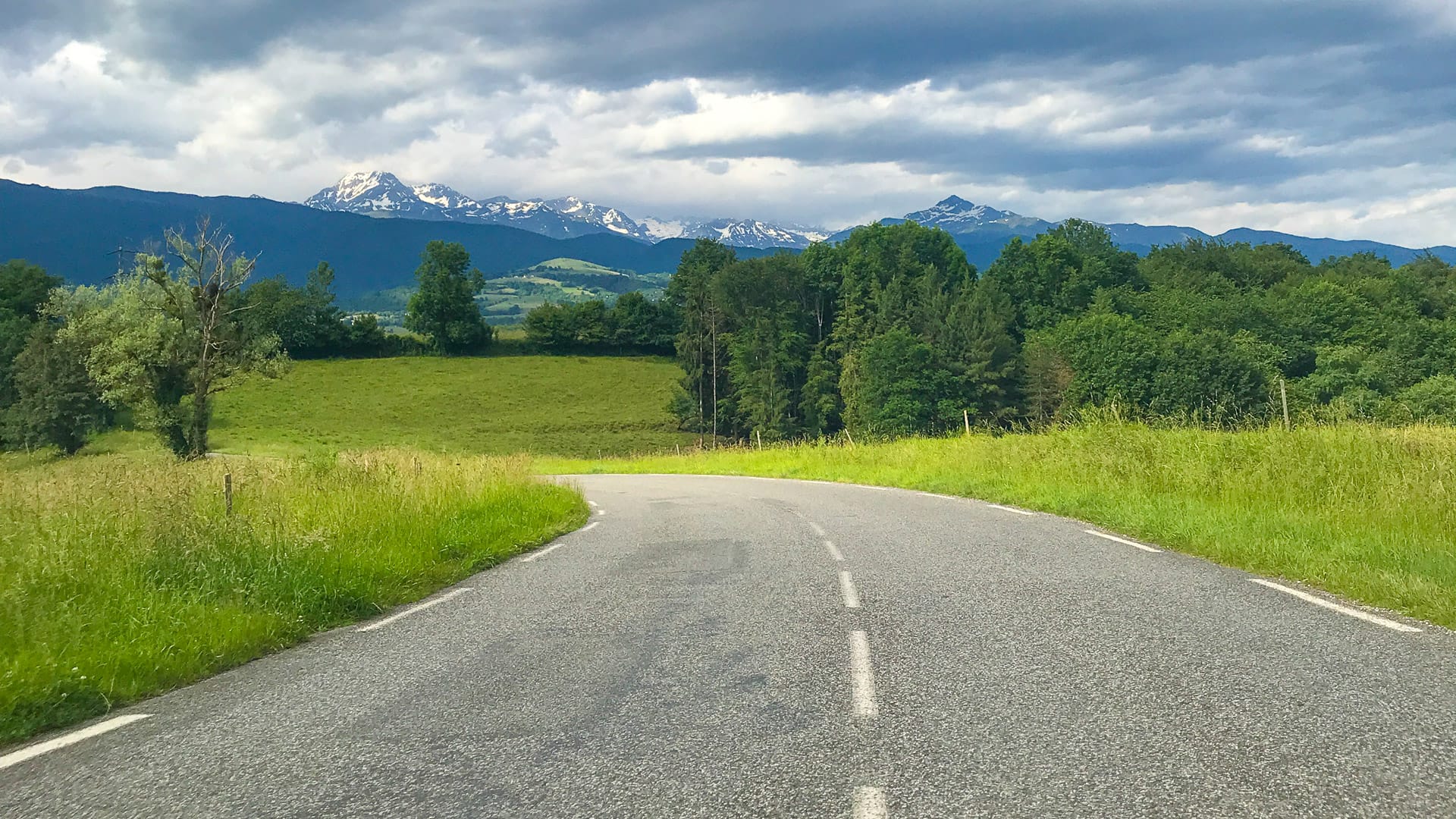
Between Lourdes and Bagnères de Bigorre, the terrain undulates through lush green fields and thick copses. At about 23 km you climb up for a couple of kilometres at 7% to the summit of the Côte de Loucrup. There’s the odd stone building and traditional hamlet, but the landscape is extremely rural. In the distance loom the craggy peaks of the mountains you’re getting ever closer to.
You wind through outskirts of Bagnères de Bigorre and soon find yourself at the base of your next main climb: the fourth category Côte de Capvern-les-Bains. It’s around 3.5km at 5%, so nothing too much to worry about.
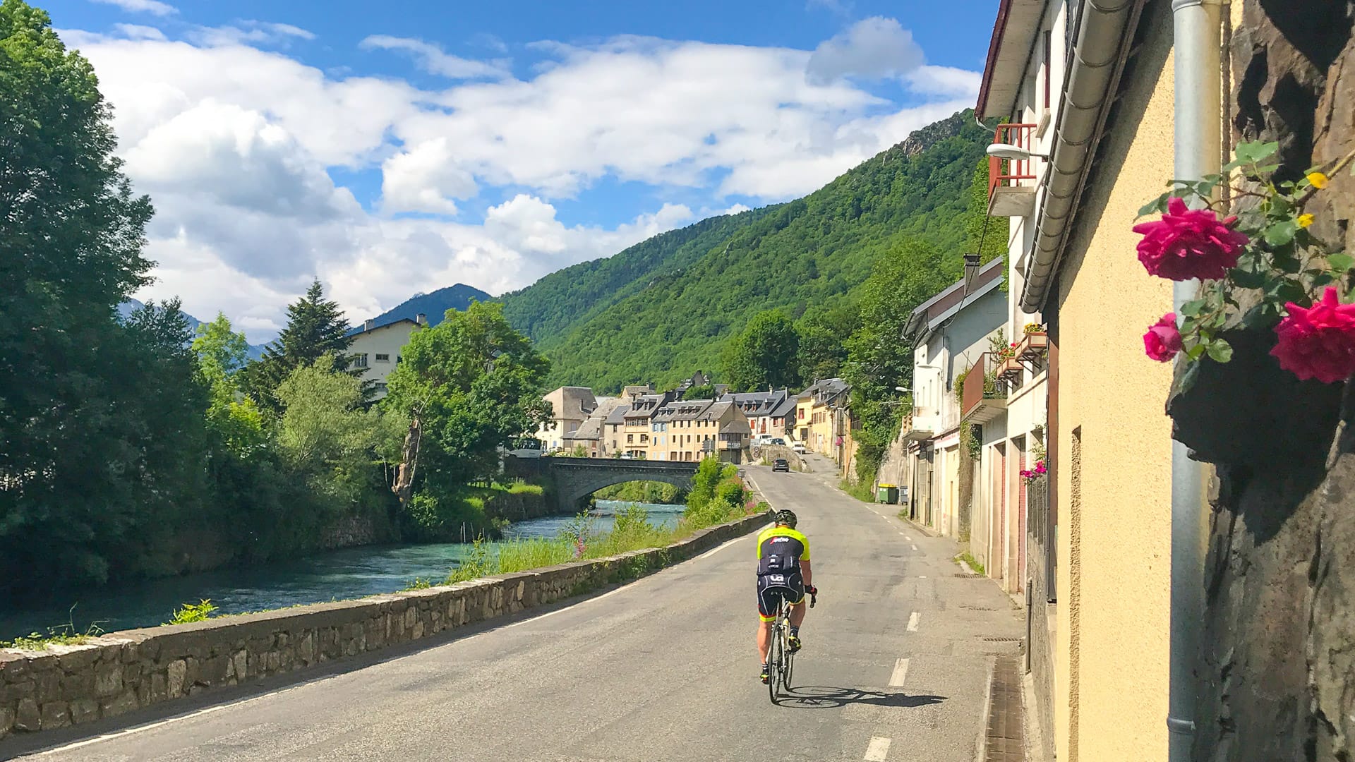
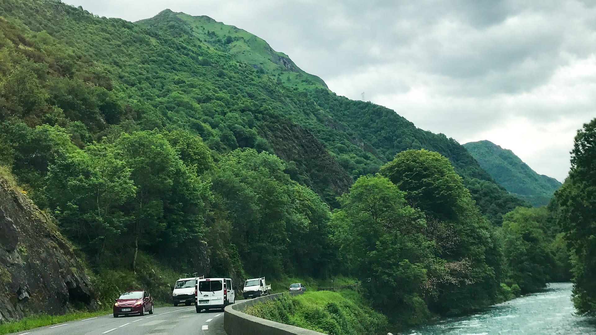
After Capvern you’re onto more major roads – but don’t expect the terrain to flatten out. It’s constantly up and down! At least the views over hills and glacier-capped peaks should keep you feeling happy. Soon you’re in the La Neste river valley. There’s a garage and restaurants, boulangerie and supermarket in Sarroncolin – or head into the lovely little town of Arreau at the base of the Col d’Aspin, if you fancy refuelling before the big climbs of the day commence!
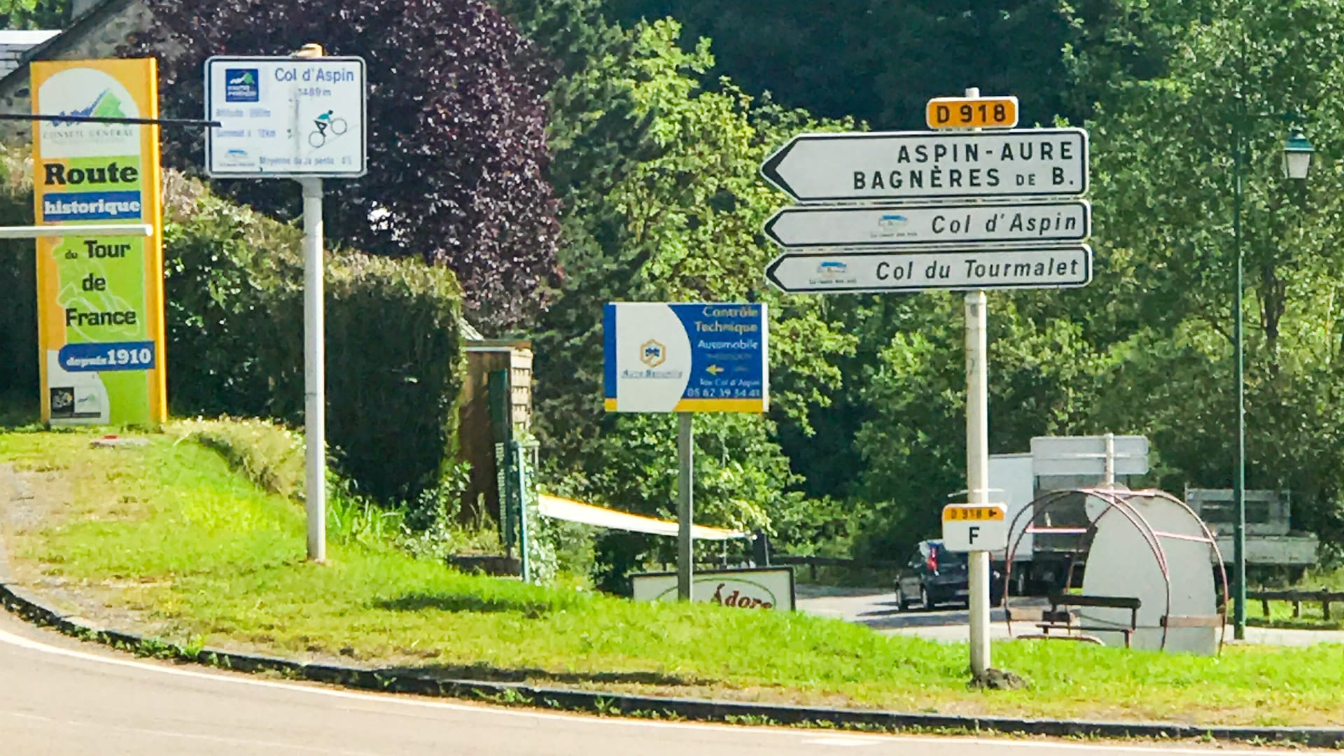
2. Col d’Aspin climb: 80-104 km
The Col d’Aspin is one of the best-known climbs in the Tour de France. That’s largely because it’s often used in conjunction with its big brother, the Col de Tourmalet.
From Arreau, it’s a first category climb that’s much gentler than the Tourmalet (though not as gentle as its average 6.5% would suggest). It gets tough around five kilometres from the summit and the final kilometres average 8%, with a few killer stretches of straight road.
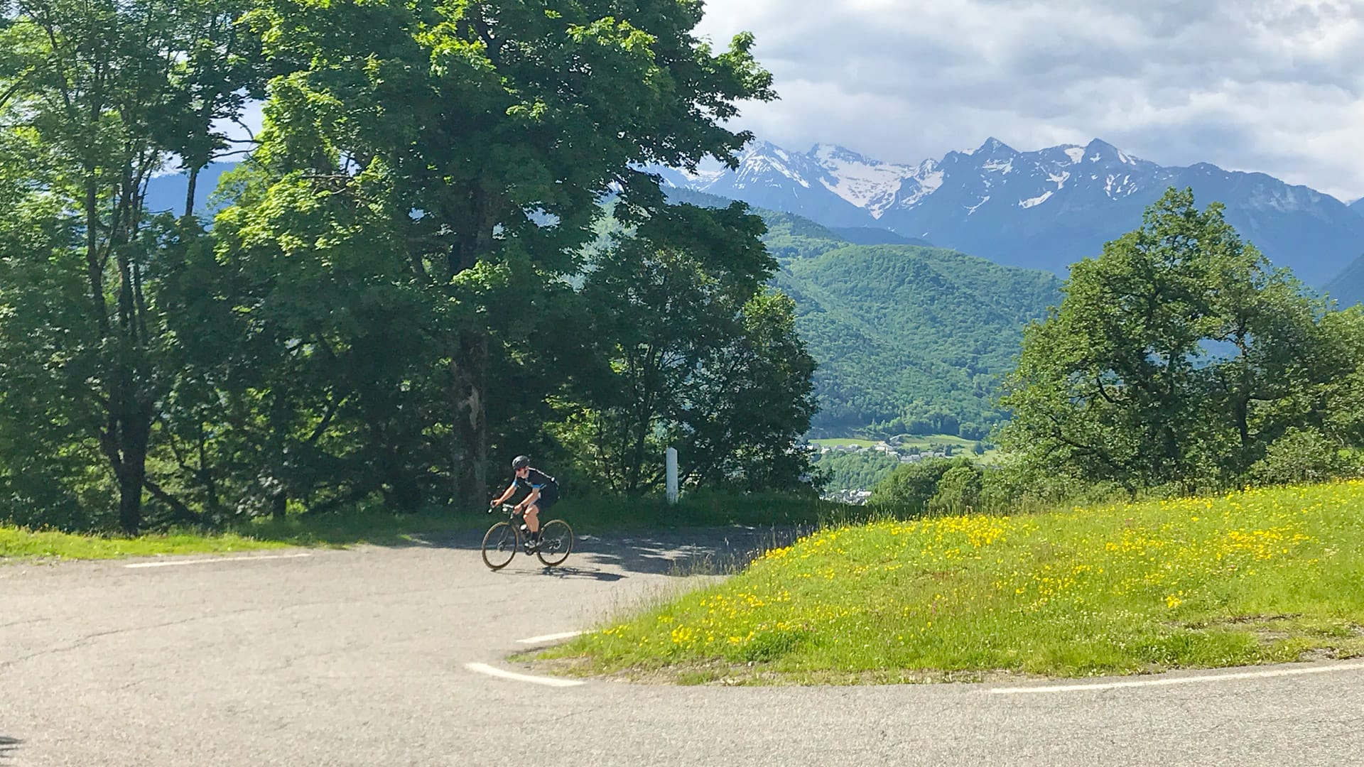
In terms of scenery, there are good views throughout the open east side. The pass offers wide panoramic views, with the Pyrenean giants (including the Pic du Midi de Bigorre at 2,872m) outlined in the distance.
You’re likely to encounter horses and/or cows on the climb/pass. The cows have big horns and are not to be messed with. As Paddy Sweeney from Velo Peloton says: “if you want to be afraid of something in the Pyrenees, be afraid of the cows.” They have killed people (seriously).
The descent down to Sainte Marie de Campan is spectacular. It’s fast and the views are wonderful (though you’ll be unlikely to have your head up to see them!).

3. Col du Tourmalet climb: 104-160 km
Sainte Marie de Campan is of course forever tied to the 1913 saga of Eugène Christophe’s broken fork. The unfortunate man had used the Tourmalet to go into the overall lead and was leading by 18 minutes when his fork snapped. As no outside assistance was allowed to competitors at that time, he had to walk 14km to Sainte Marie de Campan and then craft a new fork in the village forge.
The climb out of town is straightforward and the first kilometres are easy: through a wooded valley with waterfalls.
This relaxing start changes at the hamlet of Gripp. The gradient increases up to 8% and doesn’t show much mercy until the summit 12 kilometres later: it’s said that this 12 km is unmatched by any other French climb for consistent steepness. Certainly there isn’t much in the way of engineered switchbacks: it’s all long straight sections.
7km from the summit, don’t miss the memorial to Eugène Christophe at the spot where his forks broke in 1913 (as mentioned above). With 6km to go, you ride through a series of avalanche shelters and it’s these couple of kilometres between Barrage de Castillon and La Mongie that are the toughest, with gradients in double digits.
At 5km to the summit, you ride into La Mongie. The gradient reduces back to a mere 8% or so, and another change kicks in: the landscape radically alters as the trees disappear and are replaced by pastures and bleak grey mountains. La Mongie itself is an unbelievably ugly Soviet-style resort (that has hosted three stage finishes). There’s a sharp contrast between the monolithic straight lines of the apartment blocks and the majestic scenery all around; the juxtaposition is stark. Unnatural, yet intriguing. The sight of cattle, sheep, horses and donkeys meandering the roads just enhances the other-worldly feeling.
But you’re unlikely to be focusing on that since, from La Mongie you can see the summit. There’s a series of three hairpins just before the top, a sudden almost hidden turn to the left and then you’re there. Your legs may be burning and your lungs screaming for air, but you’ve made it!


The summit
What a summit it is: one minute you’re climbing at 8%, turn the corner and you’re plunging down towards Bareges. The views both looking back over what you’ve ridden and to where you’re about to descend, are staggering.
You can’t miss the impressive, iron Geant au Col du Tourmalet statue. Some say that it’s the 1910 rider Octave Lapize but others that it is a more general homage to the giants of the road (whether that be the Tour de France riders or, perhaps a nicer interpretation would be a homage to all the riders who cycle up each year). It’s installed on the first Saturday of June each summer, in an occasion known as Montée du Géant when around 1,000 cyclists ride up the mountain with Le Géant. The statue is removed at the beginning of October, for safe-keeping over winter.
While you’re at the summit, it’s worth popping into the restaurant just to see the collection of old Tour de France cycling memorabilia. By all accounts it’s much better than the over-priced coffee on offer.


The descent
If you stand at the summit and look east, you’ll see the road 100s of metres beneath you. It’s less than a kilometre away and gives you an idea of just how fast and furious the descent is going to be. The road is also very narrow with long drop-offs. Please take care!
When you reach the ski station, with its massive car park, the gradients become less steep and the road widens. There are gently sloped pastures and, to your right, a gushing river. It’s possible to build up some significant speed in this section, as there’s little in the way of hairpins to slow you down. As you come into Barèges, slow down: there’s a one-way system that requires a sharp right-hand turn. It’s then straight on down to Luz Saint Sauveur and back to Argelès-Gazost on the Gorge de Luz (more on that, in the Tips below).
Café stops
The 80km between Argelès-Gazost and Arreau (at the foot of the Col d’Aspin) are pretty well served by little villages and towns where you’ll find cafés, boulangeries and the odd garage or supermarket where you can refuel. You’re unlikely to need anything to start with, but might want to consider a stop at the little village of Sarrancolin at 72km (there’s a boulangerie, supermarket and restaurants) or a few hundred metres off-route in Arreau at 80km. Arreau has some good choices, just don’t eat anything too heavy with all that climbing still to come!
Once you’re on the Col d’Aspin, there’s nothing much until you’re halfway down the other side; there you’ll find are a couple of basic cafés.
6km or so further on, the village of Sainte Marie de Campan has a couple of restaurants.
La Mongie may be unattractive but it has plenty of places you could stop for food.
The restaurant at the top of Col du Tourmalet is not well regarded, but does have a captive market! Alternatives are 12km further on in Barèges or right at the bottom of the Tourmalet, in Luz Saint Sauveur.
Once back at base, don’t miss Patisserie Vignau Jean in Argelès-Gazost next to the Mairie. It’s got decent coffee and amazing cakes and chocolates!

Restaurant at the top of the Tourmalet
Accommodation
We stayed at Argelès-Gazost’s best hotel, the Hotel Miramont. It’s a three star, family-run hotel with superb food and good bike storage facilities.
Argelès-Gazost is a fantastic base for exploring the area’s riding and, as the main town in the valley, has a range of hotel options. Check out our Tourmalet destination guide (for cyclists) for lots of accommodation suggestions.
Tips
How to tailor this ride
There are lots of ways you could alter this ride, depending on what you want:
- Not bothered about following the Tour de France route? Take the D26 via Pouzac, Col de Croix Blanche, Juncalas, St. Creac to Lugagnan (or vice versa if doing the loop clockwise). We haven’t tried this but understand that while it’s a bit more hilly, it’s about the same distance, it’s prettier and there’s less traffic.
- Just want to ride the Tourmalet? You can reduce the distance and cut out the Col d’Aspin by simply continuing on to Campan after Bagneres de Bigorre on the D935.
- Want to climb the western side of the Tourmalet from Luz Saint Sauveur? Just reverse the route. We think this side is more psychologically gruelling due to the sheer rock faces and lack of green pastures. You’ll be riding the Tourmalet first, so you could always decide to stop at the top and return home. To help your decision, know that the gradient averages about 7.5% both sides of the Tourmalet and it´s about 17km, from Sainte Marie de Campan and 19km from Luz St. Sauveur.
- Want an alternative to the Aspin? You could try the Hourquette d’Ancizan, just to the south. Apparently it’s more difficult than the Aspin; be warned!
Words of warning
Read our tips for cycling in the Pyrenees before you set out.
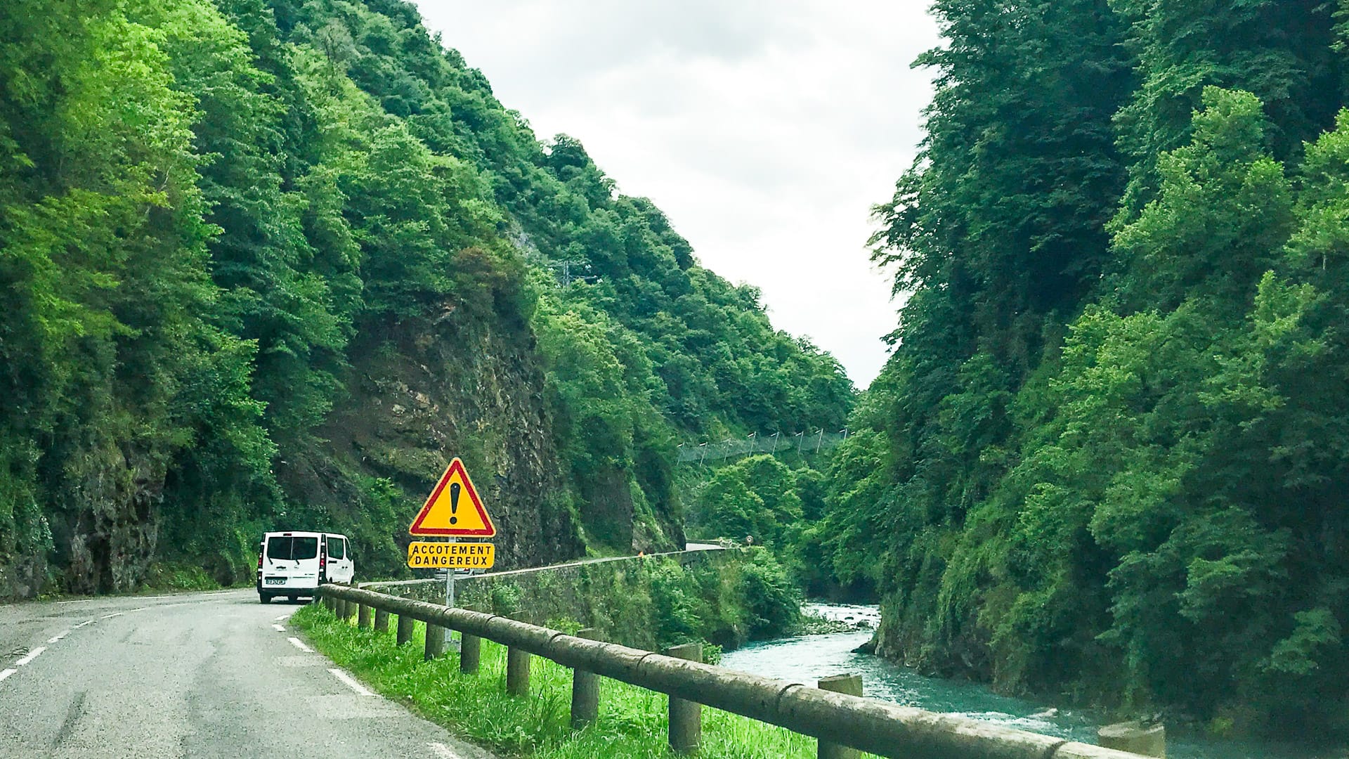
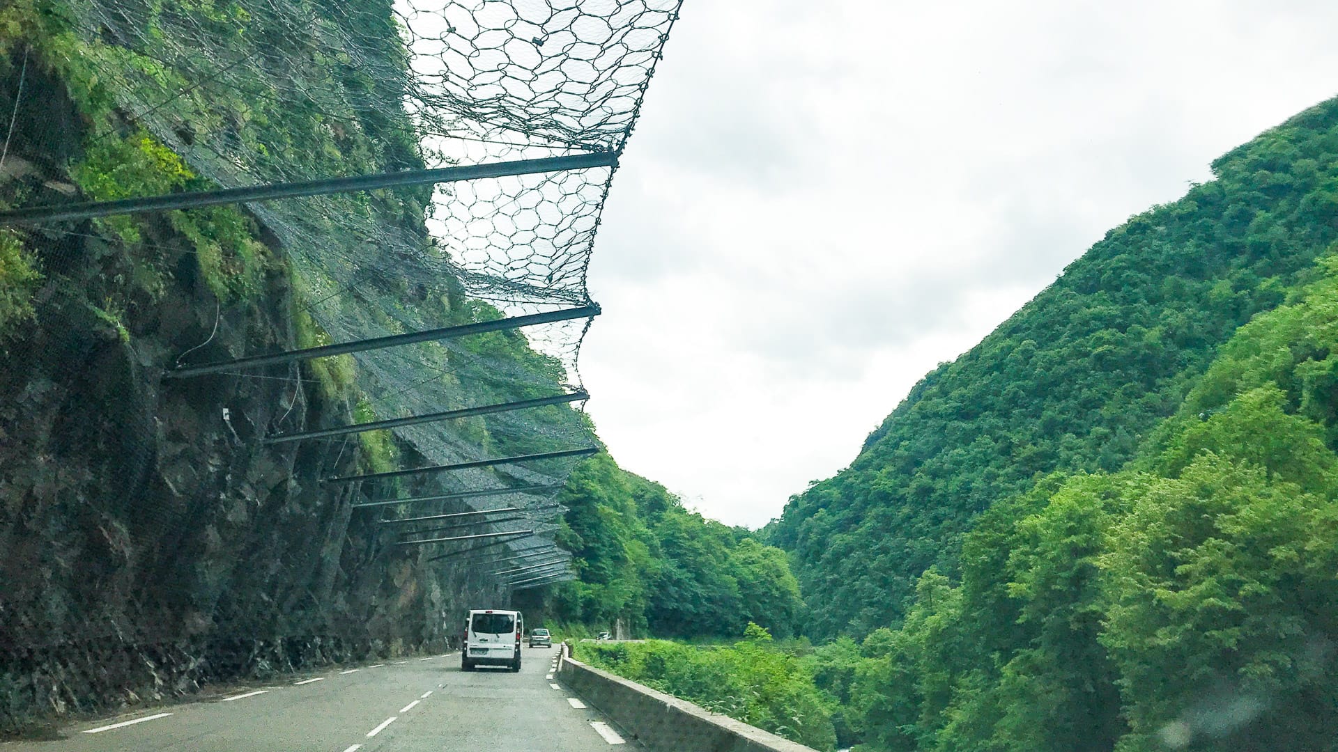
The road along the Gorges de Luz between Villelongue and Luz Saint Sauveur is picturesque but be aware that you’ll be riding in traffic; it’s a narrow road in a steep-sided valley, with a vertical rock face on one side and the river on the other. There’s no hard shoulder. Heading towards Luz, it’s a surprisingly taxing 2-3% average gradient (if you’re en route to the Tourmalet, bear in mind this is the warm-up!). These photos from our visit in June, give an idea of what the road is like:
Watch out for cattle and livestock on both the Col d’Aspin and La Mongie side of the Col du Tourmalet. They are likely to walk out into the road in front of you. You may even come across some just lying in the middle of the road. Don’t provoke them or do anything silly; the cows in particular, are large animals with big horns and have been known to attack.
You need to be particularly aware of oncoming traffic when descending these mountains. In places the roads are incredibly narrow with precipitous drops. Unfortunately it’s not uncommon to find motorists overtaking on blind corners.
You’ll be likely to encounter more traffic if you ride at the weekend and/or in July/August.
The weather in this area, and particularly on the Tourmalet, is very changeable. It can be sunny at the bottom and cold and rainy at the top. Always pack a jacket.
The upper reaches of the Col du Tourmalet can be particularly hard work when it’s hot, since the exposed rocks shield the cooling wind while acting as a magnifying glass for the sun. You can check the summit using the Tourmalet webcam.
Other useful information
Kilometre signs on the Col d’Aspin and Col du Tourmalet show average gradient, height and distance.
If you’ve got non-cyclists with you, they might like a wander around Arreau. It’s a charming place that used to be one of the most important stations for pilgrims on the way to Santiago di Compostela. The town is full of well-preserved historic buildings, half-timbered houses and has a historic market building too.
Tour de France trivia
This route takes in half of the “Circle of Death” route that comprises the Peyresourde, Aspin, Tourmalet and Aubisque. The Circle of Death was the name given by the journalists of l’Auto to stage 10 of the 1910 route from Col de Peyresourde to Col d’Aubisque, the Tour’s first visit to the Pyrenees.
We love the story of how the organisers first decided to use the Tourmalet in the Tour de France. Henri Desgrange set up the Tour de France as a means to sell more newspapers, so wanted to showcase the most challenging climbs in France. His colleague, Alphonse Steins, convinced him that the Pyrenees should be included. Steins was sent off on a recce and decided to cross the Tourmalet via the eastern side. He drove 16km before the car broke down. He decided to set out on foot alone, despite warnings of bears and huge snowfall, he made it to the top with the help of a local shepherd. On the way back down he faced a metre high blanket of snow for the next 10km and fell from the road into an icy mountain stream. Shortly before 3am, Steins was located by a rescue party, in an exhausted, near hypothermic state. He was transported to Barèges and it was from here that Steins sent the immortal message: “Road over Tourmalet pass perfect; free of snow and undoubtedly driveable.”
The Col du Tourmalet was first used in 1910. At the summit, Octave Lapize, the winner, shouted “You are assassins. Yes assassins,” at Tour de France officials.
In 1952, the legendary Fausto Coppi crested the Col du Tourmalet first in stage 18 of the Tour de France en route to victory in Pau and his second and final overall Tour de France win.
The Eagle of Toledo, Frederico Bahmontes crossed the Tourmalet in first place four times. He holds the record.
The last rider to crest the Col du Tourmalet first and win the Tour the same year was Eddy Merckx in 1969. Lance Armstrong won at La Mongie in 2002 as part of his overall victory, but the race didn’t go all the way to the Tourmalet summit.
Robert Millar is the only British rider to reach the Col du Tourmalet first in a Tour de France stage, achieving the feat in stage 10 of the 1989 Tour de France.
The western approach of the Tourmalet was devastated by floods in 2013, with significant sections totally washed away.
The Souvenir Jacques Goddet prize is awarded each year for the first rider to cross the Col du Tourmalet summit.
Found this guide useful?
We’d love to hear from you – comment below or drop us a line.
Don’t miss our other ride guides on the other legendary rides of the region: for example the Aubisque, Luz Ardiden and Hautacam. See the related rides section above.
Check out our ultimate guide to cycling the Tourmalet region and other articles on this area, below.
Please support Epic Road Rides
A huge amount of time and effort goes into the article you’ve just read, all with the aim of helping you!
If you found what you’ve read useful, I’d really appreciate it if you dropped something in the tip jar here.
It’s a way you can say thank you and help us carry on creating top quality content with no annoying ads and no pay wall.
Looking for an organised cycling trip?
If you want someone to help you plan and book your cycling holiday, fill out this form. We aren’t a tour operator/agent but we work with lots of people who are and will do our best to put you in touch with someone that can help (within 24 hours where possible)!Clare Dewey is a cyclist with a passion for travel. She set up epicroadrides.com in 2018 to help make it easy for cyclists to explore the world by bike. Today her mission is still inspiring cyclists to discover new places on two wheels - and doing what she can to make sure they have the best possible time while they're there. Clare has visited 50+ destinations around the world, many of them by bike.
Want to connect with Clare? Find her over on LinkedIn.
First Published: 03 July 2018
All metrics in this article are approximate.
The contents of this website are provided for general information purposes only. It is not intended to amount to advice and you should not rely on it. You should carry out your own due diligence and risk assessments and take professional advice. Views expressed by interviewees or other users of this website do not necessarily represent our views. We make no representations, warranties or guarantees, whether express or implied, that the content on our website is accurate, complete or up to date. If you use any information or content on this website, download from, or otherwise obtain content or services through our website, it is entirely at your own discretion and risk. Epic Road Rides Ltd disclaims all liability and responsibility arising from any reliance placed on the information and content on this website. Find out more here.
I have just ridden your route of the Col d’Aubisque as a 65th birthday prezzi to myself. It was 33deg and the Col de Spandelles was too much for me…until I came across an old bath fed by the mountains streams. Five minutes after a fully dressed bath I was taking a selfie at the summit. Great route Merci Boucoup!….jeff
Haha, that’s brilliant! You’ll remember that bath forever! So glad you enjoyed the route.
Enjoyed reading about the circle of death, looking at getting over next year to do Ventoux and then drive over to the Pyrenees to do the rides above and maybe more.
Great, glad you enjoyed the article. Hope you make it next year!
As someone who lives here it never ceases to amaze me how many people turn up on 53/39 11/28 combo’s and slick race tyres. The best advice I can give you? ‘Leave your ego at the door’ and put on the biggest cassette you can.
Ha! So much ego around. Agree with you, chuck on the biggest cassette and enjoy the ride!
Great article on the col du tourmalet, Planning to ride it next year maybe late June ,my best ratio for this is 34-28 on a bike weighing 8 kg . Any advice would be welcome , I will be 69 & 1/2 on that date, at present 71 kg. Fairly fit for an old geezer riding around 220kms per week. never ridden a mountain but love hills.
Again, thanks for the great info.
Thanks for your kind comments and congrats on 220km a week, lucky you! If you’ve never ridden in the mountains, I’d definitely suggest taking your time and not making the Tourmalet the first on your list! Hope you have an amazing time.
Asuuming it’s a nice sunny day, are there often/ known issues with black ice on the decent in November?
Apologies, but we haven’t ever ridden it in November so can’t confirm. Hopefully a local will see this and confirm for you!