
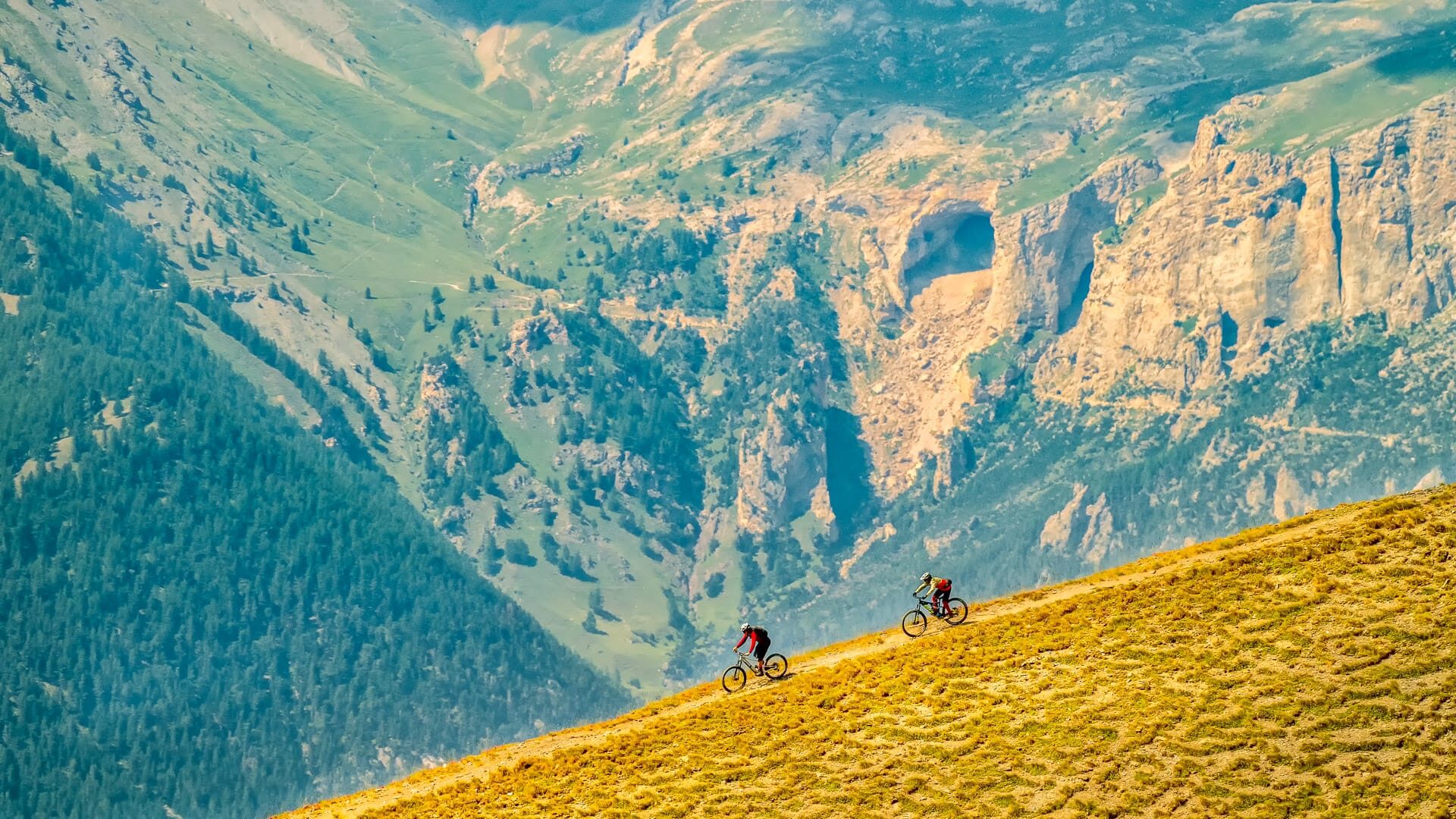
Val Susa sits just west of Turin in northern Italy, where the city gives way to Alpine valleys, historic military roads and high mountain gravel. For experienced riders, the Val Susa Gravel Loop is a brilliant way to explore this part of Piedmont by bike.
Starting and finishing in Avigliana, close to Turin, the 280 kilometre route links former military roads, valley sections, mountain villages and high-altitude tracks. It is not an easy gravel cycling holiday, but for riders with strong fitness and confident bike handling, it offers an exciting gravel route from the Turin area into the Alps.
In this guide, we speak to Alberto Surico, Head of Outdoor Tourism Development and Promotion at Turismo Torino e Provincia. Alberto’s work focuses on helping more people discover Torino and its province as an outdoor destination, including its road cycling, gravel riding and mountain cycling routes.
Here, Alberto shares practical insight into the Val Susa Gravel Loop. This guide is designed to help you decide whether the route is right for you and how to plan your cycling holiday.
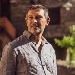
Alberto Surico is Head of Outdoor Tourism at Turismo Torino e Provincia.
His role is to help more people discover Torino and its province as an outdoor destination. Cycling is a big part of that. From alpine climbs and quiet valleys to routes linking culture, food and history, the area has huge potential for riders.
At Turismo Torino e Provincia, Alberto promotes the region to visitors, tour operators and media in Italy and abroad. His aim is simple: to show why Torino is a brilliant place to ride, stay longer and explore more.
Photo credit: Giorgio Gulmini
Always check current travel information and advice. For visitors from the UK, the UK government travel information pages are here.
Table of contents
This guide contains a lot of useful information. To help make it more digestible, we’ve broken it down into several parts:
Short on time? Start with the at-a-glance table below for the key things to know about cycling the Val Susa Gravel Loop.
| Detail | Information |
|---|---|
| Route | Val Susa Gravel Loop |
| Location | Val Susa, Turin Alps, Piedmont |
| Start/finish | Avigliana |
| Distance | 280 kilometres |
| Elevation gain | 6,859 metres |
| Highest point | 2,539 metres |
| Suggested stages | Four |
| Best time to ride | July to September |
| Difficulty | Very difficult |
| Best bike | Gravel bike or mountain bike |
| Family-friendly? | No, not as a cycling route for children |
Part 1: The Val Susa Gravel Loop
What is the Val Susa Gravel Loop?
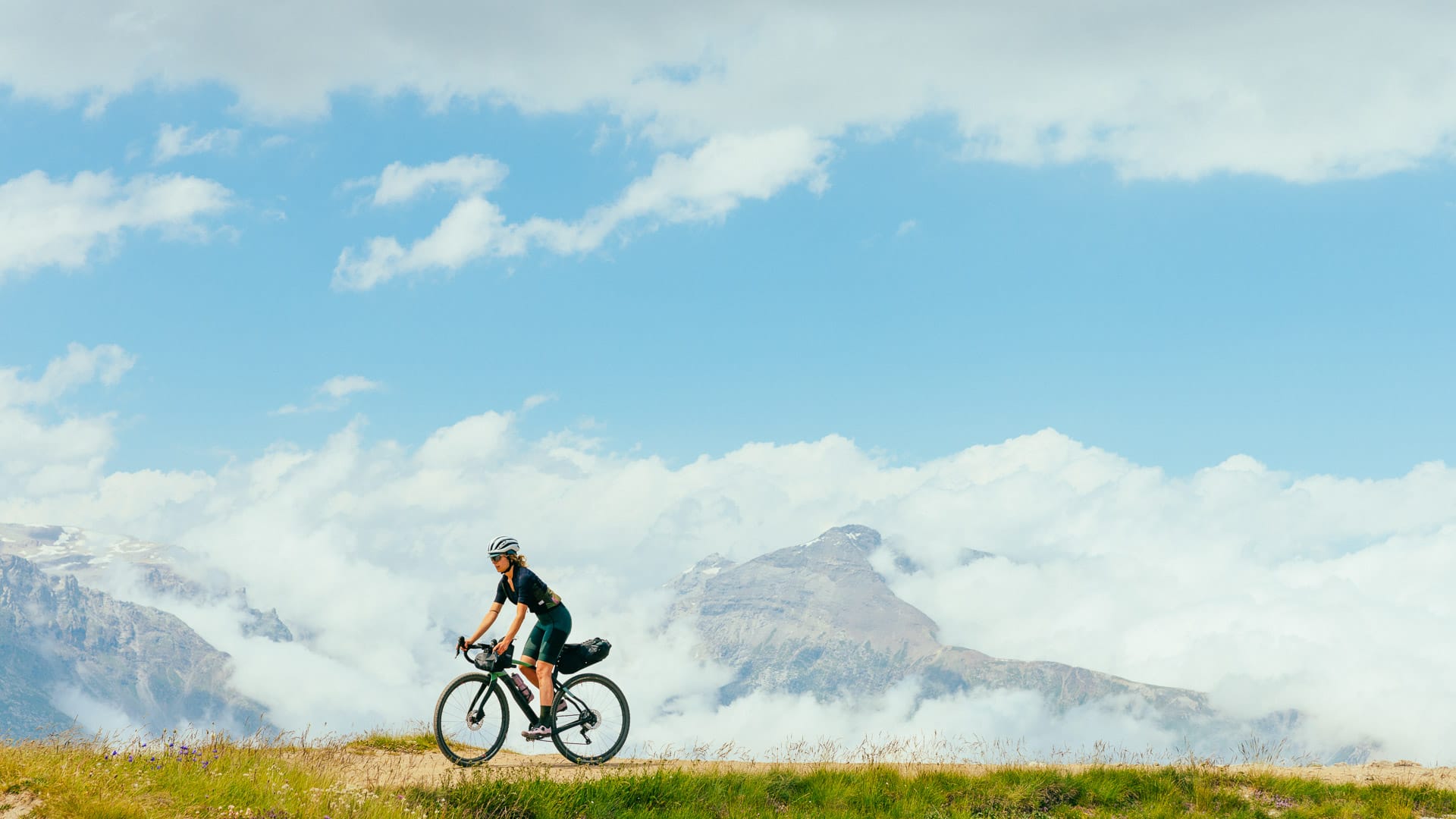
The Val Susa Gravel Loop is a demanding multi-stage gravel route through Val Susa and the Turin Alps. Starting and finishing in Avigliana, close to Turin, it covers around 280 kilometres and is usually ridden over four stages.
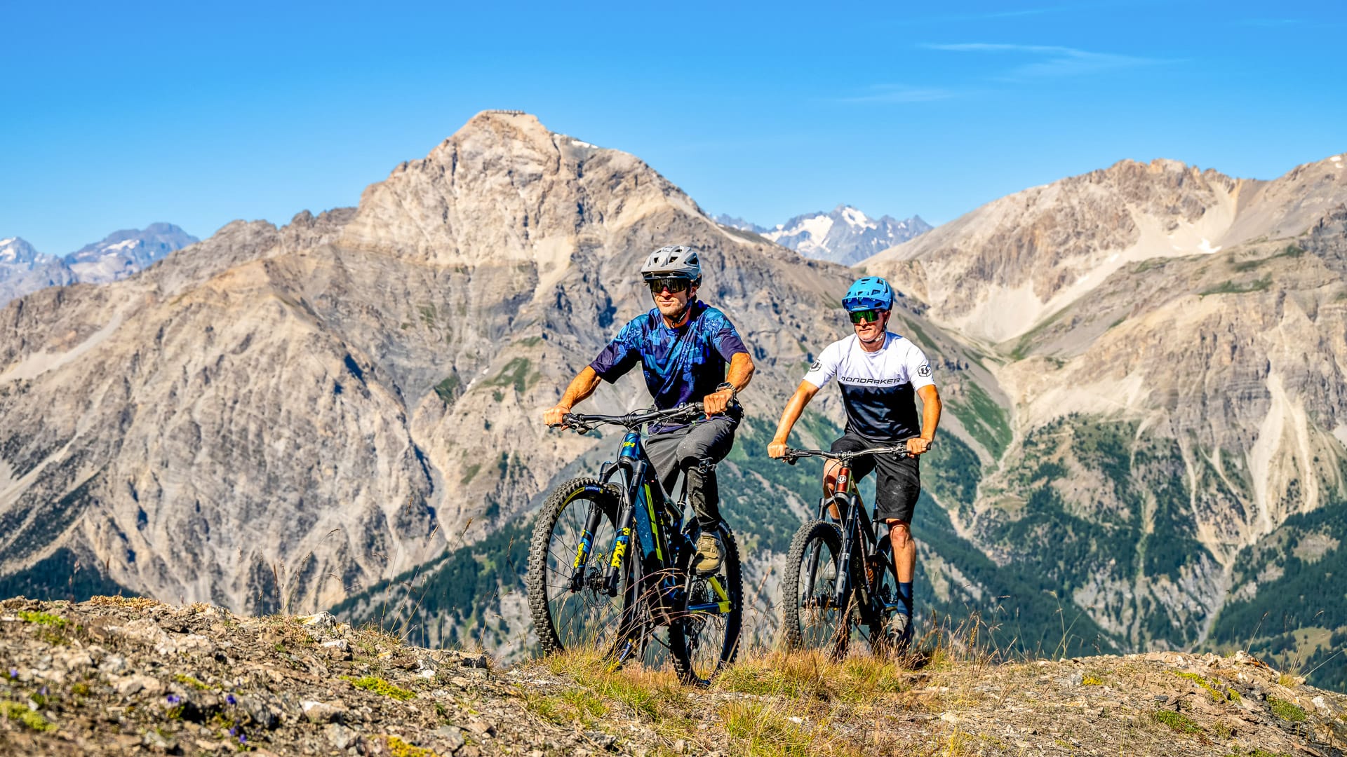
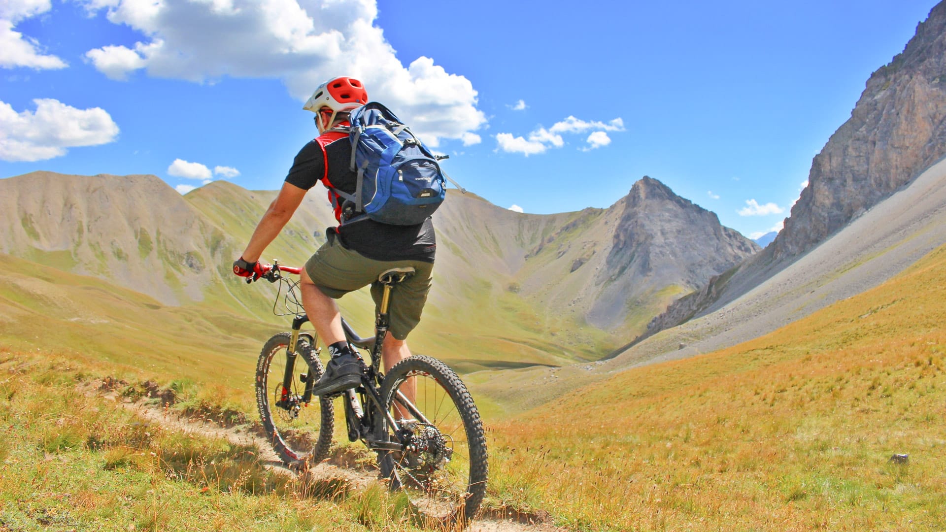
The route is best suited to experienced gravel riders. It links valley roads, former military tracks, high-altitude gravel sections and mountain villages, with several sections above 2,000 metres. Riders should expect long days, big climbs, rougher surfaces in places and fast-changing Alpine weather.
What makes the route stand out is the combination of mountain riding and history. The loop connects places such as the Sacra di San Michele, Colle delle Finestre, Strada dell’Assietta, Monti della Luna, Colle della Scala, Strada del Pramand, Galleria dei Saraceni and Forte di Exilles.
Where is it?
The route is in Piedmont, in the Turin Alps. It runs through Val Susa and between the peaks of Val Chisone and the Turin hills close to the French border.
How long is it?
The route is around 280 kilometres with around 6,800 metres of elevation gain. It ranges from around 337 metres to 2,539 metres in altitude. The route starts and finishes at the Avigliana Lakes, a gateway to Val Susa.
What are the route options?
The main route does not include alternative versions. However, the route is divided into a four stage format. This, along with good public transport links, give riders some flexibility when planning where to start, stop or where to stay overnight. More about public transport along the route below.
What is the history of the Val Susa Gravel Loop?
The Val Susa Gravel Loop traces centuries of movement through the Alps. It links Roman roads, medieval pilgrim routes and 19th-century former military roads built to move troops and supplies between Val Chisone and Val Susa.
It is promoted under the Vie Storiche di Montagna label, which brings together historic mountain routes in this part of Piedmont.
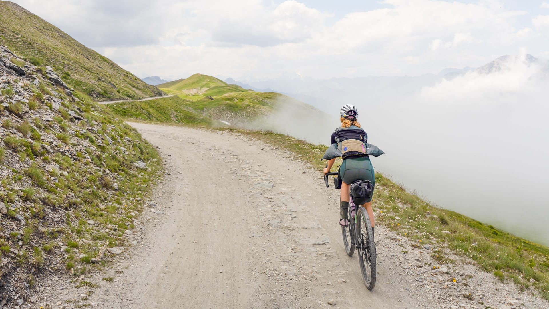
Gravel cycling in Turin (photo credit: F.Ravassard via Turismo Torino e Provincia)
Part 2: Day-by-day guide to the Val Susa Gravel Loop
| Stage | Route | Distance | Main highlights |
|---|---|---|---|
| Stage 1 | Avigliana to Pian dell’Alpe | 67 kilometres | Laghi di Avigliana, Sacra di San Michele, Colle delle Finestre |
| Stage 2 | Pian dell’Alpe to Cesana Torinese | 48 kilometres | Strada dell’Assietta, Sestriere |
| Stage 3 | Cesana Torinese to Bardonecchia | 72 kilometres | Monti della Luna, Colle della Scala, Bardonecchia |
| Stage 4 | Bardonecchia to Avigliana | 110 kilometres | Strada del Pramand, Galleria dei Saraceni, Forte Exilles |
Stage 1: Avigliana to Pian dell’Alpe (67 kilometres)
Stage 1 starts in Avigliana and quickly gives riders a sense of the history and scale of the route. The climb begins on asphalt, leading towards the Sacra di San Michele, one of Piedmont’s landmark monasteries and the first major historic site on the loop.
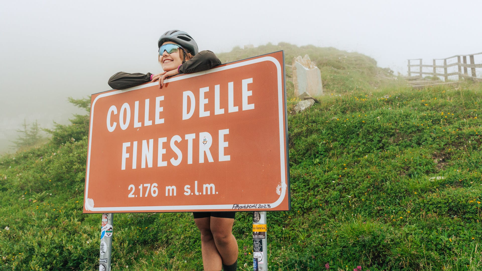
After a descent and around 20 kilometres of flatter riding along the Via Francigena cycle path, the route reaches Meana and the sign for Colle delle Finestre. This is where the character of the stage changes. The climb gains around 1,700 metres over about 18 kilometres, starting on asphalt before the final eight kilometres switch to gravel road near the top.
At the summit, riders can pause near the statue of Danilo Di Luca, the first rider over Colle delle Finestre when it appeared in the Giro d’Italia in 2005. More recently, the climb became the setting for one of the Giro’s most memorable modern attacks, when Chris Froome launched an 80-kilometre solo move on Colle delle Finestre during the 2018 race. He went on to win the stage and take the overall race lead. You can read more about Chris Froome’s attack on the Finestre here.
The route then descends slightly on asphalt before leaving the road again and joining the Strada dell’Assietta area.
Around Pian dell’Alpe, Lago delle Rane and the Assietta road, there are options for food, shelter and overnight stops.
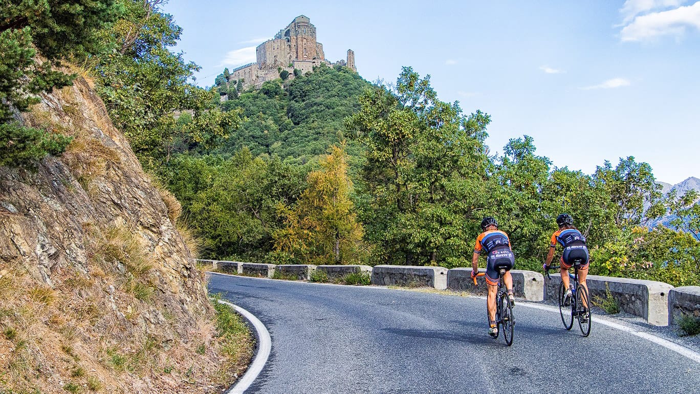
Colle Braida and Sacra di San Michele (photo credit: Turismo Torino e Provincia)
Stage 2: Pian dell’Alpe to Cesana Torinese (48 kilometres)
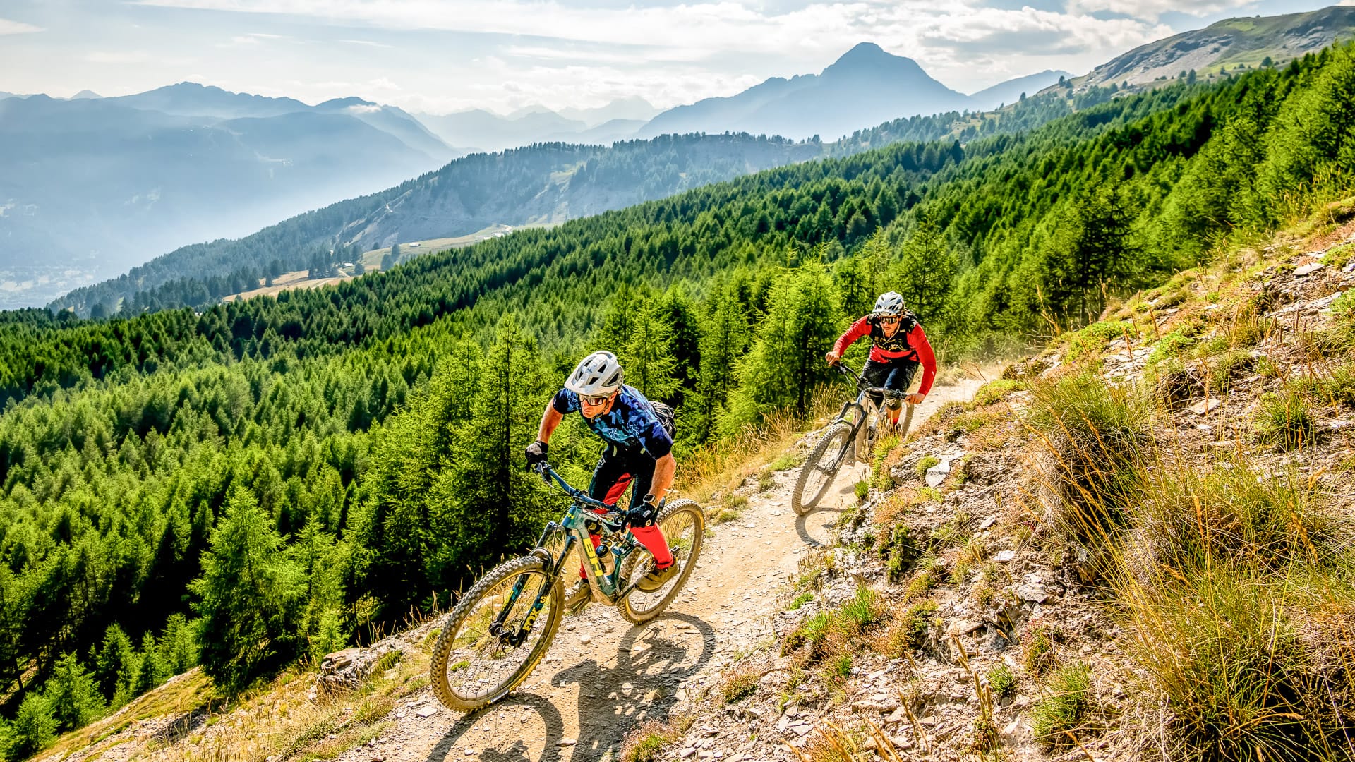
Stage 2 includes one of the defining sections of the loop: the Strada dell’Assietta. This former military road runs high above the valleys, with long stretches above 2,000 metres and wide views across Val Susa and Val Chisone.
Did you know? The Strada dell’Assietta is the highest gravel road open to vehicles in Europe!
This stage is mainly on gravel road, with around 32 kilometres of gravel road. The surface is fast and well maintained but riders should still expect high mountain conditions and some rougher sections.
The route continues along the high ridge, passing mountain landmarks such as Cima Ciantiplagna, which rises to 2,849 metres, and Monte Triplex, a peak above Sauze d’Oulx at around 2,506 metres.
This section gives a real sense of the altitude of the Strada dell’Assietta, before the route reaches Rifugio Casa Assietta, a high mountain refuge at around 2,500 metres. Near Testa dell’Assietta, an obelisk marks the site of the 1744 battle between Savoy and French forces.
After the high-altitude riding, the route descends through the Colle Basset pass towards Sestriere, the highest municipality in Italy, towards Sestriere and then continues on towards Cesana Torinese.
The first part of the descent runs along a gravel track or forest path as far as Sansicario, and then continues on asphalt.
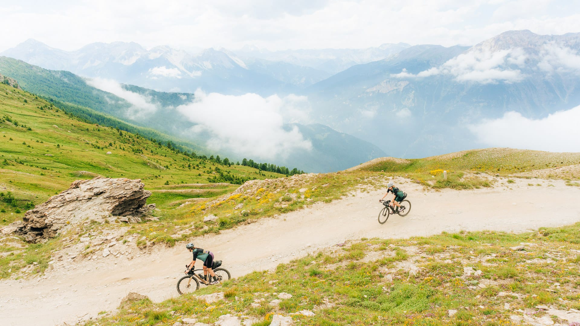
Riding along Strada dell’Assietta in the Piedmont Alps (photo credit: F.Ravassard via Turismo Torino e Provincia)
Stage 3: Cesana Torinese to Bardonecchia (72 kilometres)
Stage 3 heads from Cesana Torinese towards the Monti della Luna and Claviere, the last Italian town before the French border. The surface is mixed, but gravel road makes up the largest share of the stage, at around 39 kilometres.
From Claviere, the route continues over Col de Montgenèvre before dropping down towards Val Clarée. This section has a different feel from the exposed military roads, with straighter valley riding and conifer woodland before the climb to Colle della Scala.
The descent towards Bardonecchia is one of the most memorable parts of the stage. It gives views towards Guglia Rossa, a reddish mountain peak above Valle Stretta, close to the French border, as the route drops through the hairpins towards Bardonecchia.
The view of the Guglia Rossa and the Valle Stretta are the main attractions of the descent towards the town of Bardonecchia. The route follows a paved road with a 410-metre descent.
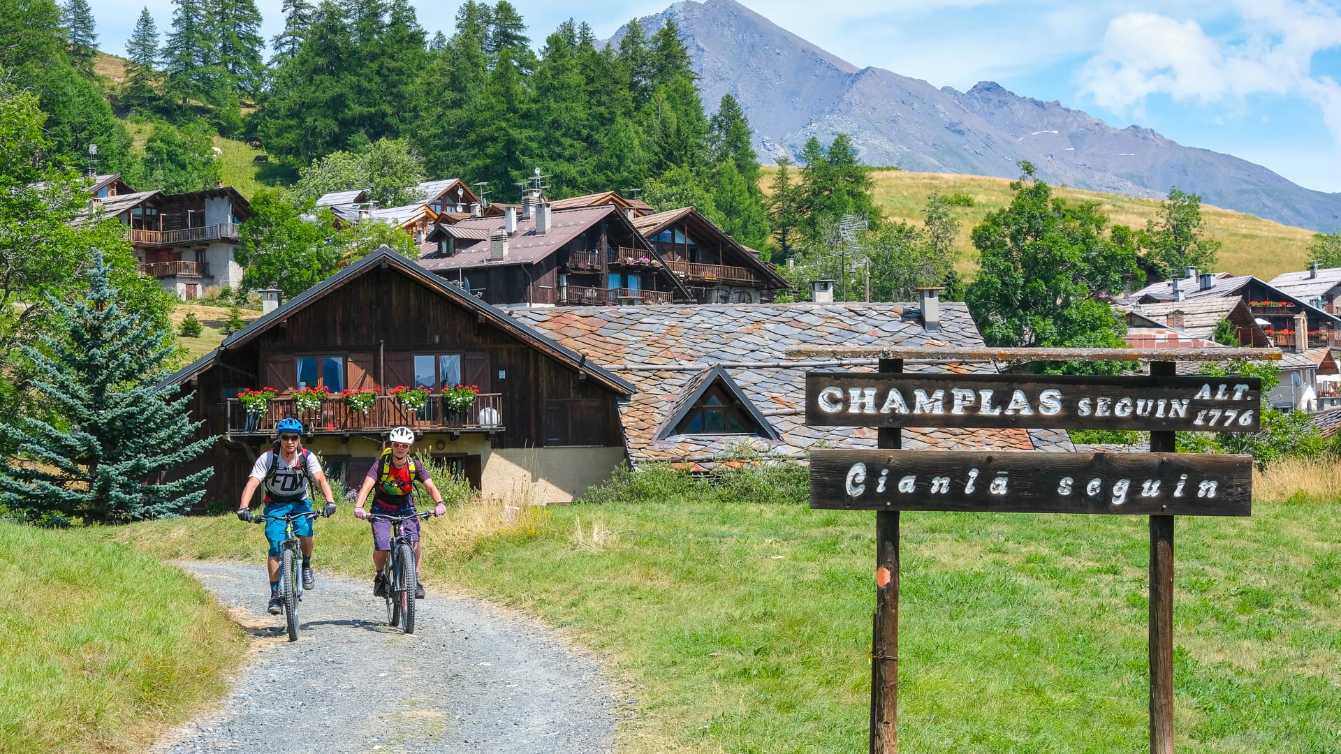
Cycling through Cesana Torinese in Piedmont (photo credit: MPons via Turismo Torino e Provincia)
Stage 4: Bardonecchia to Avigliana (110 kilometres)
Stage 4 is the longest day of the loop and one of the most physically demanding, so it needs careful pacing. From Bardonecchia, the route climbs towards Forte Foens, with double-digit gradients and hot, exposed conditions possible in summer.
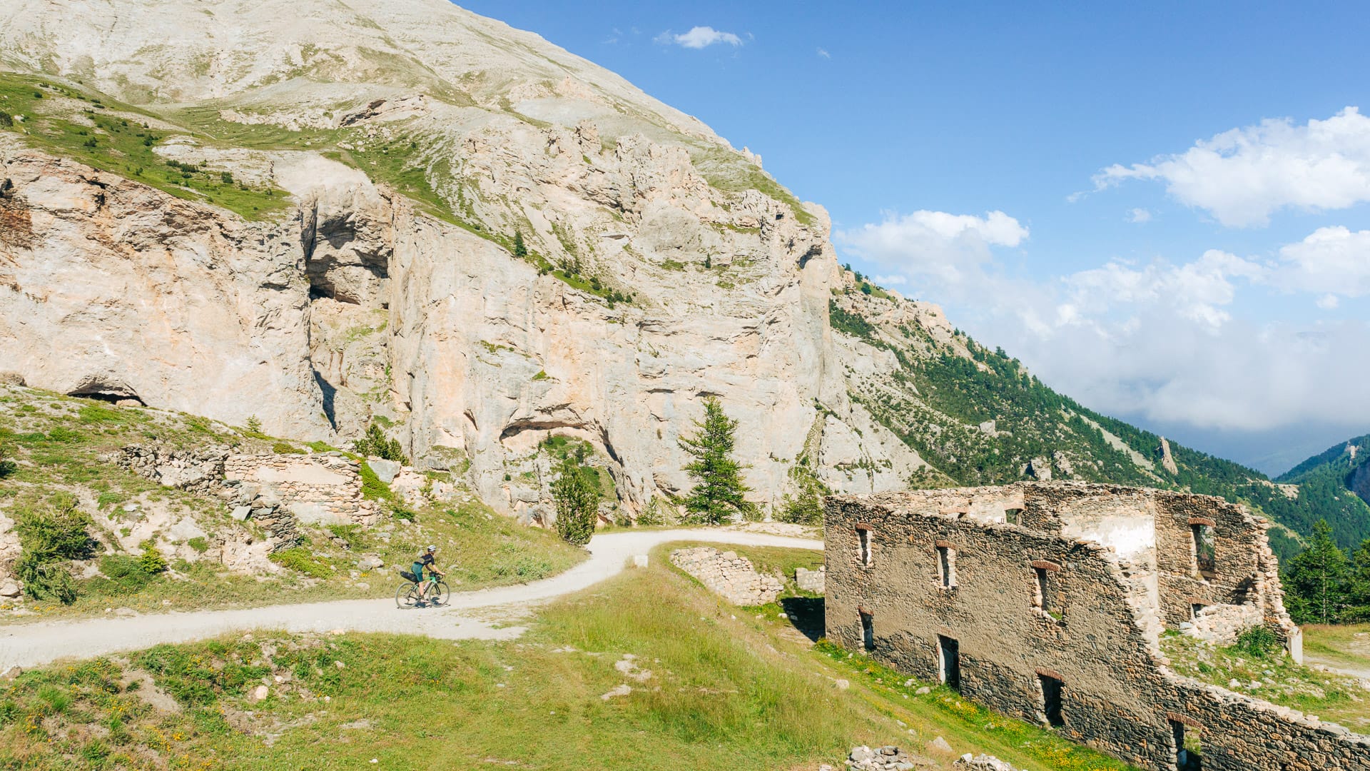
From here, the route continues on gravel roads past Forte Pramand and towards Galleria dei Saraceni, a tunnel carved through the rock. The long gravel road then descends more than 1,200 metres, towards Salbertrand, with rough surfaces that can test your hands, arms and shoulders. adding another challenge. Confident handling and a suitable gravel setup really matter here.
After returning to the valley floor, the route continues through Almese and towards the Musiné firebreak trail before reaching Rivoli. The final return to Avigliana passes through the low hills between Rivoli and Avigliana, known locally as the Collina Morenica di Rivoli-Avigliana.
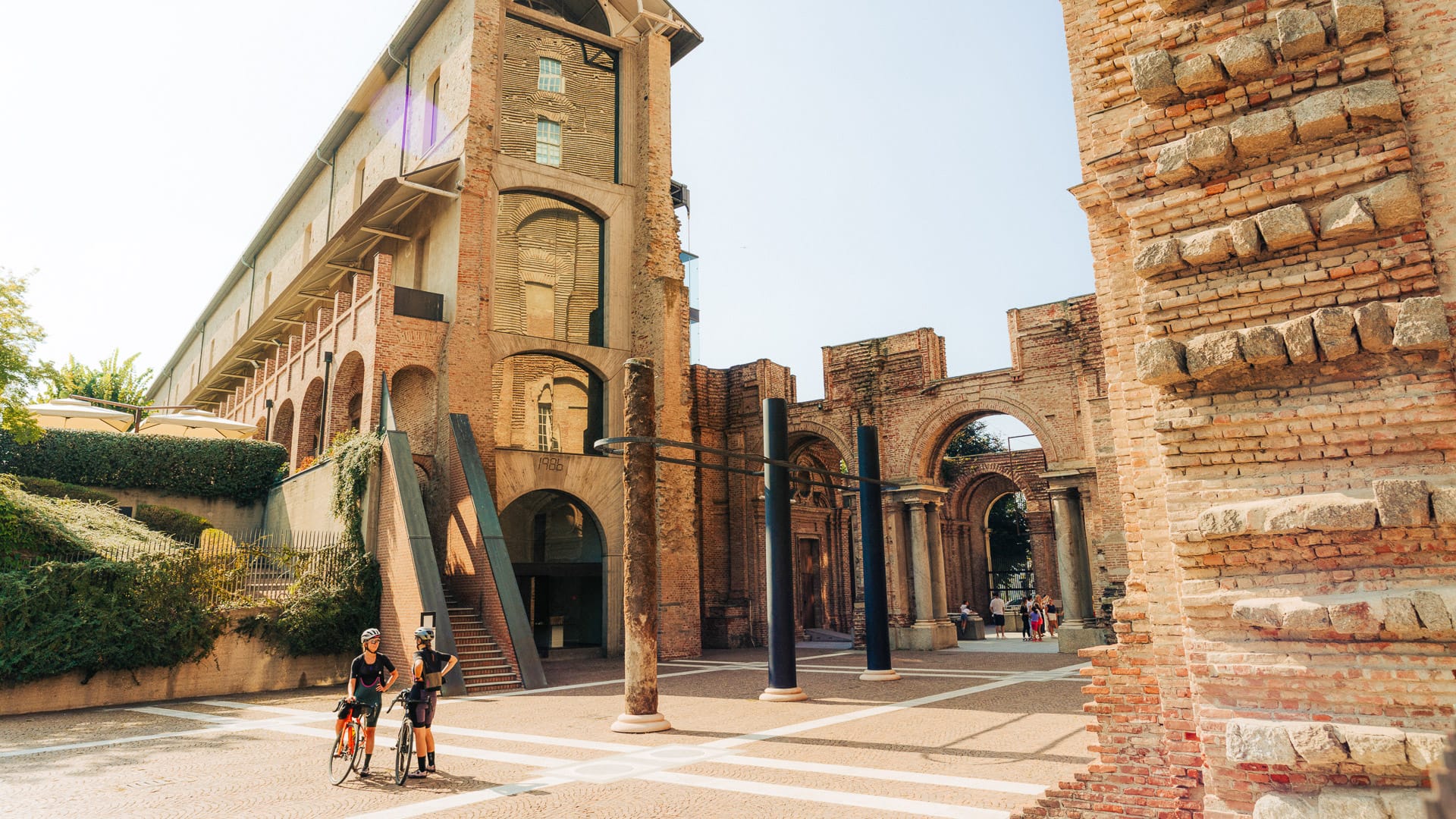
Rivoli historic centre (photo credit: F.Ravassard via Turismo Torino e Provincia)
Part 3: Why ride the Val Susa Gravel Loop?
What is the Val Susa Gravel Loop like?
What scenery can you expect?
Expect a mix of valley roads, high-altitude gravel, mountain ridges, Alpine villages, old military roads, forts and historic sites linked to Val Susa’s position between Italy and France.
Is the route signposted?
Riders should travel with the route file downloaded and available offline. In high mountain areas, do not rely only on mobile signal or signs.
What are the surfaces like?
The Val Susa Gravel Loop includes a real mix of surfaces, so riders should not expect smooth gravel throughout. Around 153 kilometres are on asphalt roads, but there are also around 93 kilometres of gravel road, 41 kilometres of forested or wild bike trails, seven kilometres of path and five kilometres where the surface is mixed road.
In practice, this means the route can change feel quite quickly. Some sections are likely to roll more easily, while others will need more confident handling. This mix helps explain why a gravel bike is suitable for many riders, but confident handling and robust tyres are important. Take particular care on rougher high-altitude sections and descents.
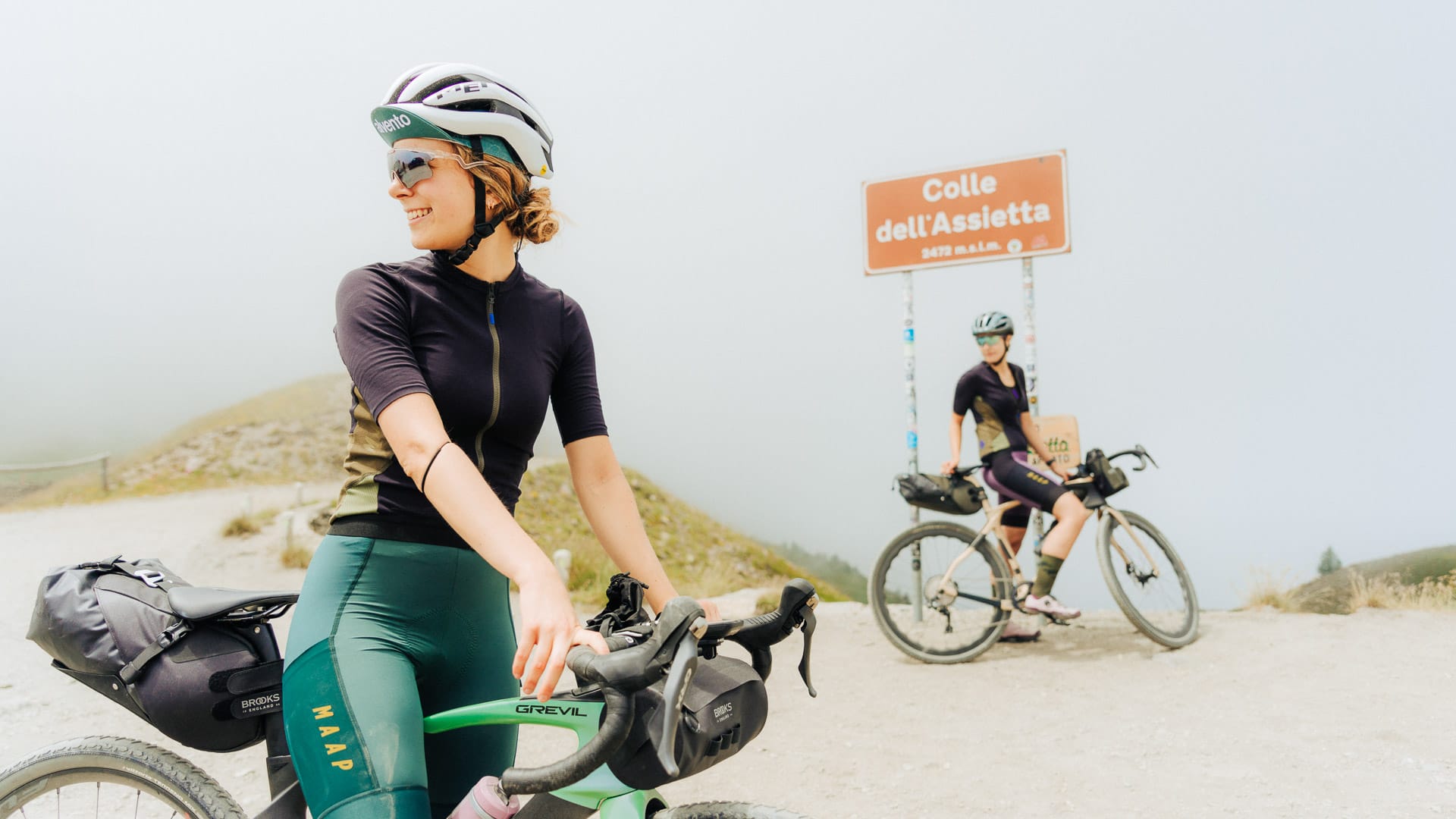
Cyclists at the Strada dell’Assietta signage (photo credit: F.Ravassard via Turismo Torino e Provincia)
What are the highlights of the Val Susa Gravel Loop?
Sacra di San Michele
The Sacra di San Michele is one of the first major landmarks on the route. Sitting above the Susa Valley, the historic monastery which gives the opening stage a strong sense of place and links the ride with one of Piedmont’s best-known historic sites. The Sacra di San Michele can be reached by climbing the first ascent to Colle Braida, which saw the passage of the Giro d’Italia in 2023.
Strada dell’Assietta
Strada dell’Assietta is a high-altitude former military road linking Pian dell’Alpe, near Colle delle Finestre, with Sestriere. Officially designated Provincial Road 173, it follows the ridge between Val Susa and Val Chisone for around 36 kilometres.
The route officially starts at Pian dell’Alpe, in the municipality of Usseaux. The kilometre zero marker sits at an altitude of around 1,950 metres, close to the turning for Colle delle Finestre.
The road finishes at Colle del Sestriere, at an altitude of 2,035 metres. Most of the route remains above 2,000 metres, with long sections of exposed gravel along the ridgeline.
This is where the loop feels most Alpine. Expect wide-open mountain views, historic military fortifications and rugged gravel riding between Val Susa and Val Chisone. It feels more like a journey along a mountain ridge than a straightforward climb over a pass.
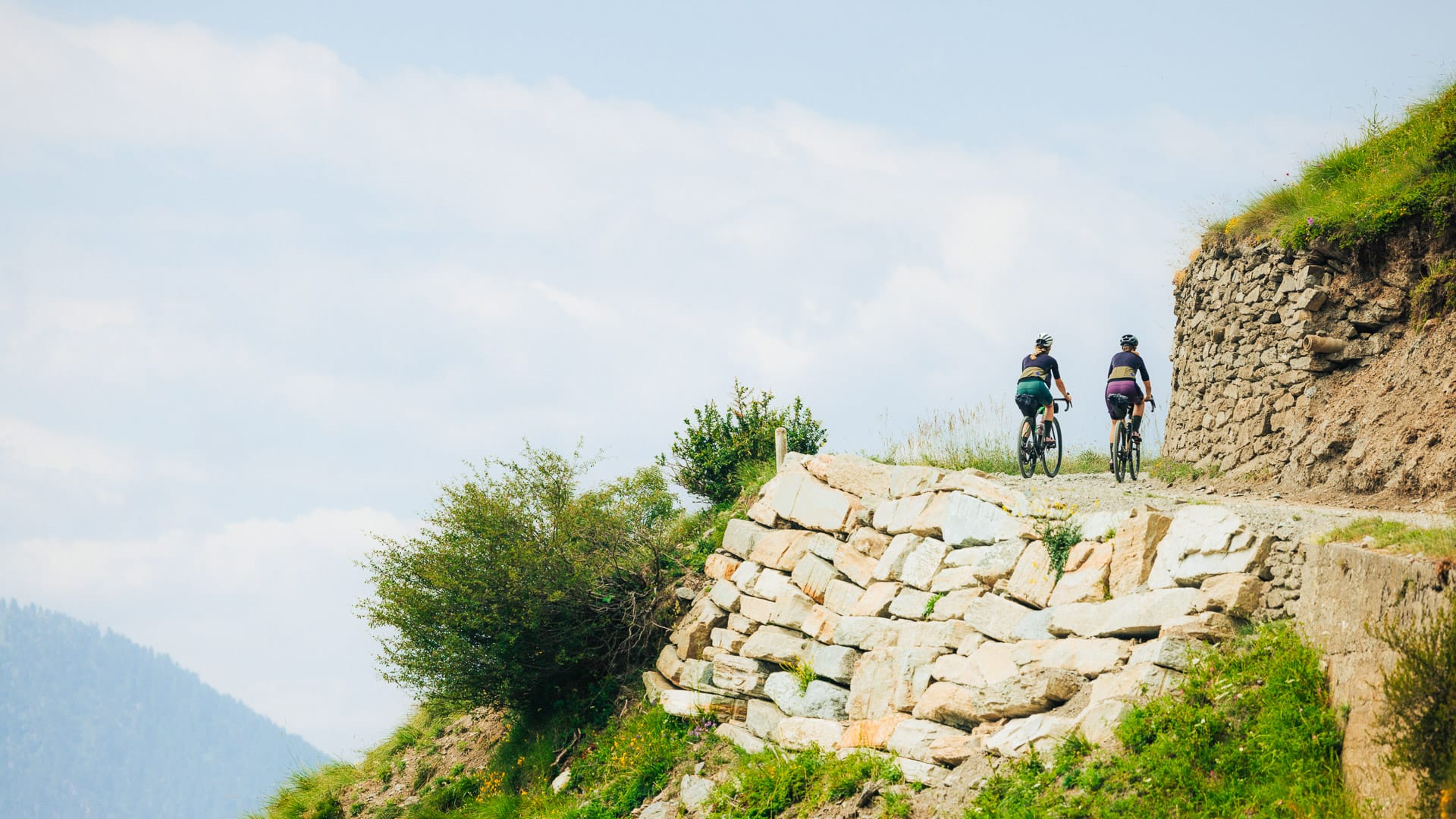
Mountain road along Strada dell’Assietta (photo credit: F.Ravassard via Turismo Torino e Provincia)
Strada del Pramand
Strada del Pramand is one of the loop’s tougher and more adventurous sections. This former military road climbs through high mountain terrain near Bardonecchia, passing Forte Pramand and the entrance to the Galleria dei Saraceni.
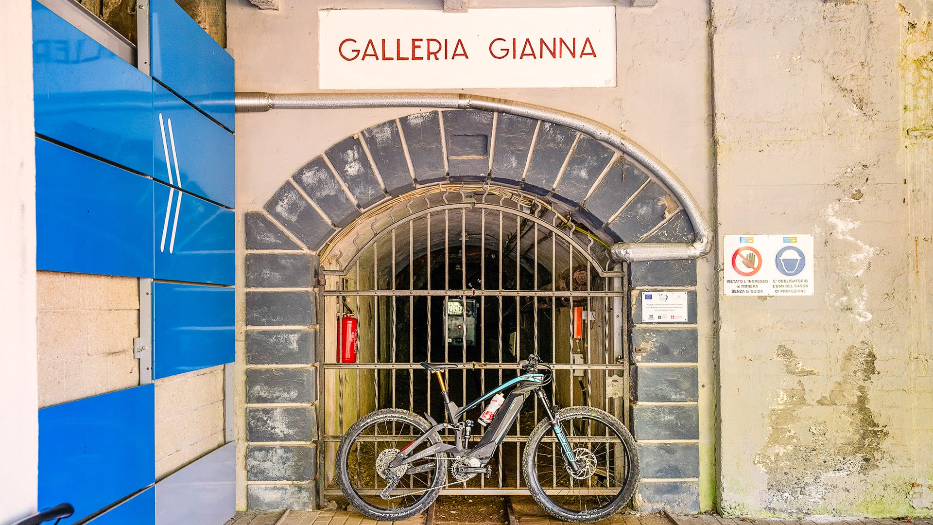
The Galleria dei Saraceni, officially known as the Galleria del Seguret, is a narrow tunnel carved through almost 900 metres of rock. There are no lights inside. Its curved layout means it becomes completely dark within a few metres of the entrance.
A powerful front light is essential. Riders should also use a rear light so they can be seen by other cyclists and vehicles.
The surface inside the tunnel is rough and unpaved. Expect fixed stones, loose limestone debris, protruding rocks, mud and standing water. Water dripping from the roof can make the rocks slippery, even when the weather outside is dry.
Ride slowly, leave space between riders and be ready to stop for oncoming traffic. The tunnel is narrow, with limited room for cyclists and vehicles to pass. Complete darkness, uneven ground and deep puddles make this one of the most technically demanding parts of the loop.
The Strada del Pramand is subject to seasonal access restrictions. Motor vehicles are sometimes prohibited on certain days during the summer, often Mondays, Wednesdays and Fridays. These arrangements can change, so check the latest local access information before setting out.
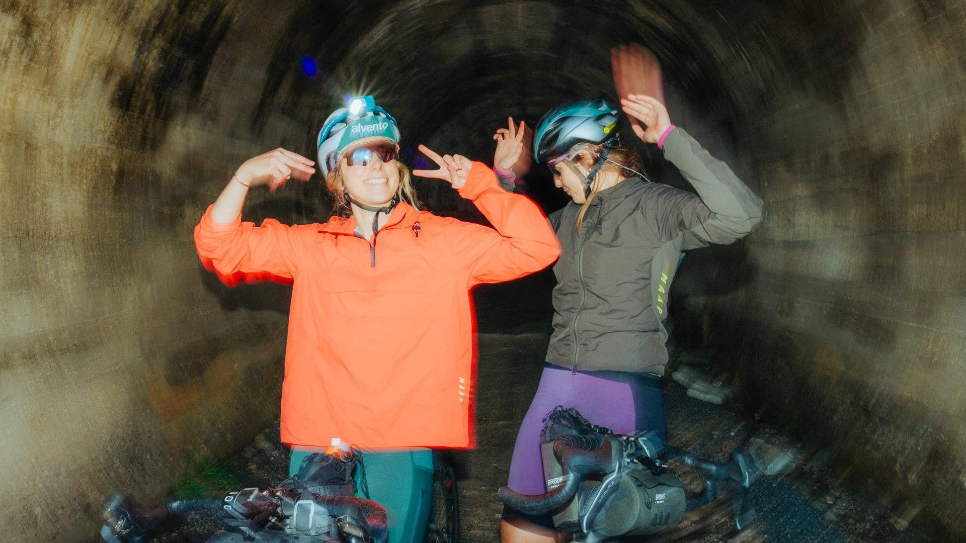
Cyclists on a tunnel along Strada Pramand, Piedmont (photo credit: F.Ravassard via Turismo Torino e Provincia)
Is this route for you?
The Val Susa Gravel Loop is for riders looking for a demanding gravel route rather than an easy touring ride. The challenge comes from long mountain days, sustained climbing, high-altitude riding, changing surfaces and descents that need confident bike handling. The Val Susa Gravel Loop is best suited to experienced gravel riders with strong fitness, confident bike handling and mountain riding experience.
The loop is divided into four suggested stages and passes through or near mountain towns and villages such as Sestriere, Cesana Torinese and Bardonecchia. This gives a useful structure, when working out where to stay, where to stop and how to manage the route.
It is also not suitable as a cycling route for children. Families could still base themselves in the area and enjoy summer activities while experienced riders complete the route, but the full Val Susa Gravel Loop is a serious mountain ride.
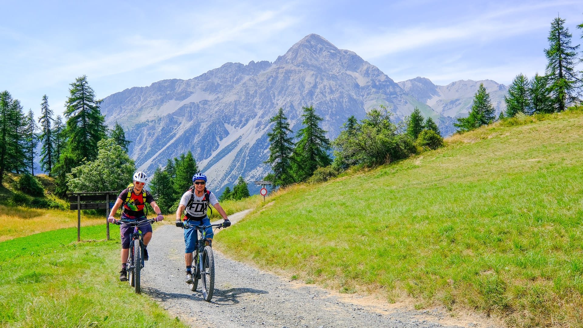
Gravel cycling in Cesana Torinese (photo credit: MPons via Turismo Torino e Provincia)
How hard is the Val Susa Gravel Loop?
The route is very difficult. As explained, the full loop is around 280 kilometres, with around 6,800 metres of elevation gain, and is usually ridden over four stages. Riders should be comfortable with the characteristics already described – i.e. long mountain days, gravel descents, high-altitude riding and an ability to be self-sufficient.
The difficulty is not just about distance. The route rises from around 337 metres to 2,539 metres in altitude, with long sections above 2,000 metres. It also includes mixed surfaces, from asphalt roads and gravel roads to forested or wild trail, path and rough high-altitude descents.
This is not a beginner gravel route. Expect long distances, sustained climbing, high-altitude sections, rough gravel roads, changeable weather and some remote-feeling sections where riders need to be self-sufficient. Prior technical training and good preparation are essential. You should be able to navigate with an offline route file, judge weather conditions and adapt your plans if mountain roads, storms or fatigue become an issue.
Part 4: Practical tips for planning your trip
When is the best time to ride the Val Susa Gravel Loop?
The usual riding window for the Val Susa Gravel Loop is from July to September. Many sections sit above 2,000 metres, so lingering snow, poor weather and seasonal road closures can affect access.
This is linked to the route’s official seasonal opening, but the dates are not fixed. Local authorities confirm the opening and closing dates each year, based on snowmelt, maintenance work and the condition of the high mountain roads.
Before setting off, contact the local tourism offices for the latest route and access information. They can advise on current conditions and any restrictions issued by the authorities responsible for the roads.
Check again shortly before your ride. Conditions can change quickly at altitude, even during the main summer riding season.
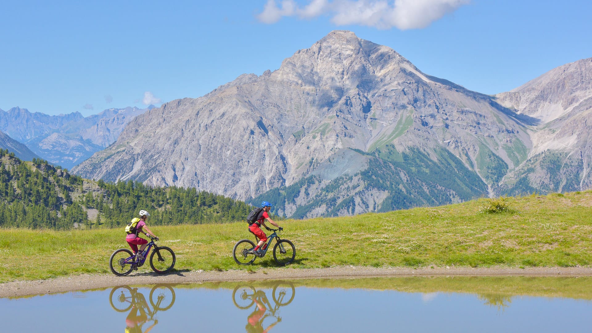
Cyclists riding through Sauze d’Oulx in the Piedmont Alps (photo credit: MPon via Turismo Torino e Provincia)
What weather should you expect?
Weather can change quickly in the high mountains. Checking the forecast before each stage and carrying a waterproof and thermal layers, even in summer, will help you prepare for the day ahead.
Does the route get busy?
The main gravel roads can be busy, especially in August. These former military roads are used by different types of visitors, including walkers, cyclists, horse riders and, where permitted, cars and motorbikes.
The route can be busy around specific tourist attractions, the best-known mountain passes and sections shared with motorised traffic. The busiest periods are weekends in July and August, particularly from 1 to 15 August. Key areas such as the Strada dell’Assietta, Colle delle Finestre and the towns of Avigliana, Sestriere and Bardonecchia are often the busiest.
If you aim to start early between Monday to Friday, you can usually enjoy only the sounds of the mountains and local wildlife for company.
Motor vehicle access is regulated and can vary by road, date and time. Some sections have closure days, tolls or vehicle limits, so check the current rules before travelling.
Stay on the main route and avoid cutting across slopes or tracks outside the main carriageway.
For more information on motorised usage visit the official Turismo Torino e Provincia website. You may also find the Bardonecchia Tourism and Strada dell’Assietta websites helpful.
Where should you stay on the Val Susa Gravel Loop?
Accommodation along and near the route includes hotels, B&Bs, mountain huts, chalets and lodges. The right choice will depend on your stage plan, whether you are riding self-supported and how much comfort you want at the end of each day.
Book ahead, especially in August and around Ferragosto, the major Italian public holiday on 15 August, when availability can be tighter. Mountain huts and smaller accommodation providers may also have limited space, so do not leave overnight stops to chance.
The Valsusa and Via Lattea Bike Experience network is a useful starting point for cyclist-friendly accommodation and services in the area. For more on accommodation visit the official Turismo Torino e Provincia website.
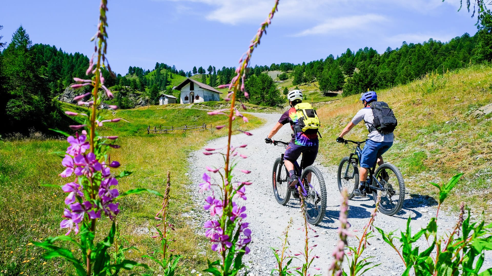
Cycling in Cesana Torinese (photo credit: MPon via Turismo Torino e Provincia)
What bike do you need for the Val Susa Gravel Loop?
A gravel bike is the main choice for the Val Susa Gravel Loop, but, as explained, this is not a smooth, easy gravel route and includes rough sections.
Some riders may prefer a mountain bike, especially if you are less confident on technical descents or are planning to ride with luggage.
Road bikes are not suitable for the full loop, although they can be used on selected asphalt climbs in the area, such as Colle delle Finestre or Colle Scala.
Can you ride the Val Susa Gravel Loop on an e-bike?
Yes, the route can be ridden on an e-bike, provided you plan charging carefully. Charging may be possible in refuges and in main villages such as Sestriere, Cesana Torinese and Bardonecchia.
If riding an e-bike, plan each stage around range, altitude gain, battery use, accommodation and charging points.
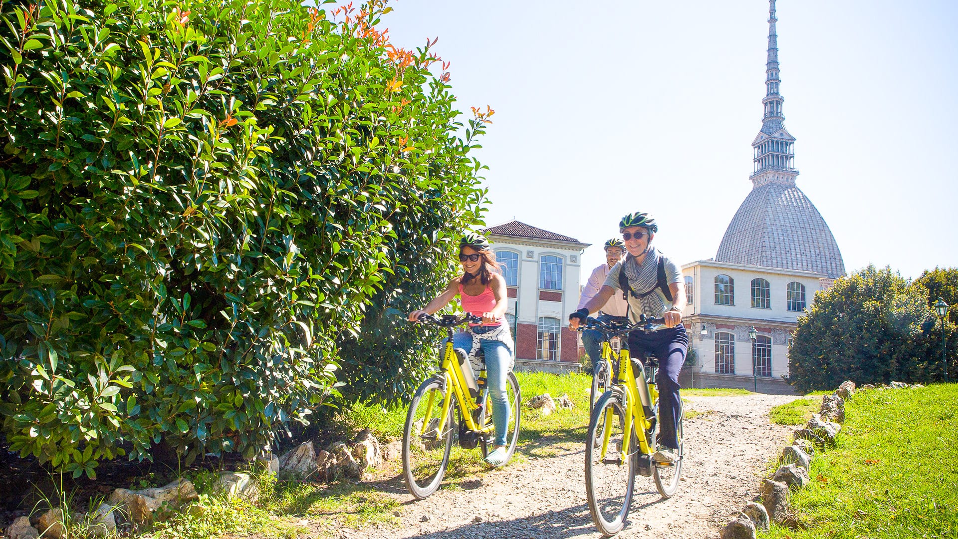
Cyclists riding an electric bike in Turin (photo credit: Turismo Torino e Provincia)
Where can you hire quality bikes in Turin and Val Susa?
Bike hire, repair shops and cycling services are available in Turin and across the wider region. Mountain, touring and city bikes are generally easier to find, while gravel bikes and road bikes may need to be arranged in advance.
For the Val Susa Gravel Loop, make sure any rental bike is suitable for high-altitude gravel, rougher sections and long mountain days. Check gearing, tyres, lights, luggage setup and bike repair kit before you travel.
For more on bike hire visit the official Turismo Torino e Provincia website.
Is there mechanical assistance?
Bike shops and hire providers in the main towns, such as Avigliana, Susa, Bardonecchia, Cesana and Sestriere, may be able to help with repairs. Opening hours and workshop availability can vary, so check ahead if you think you may need assistance.
Do not rely on finding mechanical support once you leave the main towns. The high-altitude sections are remote, so carry the tools and spares needed to deal with common problems, including punctures, loose bolts and a broken chain.
Is there luggage transfer?
There is no dedicated luggage transfer service for the Val Susa Gravel Loop.
You may need to travel self-supported, contact taxi providers in the main towns or look into separate services such as Ship to Cycle.
This is worth planning early, because luggage arrangements will affect your bike setup, overnight stops and how hard each stage feels.
Can you ride the Val Susa Gravel Loop unsupported?
Yes, but it should be approached as a self-supported high-altitude gravel trip. Carry offline navigation, suitable clothing, food, water and repair kit, and check weather and route conditions before each stage.
Do you need cash?
The currency is the euro. Card payments are generally accepted in local bars and services, but carrying some cash is sensible, especially in smaller villages or mountain areas.
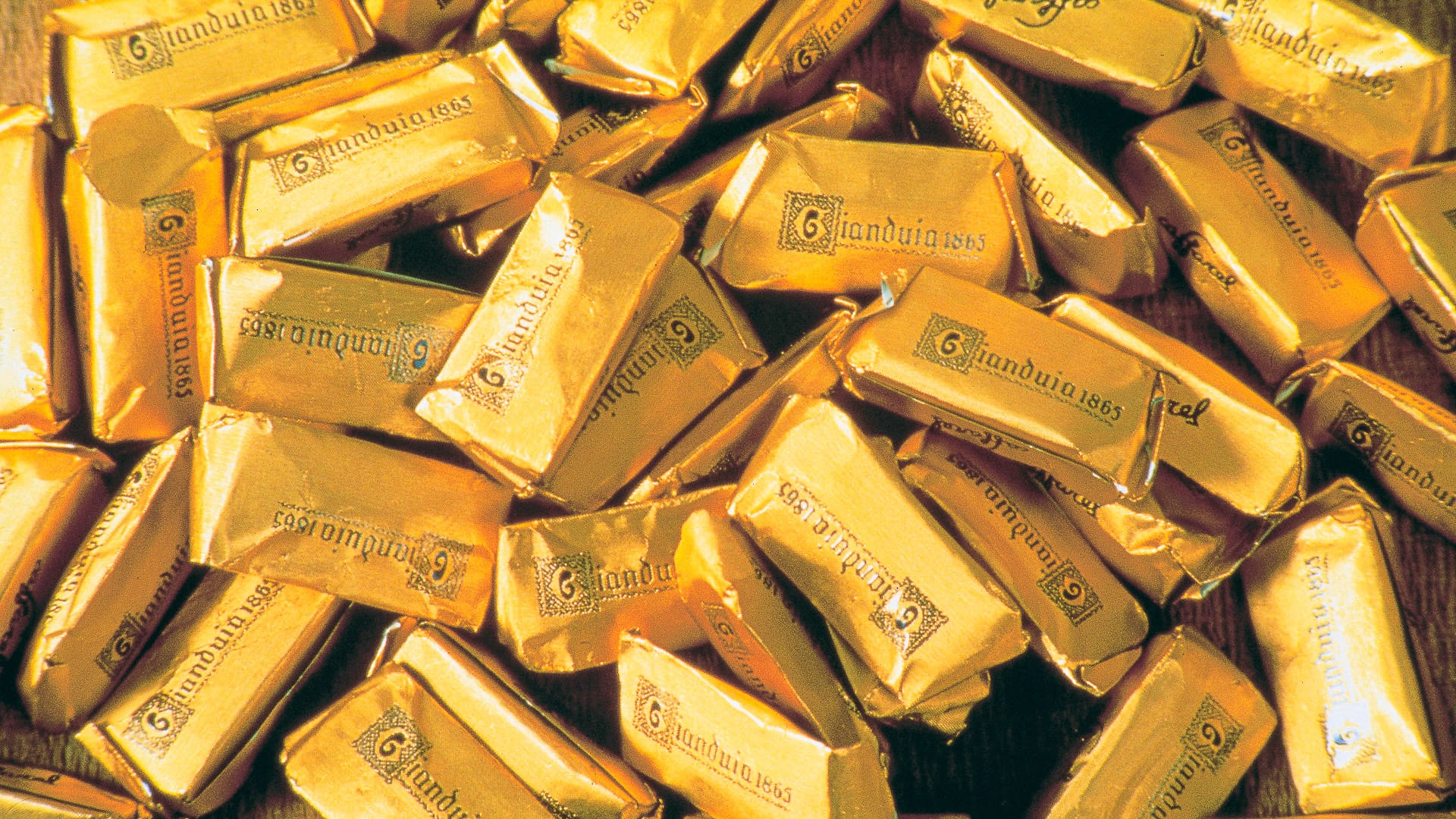
Gianduiotti, Turin’s famous hazelnut chocolate chocolates (photo credit: Turismo Torino e Provincia)
Are there water fountains, shops and restaurants?
Water is available in towns and villages, but high-altitude fountains may be seasonal or unreliable. Check with local tourist offices for up-to-date detailed information on water, shops and places to eat these can be found on the official Turismo Torino e Provincia website.
Which towns are worth spending time in?
Consider spending time in Turin and the main towns along the route, either before setting out or once the ride is complete. Each offers a different mix of history, food, mountain culture and opportunities for more riding.
Turin
The regional capital is worth exploring for its Baroque architecture, the Egyptian museum and historic cafés. It is also a convenient place to begin or finish the trip, with plenty of options for a relaxed pre-ride meal or post-ride celebration.
Avigliana
Avigliana has a medieval centre and two lakes surrounded by wooded hills. It is also a useful base for visiting the Sacra di San Michele before heading further into the mountains.
Susa
Susa has a long history, with Roman remains that include the Arch of Augustus. Its compact centre is also a good place to stop for traditional Piedmontese food before or after the ride.
Bardonecchia
Bardonecchia is surrounded by high peaks and is a useful base for riders interested in the Sommeiller, Jafferau climb and other high-altitude gravel cycling routes. The town has a lively outdoor atmosphere and a good range of services for cyclists.
Cesana
Cesana sits at a crossroads between several Alpine valleys and mountain passes. The nearby Vialattea and Monti della Luna areas offer open mountain landscapes and plenty of scope for further gravel riding.
Sestriere
At 2,035 metres, Sestriere sits at the highest point of the route. Its Olympic history, high-altitude setting and cycling facilities make it a natural place to pause before continuing the ride or to spend time once the loop is complete.
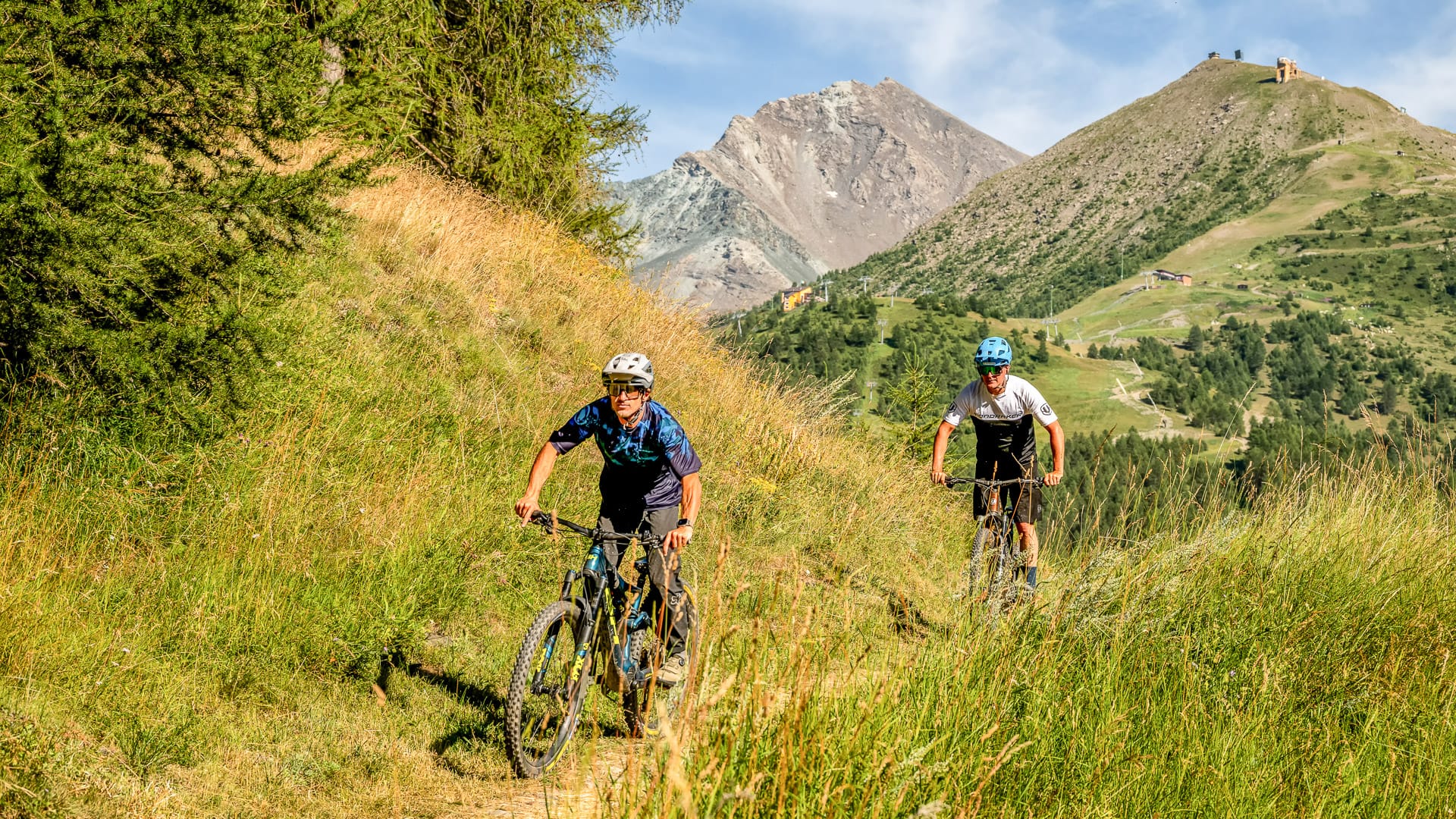
Cycling through the mountain landscape around Sestriere (photo credit: GPorracchia via Turismo Torino e Provincia)
Do you need to speak Italian?
Italian is useful, but English or French may also help in this border area.
What cycling rules should you know?
All roads are open to motorised traffic so ride within your limits and respect other road users. Use working front and rear lights, signal clearly, obey road signs and ride single file in a group. A high-visibility jacket or reflective bands are required in tunnels and on roads outside built-up areas after dark.
For more information on cycling rules in Italy, see the Italian Ministry of Infrastructure and Transport’s Highway Code, particularly the section covering cyclists (Article 182).
Are there toilets along the route?
Toilets are available in cafés, restaurants, mountain huts and public toilets in villages along the route.
Are there buses or other transport options along the route?
There is a public bus line along the route, the Arriva 285 and 272. However, the carriage of standard assembled bicycles is not always permitted, unless they are folded and stowed in the luggage compartment. For detailed information check out Arriva’s travel terms and conditions on the official website.
What safety issues should you be aware of?
The Val Susa Gravel Loop is a high-mountain gravel route, so do not treat it like a casual day ride. On the long gravel descents, fatigue in your hands, arms and shoulders can also become an issue, so take regular stops and wearing mitts/gloves can help.
These former military roads are shared with other users. Depending on the section and current restrictions, you may meet walkers, cyclists, horse riders and, where permitted, cars or motorbikes.
Make sure you are visible in low-light conditions, particularly in tunnels or if riding early or late in the day. Follow all signs and local restrictions, and keep the group compact and predictable when sharing the road with traffic.
Weather can change quickly in the mountains, even in summer. Check the forecast before each stage, carry suitable layers and be prepared to change your plans if conditions deteriorate. Powerful lights are also essential for tunnel sections, including the Galleria dei Saraceni.
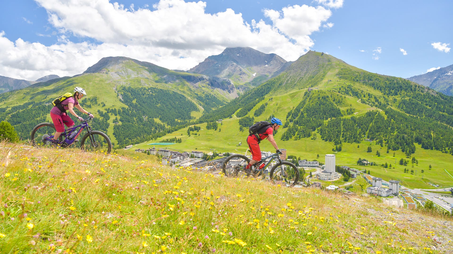
Cycling down from Sestriere (photo credit: Turismo Torino e Provincia)
What should you pack for the Val Susa Gravel Loop?
For this route, pack for a self-supported high-mountain gravel adventure.
Essential items include technical layered clothing, a waterproof shell, a windproof layer, gloves, thermal clothing for sudden weather changes, helmet, sunglasses, food, water, cash and card.
You should also carry powerful lights for tunnels, an offline GPS route, a repair kit and enough equipment to manage basic mechanical issues yourself. Shoes with grippy soles are useful for rough sections or any places where you need to walk.
For more help preparing for a multi-day ride, read our guide to what to pack for a cycling holiday.
Where can cyclists find out more?
For current route information, accommodation, bike hire, tourist office contacts and local cycling services, check Turismo Torino e Provincia before you travel.
Part 5: Turin as a base for Val Susa
How do you get to the Val Susa?
The Val Susa Gravel Loop starts and finishes in Avigliana, west of Turin and at the gateway to the Susa Valley.
Avigliana can be reached by regional train from Turin, making it a practical starting point for riders travelling without a car.
Travelling from Turin Airport
It is possible to travel from Turin Caselle Airport to Avigliana using the regional train network and Turin’s metropolitan railway services.
Travel from Turin Caselle Airport to Torino Porta Nuova, then take the SFM3 service towards Susa or Bardonecchia and get off at Avigliana.
Check current train times before travelling here.
If travelling by car from Turin Airport, allow around 30 minutes to reach Avigliana, depending on traffic.
Taking your bike on the train
Fully assembled bikes, including e-bikes, can be carried on regional trains displaying the bike symbol, subject to space being available. Bikes must be no more than two metres long.
A separate bike ticket is required. This can either be a €3.50 bike supplement, valid until 11.59 pm on the date shown, or another second-class single ticket covering the same journey as the passenger ticket.
For further information about taking a bike on the train, visit the Trenitalia website.
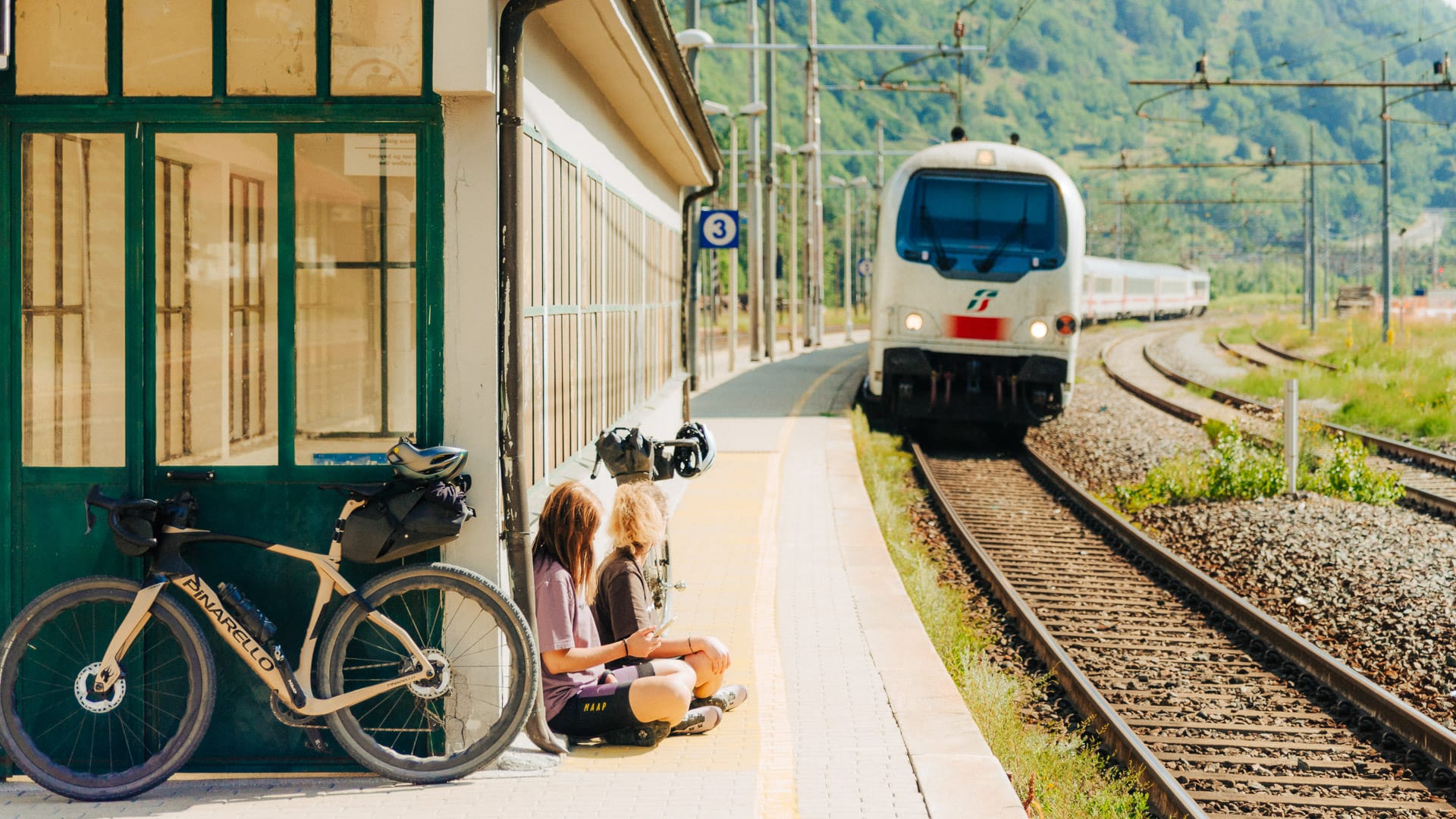
Train passing through Salbertrand (photo credit: F.Ravassard via Turismo Torino e Provincia)
Parking in Avigliana
At the time of writing, there are several parking options in and around:
- Free parking near Avigliana railway station.
- Free car parking on Via Pontetto, near Lago Grande, with paid parking for motorhomes.
- Free car parking on Corso Laghi, near the tourist office.
- Free parking near Lago Piccolo.
- Free public parking and time-limited parking spaces requiring a parking disc near the main services in the town centre.
Travelling by bus
Full-size assembled bikes are not always permitted on local Arriva or GTT buses. If you plan to travel with your bike on an Arriva bike bus, you must book at least 48 hours in advance by emailing arriva@arriva.it. Folding bikes may be accepted if they are folded and stored in the luggage compartment.
For riders travelling with an assembled gravel bike, the train is the better choice.
Why is Turin a good base for Val Susa?
Turin is one of Piedmont’s most practical bases for cyclists. It combines the services of a major city with quick access to Turin hills, valleys and high mountain roads.
For riders planning the Val Susa Gravel Loop, this is especially useful. Turin gives you accommodation, transport links, bike hire, repair shops, cafés, museums and plenty to do off the bike, while Val Susa lies just to the west, opening the way to Alpine gravel and former military roads.
This makes the region a good choice if you want a bicycle tour that combines city access with a serious mountain ride.
Can you hire bikes in Turin?
Yes. Bike hire, repair shops and cycling services are available in Turin and across the wider region. Mountain, touring and city bikes are generally easier to find, while road bikes and gravel bikes may need to be arranged in advance.
If you need a specific bike type, size or gearing for Alpine riding, book before you travel. This is especially important if you are planning to ride the Val Susa Gravel Loop, where a suitable gravel bike or mountain bike setup is essential.
What kind of cycling can you do around Turin?
The Turin region works for different kinds of cycling.
- Road cyclists can target classic climbs such as Superga, Colle delle Finestre and Colle del Moncenisio.
- Gravel riders and mountain bikers can head towards Val Susa, Bardonecchia and Via Lattea for gravel tracks, old military roads and high-altitude mountain routes.
This article focuses on the Val Susa Gravel Loop, one of the area’s more demanding gravel cycling routes.
For more information on cycling routes in Turin check out our in-depth guide to the Piedmont region.
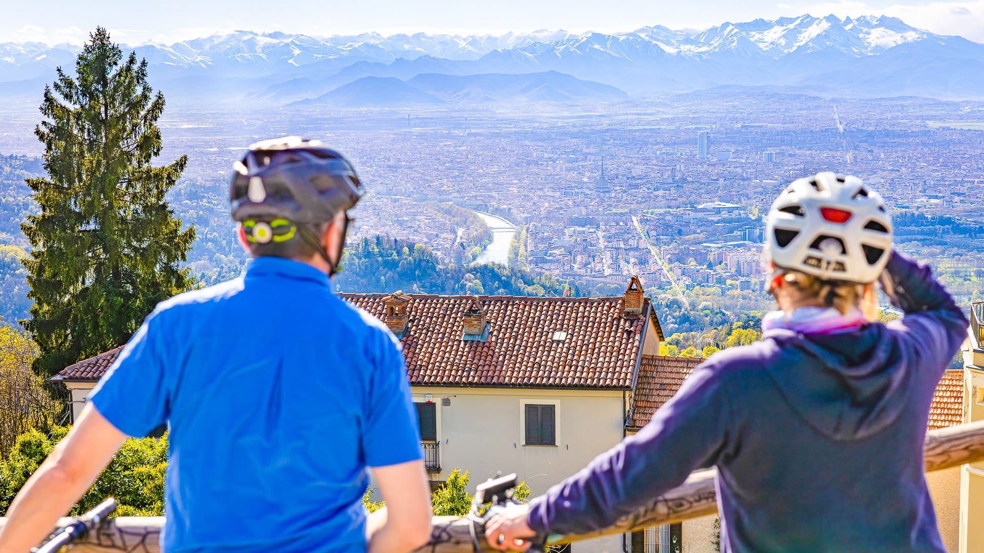
Enjoying the views from Superga (photo credit: EMelchiori via Turismo Torino e Provincia)
What is there to do off the bike?
Turin is not just a launchpad for the ride. It is also a strong city break destination, with historic cafés, museums, royal residences, including the UNESCO-listed Savoy Royal Residences and Royal Palace of Turin, Baroque architecture and a well-known food and coffee culture.
For cyclists riding the Val Susa Gravel Loop, you can spend time in Turin before or after the route, or use it as a practical arrival point before heading west into the mountains.
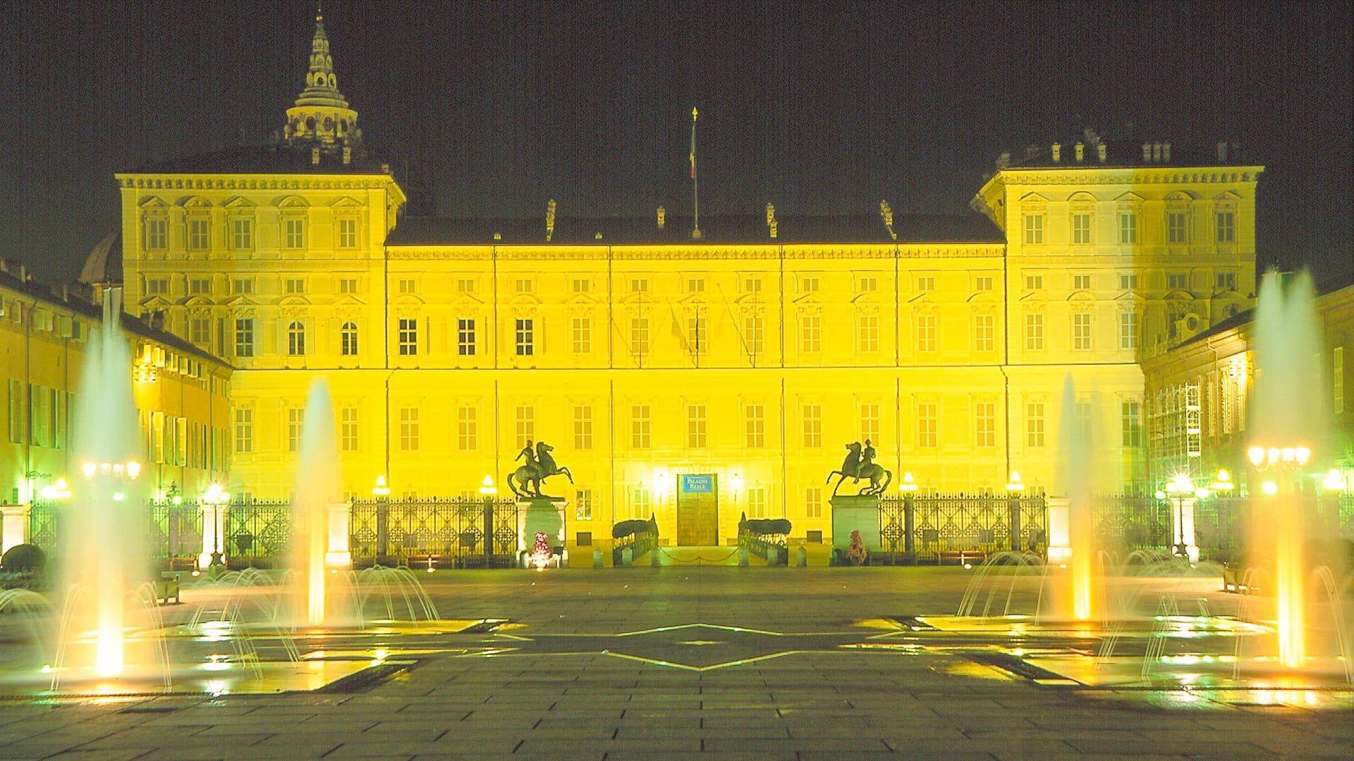
Palazzo Reale in piazza Castello (photo credit: Turismo Torino e Provincia)
What’s next?
- Cycling Turin and Cuneo, Piedmont, featuring the famous mountain cols such as Col d’Izoard, Col Delle Finestre, Colle del Moncenisio and more.
- Gravel cycling Piedmont (+ Cuneo’s secret strade bianche), for more insights on the Alta Via del Sale.
- Our pick of the best gravel bike holidays, for more gravel cycling inspiration such as Mont Ventoux, Sardinia and more.
Got a question for Alberto?
Fill out this form and we will send it to Alberto. We aim to get you an answer within 24 hours where possible!Alberto Surico is Head of Outdoor Tourism at Turismo Torino e Provincia.
His role is to help more people discover Torino and its province as an outdoor destination. Cycling is a big part of that. From alpine climbs and quiet valleys to routes linking culture, food and history, the area has huge potential for riders.
At Turismo Torino e Provincia, Alberto promotes the region to visitors, tour operators and media in Italy and abroad. His aim is simple: to show why Torino is a brilliant place to ride, stay longer and explore more.
Photo credit: Giorgio Gulmini
First Published: 12 August 2026
The contents of this website are provided for general information purposes only. It is not intended to amount to advice and you should not rely on it. You should carry out your own due diligence and risk assessments and take professional advice. Views expressed by interviewees or other users of this website do not necessarily represent our views. We make no representations, warranties or guarantees, whether express or implied, that the content on our website is accurate, complete or up to date. If you use any information or content on this website, download from, or otherwise obtain content or services through our website, it is entirely at your own discretion and risk. Epic Road Rides Ltd disclaims all liability and responsibility arising from any reliance placed on the information and content on this website. Find out more here.
Comments