

Cuneo sits in the south-west corner of Piedmont, a place long loved by Italian cyclists but still relatively undiscovered by riders beyond Italy and its closest neighbours.
Set between the Alps and the Mediterranean, the Cuneo region offers a rare mix of terrain: high mountain passes used by the Giro d’Italia, quiet valley roads and an extraordinary network of historic strade bianche gravel routes. These former military and trade roads now provide some of the most memorable off-road riding in northern Italy.
The Alta Via del Sale is the best known of Cuneo’s strade bianche. This picturesque, high-altitude route links the Alps to the sea and is often the starting point for cyclists planning a trip to the area. However, it is far from the only option, and one of the real highlights of cycling in Cuneo is discovering the range of routes across the region.
Planning a cycling trip in this part of Italy can take a bit of thought. The terrain is mountainous, some routes are remote, and knowing where to base yourself and which areas to focus on can make a big difference to your experience.
To help, we spoke to Gabriella Giordano, Chair of ATL del Cuneese, who shares her insights on cycling in the region, from the best places to ride to practical tips for planning your trip.
Time to delve into part of Italy you didn’t know existed: enjoy!

Gabriella Giordano has served on the board of ATL del Cuneese since 2014, giving her a direct view of the Cuneo area’s development into a recognised cycling and outdoor destination.
During this time, cycling tourism has become an increasingly important part of the region’s tourism identity, supported by its mountain landscapes, sporting heritage, outdoor experiences and specialist hospitality services.
In 2025, she was appointed Chair of ATL del Cuneese. In this role, she works to strengthen the destination’s international visibility and support the continued development of sustainable, experience-led tourism across the region.
Always check current travel information and advice. For visitors from the UK, the UK government travel information pages are here.
Table of contents
This article contains a lot of useful information. To help make it more digestible, we’ve broken it down into several parts:
- Part 1: Why cycle in Cuneo?
- Part 2: Best strade bianche in Cuneo
- Part 3: Alta Via del Sale
- Part 4: Practical tips
Part 1: Why cycle in Cuneo?


A destination with real variety
In my opinion, the Cuneo area offers a complete and authentic experience for cyclists.
You’ll find demanding Alpine climbs, including iconic passes such as Colle dell’Agnello and Colle Fauniera, alongside easier routes through valley floors and lowland areas.
There are also gentler itineraries such as the Via della Pietra cycle route, riverside paths like the Sentiero sul Maira, and routes through the Parco Fluviale Gesso and Stura.
This variety allows you to tailor your trip depending on what you are looking for, whether that is a sporting challenge or a more relaxed ride surrounded by natural scenery.
High-altitude gravel routes and historic roads
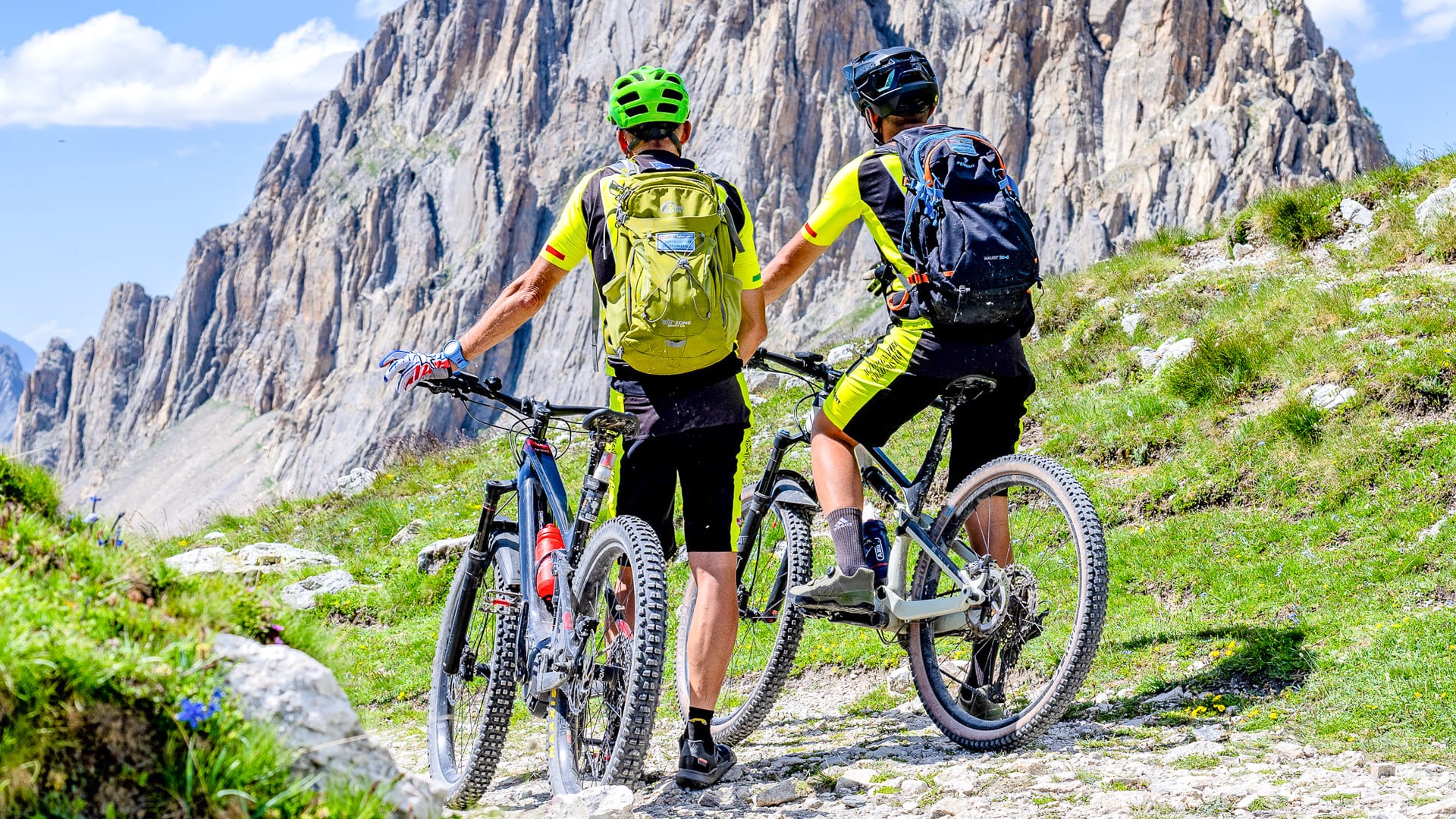
One of the defining features of the area is its network of high-altitude dirt roads.
These include historic military and trade routes that now form some of the most interesting strade bianche bike riding in the Alps. Among them is the Alta Via del Sale, one of the best-known off-road routes in the region.
These routes combine altitude, history and wide open landscapes, offering a very different experience from typical cycling destinations.
Well set up for cycling
Outdoor activities are vital to tourism in the Cuneo area. There is a rich calendar of high-profile national and international sporting events in the region, including
- GF Étape Piemonte by Tour de France (31 May, Maritime Alps, starting in Entracque)
- Giro d’Italia Women – Grand Final (7 June, Saluzzo–Saluzzo, Monviso Valleys)
- La Via del Sale MTB Race (21 June, starting in Limone Piemonte)
- GF La Fausto Coppi (28 June, Cuneo–Cuneo Alps–Cuneo, crossing Colle Fauniera
- L’Étape Mondovì by Tour de France | GF Alpi del Mare (20 September, starting in Mondovì).
This means that cycling is at the heart of tourism for the area and is well supported by businesses who understand the needs of cyclists. These include bike-friendly accommodation, rental services, repair workshops and logistical support. This makes the area manageable even for international visitors who may not want to organise everything independently.
Authentic riding without the crowds
Another reason to visit the Cuneo area is its authenticity.
It is still possible to cycle in a landscape that feels hidden from mass tourism. The mountain roads are often used for major cycling events and retain a strong sporting identity while also offering fantastic riding.
Culture and food as part of the experience
Cycling in Cuneo is not just about the riding.
You’ll also get a feel for local traditions, with chances to try local delicacies like fresh cheeses, cured meats and regional wines along the way. For more information, check out ATL del Cuneese’s food page.
Part 2: Best routes for Strade Bianche in Cuneo
Here are three of my favourite routes for riding strade bianche in Cuneo, each offering something a bit different, from high-altitude tracks to more relaxed countryside routes.
Below is a map of the region, which includes several places featured in this article. Hover over the map pins to see the names of places.
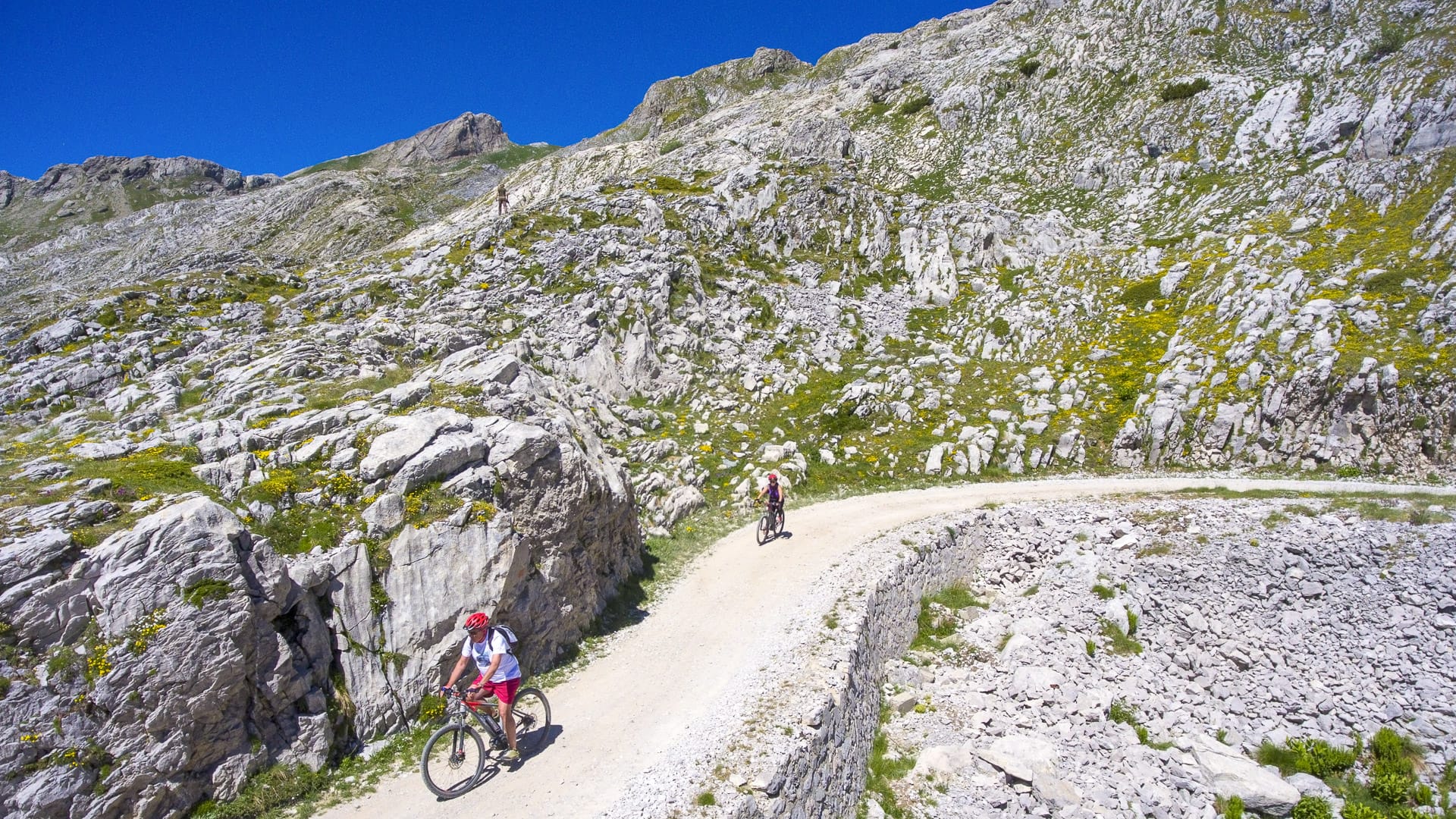
Alta Via del Sale and Limone Piemonte
Key statistics
111 kilometres
2,400 metres of elevation gain
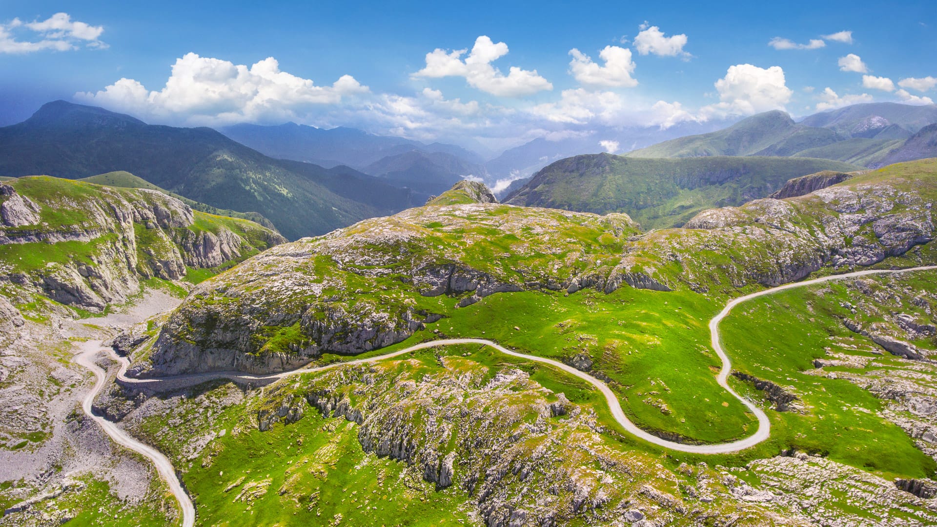
The Alta Via del Sale is one of the most well-known cycling routes in the province of Cuneo.
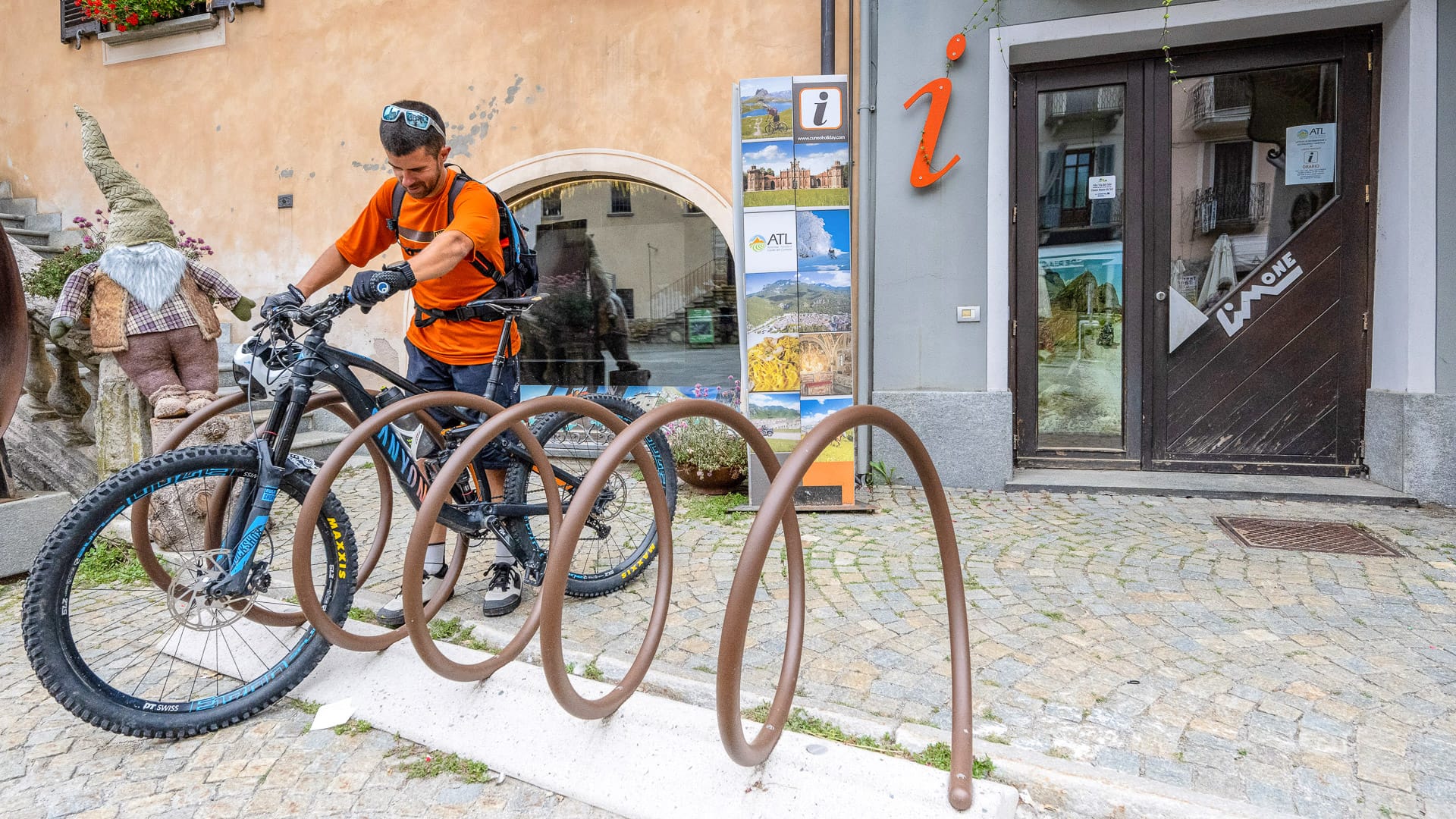
Limone Piemonte is a popular starting point for the route.
Located on the border between Piedmont and Liguria, Limone Piemonte is an Alpine destination that provides easy access to this high-altitude route, which combines history, landscape and a sense of adventure.
We cover the Alta Via del Sale route in more detail below.
Riding conditions and difficulty
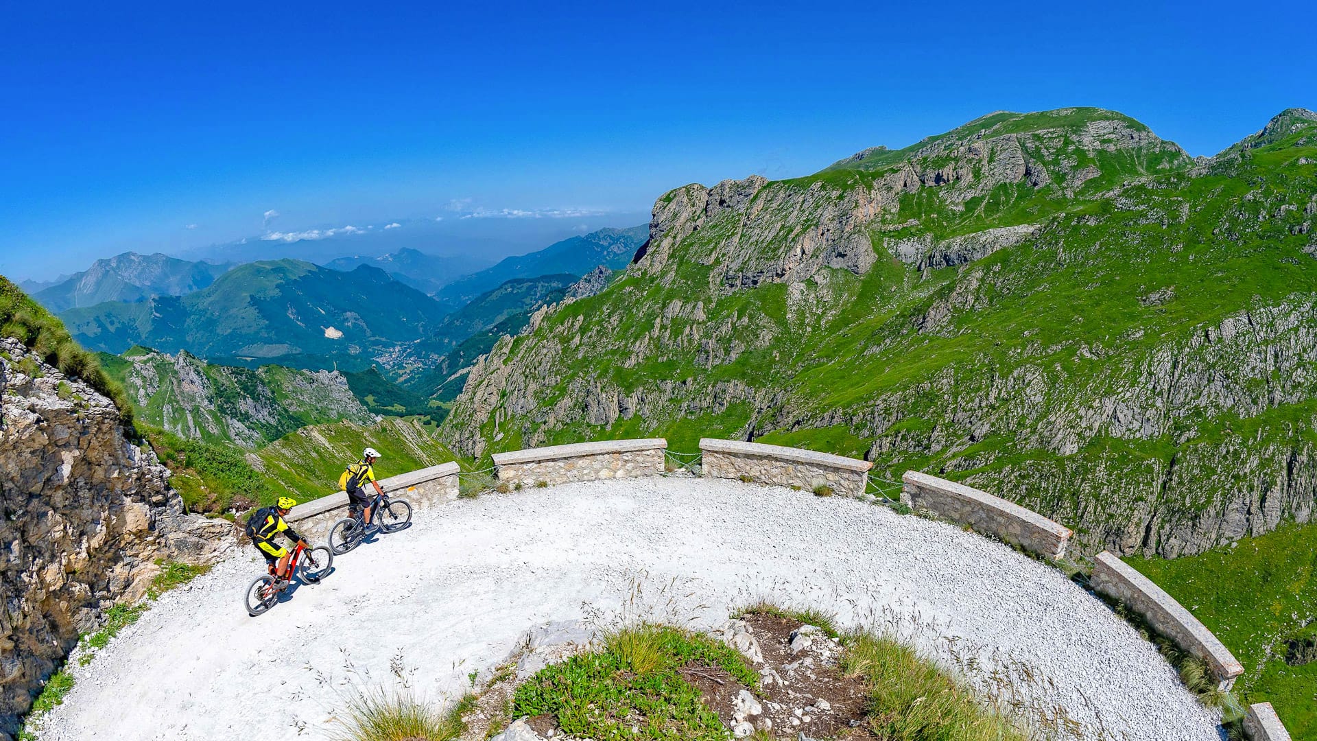
The route follows ancient commercial and military roads between 1,800 and 2,200 metres above sea level, with wide panoramic views stretching from the Maritime Alps towards the Ligurian Sea. The surface is mainly compact dirt, with gravel sections and some more technical stretches. For this reason, a mountain bike, either traditional or electric, is a good choice.
Overall the route is rated as medium to high difficulty, thanks to its length and altitude rather than any steep gradients.
Landscape and highlights
On the Alta Via del Sale, you’ll tackle switchbacks on old military tracks that cut across the mountains.
Limone Piemonte adds to the experience with bike-friendly accommodation, rental services and the option of guided rides. Food is also an important part of the experience here. The mountain gastronomy of the Cuneo Alps is closely tied to its individual valleys and Alpine traditions, with Piedmontese dishes including polenta and bagna caoda, as well as Nostrale cheese from the Vermenagna Valley. For more on the flavours and food traditions of the Vermenagna Valley, visit ATL del Cuneese website.
What makes it special?
What makes this area stand out is the sense of freedom and immersion in nature. You ride far from traffic, surrounded by open landscapes, in one of the most distinctive Alpine environments in northern Italy. It’s incredible.
More information
Check out ATL del Cuneese’s website for more details on the Alta Via del Sale route.
Limone Piemonte Tourist Office (photo credit: R. Croci – ATL del Cuneese)
Sentiero Landandè and Mondovì
Key statistics
47 kilometres
1,613 metres of elevation gain
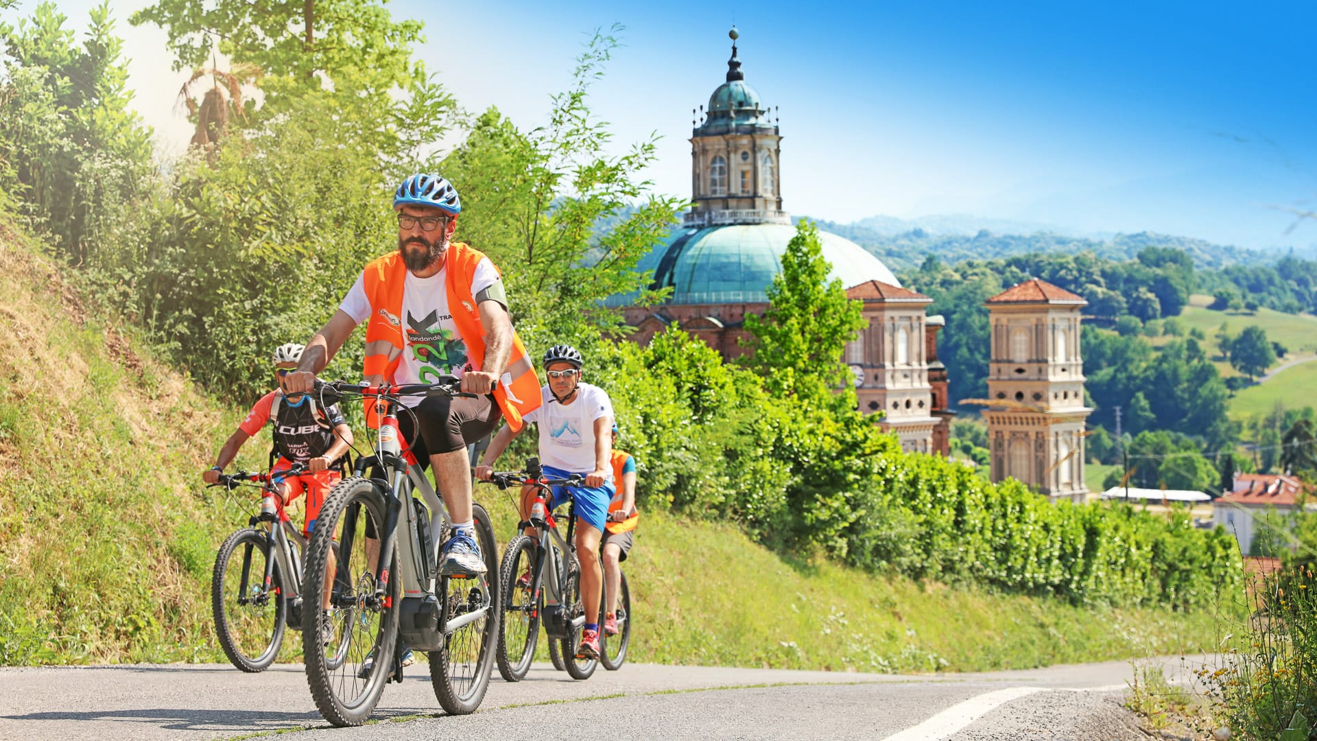
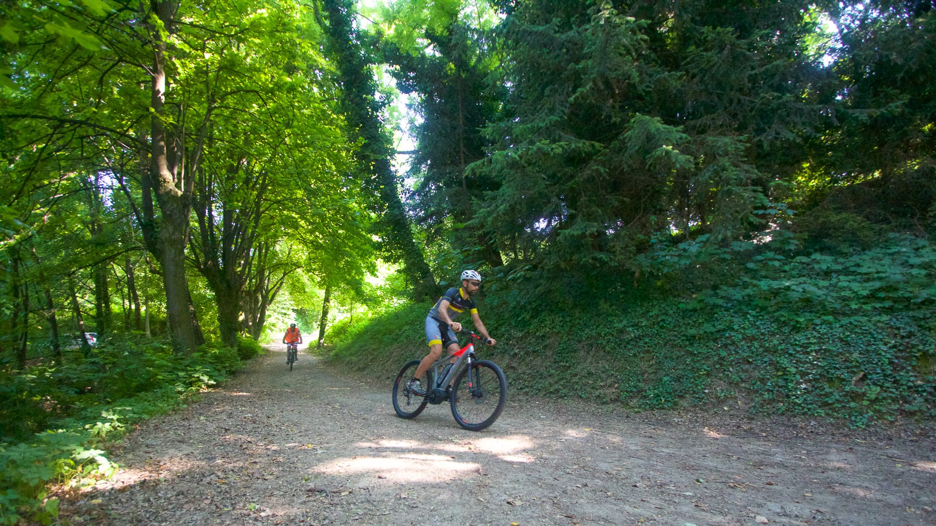
The Sentiero Landandè is a network of lesser-known but highly enjoyable routes, with the town of Mondovì acting as a convenient base.
The riding is through varied landscape of forests, hills and rural areas.
Riding conditions and difficulty
The route surface is mixed, with unpaved sections alternating with secondary asphalt roads. It is best suited to gravel bikes and mountain bikes, including e-bikes, and is less suitable for standard road bikes. The difficulty is moderate, with manageable elevation but some more technical sections that require good bike handling skills.
Landscape and highlights
Riders pass through small villages such as Vicoforte, Briaglia and Niella Tanaro, as well as unspoilt natural areas.
There are also cultural highlights along the way. These include small medieval chapels with frescoes and the Sanctuary of Vicoforte, which has the largest elliptical dome in the world and can be visited on a guided tour.
Mondovì itself adds another dimension, with its historic centre in the Piazza district, set on the Monteregale hill, along with museums and other cultural sites.
What makes it special?
This is an ideal area for those looking for a quieter, more contemplative cycling experience, where the focus is on exploring the landscape at a slower pace.
Sentiero Landandè path (photo credit: G. Mignone – ATL del Cuneese)
Gardetta Plateau
Key statistics
27 kilometres
250 metres of elevation gain
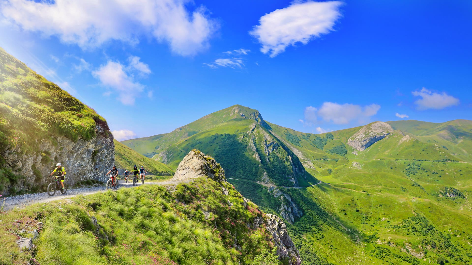
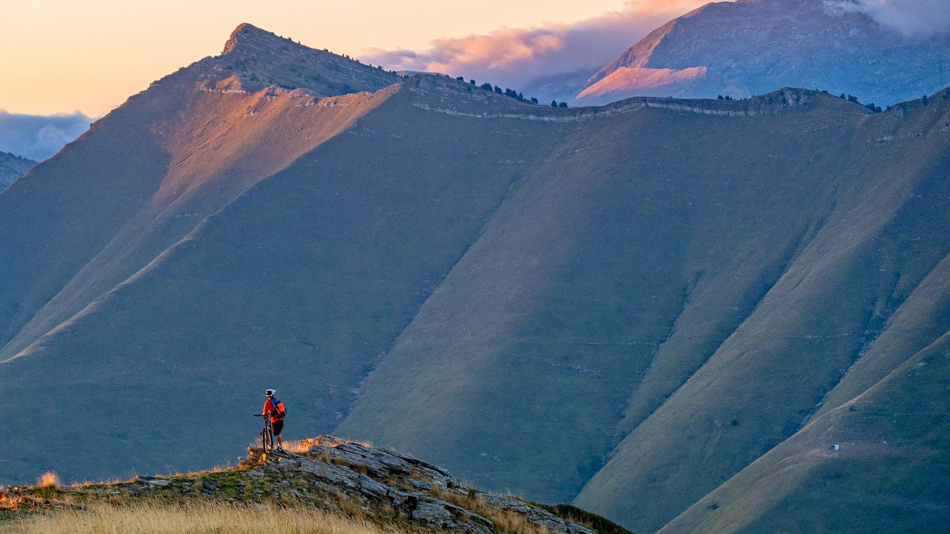
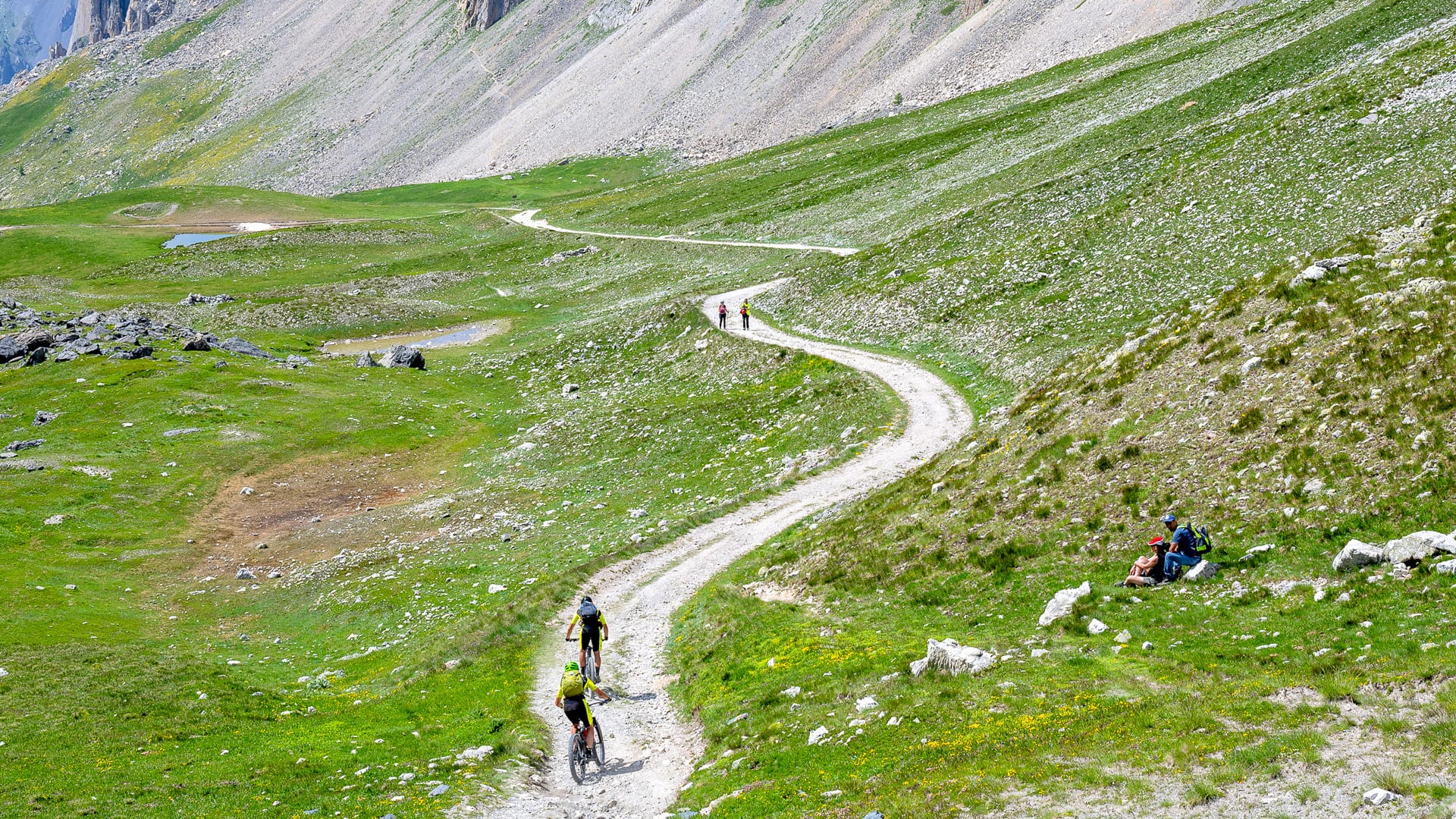
The Gardetta Plateau is one of the most distinctive high-altitude cycling experiences in the Cuneo area.
Located between Maira, Stura and Grana Valleys, the plateau is known for its wide open spaces, soft contours and varied colours, creating a landscape that feels very different from more rugged Alpine terrain.
Riding conditions and difficulty
The routes here follow unpaved military roads and pastoral tracks, with some rougher sections. A mountain bike or e-MTB is the most suitable choice. The difficulty is medium to high, mainly due to the altitude, which exceeds 2,000 metres, and the length of the routes.
Access is usually via Canosio and Colle del Preit, or from Colle di Valcavera near Colle Fauniera. Both involve demanding climbs on asphalt before reaching the plateau.
Landscape and atmosphere
Once at the top, the landscape opens out into wide, quiet spaces where you can ride with very little disturbance, often in near-total silence.
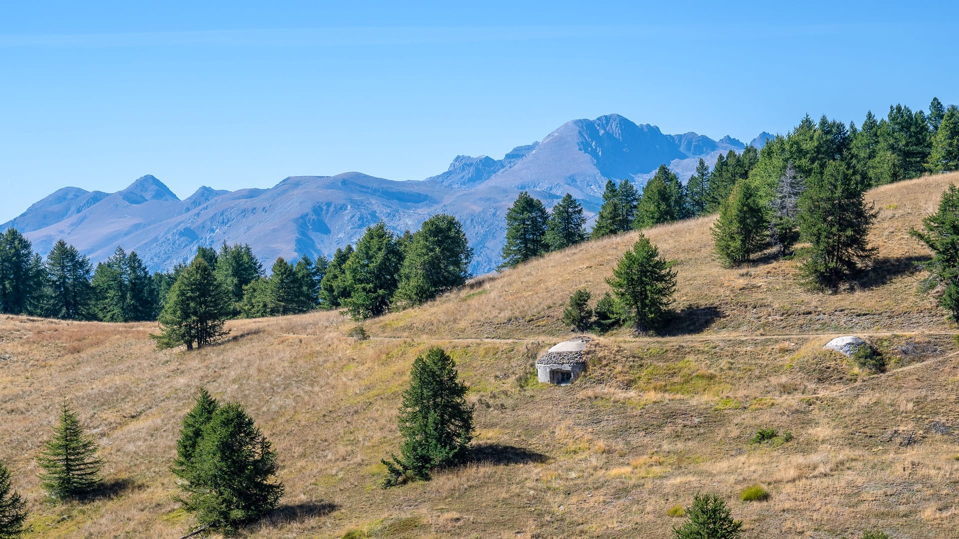
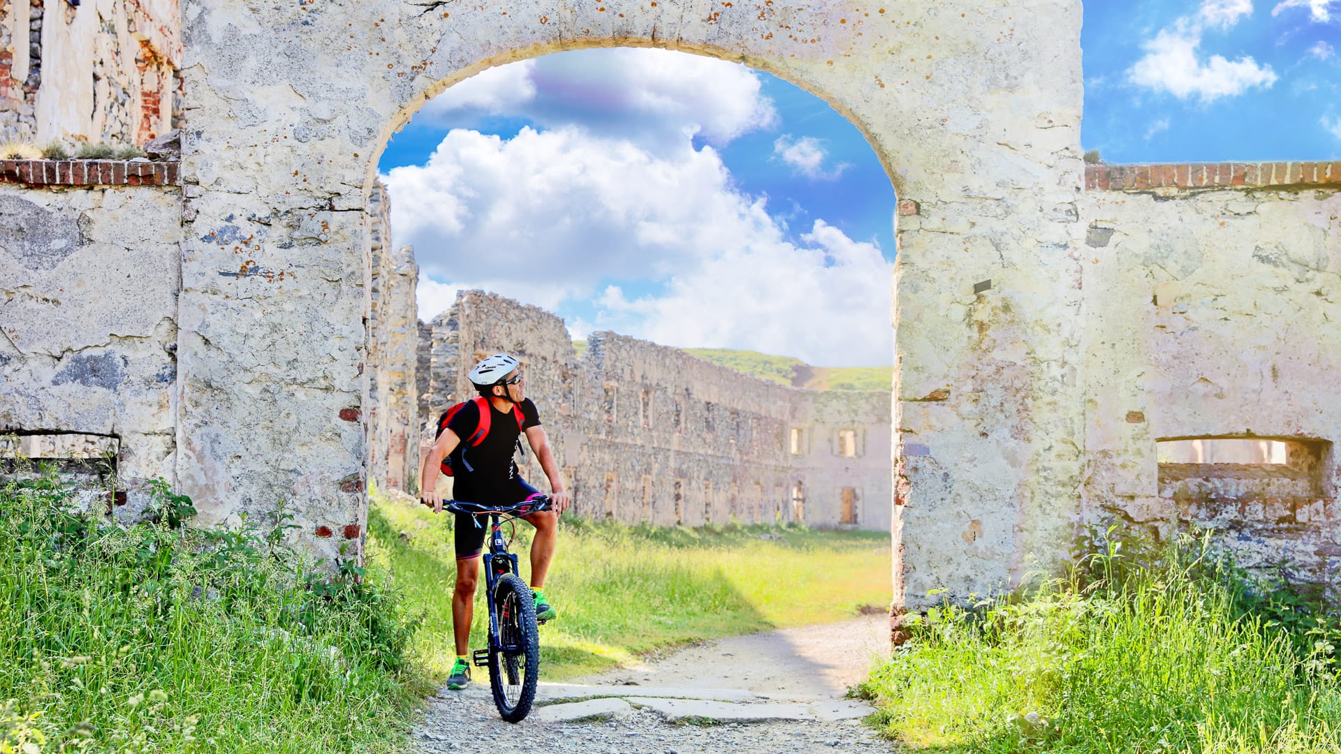
The area also has a strong historical character, with barracks, fortifications and old military tracks that reflect its past strategic importance. Many of these remains are found on and around the Gardetta Plateau, particularly along the old military roads linking Colle del Preit, Colle di Valcavera, Colle della Gardetta and Colle Bandia.
Examples include the Bandia Barracks near Colle Bandia, the Escalon Shelter/Vittorio Emanuele I Barracks around Passo della Gardetta, and former barrack structures at Prato Ciorliero. There are also scattered bunkers, shelters and defensive positions near the mountain passes and ridgelines between the Grana, Stura and Maira valleys.
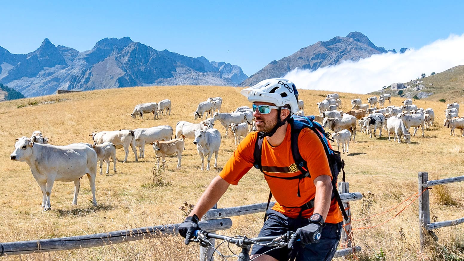
The experience can be combined with stops in mountain refuges and small Alpine villages in the surrounding valleys, where local food traditions are still very much part of daily life. Must-try local specialities include Sambucano lamb, Castelmagno cheese in Valle Grana, the food traditions of Valle Grana and the flavours of Valle Stura.
For more information check out ATL del Cuneese’s food page.
What makes it special?
What makes the Gardetta Plateau particularly special is the sense of scale and isolation. It is a place where you can experience the mountains in a more essential way, away from heavy infrastructure and large numbers of visitors.
Gardetta Plateau (photo credit: R. Croci – ATL del Cuneese)
Part 3: The Alta Via del Sale
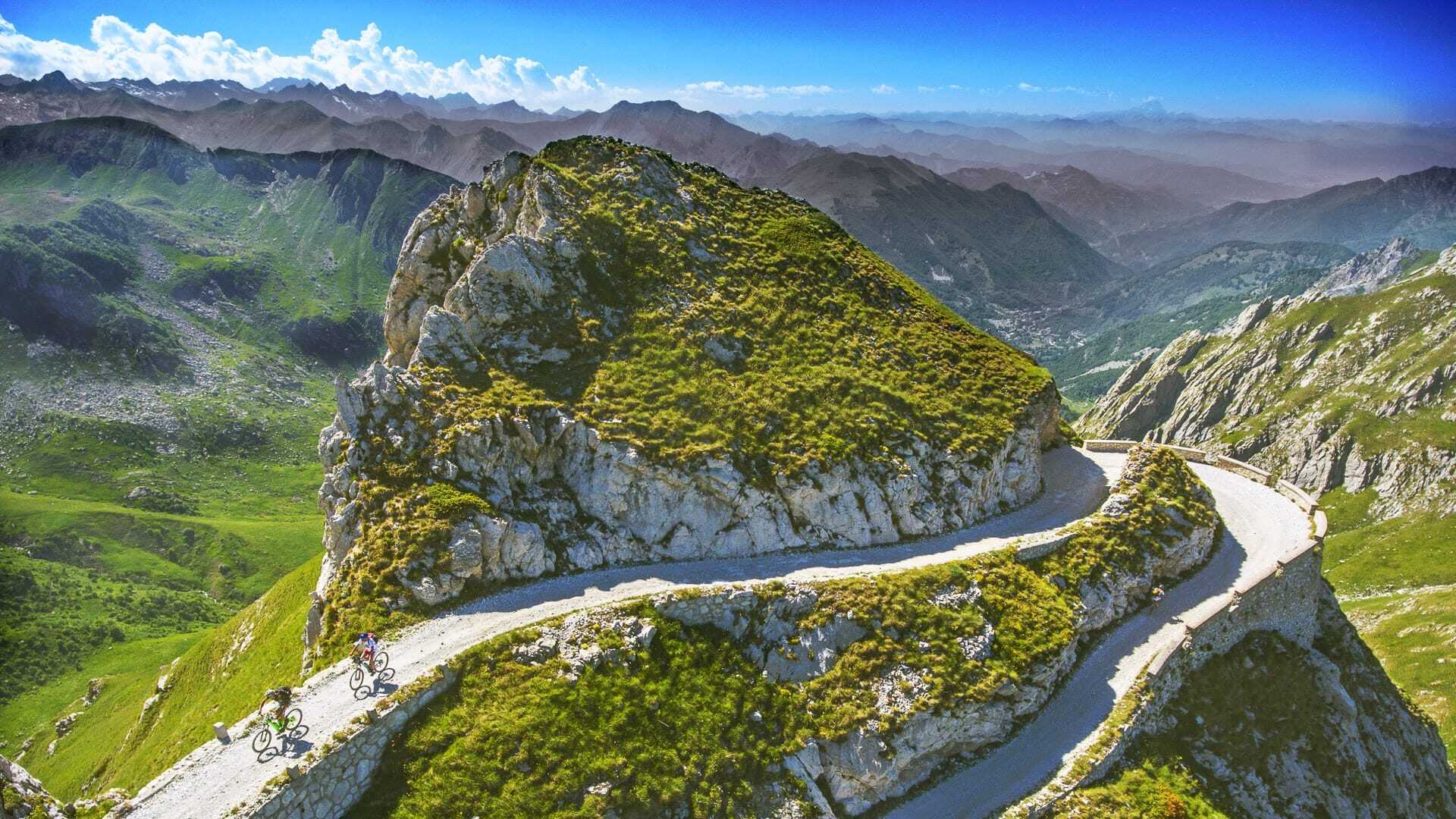
The Alta Via del Sale is one of the standout routes in the province and the wider Alps, linking the mountains all the way down towards the Mediterranean. It’s the kind of ride that gives you a bit of everything, long stretches at altitude, gravel tracks and constantly changing scenery along the way and therefore, in need of a detailed overview.
The Alta Via del Sale is one of the standout routes in the province and the wider Alps, linking the mountains down towards the Mediterranean. It’s the kind of ride that gives you a bit of everything, with long stretches at altitude, gravel tracks and constantly changing scenery along the way.
Cyclists should note that a ticket is required for the section between the Limone Piemonte gate and the Briga Alta gate. More information on this below.
What is the Alta Via del Sale?
The Alta Via del Sale is one of the most iconic off-road cycling routes in the Alps.
It follows a network of historic commercial and military roads built between the 19th and 20th centuries, originally used to transport salt from the Ligurian coast into the Alpine hinterland. You may see it called the haute route du sel – the French name, since the route crossed both France and Italy.
Today, it has become a benchmark route for high-altitude cycling tourism combining landscape, history and a strong sense of adventure.
Military bunkers of the “Cima di Marta” fortified system (photo credit: R. Croci – ATL del Cuneese)
Where does the route start and finish?
The classic route begins in Limone Piemonte, climbing up to Colle di Tenda, the historic mountain pass linking Italy and France.
From here, the route follows the Alpine ridge towards Monesi di Triora. However, the itinerary described here continues beyond Monesi, descending through Liguria all the way to the Mediterranean, finishing in Ventimiglia.
This transition from high Alpine terrain to the coast is one of the defining features of the route, creating a continuous journey through very different environments.
Please give us a route overview?
The full route from the Alps to the sea connects Limone Piemonte (1,004 m) with Ventimiglia on the Ligurian coast.
How does the route start?
The first section climbs towards Colle di Tenda (1,871 m) on a mix of paved and connecting roads. From there, the main Alta Via del Sale begins, staying at high altitude between around 2,000 and 2,230 metres along the border between Italy and France.
How is the route structured?
The route is usually split into two stages, with an overnight stop at Rifugio Don Barbera (2,079 m), located in the Marguareis Natural Park. This refuge is a key point on the route and also offers e-bike charging facilities.
Other charging points are shown in the brochure and include the following locations:
Rifugio Don Barbera can be booked directly via the refuge website. If it is full, Rifugio La Terza and Rifugio Allavena also offer overnight accommodation along the route.
What are the stages like?
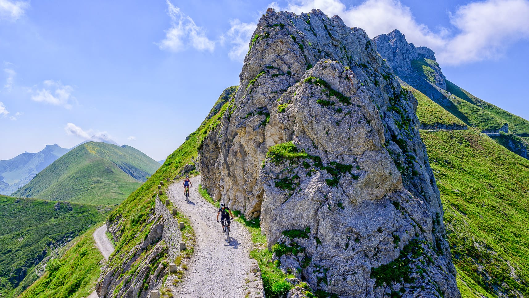
The first stage is approximately 31 km with around 1,600 metres of climbing. It passes through high mountain terrain, including Colle Campanino, the Boaria hairpin bend and the karst landscape of the Conca delle Carsene.
The second stage is longer and more demanding, around 82 km, with approximately 800 metres of climbing and nearly 2,900 metres of descent towards the sea. Riders who prefer to spread the route over three days can stay at refuges along the route, including Rifugio Don Barbera, Rifugio La Terza and Rifugio Allavena. The route brochure also highlights additional services available in the area, including overnight stays, meals, e-bike rental, guides, luggage transport and customer transfers.
How does the route finish?
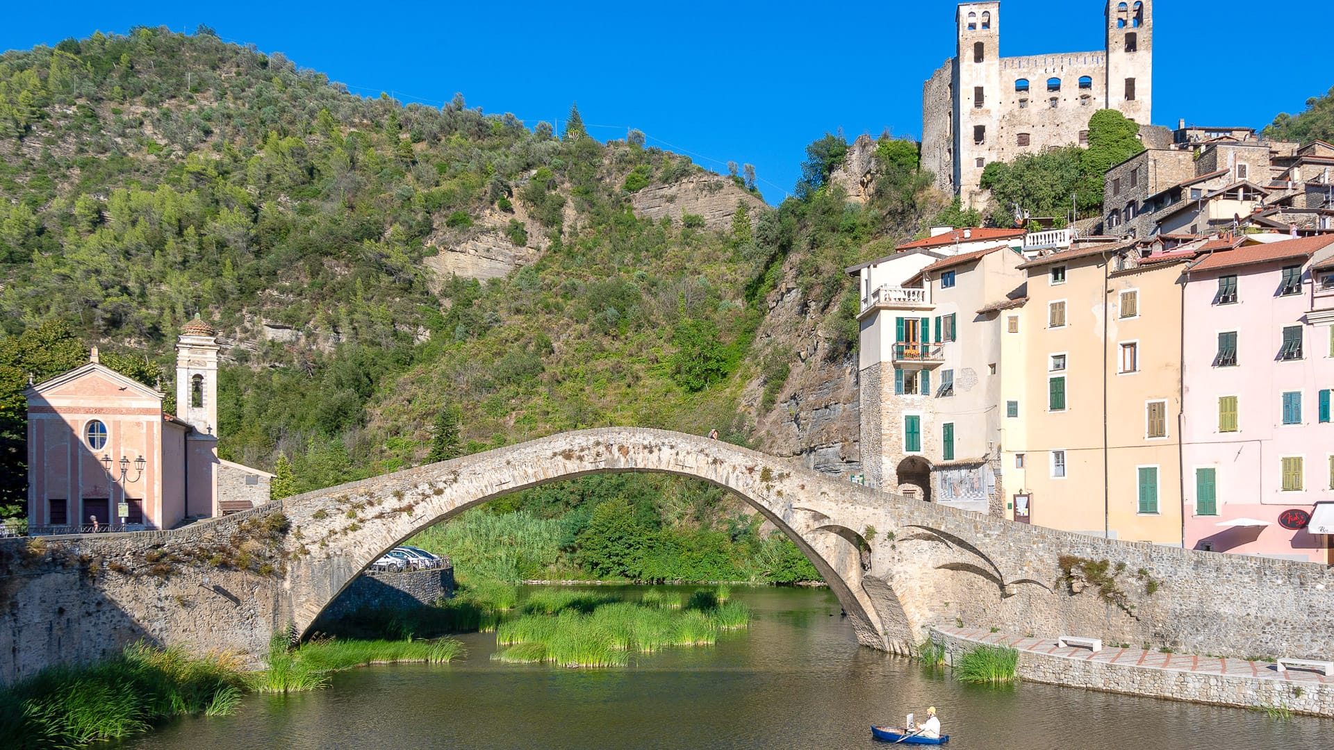
After the highest point at 2,239 metres, the route descends through the Bosco delle Navette, before continuing towards Colle Melosa. From here, the terrain gradually becomes smoother, with more paved sections as you pass through the Nervia Valley and villages such as Pigna, Isolabona and Dolceacqua, before reaching the coast at Ventimiglia.
Upper Salt Road, the Carsene Area (photo credit: G. Mignone – ATL del Cuneese)
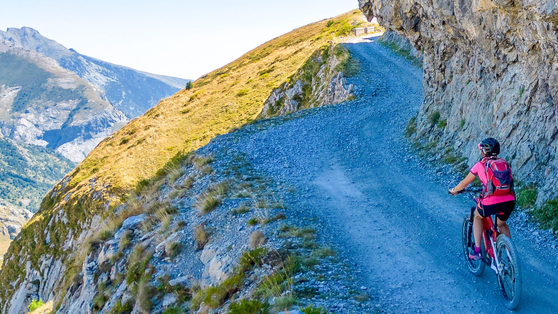
What are the surfaces and difficulty like?
The route is mainly unpaved, with compact dirt roads, gravel sections and some rougher stretches, combined with occasional paved sections.
There is very little technical singletrack, but the overall difficulty is medium to high.
The main challenges come from the altitude, exposure to weather, route-finding and the limited availability of water and services.
A GPS track is essential, and riders should be comfortable managing long distances in remote terrain.
Is it signposted?
The route is marked and regulated, with signage along the way, particularly in more exposed areas.
Pedestrians can use the road free of charge, while cyclists pay €1. On Tuesdays and Thursdays, the road is reserved for cyclists and walkers, and motor vehicles are not permitted.
Access is controlled at the Limone Piemonte and Monesi di Triora gates. There are toll booths at both entrance points. A gatekeeper is also available for traffic management and technical information.
More information can be found on the Alta Via del Sale website.
How do you get there?
The main access point is Limone Piemonte. It can be reached:
- by train from Cuneo and Turin
- by car from Cuneo via the Vermenagna Valley
The route is seasonal and is generally open from late June to October, depending on snow conditions.
What bike do you need?
A mountain bike or e-MTB is the best option for this route.
A gravel bike can be used by experienced riders, but a road bike is not suitable due to the surfaces.
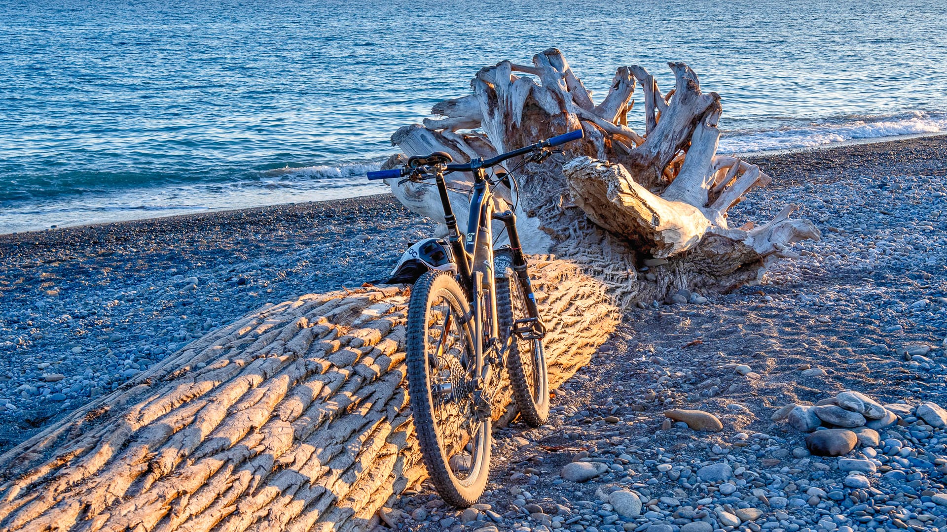
Ventimiglia beach on the Ligurian coast (photo credit: R. Croci – ATL del Cuneese)
What are the highlights of the route?
One of the most striking aspects of the Alta Via del Sale is the variety of landscapes and historical features along the way.
- Colle di Tenda fortifications are a key highlight, with a system of high-altitude military structures that reflect the strategic importance of this Alpine pass.
- The Boaria hairpin bend is one of the most recognisable features of the route, a suspended curve built into the mountainside.
- The Conca delle Carsene offers a very different environment, with a karst plateau that has an almost lunar appearance.
- Further along, the Bosco delle Navette marks the transition from Alpine to Ligurian landscapes, with dense forest and a different atmosphere.
Throughout the route, there are also viewpoints where, on clear days, you can see the Mediterranean Sea, which adds to the uniqueness of the experience.
What makes it special?
The Alta Via del Sale is more than just a mountain bike route.
It is a journey that combines history, landscape and a sense of progression, moving from high mountain ridges down to the sea.
The combination of altitude, scale and changing environments makes it one of the most distinctive cycling experiences in Europe. Similar “salt road” heritage has inspired cycling events elsewhere in Italy, such as the Gran Fondo Via del Sale in Cervia.
Part 4: Practical tips for planning your trip
When is the best time to ride?
The high-altitude strade bianche in the Cuneo area are generally rideable from late spring to early autumn.
The best period is typically from June to September, when snow has cleared from higher elevations and weather conditions are more stable. This is when routes such as the Alta Via del Sale are fully reachable.
Winter and early spring should be avoided for high-altitude riding, as many routes are either inaccessible or do not offer safe conditions.
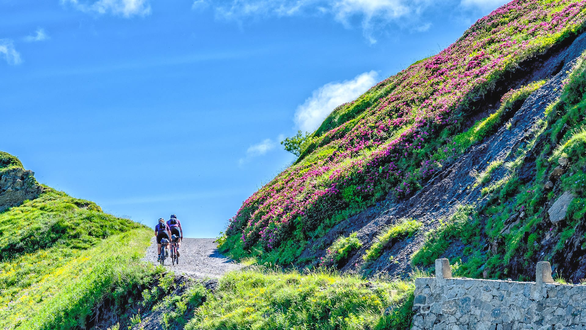
Upper Salt Road, cycling amongst the rhododendrons (photo credit: R. Croci – ATL del Cuneese)
Are the strade bianche safe?
The routes are generally safe for cyclists, particularly because they follow high-mountain dirt roads with limited motorised traffic. 4x4s are permitted on the route, but access is limited to 80 vehicles per day. On Tuesdays and Thursdays, the road is reserved for cyclists and pedestrians.
However, cyclists should remember this is still a shared, high-mountain route. There is a 20 kilometre per hour speed limit, and riders should slow down when approaching vehicles, pedestrians or animals. They should also be prepared to stop where needed to allow safe passage.
Cyclists must use a bell, or another acoustic device, when approaching bends or crests with limited visibility. The Italian and French Highway Code also applies on the relevant sections of the route.
Safety also depends on the Alpine environment. The route is entirely unpaved, with uneven surfaces, narrow sections, no barriers on the downhill side and possible rockfall. In many places, passing or overtaking is difficult or impossible.
Access is not allowed in adverse weather, including rain, snow or fog, as the surface can become extremely slippery. Many sections are remote, so self-sufficiency and good navigation skills are important.
These routes are best suited to riders with experience of mountain biking or high-altitude cycling. Less experienced cyclists may benefit from riding with a guide.
Upper Salt Road, Passage beneath the rock face of the Pertegà peak (photo credit: R. Croci – ATL del Cuneese)
Do you need an organised tour?
It is not essential to join an organised tour, but it can be a good option, especially if you are unfamiliar with the area or new to high-altitude riding.
A supported trip offers several advantages. A local guide provides route knowledge, technical support and an added level of safety. Logistics are also simpler, with help arranging accommodation, luggage transfers and mechanical support.
There are organisations in the area, including the Conitours Tourist Consortium and the Valle Maira Tourist Consortium, that offer structured cycling experiences and help make the region more do-able.
How long should you spend in Cuneo?
The ideal length of a trip depends on the type of experience you want.
A weekend (2–3 days) is absolutely feasible and well suited to those seeking a first introduction: it allows visitors to explore a single itinerary or valley, with a more concentrated yet still meaningful pace.
For a more complete and immersive experience, a stay of 5–7 days is recommended. This makes it possible to combine multiple valleys, ride a range of routes, and include major Alpine crossings such as military roads or the demanding climbs featured in the Giro d’Italia and the Tour de France.
A longer stay allows for a more in-depth trip, combining more challenging rides with easier days and time to explore the region at a slower pace.
Take a look at our in-depth packing guide for more useful suggestions.
What should you pack?
Essential equipment
A well-serviced bike is essential, ideally a mountain bike or e-MTB for higher-altitude routes, with durable tyres and a repair kit.
A GPS device or offline route is also important, as not all routes are clearly signposted.
Clothing and accessories
Weather conditions can change quickly in the mountains, so it’s worth packing layered clothing. A windproof and waterproof jacket, gloves and a thermal layer are useful even in summer.
Sunglasses, sunscreen and a helmet are essential. For longer rides, a backpack with enough water capacity is advisable, as water sources can be limited at higher elevations.
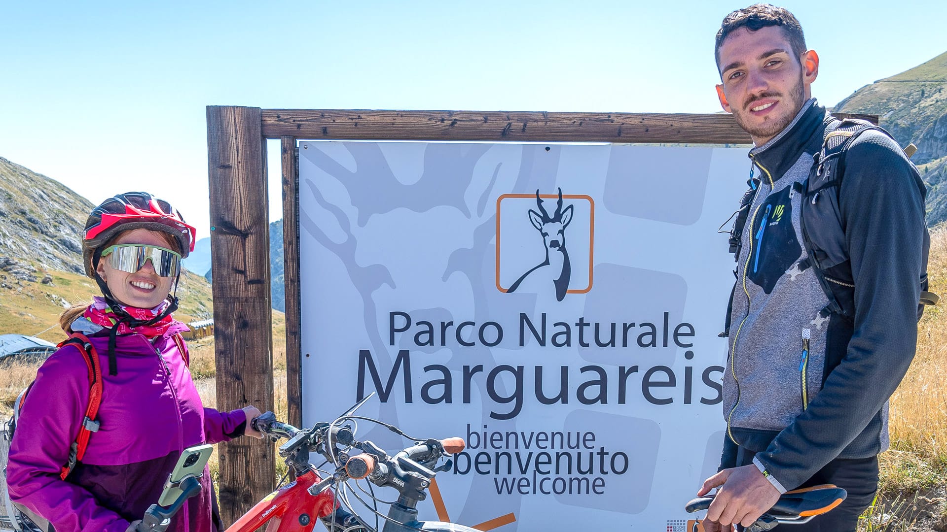
Access to the Marguareis Natural Park (photo credit: R. Croci – ATL del Cuneese)
Is bike hire and support available?
Bike rental, including e-bikes, is available in the main tourist centres and valleys, with additional support from services such as Cuneo Bike Experience, which offers rental, guided rides and logistics. Mechanical assistance is also available, particularly in more frequented areas, and the Cuneo Tourist Office provides a fully equipped bike room with repair support and booking assistance.
There is also a fully equipped bike room located adjacent to the Cuneo Tourist Office. While the tourist office itself is managed by ATL del Cuneese, the bike room is operated by Consorzio Conitours and provides repair support, rental services and help with booking activities.
For a more structured experience, services such as Cuneo Bike Experience combine bike rental, guiding and logistical support.
Tips for your first cycling trip in Cuneo
Food and local specialities
Food is an important part of the experience in Cuneo.
In the mountains, you have to try the high-quality alpine dairy products such as Castelmagno and Raschera cheeses. In the plains, there are local products including Cervere leeks, Piozzo pumpkins, Piedmontese beef and Cuneo IGP apples.
Traditional dishes include polenta, bagna caoda and local pasta such as ravioles from the Varaita Valley and cruzet from the Stura Valley.
Getting there and around
Cuneo is connected by train to Turin and Liguria, with the journey to Turin taking around 1 hour 15 minutes to 1 hour 30 minutes. By car, it is accessible via the A6 Turin–Savona and A33 Cuneo–Asti motorways, with most journeys taking around 1 hour 30 minutes.
Cuneo is a convenient base for accessing the surrounding valleys. Some areas can be reached by bike, but for longer or high-altitude routes it is often easier to use a car or local public transport.
Budget and accommodation
The region offers a range of accommodation options, including agriturismi, mountain refuges and bike-friendly hotels.
This makes it possible to plan a trip that suits different budgets while still maintaining a good level of quality.
Any highway code and travel information I should be aware of?
As ever, it’s a good idea to check current travel information before you book and travel. For UK visitors, the UK government travel information pages for Italy are here.
You should also read and follow Italy’s highway code.
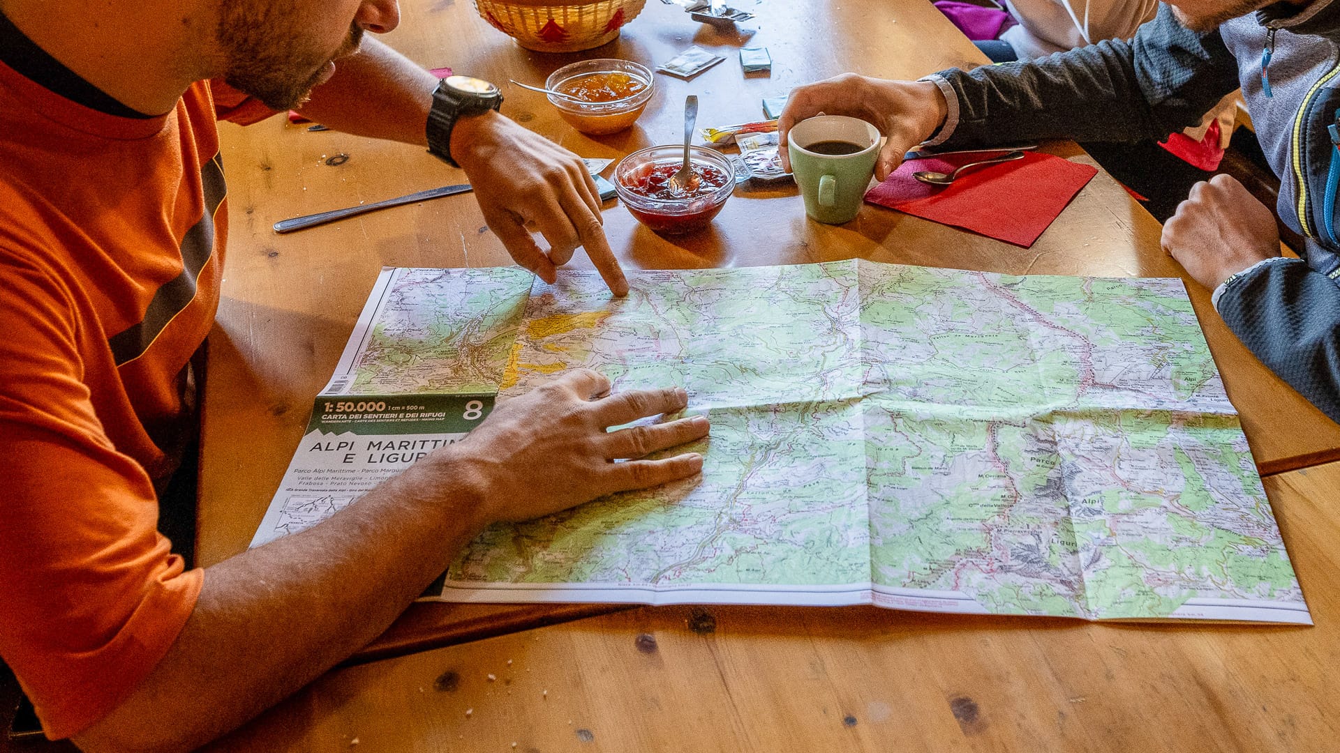
Breakfast at the Don Barbera hut (photo credit: R. Croci – ATL del Cuneese)
What’s next?
Thanks to Gabriella for sharing these insights into cycling Cuneo’s strade bianche.
Looking for more exciting content on cycling in Italy?
- 12 best Italy bike hotels, including some excellent options in Piedmont.
- Our pick of the best Tuscany bike tours, if you’re looking for something a little different.
- 10 iconic Giro d’Italia cycling climbs, offering some real challenges if you want to follow in legendary footsteps.
- 5 of the best electric bike tours (multi-day), including options around the world for e-bike riders.
Got a question for Gabriella?
Fill out this form and we will send it to Gabriella. We aim to get you an answer within 24 hours where possible!Gabriella Giordano has served on the board of ATL del Cuneese since 2014, giving her a direct view of the Cuneo area’s development into a recognised cycling and outdoor destination.
During this time, cycling tourism has become an increasingly important part of the region’s tourism identity, supported by its mountain landscapes, sporting heritage, outdoor experiences and specialist hospitality services.
In 2025, she was appointed Chair of ATL del Cuneese. In this role, she works to strengthen the destination’s international visibility and support the continued development of sustainable, experience-led tourism across the region.
First Published: 16 June 2026
The contents of this website are provided for general information purposes only. It is not intended to amount to advice and you should not rely on it. You should carry out your own due diligence and risk assessments and take professional advice. Views expressed by interviewees or other users of this website do not necessarily represent our views. We make no representations, warranties or guarantees, whether express or implied, that the content on our website is accurate, complete or up to date. If you use any information or content on this website, download from, or otherwise obtain content or services through our website, it is entirely at your own discretion and risk. Epic Road Rides Ltd disclaims all liability and responsibility arising from any reliance placed on the information and content on this website. Find out more here.
Comments