This is one of our all-time favourite rides.
Cycling Mt Baldy Road has serious cycling pedigree: it’s ranked as the 20th toughest climb in the US and has queen stage status on the Tour of California. It’s often compared to Alpe d’Huez.
We found it a bit like wrestling a bear.
But once you’re at the top, the (mostly) descent down Glendora Ridge Road and on to Glendora Mountain Road is out of this world. 35km of quiet road with jaw-dropping mountain panoramas at every turn and gradients that are fun, rather than bone-shaking, to descend.
Looking for road bike rides in Los Angeles? Not sure where to ride next? You do now.
This guide has not been updated post the recent devastating wildfires. Please let us know if you see any information that is no longer accurate.

Clare Dewey is a cyclist with a passion for travel. She set up epicroadrides.com in 2018 to help make it easy for cyclists to explore the world by bike. Today her mission is still inspiring cyclists to discover new places on two wheels - and doing what she can to make sure they have the best possible time while they're there. Clare has visited 50+ destinations around the world, many of them by bike.
Want to connect with Clare? Find her over on LinkedIn.
Highlights
It doesn’t get much better than the 19km single lane rollercoaster that is Glendora Ridge Road. The road winds across the top of a high ridge and often teeters on the knife edge. It offers a never-ending assault on your senses as you swoop down, with massive views of immense canyons, wooded mountain peaks, rugged river valleys and the coastal plains of LA. It’s also awesome fun: you descend on a pitch that’s enough to make you feel fast and strong but still allows you to pedal through the corners. It seems incredible that such a place exists just 15 or so kilometres (as the crow flies) from the urban sprawl of the Los Angeles basin.
Could Glendora Ridge Road be the world’s best ridge road? We think so.
 Glendora Ridge Road
 One way Glendora Ridge Road, the other way Mt Baldy Road. Awesome choices!
 Climbing Mt Baldy Road is tough, no two ways about it!
 Route notes
1. Glendora up Mt Baldy Road to intersection with Glendora Ridge Road: 0-29 km
We suggest starting in Glendora to give yourself a 16 km warm up along city streets before you hit Mt Baldy Road. It also gets the boring part of the loop out of the way. But if you want to skip this section entirely and start at the bottom of the climb, head for the intersection of Mt. Baldy Road and Mills Avenue.
The easy part of the route up Mount Baldy Road is the navigation: it’s one road to the top. The pedalling is another matter.
We think of the ascent in two sections.
The first section is the 13 km to where Mt Baldy Road meets Glendora Ridge Road. The first couple of kilometres are easy as you pass through the residential streets of Claremont. The gradients start to ramp up pretty quickly as you hit the dry and scrubby (yet beautiful) canyon you follow to the top. When you come to two tunnels, get ready: this is where it gets really tough. The 3 kilometres following the tunnels average 9.2%. There’s a short descent, you pass the turnoff to Glendora Ridge Road, and then you’re into Mount Baldy village.
2. Intersection with Glendora Ridge Road to Mt Baldy summit: 29-37.5 km
The second part of the Mount Baldy Road ascent is the toughest: if you take a break in Mount Baldy village, don’t eat too much!
From the intersection with Glendora Ridge Road, it’s an infamously nasty 8.2 kilometres to the ski lifts at an average of 8.1%. At the intersection with Icehouse Canyon Road, Mount Baldy Road turns skyward, and the road surface worsens. That’s when you hit eight notoriously steep and tight switchbacks. The gradients in this 3.3 km section hit an average of 9.5%!
You get a quick respite with some easy climbing through Manker Flats. Then it’s the last push up to the ski lifts: averaging 13% over 400 metres, your legs will burn. But you’re very nearly there. You climb the gently zigzag of the sloping parking area, it’s a short steep final burst, and you’re at the ski lift itself.
3. Mt Baldy summit to Glendora Ridge Road and Glendora Mountain Road: 37.5-81 km
The descent from the ski lifts back to the intersection with Icehouse Canyon Road is very technical due to the steep gradients, poor road surface and tight turns. There may also be rock debris. Take care.
You turn onto Glendora Ridge Road (which later turns into Glendora Mountain Road), and it’s payback time for all that lung-busting climbing.
This is one of our all-time favourite roads, with glorious views and, if you’re lucky, very little traffic. There are a few minor uphills but nothing too tough. The road surface was even pretty decent when we were there. As you descend through your millionth hairpin turn, you wonder if it’s wrong to get bored of switchbacks. The sign of a truly great descent!
 In the last few kilometres of Mt Baldy Road, the thin air and tough gradients take their toll.
 The last 8 kilometres of Mount Baldy average around 8%
 Exhausted but mission completed!
Café stops
Fill your water bottles and pick up an espresso in Glendora before you start. There’s nowhere to refuel until you reach Mount Baldy village. The village has several options to pick from, with Mt. Baldy Lodge being a popular option for cyclists.
We spotted a small snack bar in the Manker Flats area, just before Mt Baldy summit.
At Mt Baldy summit there is a small ticketing station which also sells a limited range of refreshments. When we visited in early November, it was open: the sign said opening hours were 11am-6pm on Fridays and 7am-7pm on Saturdays and Sundays. This was written in board marker pen, so not to be relied on.
 Restaurant option in Mount Baldy village
 A summit sign of sorts at Mount Baldy (albeit there’s still a large car park to cycle through before the top!)
Accommodation
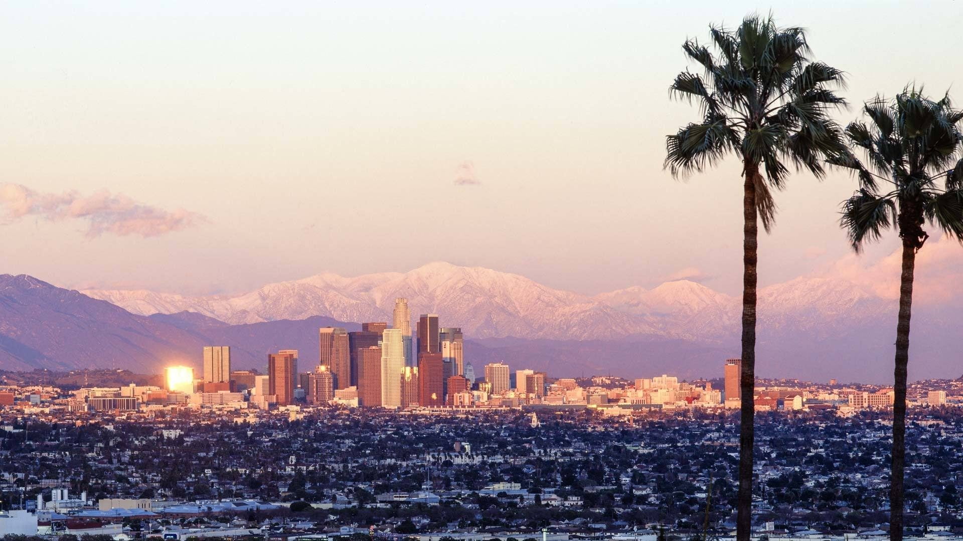
If you’re wondering how far Mt Baldy is from Los Angeles, the answer is that it’s very accessible. Glendora, the start of the ride, is about:
- 48 kilometres (35 minutes) to downtown LA
- 70 kilometres (45 minutes) to LAX international airport
- 97 kilometres (1 hour 10 minutes with no traffic) from where we stayed in Malibu.
* Accuracy of travel times depends on traffic.
The location of the ride makes it easy to incorporate into a trip. We did it on the way to catch our flight back to the UK. Not advisable for stress-free pedalling, but certainly time efficient! It’s obvious, but if you’re going to take our kind of approach, leave enough slack in your schedule for mishaps and consider a support car in case there’s a mechanical you can’t deal with!
Tips
If you’re only going to ride Mount Baldy once, ride it this way around: you’ll have conquered the steep side of Baldy, and you then get the epic descent down Glendora Ridge Road and Glendora Mountain Road.
Water and refuelling options are limited. Bring sufficient supplies and layers for the descent. As the sun begins to set it gets cold quickly.
The road was extremely quiet when we were there, but there were a worrying number of tyre skid marks – particularly around the junction of Glendora Ridge Road and Glendora Mountain Road. Whether it’s local kids with new driver licenses or crazy fools in fast cars, don’t assume you have the road to yourself. We stopped to take a photo at one point – just over the edge of the road was the wreckage of a car. Take care.
Glendora Ridge Road may be a stone’s throw from downtown LA, but it’s a desolate and remote place. We’ve read reports of people having seen deer, foxes, bobcats, bears, tarantulas, snakes – and even the odd mountain lion! Take care and consider riding with a friend.
You’re in high mountains, and it’s common to see rock debris on the roads.
Read our tips for cycling in Southern California before you set out.
If you want to incorporate the ride into a trip to the Santa Monica Mountains or Santa Barbara, our guides will help.
Found this guide useful?
Please tell us! Comment below or drop us a line.
Don’t miss our other ride guides on the Santa Monica Mountains: see the related rides section above.
Check out our ultimate guide to cycling Santa Monica Mountains National Park and other articles on Southern California, below.
Please support Epic Road Rides
A huge amount of time and effort goes into the article you’ve just read, all with the aim of helping you!
If you found what you’ve read useful, I’d really appreciate it if you dropped something in the tip jar here.
It’s a way you can say thank you and help us carry on creating top quality content with no annoying ads and no pay wall.
Looking for an organised cycling trip?
If you want someone to help you plan and book your cycling holiday, fill out this form. We aren’t a tour operator/agent but we work with lots of people who are and will do our best to put you in touch with someone that can help (within 24 hours where possible)!Clare Dewey is a cyclist with a passion for travel. She set up epicroadrides.com in 2018 to help make it easy for cyclists to explore the world by bike. Today her mission is still inspiring cyclists to discover new places on two wheels - and doing what she can to make sure they have the best possible time while they're there. Clare has visited 50+ destinations around the world, many of them by bike.
Want to connect with Clare? Find her over on LinkedIn.
First Published: 08 March 2018
All metrics in this article are approximate.
The contents of this website are provided for general information purposes only. It is not intended to amount to advice and you should not rely on it. You should carry out your own due diligence and risk assessments and take professional advice. Views expressed by interviewees or other users of this website do not necessarily represent our views. We make no representations, warranties or guarantees, whether express or implied, that the content on our website is accurate, complete or up to date. If you use any information or content on this website, download from, or otherwise obtain content or services through our website, it is entirely at your own discretion and risk. Epic Road Rides Ltd disclaims all liability and responsibility arising from any reliance placed on the information and content on this website. Find out more here.
Very helpful! Gave me a good idea of what to expect. Exactly what I was looking for. Thank you.
Excellent – so pleased it was useful and thanks for taking the time to let us know!