
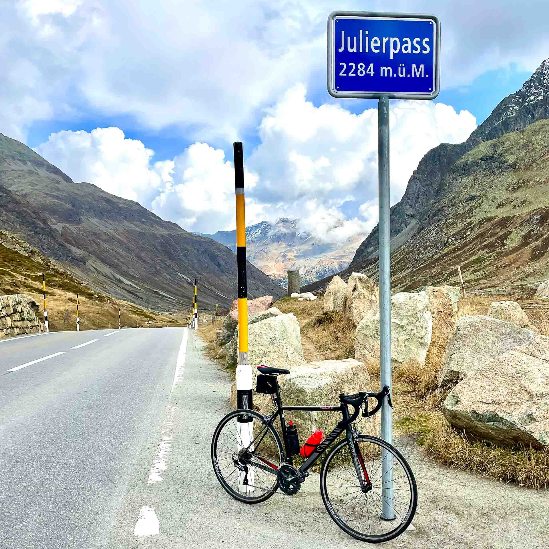
If dramatic Alpine scenery appeals to you, this route delivers; expect towering snow capped mountains, rugged valleys, lush green farmland and traditional Swiss mountain villages. It has something for everyone, long climbs with steep sections and fast descents with some technical sections too. You get to conquer two famous Swiss Passes, Albula (2,315m) and Julier (2,284m).
This is a challenging ride, and although relatively short at only 100km with 2,200m of climbing it still feels tougher than the numbers suggest.
You can ride it either way as it is a circular route, and I would love to do it the opposite way as well if I get a second chance.
Route notes
To the Albula Pass summit
Once past St Moritz you head in the direction of Bever. The road takes you right past Engadin Airport, running parallel to the runway, this section is nice and flat and a good way to warm up the legs for the climb that will take you out of the valley.
The route passes Bever and then on to La Punt-Chamues-ch. It is at this point you turn sharp left and straight away go into quite a zesty little climb. The road rises quite sharply up a few hairpins and before you know it you are looking down on La Punt. After that it climbs steadily before another few hairpins, and then continues up above the tree line.
Your vision is now focussed up the pass as you are hemmed in by imposing summits either side of you. The road is a lot straighter from here most of the way up to the top and the gradient mellows as you near the top of the pass.
From La Punt to where the climbing eases is about 6.5km with an average of just under 9%.
There is not a lot to see at the very top, just two small buildings one of which is Albula Hospiz, a hotel and restaurant. I did not stop however it looked inviting and had I done the route the other way I am sure I would have stopped, just as a reward and to refuel.
There is also the obligatory summit sign announcing that you are at the top of the Albula Pass at an altitude of 2315m

Descending Albula Pass
Not long after passing the summit sign, the road dips down and you are on the descent. This side of the pass is in the shade in the morning and the overnight rain meant that some of the road surface was damp, making the decent a bit more precarious.
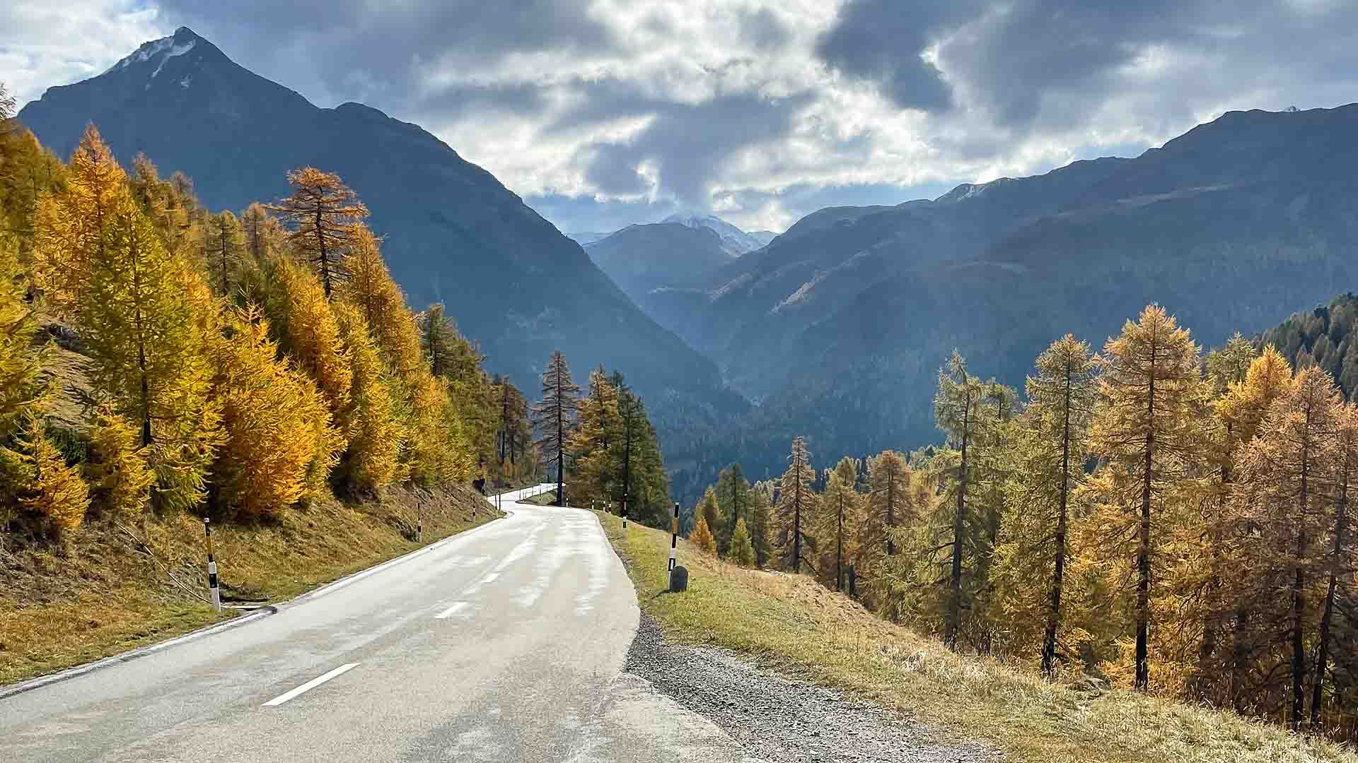
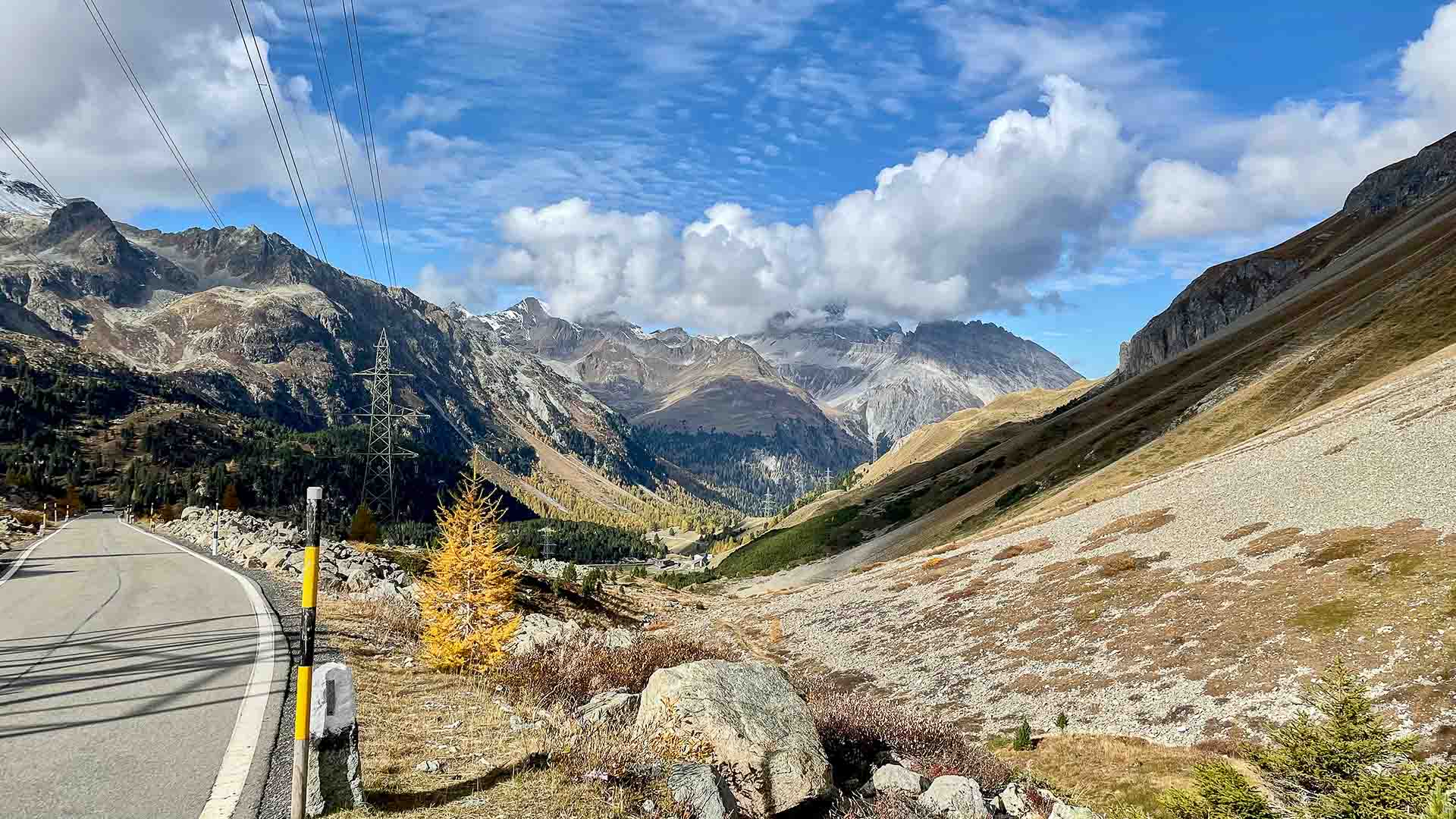
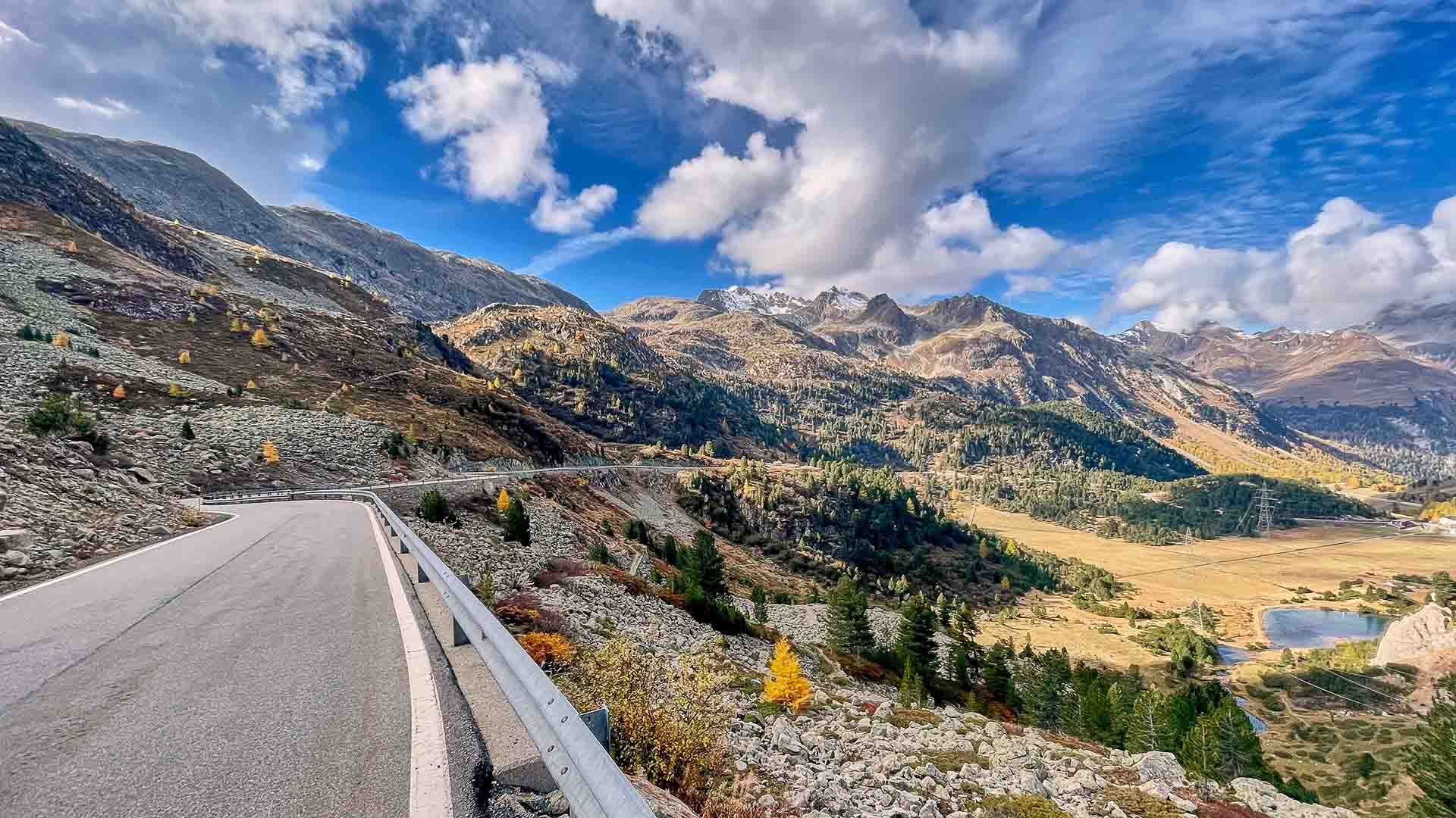
The views on this side of the pass really are magical and it is worth slowing down from time to time to appreciate it all. The top half is very rugged with lots of rocky scree on both sides of the road and high snow capped peaks towering above you, and then as you get lower the slopes turn grassy and then lower down the grass gives way to forests.
Just as you reach the top of the tree line the road passes the Lai da Palpuogna. This is well known beauty spot, with a crystal clear mountain lake surrounded by trees. It’s really popular with picnickers and hikers.
I happened to be here in Autumn, and the larch trees were glowing golden in the sunlight. It was a wonderful contrast to the green-blue waters of the lake.
Once into the trees, the road seems even narrower and was also damper too.
Soon the village of Preda comes and passes by in a blink then you go under one of the many stone bridges that carry the Bernina Express train up the valley. The road seems to widen and you can ride a little quicker as you get lower down the pass. Next up is the town of Bergun this is a very traditional Swiss Town famous for sledging.
Filisur is the next town on the way down, but you do not really see it as the road bypasses the village. Soon after the village you get a brief glimpse of the famous Landwasser Viaduct bridge that the train uses, but blink and you’ll miss it!
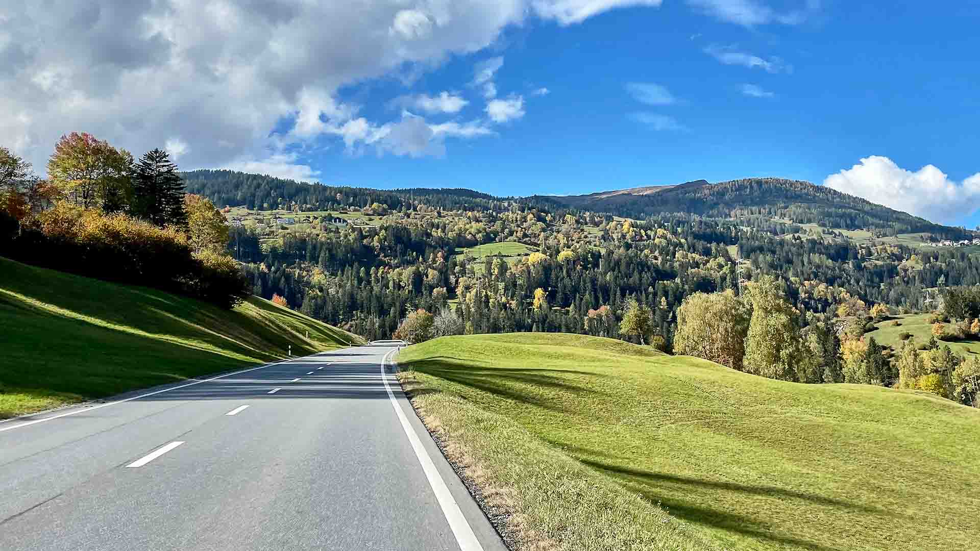
Now that you are getting lower you now find yourself surrounded by green meadows and farmland and even a golf course. The gradients are mellower and the road wider and it is not long before you are approaching the lowest point of this route Tiefencastel.


Climbing the Julier Pass
After all that descending, it feels good to have a bit of resistance on the pedals. But that novelty soon wears off as for the next 35km it is a steady climb all the way to the top of the Julier Pass!
While the average gradient is not that steep, the sheer length of the climb and that fact that you already have a decent climb in the legs will eventually catch up with you, so take it easy and if you do feel good you can always attack the final few kilometres. Even though the average over the 36km is only around 4%, there are some steeper ramps and the total gain of the climb is over 1,800m, so it is best to exercise a bit of caution.
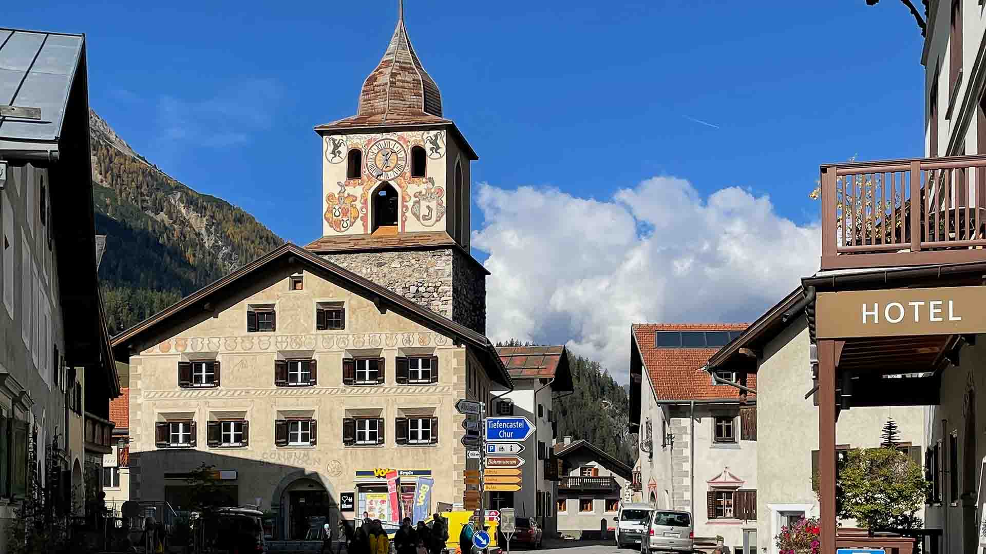
Tiencastel
The climb starts off, just after Tiefencastel, with one of these steep ramps – it rears up to 11% for the first 2km before easing off to a more manageable 3-4%.
Before long you reach the d’Crap Ses Tunnel which is approximately 800m long. This is not brilliant on a bike and even though I did have a rear light I did feel a little exposed to traffic. There is an option to avoid the tunnel by heading out of Tiefencastle in the direction of Salouf and then aiming for Cunter the next town on the main road above the tunnel. This then reconnects with the route.
Savognin
Once clear of the tunnel it is a long series of steps that take you gradually all the way up the valley. It is very picturesque and for most of the climb you are surrounded by lush green meadows and farmland dotted with forests. There are multiple quaint Swiss villages all the way up the climb, the first being Savognin. These villages mean there are places to top up bidons or get some food on the way up, but I did not stop.
Tinizong to Marmorera
The gradient remains quite manageable from the tunnel to Tinizong. Around 4km before Rona there is another step up at just over 5%. The next 4km are easy again at just over 1.5%. These are great sections to spin the legs and to eat on; you will need to keep on top of your nutrition so lack of fuel does not catch up with you later. The easier sections seem to go by too fast, and before you know it the road snakes up through the twists and turns and you are on the next section of about 4.5% for the 5 or so kilometres between Mulegns and the reservoir at Marmorera.
What now follows is another easier segment along the shores of the lake initially, before continuing up the valley towards Bivio as with most of the steps this is also about 5km in duration at a mellow 2% average.
Bivio
Bivio is the last town before you start getting into the final and tougher stages of the pass, and if you haven’t stopped to top up bottles or eat this is a good place to do so. I had neglected my nutrition somewhat and was in need of a break and some food, so I stopped at the Hotel-Restaurant Guidon. Once slightly rested and feeling a bit rejuvenated thanks to some food and caffeine, I was on my way again.
Final push to the summit
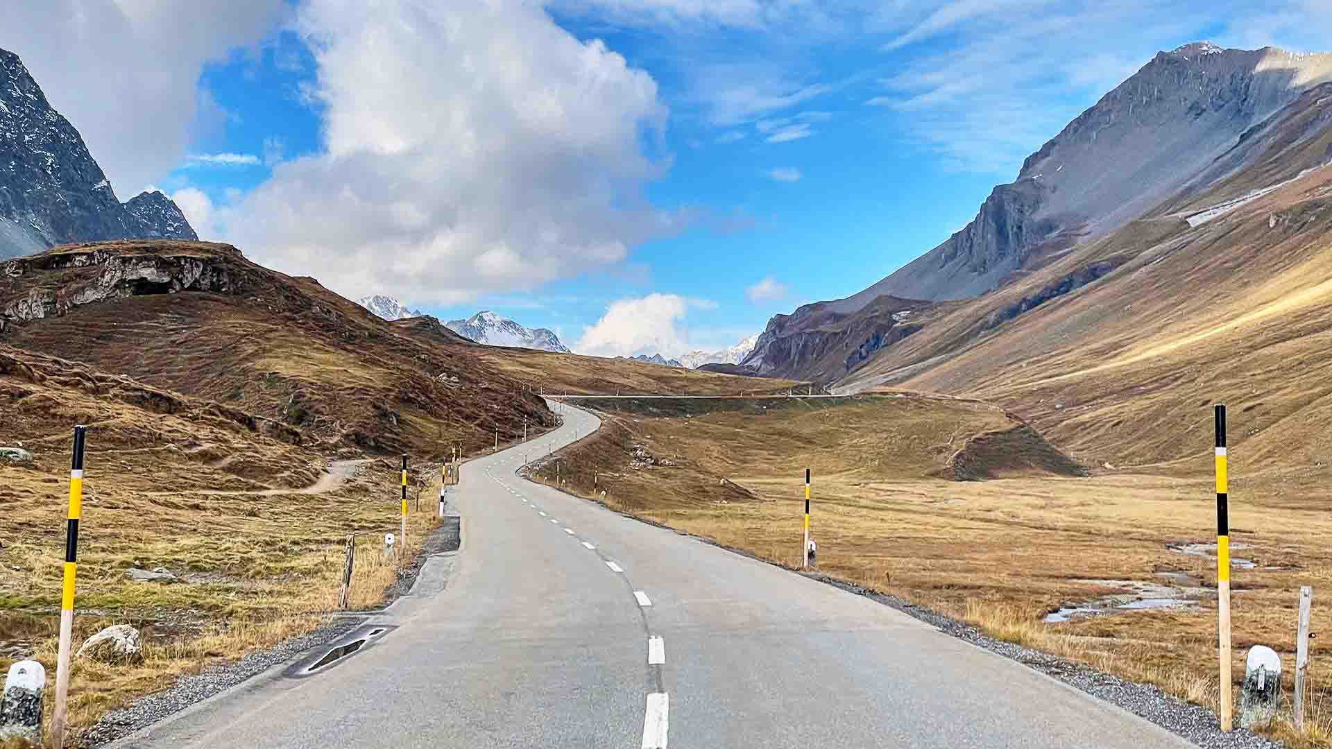
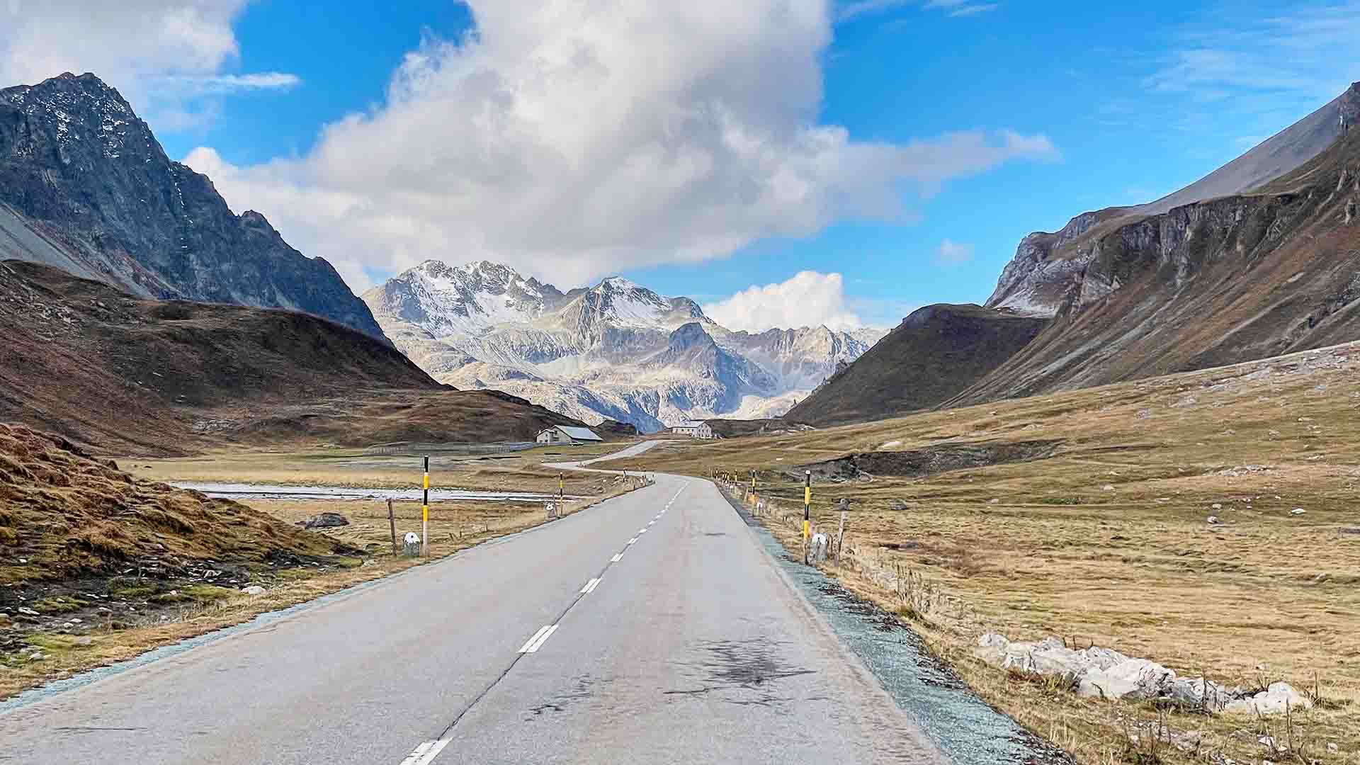
After Bivio you are almost at an altitude of 1,800m and as such the scenery changes as you rise out of the tree line and the lush green meadows give rise to the shorter mountain grasses. You are now at the top of the valley that you have been steadily moving up, and now the road turns to the east and you head up to the pass proper.
Gradients of 4-7% are now with you for the next 6km and the fatigue in the legs soon starts to build again despite the stop. Because you are now out of the trees and more exposed the wind is more noticeable, but you can also see your progress and soon Bivio is far below. You reach the first section of hairpins about 4km out of Bivio and now you really feel like you are climbing a pass. There is another section of switchbacks a further 2km on and then plenty of twists before you hit the final section of about 1.5 km at 10%.
As soon as you can see the rust coloured building, which is actually a theatre, you know you are very near the summit of the pass. That should give you the last bit of incentive to push up the final stretch before you hit the top at 2,284m. There is a small kiosk and a car park and there is lake below the car park.


Descent back to St Moritz
The descent down into Silvaplana is a roller-coaster ride.The road surface is brilliant and the bends not too tight so you can have a few minutes of sheer pleasure as reward for your efforts over the last 35km as you sweep through the bends and then fly down the straights spinning out of gears.
Just make sure your brakes are working as it is easy to hit the big speeds down there!
There is a big tunnel that was built as a bypass around Silvaplana, (cycling prohibited) but there is a turn off just before which will take you on the old road down into Silvaplana to avoid it. This brings you out in the old part of the town and the end of the journey.
Tips
The road over the Albula Pass is one of the older ones; it’s not such a main route into the Engadin Valley. As such, it’s narrower but also has less traffic. While this is nice the bends seem tighter, and I felt I needed to take a bit more care than some of the other roads in the area.
Note the comments above about the d’Crap Ses Tunnel and the possible diversion to avoid it.
As mentioned near the beginning, this route can be ridden both ways. I would love to try it the other way too, as the descent from the top of Julier to Tiefencastel looks really fast and the climb up the Albula from there looks like a lovely challenge!
Please support Epic Road Rides
A huge amount of time and effort goes into the article you’ve just read, all with the aim of helping you!
If you found what you’ve read useful, I’d really appreciate it if you dropped something in the tip jar here.
It’s a way you can say thank you and help us carry on creating top quality content with no annoying ads and no pay wall.
Looking for an organised cycling trip?
If you want someone to help you plan and book your cycling holiday, fill out this form. We aren’t a tour operator/agent but we work with lots of people who are and will do our best to put you in touch with someone that can help (within 24 hours where possible)!First Published: 29 March 2023
All metrics in this article are approximate.
The contents of this website are provided for general information purposes only. It is not intended to amount to advice and you should not rely on it. You should carry out your own due diligence and risk assessments and take professional advice. Views expressed by interviewees or other users of this website do not necessarily represent our views. We make no representations, warranties or guarantees, whether express or implied, that the content on our website is accurate, complete or up to date. If you use any information or content on this website, download from, or otherwise obtain content or services through our website, it is entirely at your own discretion and risk. Epic Road Rides Ltd disclaims all liability and responsibility arising from any reliance placed on the information and content on this website. Find out more here.