This is a tough ride on quiet roads through the Anaga rural park. You’ll find stunning laurel forests, deep ravines, craggy peaks and tiny hamlets. The route predominantly follows the TF-12, which many say is the most beautiful road in Tenerife.
One of the great things about this ride is you can easily flex the distance and elevation gain as, once you’ve left the towns, you’re (pretty much) on a loop of the TF-12 with optional add-ons. If you “just” did the TF-12 you’d still get a good sense of the Anaga region while reducing the distance to 50 km and elevation gain to 1,324 m. Why not start with the basic loop and then decide which, if any, of the out and backs you want to add on (see our Tips below) for more information.

Clare Dewey is a cyclist with a passion for travel. She set up epicroadrides.com in 2018 to help make it easy for cyclists to explore the world by bike. Today her mission is still inspiring cyclists to discover new places on two wheels - and doing what she can to make sure they have the best possible time while they're there. Clare has visited 50+ destinations around the world, many of them by bike.
Want to connect with Clare? Find her over on LinkedIn.
Due to the terrible forest fires in 2023, we understand that some of the roads in Tenerife are closed. Check with the local tourism office, bike shop, your accommodation or tour operator for the latest news.
Highlights
Our three favourite things about this ride are:
The views. You have to remember to keep your eyes on the road and not the incredible vistas… Particular stand-outs were the panoramas all the way up the climb from San Andrés, down over Taganana, along the TF-12 between the turn off to Afur and Las Carboneras and from the Mirador Cruz del Carmen viewing platform.
The forest. This is the ride to do when temperatures soar: once you’re up on top of the ride, the TF-12 passes through cool, green woodland. We were surprised just how green and cool it was, especially compared with the barren moonscape of Teide, just up the road.
The sense of isolation, particularly down the tiny roads to Afur and Las Carboneras. There are very few other people around and the ancient villages feel lost in a time warp, a million miles from the high-rise party towns of Playa de la Américas.
Route notes
1. La Laguna to Turn off to Taganana: 0-26 km
San Cristobal de La Laguna (“La Laguna”) is a beautiful starting point for this ride: the only UNESCO World Heritage Site protected town in the Canaries, with elegant buildings that reflect its colonial legacy. The traffic between La Laguna and Santa Cruz de Tenerife is less enjoyable. See our Tips below for more.
Once out of the city, you hit the seafront road that passes huge, industrial docks. The TF-11 follows the coast to San Andrés. This is where the 16 km flat warm up ends and it’s time to test the legs. It’s about 10 km (av. gradient 5.8%) to the top, on the quiet, twisty TF-12 that curves it’s way up lushly vegetated slopes with jaw-dropping views in all directions.
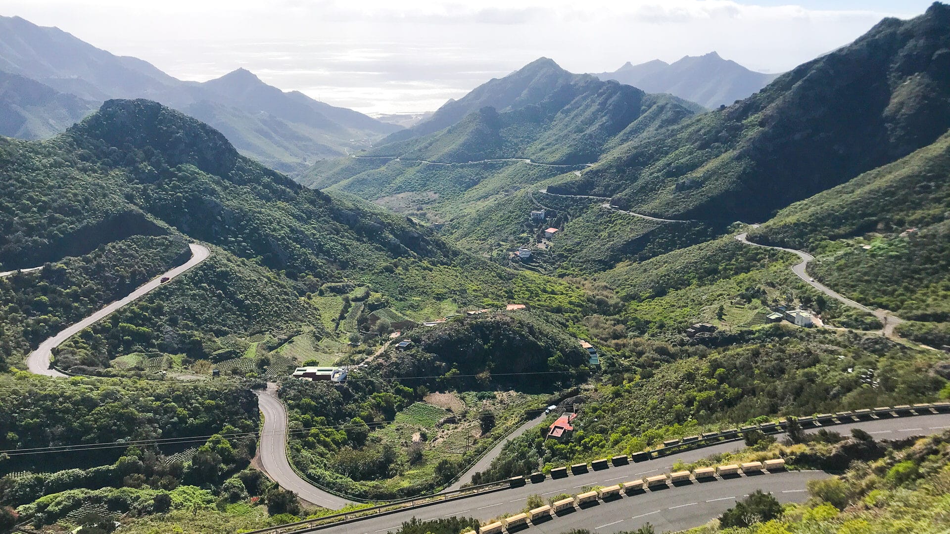
2. Turn off to Taganana to turn off for Las Carboneras: 26-79 km
At the top of the climb you come to your first decision: down to Taganana or continue on the TF-12.
To help you decide we describe the TF-12 and then each of the out and backs that take you steeply downward, before you retrace your route up to the TF-12 once more.
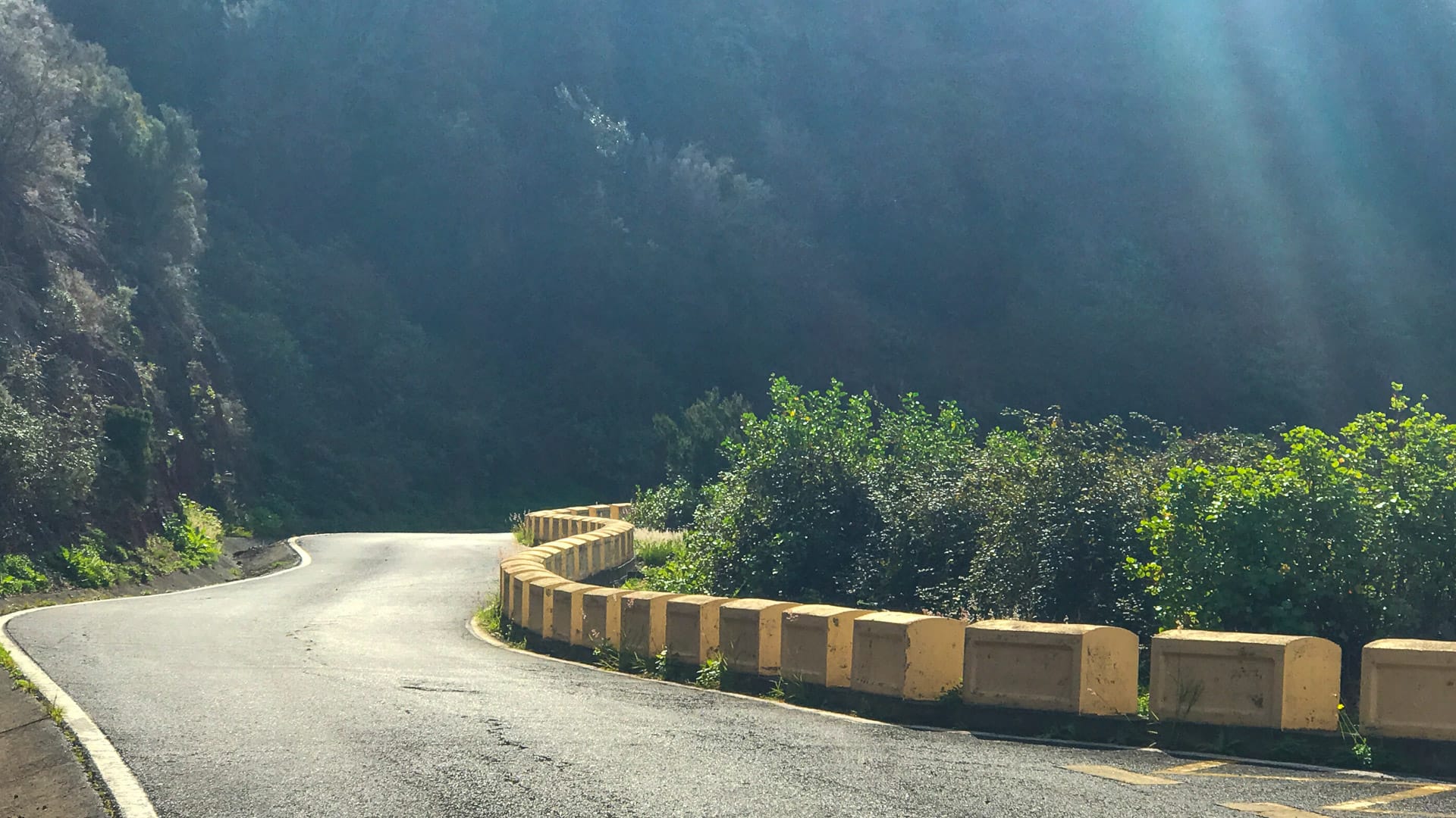
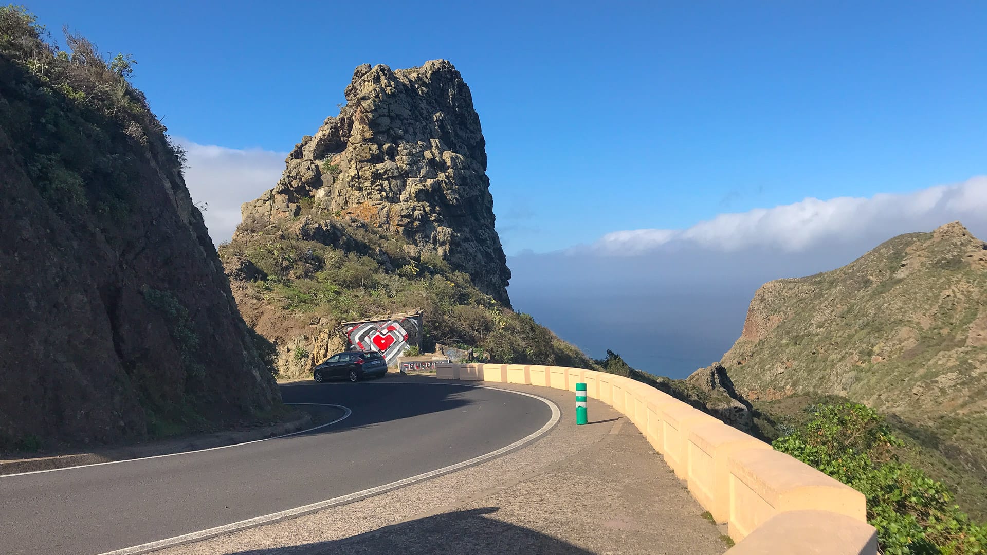
The TF-12: If you stay on the TF-12 and don’t head down from the ridge, it’s roughly 10.5km until the descent begins. It’s a bit lumpy, but tame by Tenerife standards, with an average 4.3% gradient, 600 m of climbing and 300 m of descent over those 10.5km. It’s a gorgeous ride, through shaded woodland, often cutting through cliff faces and interspersed with views over the richly carpeted slopes of the Anaga mountain range.
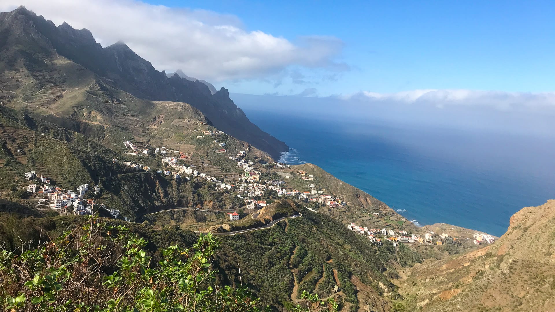
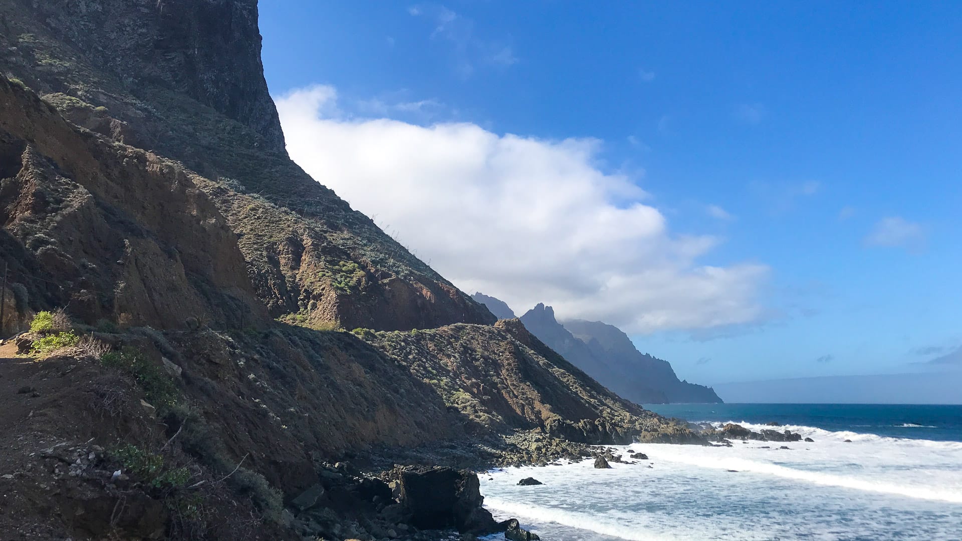
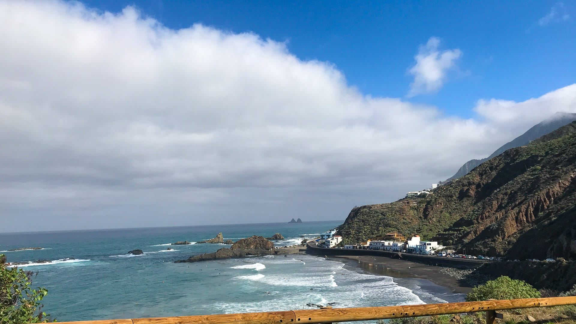
To Benijo and back (18.1 km, +845 m): This is probably the most beautiful of the three out and backs. We also found it the most busy and came across a coach doing a three point turn around a particularly tight corner near the bottom (there was also a guy skateboarding down, with two mopeds accompanying him – totally insane!). Like the Sa Calobra in Mallorca, as you speed down the hairpins, you know you’re in for a painful return journey. If you can take your eyes off the road, the views are epic. The whitewashed villages at the bottom of the mountain sit next to a crashing shoreline and make a good stop for a breather, though you won’t want to eat anything too heavy with the return leg ahead of you!
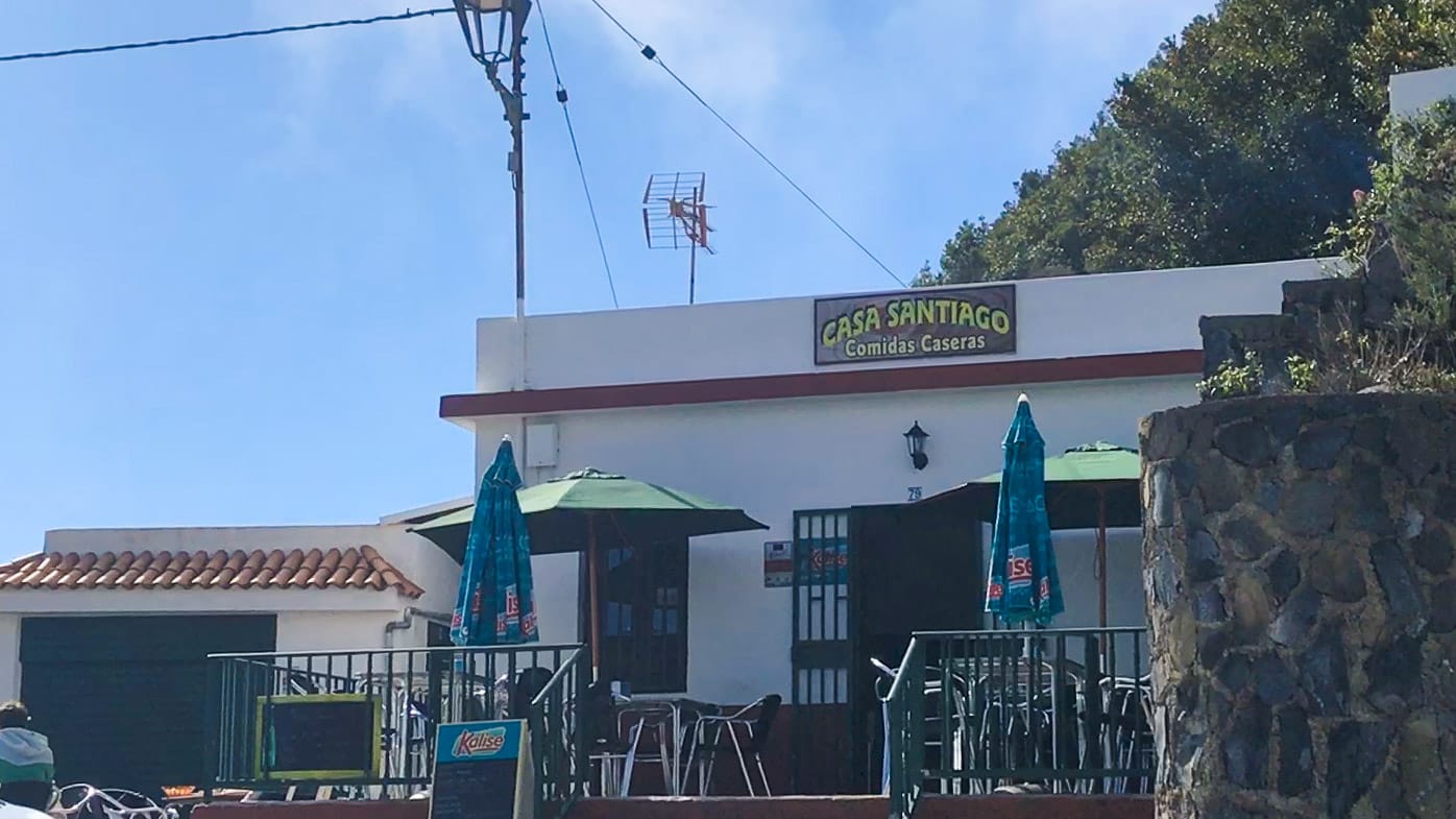
To Afur and back (13.4 km, +827 m): You may be tempted to stop at the Casa Santiago restaurant which is in a sunny spot with a fabulous view. If you resist the temptation, you’ll find yourself cycling through dense woodland which soon opens out into views of vertical ravines leading down to the sea. Watch out for some crumbly rock debris on the road and we spotted some patches of moss too. We found this road much quieter than the road to Benijo; there was a heavy sense of isolation, as if you were riding a road not often explored. Afur is a tiny village, with a church and a little rustic restaurant where you can get a drink, bread and cheese.
To Las Carboneras and back (9.8 km, +439 m): The easiest of the three out and backs, the start of the descent is wooded with ferns and an almost Cornish smell in the air. We passed steeply terraced fields planted with crops and little yellow flowers dancing in the breeze. The view opens out in places and the road is dotted with houses. We pulled up in Las Carbonaras to wonderful birdsong and an air of tranquility exuding from this brightly coloured village. It’s in a sunny spot and the road to the village is lined with palm trees. You’ll also find a pretty main square, behind the exuberantly orange church. There’s a bar and somewhere to eat too.
3. Turn off for Las Carboneras to La Laguna: 79-91.5 km
After the turn off for Las Carboneras, it’s a twisty descent back to civilisation: 12.7 km with 526 m of descent and 57 m of climbing. After Las Mercedes, you leave the TF-12 and you’re back to more traffic and urban sprawl.
If you want to extend the ride, about 1 km after the Las Carboneras turn off, there’s a turn up the TF-114 to Mirador Pico del Inglés (1 km each way, 50m of climbing). We managed to miss it, but would love to know what it’s like; tell us if you’ve done it, by commenting below.
Café stops
While there’s not an over-supply of places to re-fuel, you should be fine if you take supplies with you and plan. On the TF-12, at the turn off to Afur there’s Casa Santiago. There’s also two restaurants at Mirador Cruz del Carmen, one by the side of the road and the other under the Tourist Information Centre.
If you do the extensions to Benijo you’ll find restaurants there and in Taganana and Almáciga, on the way down. We’ve also heard good things about a place called La Ola, at Roque de las Bodegas between Taganana and Benijo (but note opening hours were (at the time of visiting) weekday lunchtimes only).
There’s also the very basic inn at Casa Jose Cañon in Afur and Bar Restaurante Tesegre in Las Carboneras.
Accommodation
We stayed at Belive Playa Arena, which worked well for us. From Playa La Arena it’s about an hour and a quarter’s drive to La Laguna.
You can find more information about this hotel and our suggestions for hotels in La Laguna and other towns, in our ultimate guide to Tenerife for cyclists.
Alternatively, our best towns for cyclists article should help you decide the best town for you.
Tips for cycling Anaga Rural Park
- The section between La Laguna and Santa Cruz was very congested, though the tree-lined boulevards were attractive! Avoid morning rush hour (which seems to go on until at least 11am) and also consider:
- Persuading someone to come and pick you up so you can avoid the congestion; or
- Doing the route (or part of it) as an out and back from either La Laguna or Santa Cruz.
- We chose to start the ride in La Laguna and ride anti-clockwise in order to provide a flat-ish 15-16 km warm up and get the town riding out of the way first. However, if you love descending, we think it would be worth considering doing the loop clockwise, as it would give you a cracking 10.5 km descent from the turn off to Taganana to the coast at San Andrés. If you’ve done the loop this way around, comment below or get in touch, we’d love to know how it was!
- If you’re thinking of missing out one or more of the out and backs, or you’re looking for additional extensions, take a look at the Ride Log above.
- On our trip, temperatures were about 5°C cooler in the shade of the forest than in the full sunshine (so 16°C compared with 21°C).
- Read our tips for cycling in Tenerife, before you set out.
Over to you!
What did you think of this guide? We’d love to hear from you – comment below or drop us a line.
Don’t miss our other ride guides on Tenerife: see the related rides section above.
Click here for our complete guide to planning a holiday in Tenerife and other articles on Tenerife, below.
Please support Epic Road Rides
A huge amount of time and effort goes into the article you’ve just read, all with the aim of helping you!
If you found what you’ve read useful, I’d really appreciate it if you dropped something in the tip jar here.
It’s a way you can say thank you and help us carry on creating top quality content with no annoying ads and no pay wall.
Looking for an organised cycling trip?
If you want someone to help you plan and book your cycling holiday, fill out this form. We aren’t a tour operator/agent but we work with lots of people who are and will do our best to put you in touch with someone that can help (within 24 hours where possible)!Clare Dewey is a cyclist with a passion for travel. She set up epicroadrides.com in 2018 to help make it easy for cyclists to explore the world by bike. Today her mission is still inspiring cyclists to discover new places on two wheels - and doing what she can to make sure they have the best possible time while they're there. Clare has visited 50+ destinations around the world, many of them by bike.
Want to connect with Clare? Find her over on LinkedIn.
First Published: 17 January 2018
All metrics in this article are approximate.
The contents of this website are provided for general information purposes only. It is not intended to amount to advice and you should not rely on it. You should carry out your own due diligence and risk assessments and take professional advice. Views expressed by interviewees or other users of this website do not necessarily represent our views. We make no representations, warranties or guarantees, whether express or implied, that the content on our website is accurate, complete or up to date. If you use any information or content on this website, download from, or otherwise obtain content or services through our website, it is entirely at your own discretion and risk. Epic Road Rides Ltd disclaims all liability and responsibility arising from any reliance placed on the information and content on this website. Find out more here.
Anaga is incredible… some notes:
1) Benijo – if you go down to see this epic coastline, you might as well continue on the east dirt path to El Draguillo, beautiful views and the town is quite interesting. Also La Ola is delicious, but expensive
2) Don’t stop at Los Carboneras! Go all the way to Chinamada. Epic views and a highlight. It’s short and barely any extra climbing.
3) Don’t miss Pico Del Ingles. It’s a false flat for less than 2km, but leads to one of the best viewpoints in all of Tenerife. Looking down from the viewpoint you’ll see a very picturesque road that snakes into the valley. If you’re like me, you instantly re-routed to take this gorgeous and secluded path. Don’t do it unless you have a gravel bike or you’re ok with significant amount of hike a bike. It was worth it to me, I like the adventure
4) The road to Igueste is so memorable and you get some iconic views of the coast and the town. Reminded me of the Punta de Teno road. Fun descent with good sight lines so you can rip it.
5) The descent down TF-12 is incredible. The pavement is excellent. Just be careful because the tight long turns aren’t marked and some of them get tighter a you go in
6) Worth getting an early start to get the morning light on the mountains
Hi Calvin, thanks very much for taking the time to share your experience! Happy riding!
Second all your recs Calvin! All the valleys in Anaga are worth exploring to their ends. Monday-Thursday (and Friday mornings) you’ll have the roads pretty much to yourself. Also, coming or going to La Laguna, the Pedro Alvarez option is quite enticing rather than the direct route Cruz del Carmen to/from Las Lagunetas. If you take this way, you miss a lot of the traffic coming to/from La Laguna and you can add on the enticing village of Los Batanes which has a restaurant and enchanting views across the valley to Chinamada. Compact gearing doesn’t hurt in this most enchanting area of the island. Roll On🚲!
This guide of yours was the final argument in finally deciding to go to Tenerife. Anaga is incredible! Thank you so much!
Some additional notes:
The road up from Taganana is pretty steep, much steeper than up from San Andres which is relatively easy. The road up from from Afur is in between the two regarding steepness.
The road surface quality of the first ~200m leading to Las Carbonaras looks terrible – but this should not discourage anyone, after that it is fine.
The outstanding feature of the Mirador Pico del Inglés is that from there you can view how the road twists on the ridge of Anaga. (See the right hand side of this photo: https://photos.app.goo.gl/iRKSHvEM2pLcm2jp9 )
I tried the first few kilometers of the turn off to Los Batanes – it looked very promising: perfect road, zero traffic. Unfortunately I didn’t have time, I had to turn back after a few kilometers.
Thank you again!
Hi Ferenc, so glad to hear we helped in your decision process – and really pleased to hear you had a great time! Thanks for taking the time to share your additional notes, I’m sure they will be of assistance to others.
I’ve done this ride both ways and would say it’s slightly better clockwise, but you are stuck with busy town riding (and a climb) at the end.
Warning: The climb back out of Benijo is VERY steep. I would recommend that you don’t stop at the bottom for lunch….
Thanks for sharing your experience Tom!
Yes, that climb does have that certain bite, doesn’t it😂. But after a swim, a light lunch and at least a double espresso, you are slightly better prepared for the challenge. And then enjoy a periodic stop along the way to enjoy the staggering views.
Did part of this ride 2 weeks ago. We started in Santa Cruz and thought we were following the route but then found we were doing it clockwise ! San Christobel is lovely place and from there it was a great ride. We didnt do any of the spurs off as we had already done 2 of the other routes and our legs were feeling it. The descent into San Andres was brilliant. If i did the ride again i think i would park in San Andres and ride to San Christobel and then do the return back putting in any of the spurs that you fancy.
Thanks for sharing your tips Ian!
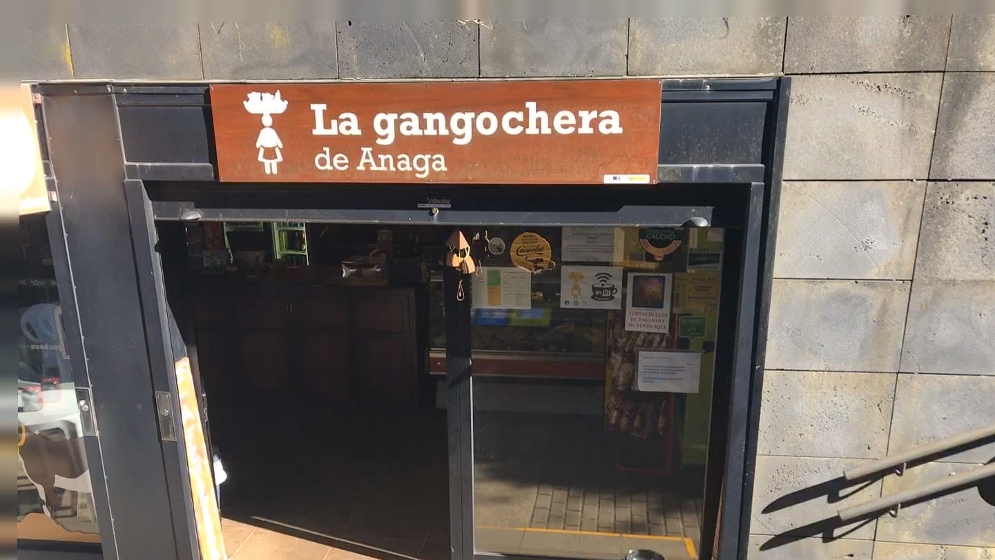
Hi Clare, I forgot to tell you the charming Gangochera restaurant at Mirador Cruz del Carmen closed several years ago. The government wanted to build a larger tourist center in the space. Big loss for cyclists. They have another iteration in La Laguna though.
Thanks for the update Kevin – this is very helpful (if sad) to know…