This loop is dominated by the Pico de las Nieves cycling climb, but it provides incredible landscapes and fantastic riding throughout.
It starts with the quiet gem of the GC505 Soria climb, moves on to the twisting pine tree beauty that is the GC605 Serenity climb to Ayacata and finishes with Gran Canaria’s volcanic summit, Pico de las Nieves.
After taking in the awe-inspiring views, there’s then an adrenalin-fuelled descent back to the coast.
It’s an excellent day out and one you won’t forget in a while.
Note: this route includes a stretch of road that is closed to bicycles (see section 2 of the ride log below).

Clare Dewey is a cyclist with a passion for travel. She set up epicroadrides.com in 2018 to help make it easy for cyclists to explore the world by bike. Today her mission is still inspiring cyclists to discover new places on two wheels - and doing what she can to make sure they have the best possible time while they're there. Clare has visited 50+ destinations around the world, many of them by bike.
Want to connect with Clare? Find her over on LinkedIn.
Highlights
Tricky to choose one!
We loved drinking mango juice and espresso having tackled the Soria climb. It’s a beautiful climb and we’re always suckers for a nice café!
We also have a soft spot for the curves of the GC605…
…But what will probably stay with us longest is the memory of THAT view from the top of Pico de las Nieves. It just blew us away. There’s that sense that you’re on the roof of the world – plus, having cycled all the way from the coast, you feel you’ve really earned it.
Route notes
1. Maspalomas to Soria (inc Soria climb): 0 – 34 kilometres
It’s roundabout after roundabout as you leave Maspalomas, but within a few kilometres you’re free and out onto the rolling GC500 that takes you west along the coast. It’s a bit like being on a rollercoaster, as you drop down the hills and up the other side, barren rock fields either side and beyond them, to your left, the sea. As you come around one corner you suddenly see the incongruous sight of an enormous cement works. The road drops down to the coast and then at the roundabout you head inland on the GC505.
The GC505 takes you up a wide valley with hills on either side. It feels like you’re escaping the hectic coast and heading into the countryside. The road climbs up all the way from the coast, passing banana farms and little hamlets.
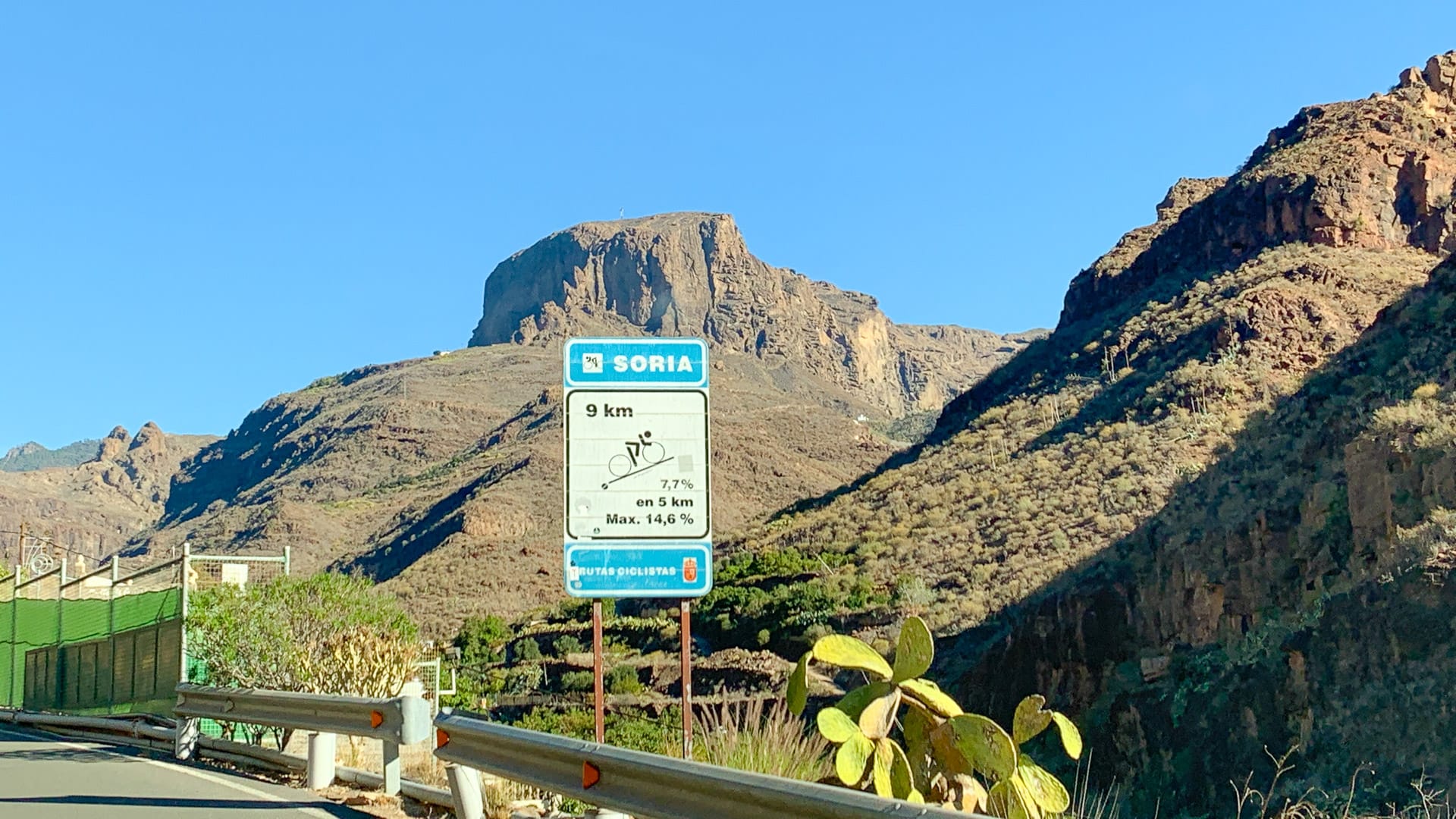
At the hamlet of Las Filipinas, about 26km into the route, there’s a sign showing the Soria climb (9km at a 7.7km average and 14.6% maximum).
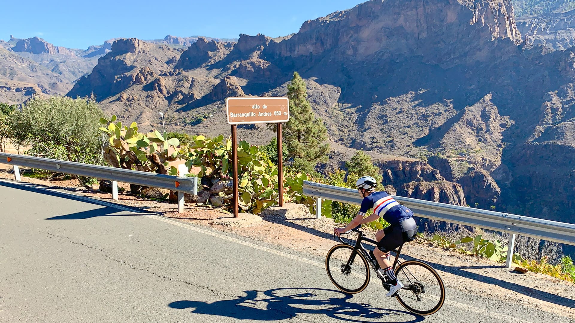
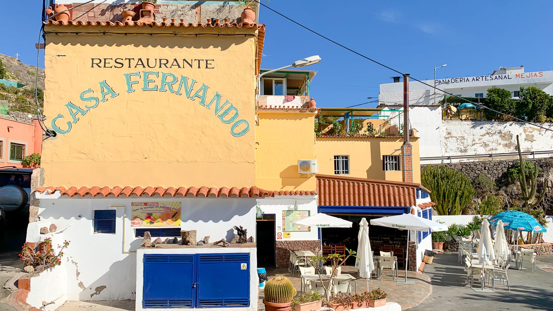
A series of turns take you up high above the valley, past a pile of enormous boulders balanced on one another, to the top of the Alto de Barranquilla Andres (650m). The road narrows and you come to a junction, left and up or straight on and down. Straight on takes you to Soria (2.5km each way). It’s worth it because you find the gorgeous Restaurante Casa Fernando, with unpretentious white tables outside facing the view down the valley you’ve just ridden up.
Most road cyclists turn back the way they just came after Restaurante Casa Fernando. We were feeling intrigued by the final few kilometers beyond Soria. These take you above the top of the dam and beyond to a vast rock wall where a mountain biker suddenly appeared from. Not much to see: nice but not must-do.

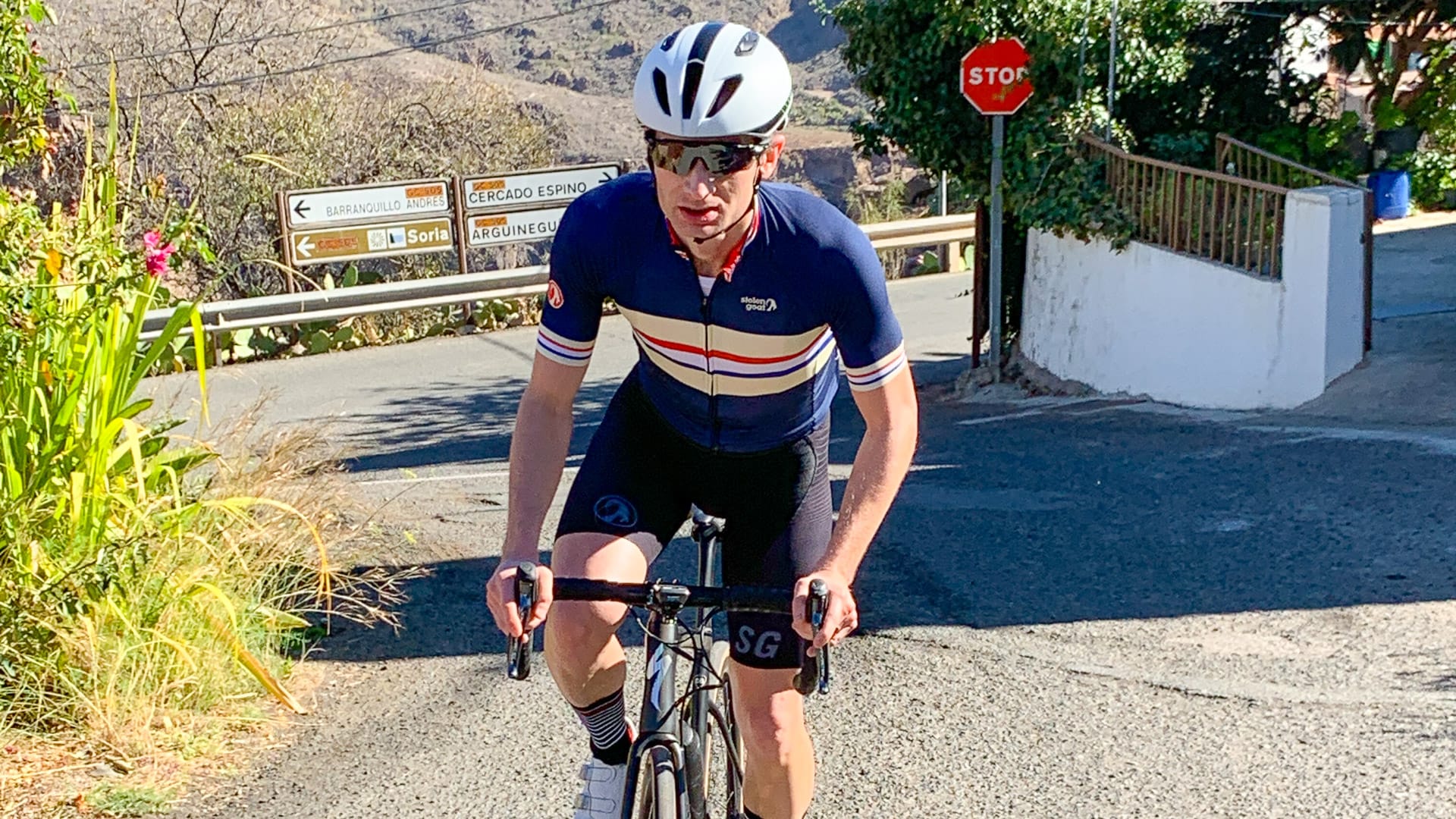
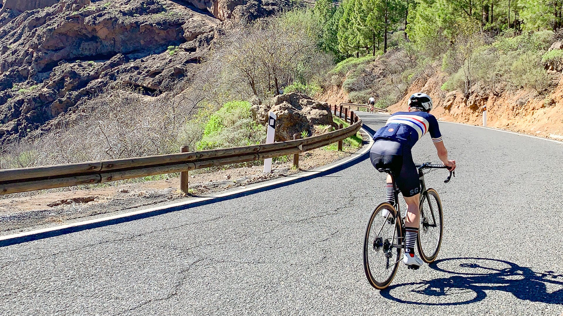
2. Soria to Ayacata (inc part of Serenity climb): 34 – 54 kilometres
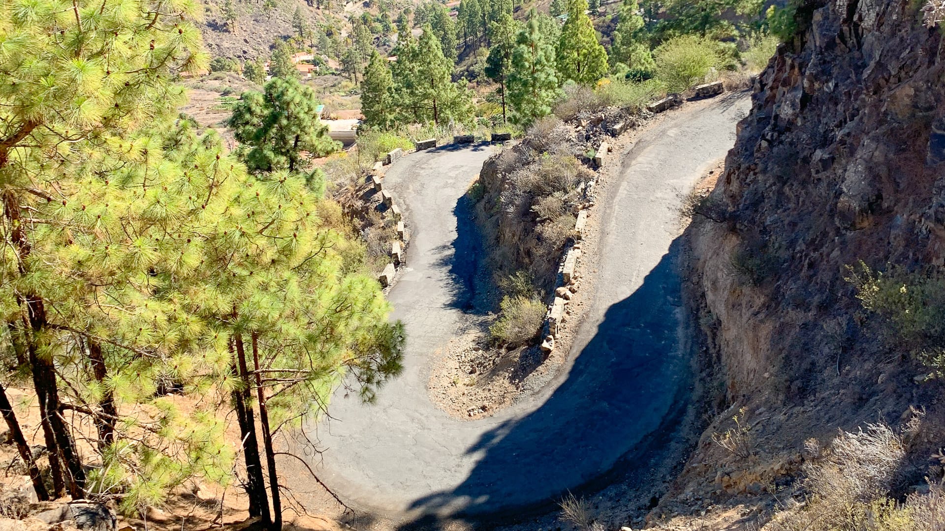
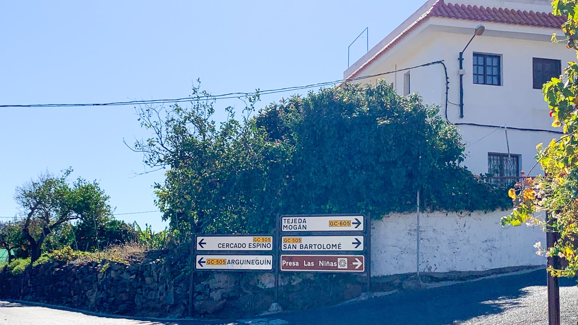
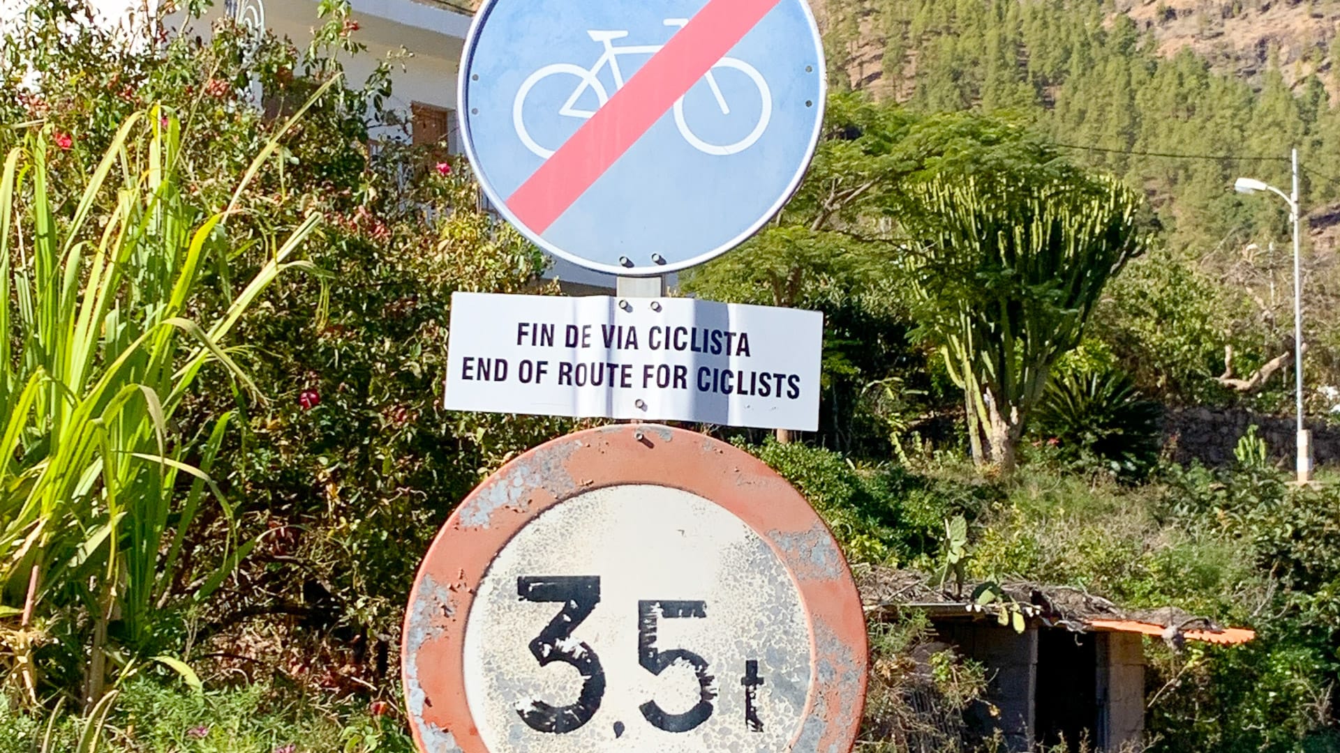
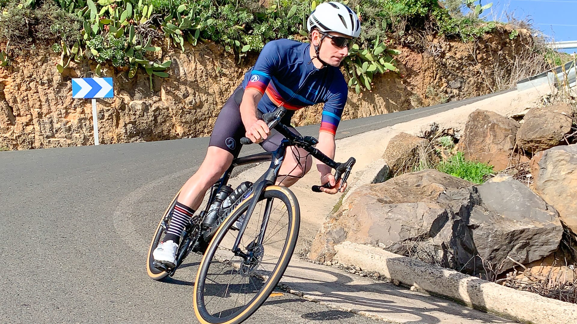
Head back up and down the twists and turns you rode to Soria and take the brutally steep right-hand turn signposted Tejeda and Mogán on the GC605 (see the two photos below).
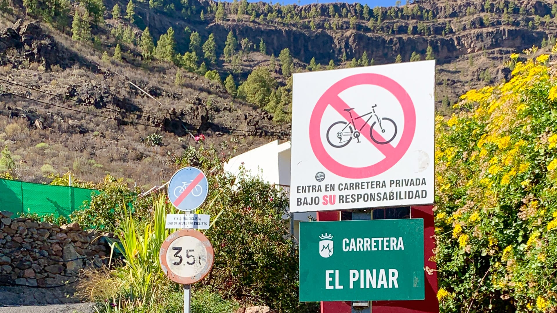
Important: there are several signs saying this road is not open to cyclists (see photos below). So if you decide to ignore these signs and continue riding, be aware that you’re doing so against advice.
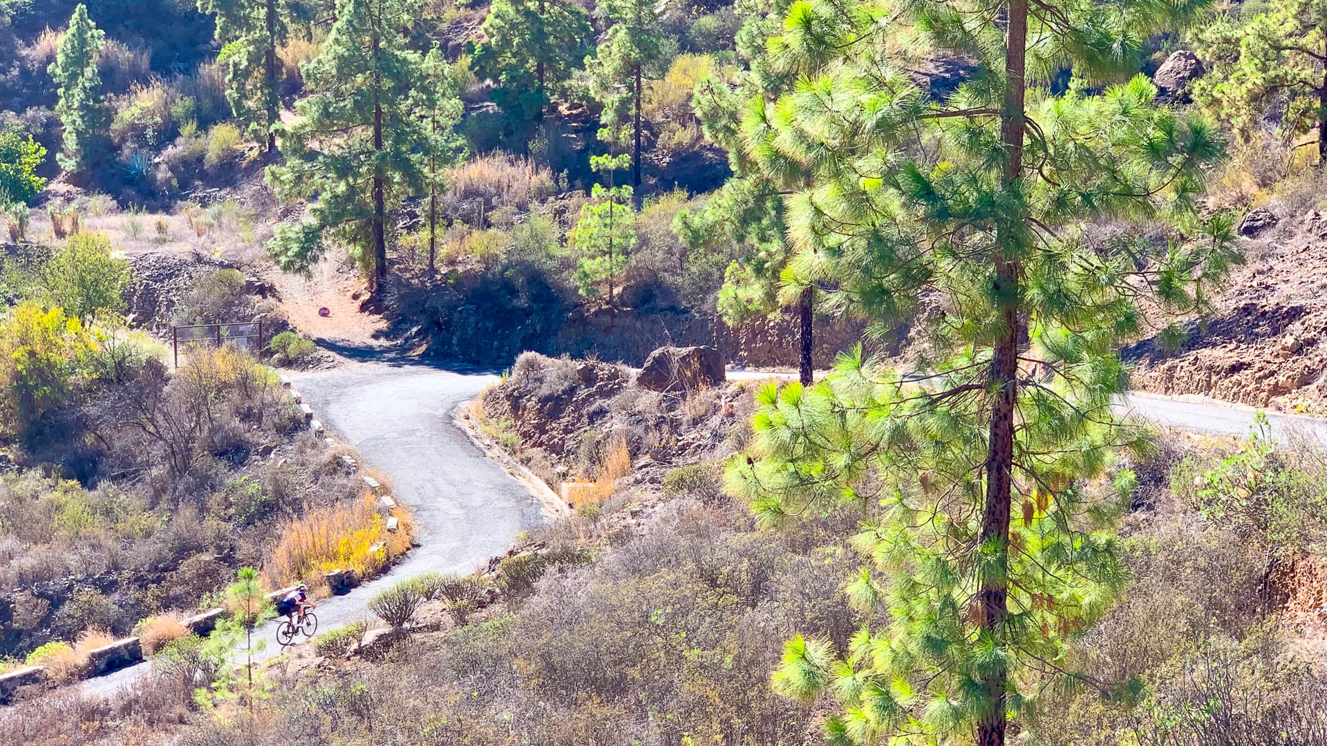
We decided to go for it and found an extremely narrow road through pine trees, with switchbacks and big drop offs. The road surface is poor. We had been told by various people that the road is extremely quiet and we wouldn’t encounter any traffic, but that wasn’t the case for us. Not lots of traffic by any means, but certainly a handful of cars and quite a few cyclists. Extreme care is needed.
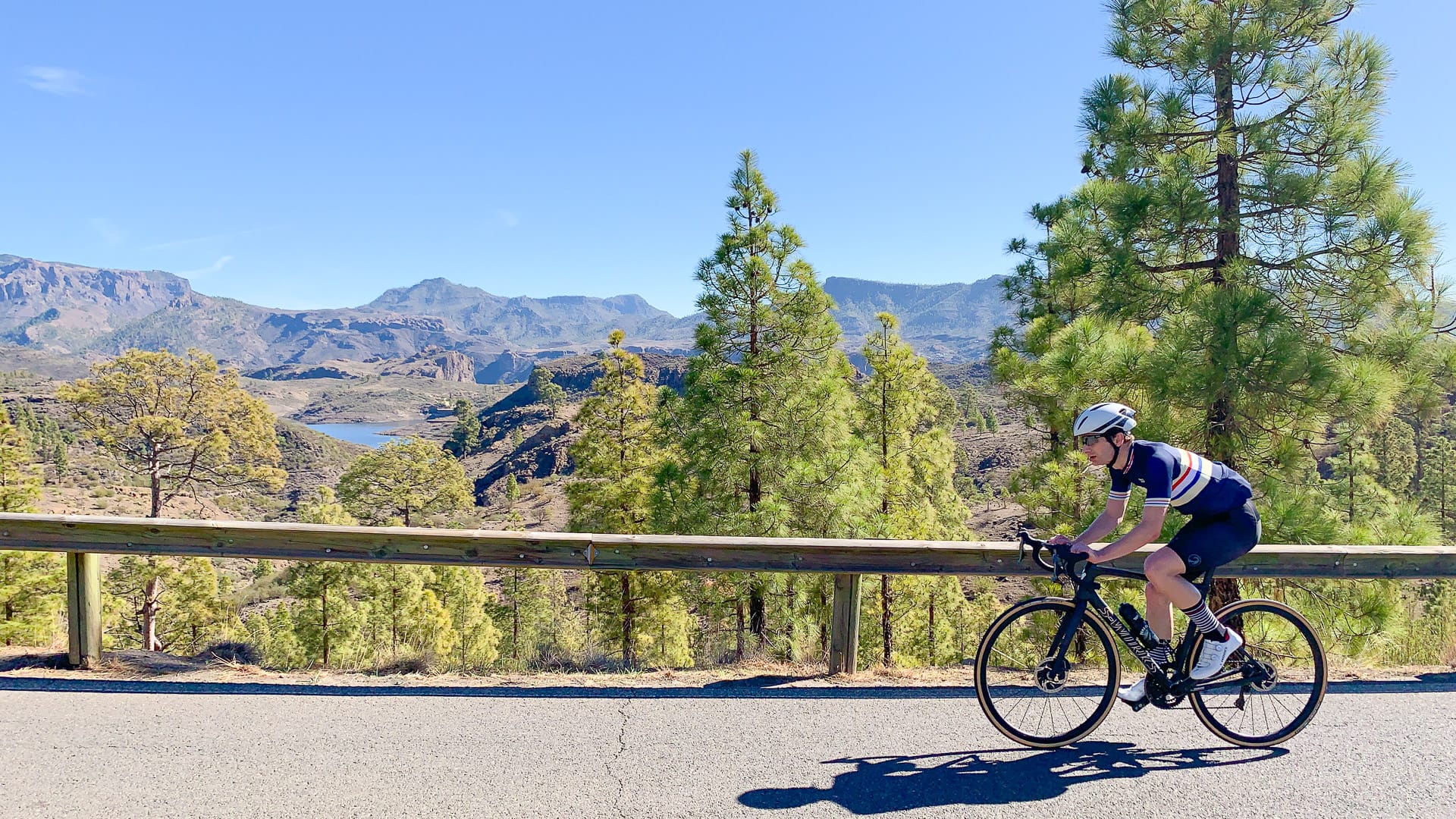
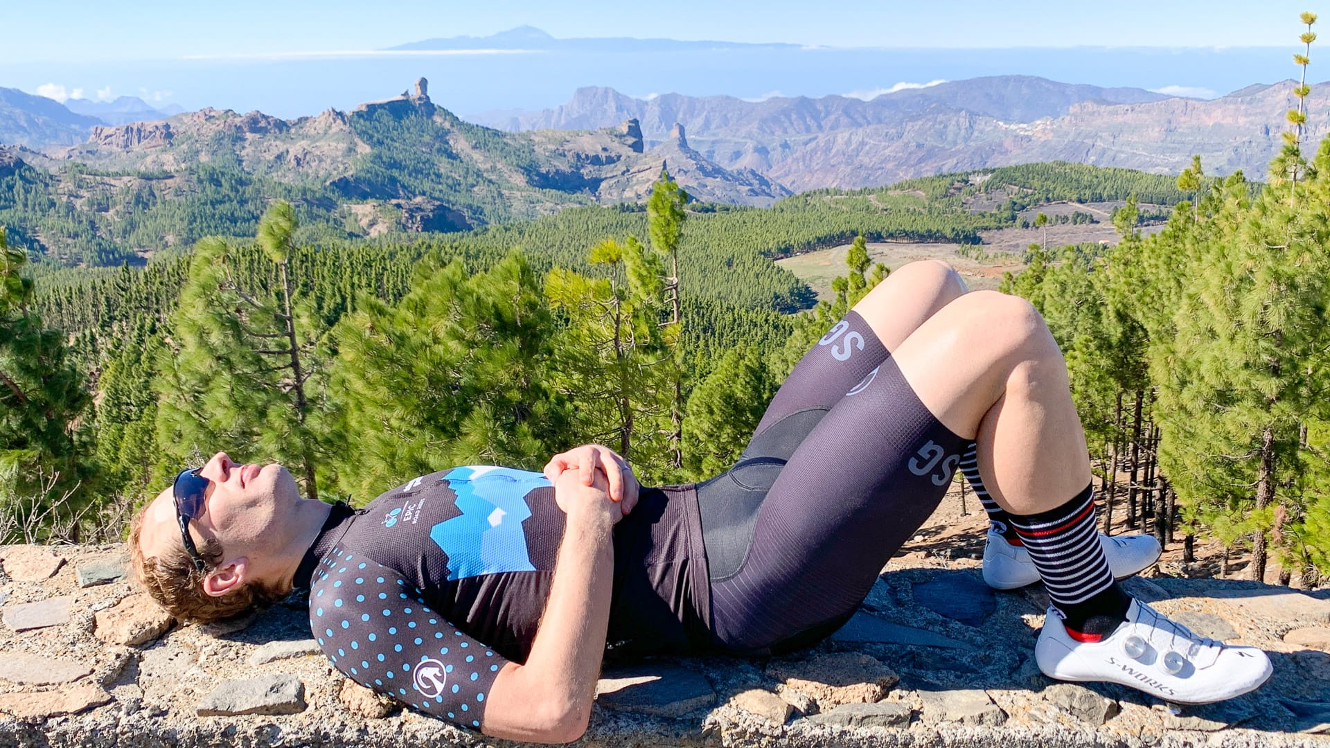
This tiny road pops you out at the junction with the GC605. You’re back to civilisation on a two lane road and a decent road surface (at least until you get further up the GC605!). You wind through pine trees, past the las Niña reservoir up and up, with the towers of Montaña de los Jarenes and Montaña de Paajonales to your left, until you come to Ayacata.
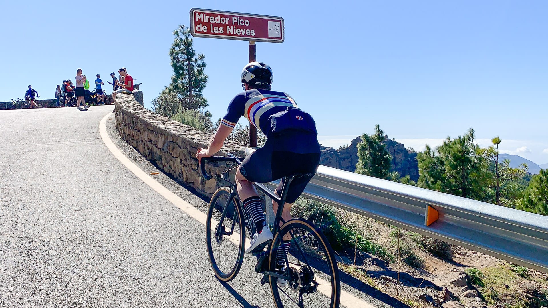
3. Ayacata to Pico de las Nieves: 54 – 78 kilometres
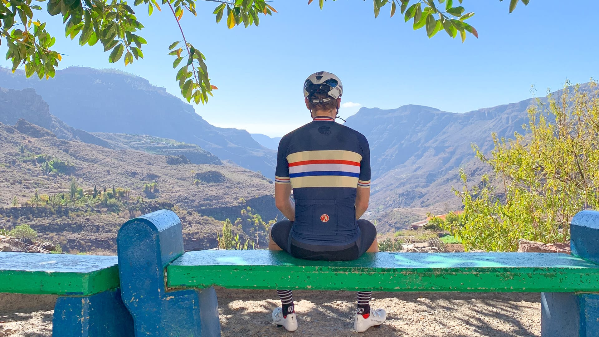
At Ayacata you might like a break at one of the roadside cafés, to prepare for the final push to the top of Pico de las Nieves.
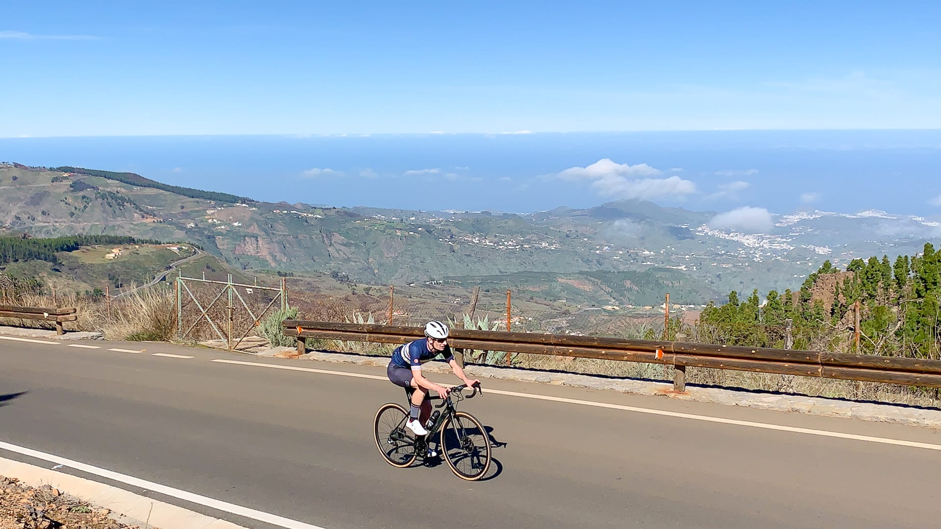
After the row of cafés, you turn sharp left onto the GC600 – be prepared for some tough gradients as you go around Roque Nublo and then wind around through the forest under Pico las Nieves. From Ayacata to the top, it’s just under 13 kilometres at an average 5.2% but with a few double digit sections in there!
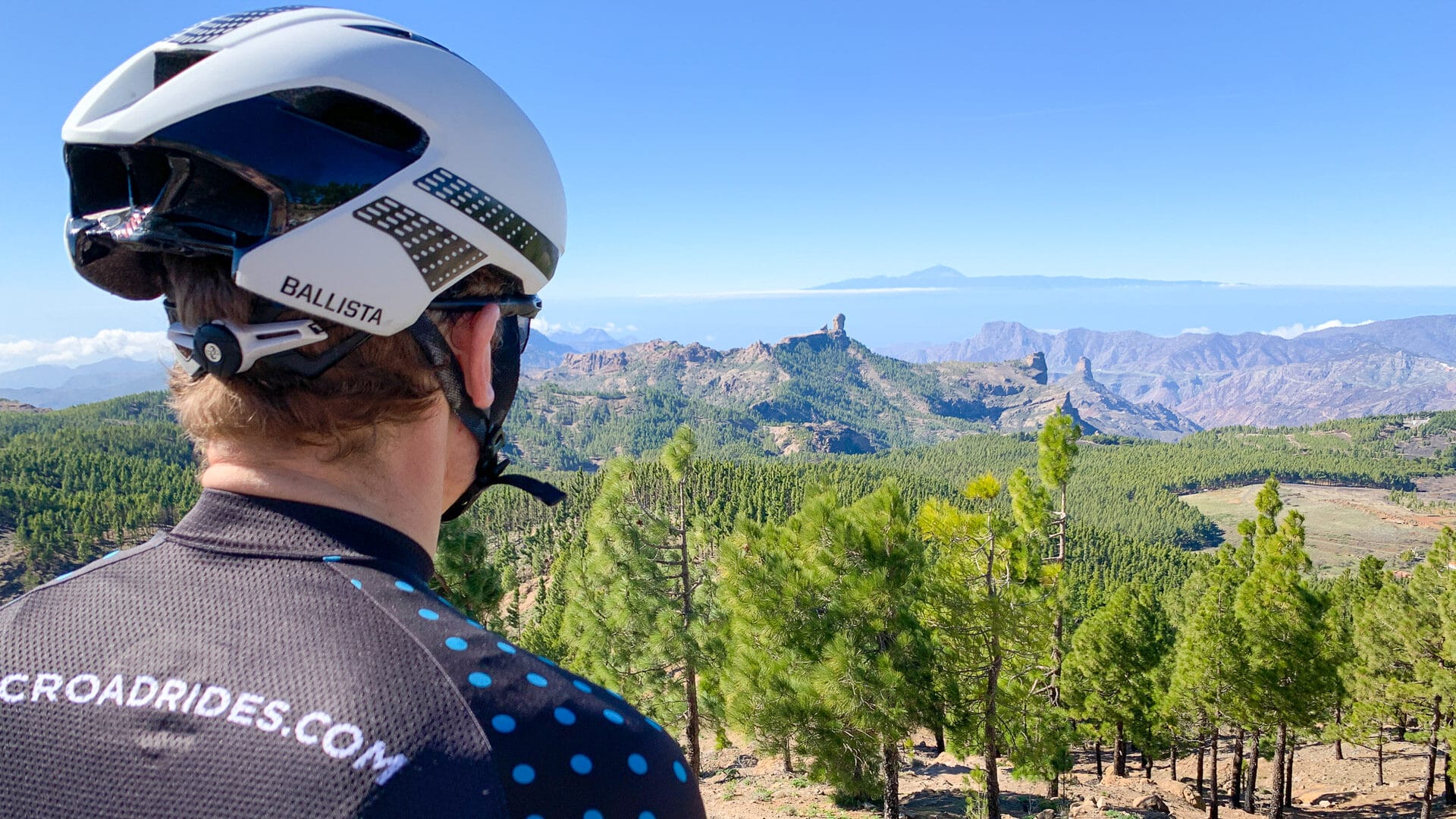
After you turn from the GC600 onto the GC130, there are some fabulous views to your left, over Gran Canaria and out across the sea to Tenerife. Then you’re heading up the final narrow climb to the summit of Pico de las Nieves.
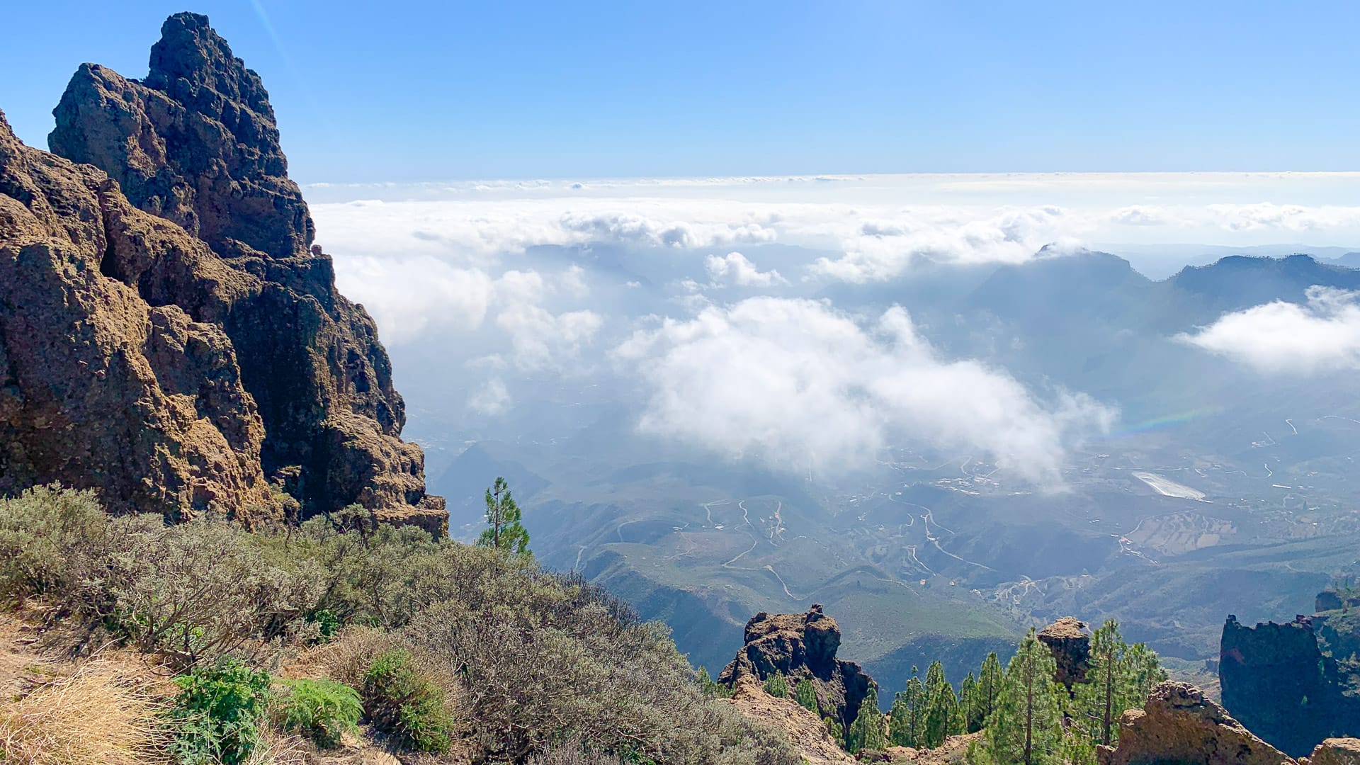
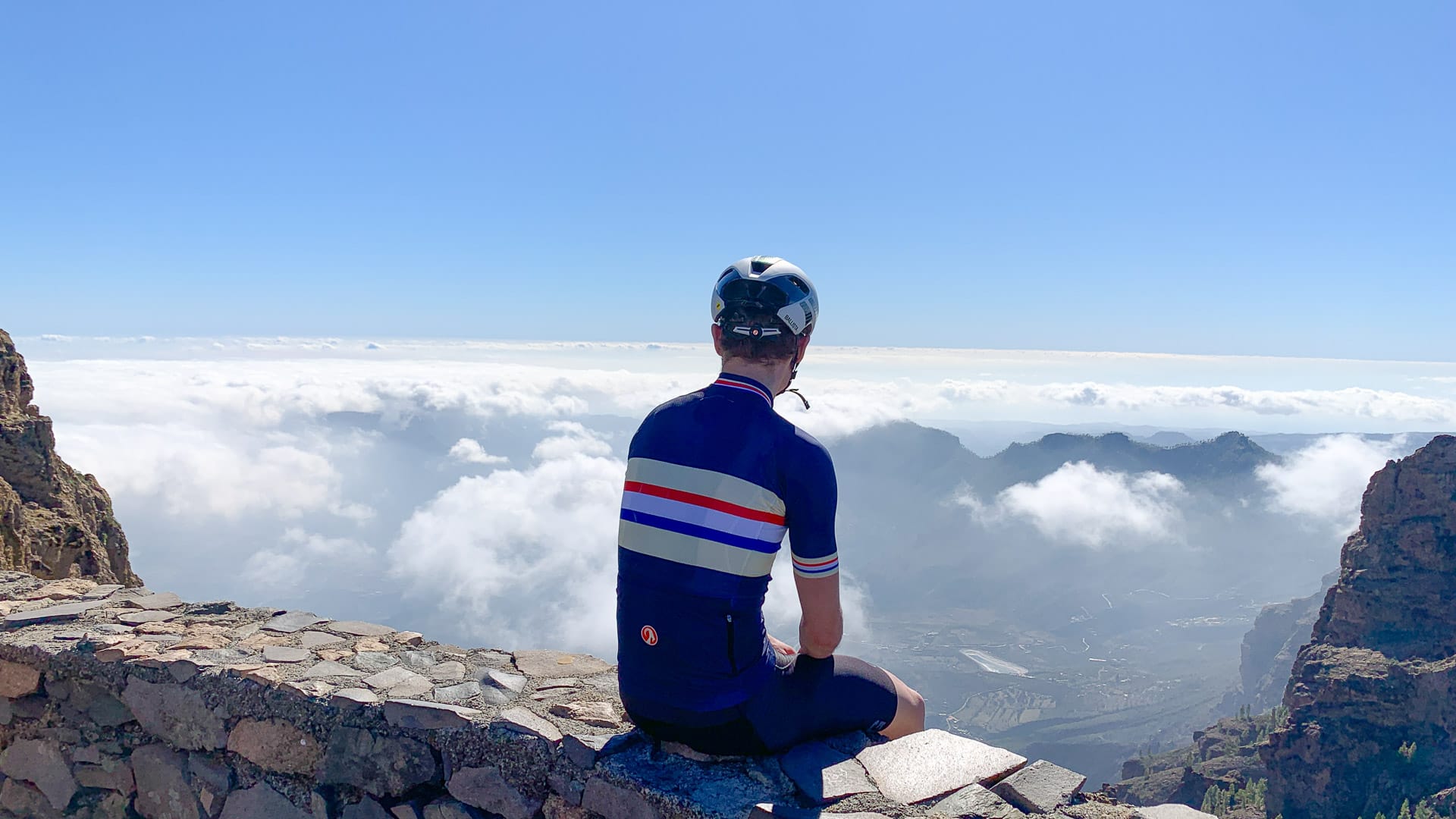
From the top, the views are even better than the tasters you’ve seen on the way up. There’s the distinctive Roque Nublo, Tenerife and Teide away on one side, lush forest in the foreground, and the craggy El Campanario to your left. Even further left, the vista drops away to the winding roads in the valley far below. When we were there, we were standing above wispy clouds above the valley. Quite a spectacular feeling.
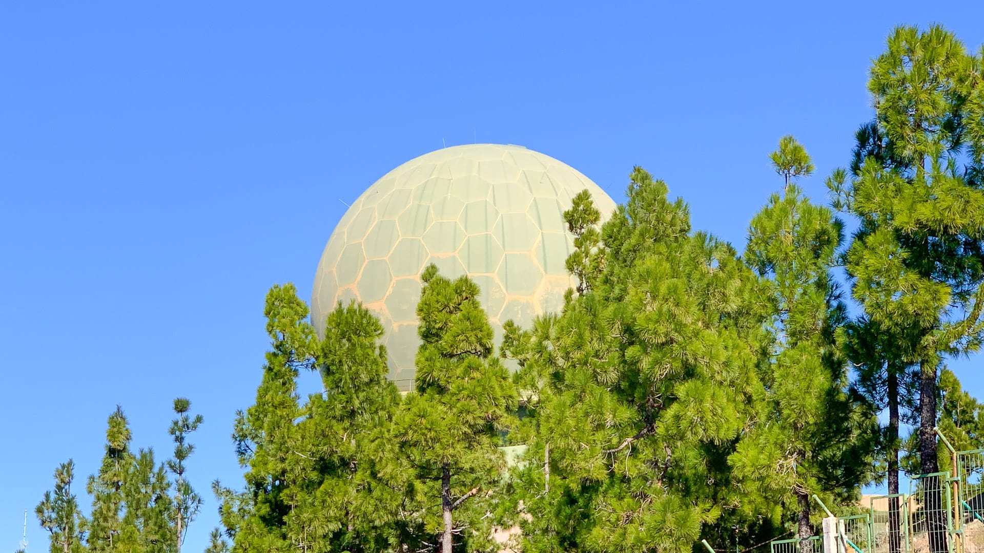
Behind you is a massive green ball – apparently it’s a radar used by the military.
4. Descent to the coast: 70 – 114 kilometres
There are a few choices for the descent (see the extra info below), but we suggest the GC60 if you’re staying in Maspalomas.
From the summit, you retrace your path back to Ayacata before turning left onto the fantastic descent back dropping down through San Bartolomé, Fataga and back to the coast. While it’s mostly descent, it’s peppered with a few climbs to keep the heart pounding until the very end! In particular, if you’ve done our GC60 ride, you’ve got to go back up that 180 switchback and then climb to the mirador that you descended down on that ride!
Café stops
If you plan on visiting any of these suggestions, before you leave home make sure they’re still operating and will be open at the time you want to visit. There are probably other options besides these; these are just ones we noticed while riding:
Restaurante El Pinillo, Carretera GC 505, KM 8, Barranco de Arguineguin
Bar Miguel, Calle Horno, 1a, Barranco de Arguineguin
Restaurante Casa Fernando, Lugar Soria, 24, Soria
Casa Melo, Ayacata, 37, San Bartolomé
Bar La Candelilla, Carretera de Ayacata, 7, San Bartolomé
Bar Restaurante La Cueva, Calle Tamaran, 15, San Bartolomé
Restaurante El Labrador, Calle Nestor Alamo, 23, Fataga
At Restaurante Casa Fernando in Soria, definitely try the mango juice. The mangoes are grown locally and the juice tastes divine. The espresso isn’t bad either.
When we were at Pico de las Nieves, there was a van selling drinks, sweets and aloe vera products. There were also tasty small bananas and an almond and fig cake that was absolutely delicious. We aren’t sure if the van is here throughout the week or whether this was just a Saturday thing. Let us know in the comments below if you know!
Accommodation
Maspalomas is the best base for this ride.
Check out the “where to stay” section of our Gran Canaria guide or our article that takes an in-depth look at the best places for cyclists to stay in Gran Canaria.
Tips
Don’t miss our tips for riding in Gran Canaria and loads of other information in our ultimate guide to Gran Canaria.
Route notes
Part of this route, plus the Ayagaures loop, forms stage 1 of the Epic Gran Canaria sportive ride, which usually takes place in the early spring each year.
The GC505 between the junction with the GC605 and Soria (i.e. the section that’s marked as not for cyclists but which we climb in this route) is not one we’d want to try descending on a road bike – it’s very narrow and the road surface was in a bad way.
At Pico de las Nieves viewpoint, you’ll spot a rock above the road that you can climb up to get that little bit higher. In case you’re wondering whether it’s worth attempting in cleats, the answer is that the view is more or less the same as the one you get from below!
When we visited, we decided to ride down the GC130 off the top of Pico de las Nieves towards Ingenio. However the road surface was not in good shape for much of the way. It’s also very steep. The other downside to taking the GC130 down from Pico de las Nieves to the coast is that if you’re staying in Maspalomas, you’ve got the not-so-fun GC500 to contend with to get you home.
The GC65 is also an amazing descent (see this guide for more information) but you’ve got the same coast road drawback.
That’s why we suggest the GC60 back to Maspalomas!

General points of interest
The whole area forms part of the World Biosphere Reserve of Gran Canaria, declared by UNESCO on 29 June 2005.
A sign at the viewpoint says: “From the blue sea to the green pines, planted in the 1950s, we can make out Los Llanos de la Pez and Pargana, to the south La Aldea de San Nicolas, Mogán and Las Tirajanas. To the northwest the Tamadaba Massif, to the southeast the Amurga Massif, with the Teide in the distance. In this area there are some fine geographical landmarks: the Roque Nublo, the Roque Bentayga, El Fraile, Llanos de la Pez y Pargana or La Caldera de Tejeda and the Tirajana crater.”
Please support Epic Road Rides
A huge amount of time and effort goes into the article you’ve just read, all with the aim of helping you!
If you found what you’ve read useful, I’d really appreciate it if you dropped something in the tip jar here.
It’s a way you can say thank you and help us carry on creating top quality content with no annoying ads and no pay wall.
Looking for an organised cycling trip?
If you want someone to help you plan and book your cycling holiday, fill out this form. We aren’t a tour operator/agent but we work with lots of people who are and will do our best to put you in touch with someone that can help (within 24 hours where possible)!Clare Dewey is a cyclist with a passion for travel. She set up epicroadrides.com in 2018 to help make it easy for cyclists to explore the world by bike. Today her mission is still inspiring cyclists to discover new places on two wheels - and doing what she can to make sure they have the best possible time while they're there. Clare has visited 50+ destinations around the world, many of them by bike.
Want to connect with Clare? Find her over on LinkedIn.
First Published: 18 September 2021
All metrics in this article are approximate.
The contents of this website are provided for general information purposes only. It is not intended to amount to advice and you should not rely on it. You should carry out your own due diligence and risk assessments and take professional advice. Views expressed by interviewees or other users of this website do not necessarily represent our views. We make no representations, warranties or guarantees, whether express or implied, that the content on our website is accurate, complete or up to date. If you use any information or content on this website, download from, or otherwise obtain content or services through our website, it is entirely at your own discretion and risk. Epic Road Rides Ltd disclaims all liability and responsibility arising from any reliance placed on the information and content on this website. Find out more here.
Comments