The Col de la Madeleine is one of cycling’s greatest climbs.
Despite being a relative newcomer to the Tour de France (first used in 1969), the Madeleine col has been included 24 times since then. There‘s a reason for that.
It’s one of the toughest and most beautiful climbs out there. It’s ranked hors catégorie (beyond category) which is testament to the struggle and suffering you’re letting yourself in for. That category makes sense when you look at the profile of Col de la Madeleine: 6.2% for 25km from Feissons sur Isère or 19 km at 7.9% from La Chambre.
Yet there’s something special about it that makes it more than just a tough ascent. It’s often described as majestic and inspirational, like you’re on a journey into the unknown. Ride it and you’ll understand.
Looking for a return GPX route from the north? Click here.
Highlights
There are so many!


Route notes
Sections 1-3 below describe the route up the Col de la Madeleine north side, from Feissonet. It’s the most accessible side if you’re staying in Bourg Saint Maurice like we were (more on Bourg Saint Maurice, here).
Want to ride Col de la Madeleine from Saint Jean de Maurienne? Check out our four other ways up Col de la Madeleine in section 4 below.
1. Feissons sur Isère to Bonneval: 0-7 km
You’re climbing almost immediately, up a series of switchbacks on a lush, tree-lined forest road. Very quickly it feels like you’re in the middle of nowhere.
2. Bonneval for 5 kilometres: 7-12 km
The journey continues, over stone bridges and past cascading waterfalls. From Bonneval, the gradients relax for a 5km section which includes 3km of flat and downhill. It’s time to rest the legs for the very tough last 12 kilometres.
3. Kilometre 12 to summit: 12-25.5km
Now you’re in for the real test (check out the Col de la Madeleine profile above).
Kilometres 12 to 18.5 take you over small stone bridges and through the hamlets of La Thuile and Celliers. It may be pretty, but you’re on a 7.5% average gradient, and some kilometre stretches where it’s more like a 9 or 10% average.
You get a short respite for a kilometre or two after that, with gradients back down to under 6%. It’s then back to the 9 and 10%s for the last 5 or so kilometres to the summit.
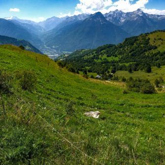
Make no mistake; it’s a tough ride. But the satisfaction of conquering it makes the journey worth it. Surrounded by views of the snowy peaks of Mont Blanc and the surrounding Alpine climbs, it feels like you’re on the top of the world. There’s a deep sense of satisfaction as you stand at 2,000m and look back across the valley floor to the ribbon of road weaving all the way back to the deep green valley of Feissons.
4. The descent/other routes up the Madeleine
Descend to Feissons sur Isère
This is the most straightforward route to take. This descent is shown on the GPX download at the top of the page.
OR…
Climb the south side of the Madeleine from La Chambre (D213)
Descend to La Chambre. Climb the Col du Madeleine again, this time from La Chambre. Descend to Feissons sur Isère.
This makes for a tough day out, since the south side is thought by many to be even tougher than the north side you’ve just ridden. That’s because though it’s shorter than the north side at just over 19km, it’s also steeper with a 7.9% average gradient. This includes 500m at 12.5% and there are none of the “rest kilometres”, with shallower gradients, that you get on the other side.
If you do manage it, you’ll have some serious bragging rights having conquered both the classic south side and quieter, more picturesque north side in just one day.
OR…
Climb the alternative southern route up the Madeleine (D76)
Descend to La Chambre. Climb the Col du Madeleine, this time on the D76 via Montgellafrey. Descend back to Feissons sur Isère.
We haven’t done this route, but it looks stunning. The stats look as tough as the classic D213 route, but we bet it’s much quieter. You’re back on the D213 for the last three kilometres to the top.
OR…
Climb the spectacular southern cyclo-cross route up the Madeleine
Descend to the D99 just north of La Chambre. Climb the Col du Madeleine on an unpaved backroad. Descend back to Feissons sur Isère.
This is one of the most stunning rides we’ve ever done. But a word of warning, it’s very tough, and it’s best done on a cyclocross bike. We did it on a road bike and it was pretty sketchy.
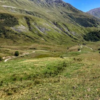
You take the D99 off the D213 and it’s paved climb to Bonvillard. There you take a left and head up an unpaved road to the Lac du Loup. About 5.5km after the lake, you cross a ridge back down to the valley with Madeleine, above St-François-Longchamp. You then rejoin the southern ascent of the paved D213 to the summit before heading back down to Feissons.
We talk about climbs feeling remote and untouched, but this defines those words. The scenery is stunning and we’ve never felt more alone.
OR…
Climb Les Lacets de Montvernier and the southern cyclo-cross route up the Madeleine
Descend to La Chambre. Climb the Lacets de Montvernier and Col du Chaussy. Climb the Col du Madeleine on an unpaved backroad. Descend back to Feissons sur Isère.
This would be a very big ask if you’ve already climbed the northern side. The Lacets de Montvernier was brought to popular attention by the 2015 Tour de France and are truly spectacular. However, doing the northern ascent, the Lacets de Montvernier, the Col du Chaussy (which is a great climb in its own right) plus the off-road section described in 4 above may be a step too far.
We weren’t up to the challenge. Anyone done it?! Let us know!


Col de la Madeleine restaurant and café stops
Accommodation
We stayed at The Peak, in the ski station of Sainte Foy Tarentaise, about 20 km south-east of Bourg Saint Maurice. It was a good place to ride from for riding in the Isère valley, but you’re 20km in the wrong direction for the Madeleine.
For alternatives, take a look at our accommodation suggestions in our ultimate guide to the Northern French Alps: Col d’Iseran and surrounds. You could also consider Les Chalets de la Madeleine, for something closer at hand.
Tips
Found this guide useful?
Please support Epic Road Rides
A huge amount of time and effort goes into the article you’ve just read, all with the aim of helping you!
If you found what you’ve read useful, I’d really appreciate it if you dropped something in the tip jar here.
It’s a way you can say thank you and help us carry on creating top quality content with no annoying ads and no pay wall.
Looking for an organised cycling trip?
If you want someone to help you plan and book your cycling holiday, fill out this form. We aren’t a tour operator/agent but we work with lots of people who are and will do our best to put you in touch with someone that can help (within 24 hours where possible)!All metrics in this article are approximate.
The contents of this website are provided for general information purposes only. It is not intended to amount to advice and you should not rely on it. You should carry out your own due diligence and risk assessments and take professional advice. Views expressed by interviewees or other users of this website do not necessarily represent our views. We make no representations, warranties or guarantees, whether express or implied, that the content on our website is accurate, complete or up to date. If you use any information or content on this website, download from, or otherwise obtain content or services through our website, it is entirely at your own discretion and risk. Epic Road Rides Ltd disclaims all liability and responsibility arising from any reliance placed on the information and content on this website. Find out more here.


Comments